After anticipating and planning my 115 mile CDT section hike from Grand Lake to Georgia Pass since the previous summer, I was feeling a sense of anxiety that something in my non-trail life might prevent me from being able to go. I then had the comforting realization that even if I did have to cancel for some reason, the real gift of this hike was the past year of preparation, training, hope, and excitement that I had already experienced. I wouldn’t have done that early morning run on the Malecón de Mazatlán in April. I wouldn’t have missed that turn on a July trail race and still finished even, though I had to run a couple extra miles. And I wouldn’t have been inspired by all those still excited and grinning Colorado Trail thru-hikers on my Tennessee Pass training hike just a few weeks earlier. This hike would certainly be a challenge, but I’d already had so many hard and wonderful moments before I even started out on the trail.
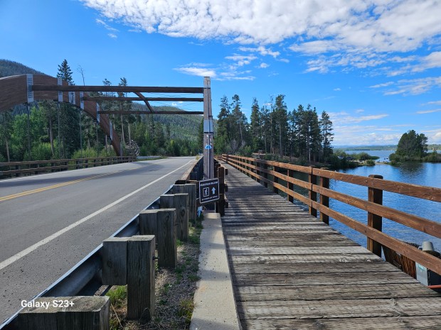
As I clocked out after my Saturday night graveyard shift, I got bit choked up with gratitude that I was I getting back on the CDT. Making it even better would be camping with my nomadic buddy Chris at Lake Granby the first night on trail. This committed me to cover about 13 miles, thankfully without much climbing but still a respectable first day on a section hike. I drove straight from work in Steamboat to the Grand Lake rec center, where I had made a previous arrangement to leave my vehicle during my hike. I stopped in the rec center to grab a parking permit then started my hike into downtown Grand Lake. I turned south to follow the CDT over the bridge alongside Shadow Mountain Lake.
I had grabbed a convenience store breakfast burrito on my drive to Grand Lake, and I could already feel the regret in my stomach. I was super relieved to find restrooms at the recreation area after crossing the bridge. That first bad burrito decision continued to haunt me most of the morning, but that at least kept my thoughts off the trailhead sign that warned of mountain lions in the area.
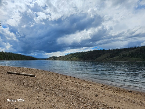
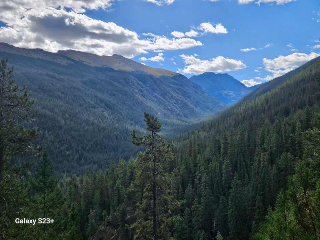
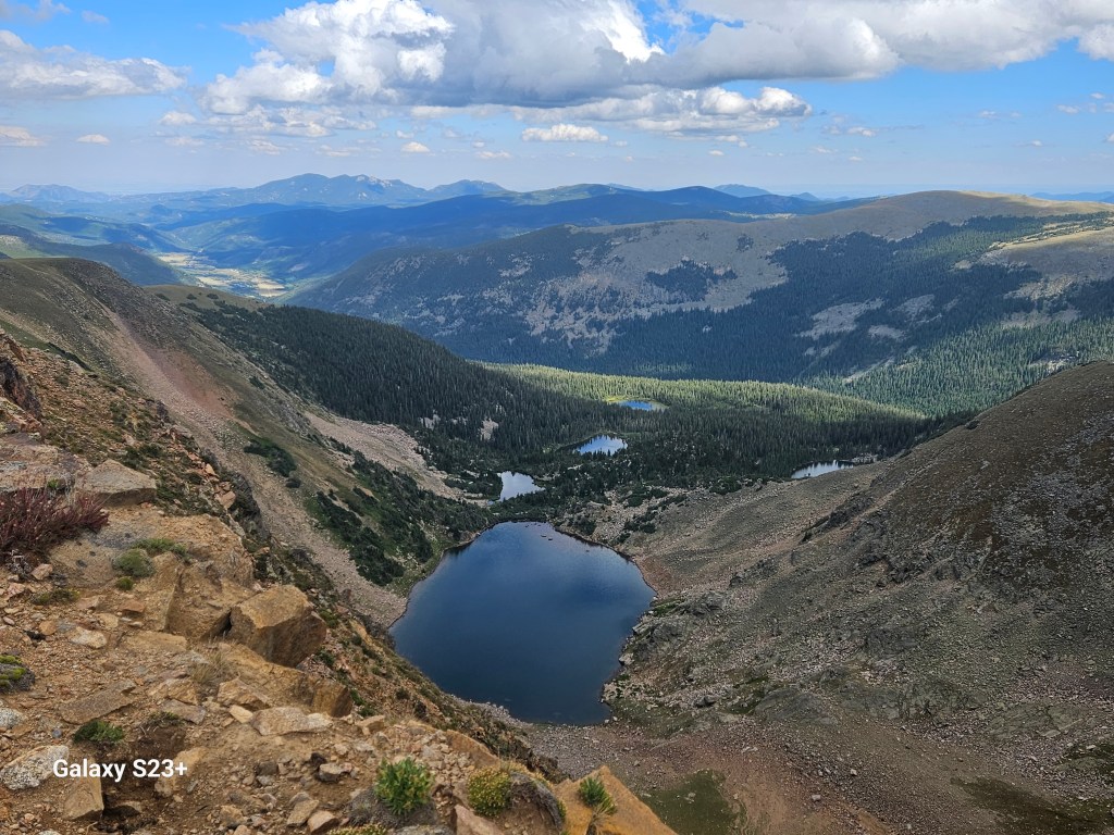
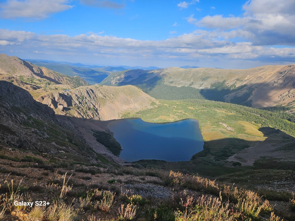
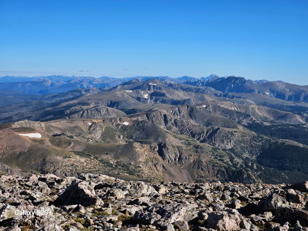
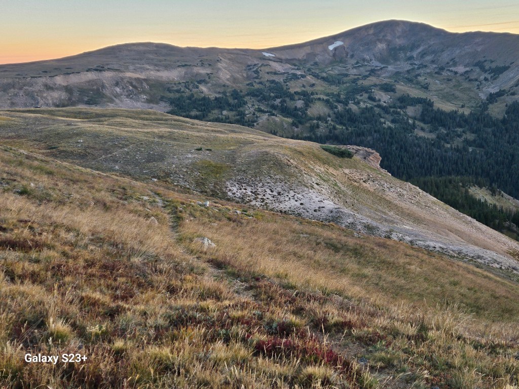
The trail crosses a swampy meadow after Shadow Mountain Lake, then follows along a narrow Colorado River as it turns into expansive Lake Granby. I’d not been at the this lake before, but even more impressive than its size is the scenic shoreline with the Indian Peaks for a backdrop. The CDT parallels above the lake with several seemingly unnecessary ups & downs, but from the higher vantage I could at least see what looked to be our very scenic campground.

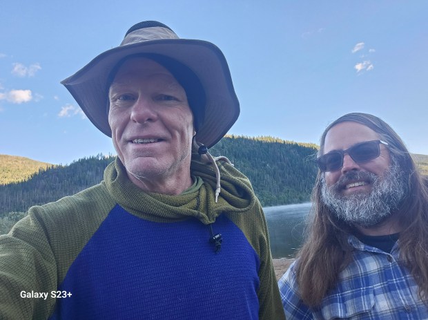
Per my usual luck (and as predicted in the weather forecast), the rain began right as I reached camp. Thankfully it wasn’t a big storm but my single-wall Xmid tent still ended up with record-level condensation overnight after camping alongside the big lake. Chris & I have camped a bunch together over the past few years and his influence played a big part in finding my love for backpacking. It was cool to be able to camp on the CDT with him now that he is not able to do much backpacking.
I got my usual early start the next morning and was happy to see Chris get up for a nice goodbye. The Indian Peaks looked impressive and I had heard plenty about the climbs ahead. The CDT follows a nicely grated dirt road to Monarch Lake, and along the way I met some fellow CDT section hikers heading northbound.
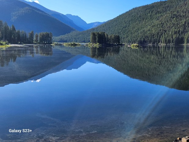
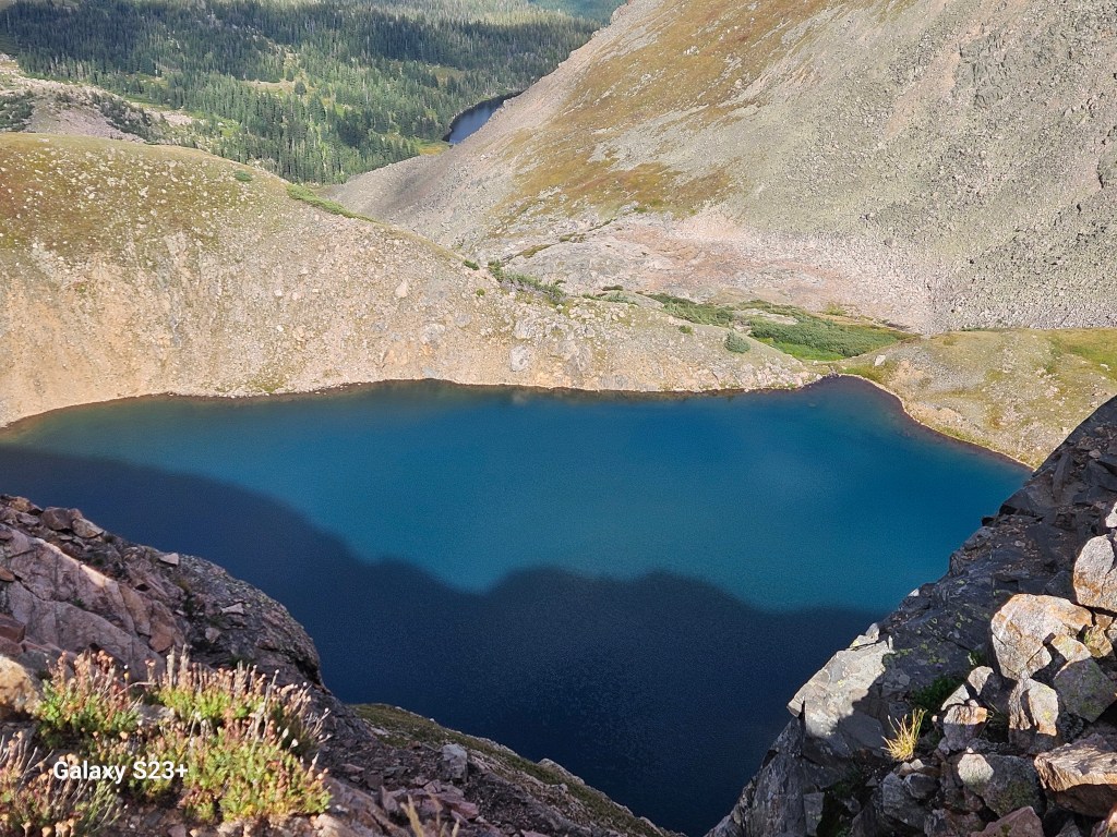
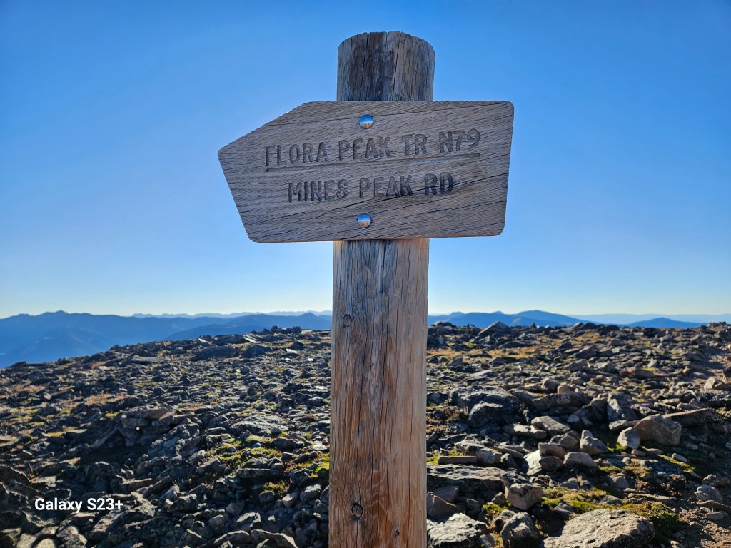
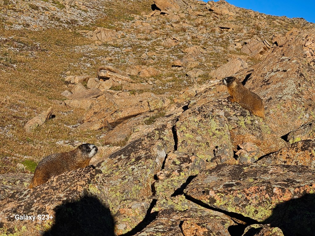
I’m not sure how I had never heard of Monarch Lake – it’s one of the prettiest lakes, is accessible by car, and features a long loop around the lake. I hope to make it back there some time for an ambitious trail run. The CDT joins the High Lonesome Trail and passes through a corner of the Indian Peaks Wilderness beyond the lake. I had hung my wetted-out gloves off my backpack and they fell off somewhere early that morning – that was a mistake I would regret in the coming days.
Only a limited number of advance camping permits are allowed in each zone of the wilderness area. My plan for the day was to make about 13 miles, with a fair amount of climbing, to camp near water just ahead of the Devil’s Thumb burn zone and outside of the Indian Peaks Wilderness protected zones. Some advance planning really paid off here.
I thought a lot about my young grandson Silas in Wisconsin that I’m not able to see much, and the need to make him a bigger priority in my life. If I can be so committed and perseverant about hiking, I can certainly do more to find a way to be present for Silas.
By late afternoon I made it to the Far Out-promised campsite near a small stream, and was relieved to be able to set up camp without rain. A couple fast-moving but friendly SOBO thru-hikers passed by, their pace indicating they were far from done for the day.
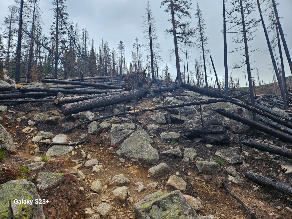
I started out the next morning hiking through the Devil’s Thumb fire burn zone that had closed that part of the CDT for much of the summer. This had involved an extra 20 mile reroute around the closure, and I was relieved to see that closure lifted just a few weeks ahead of my hike. I was impressed they re-opened that section the same summer, as the CDT crosses directly through the fire damage.


I gained some new perspective on my life almost every day on trail, and today’s was the realization that I wasn’t trying to escape from my “regular ” life anymore, and how grateful I am for that. Lessons from the past few seasons on the Colorado Trail and CDT had played a huge role in showing me the person I want to become, and my newfound love / obsession for hiking had given me a passion and greater reason to actually make some change. On every trip I realized almost immediately that the hike only had meaning with the gratitude I felt for my family, especially my wife, son, and granddaughter.
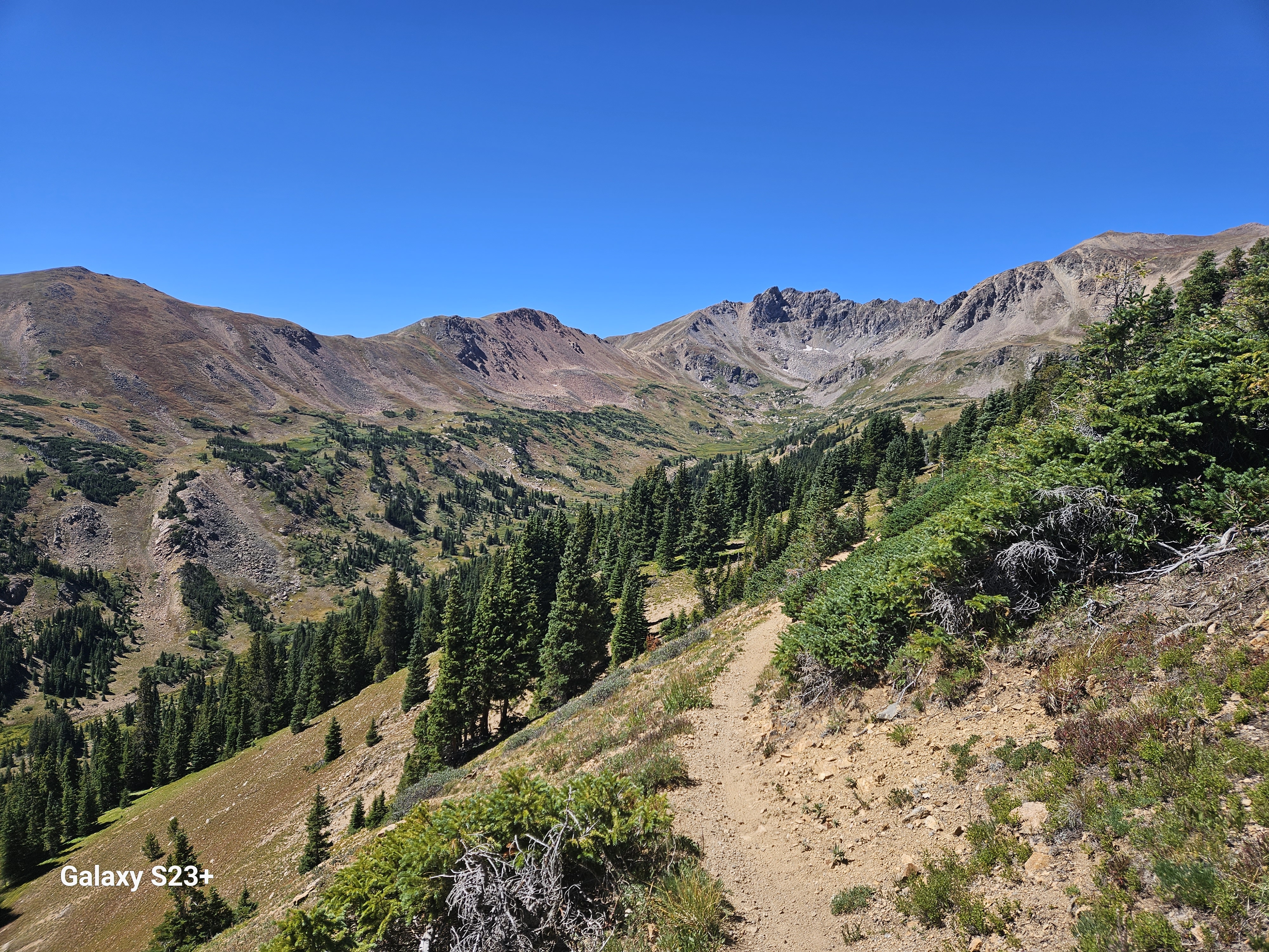
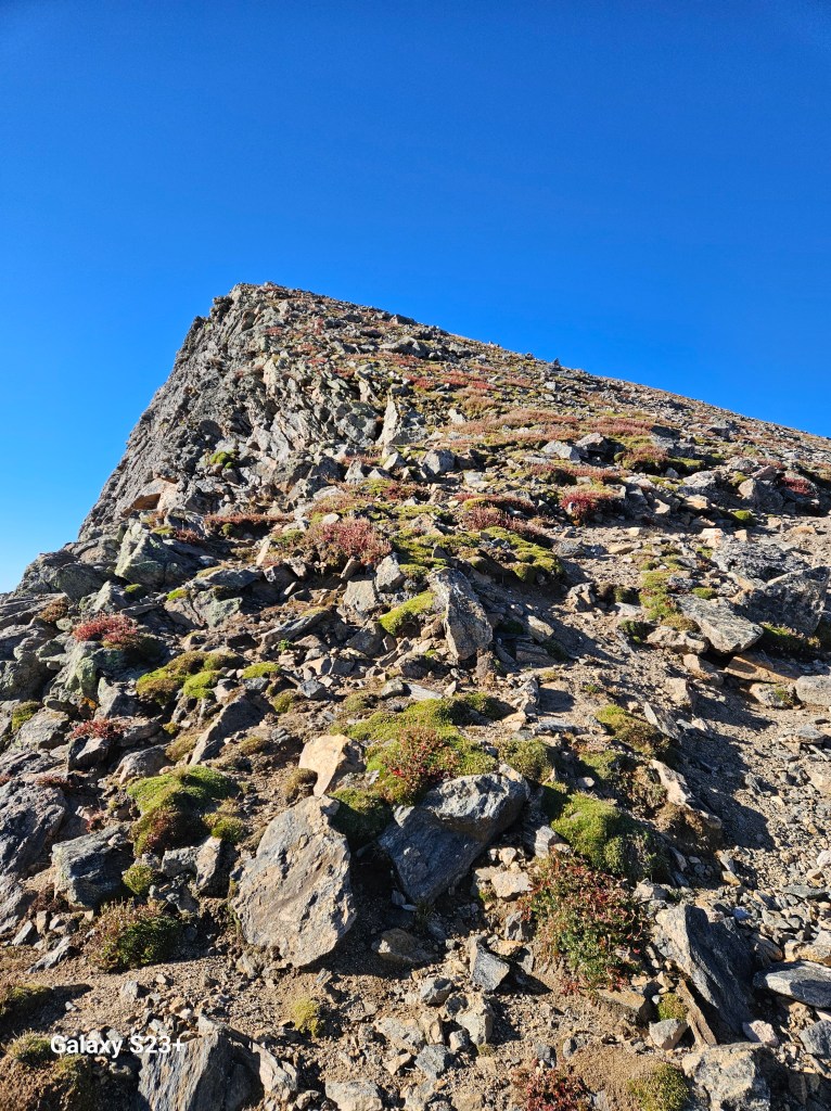
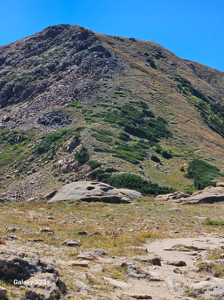
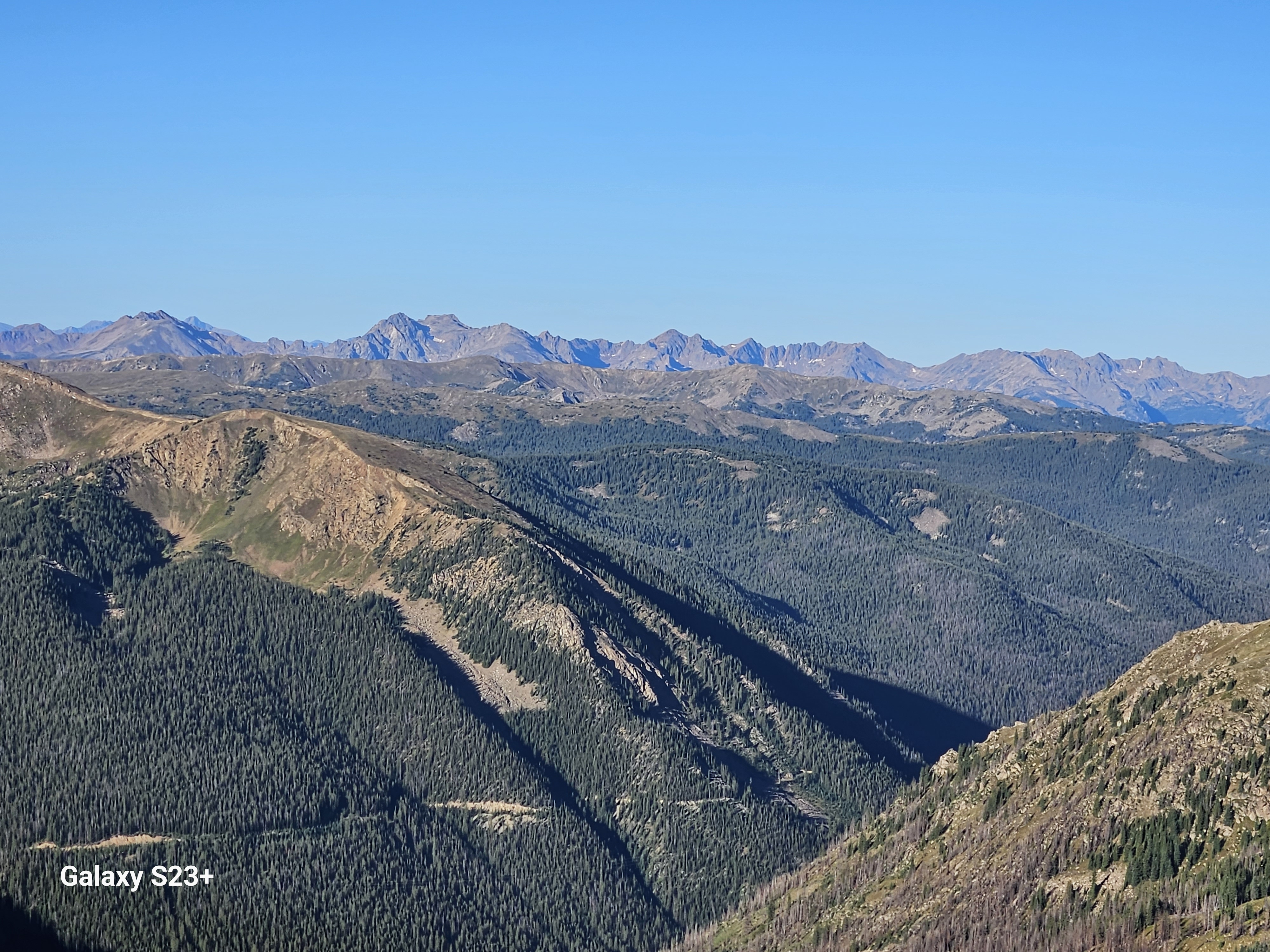
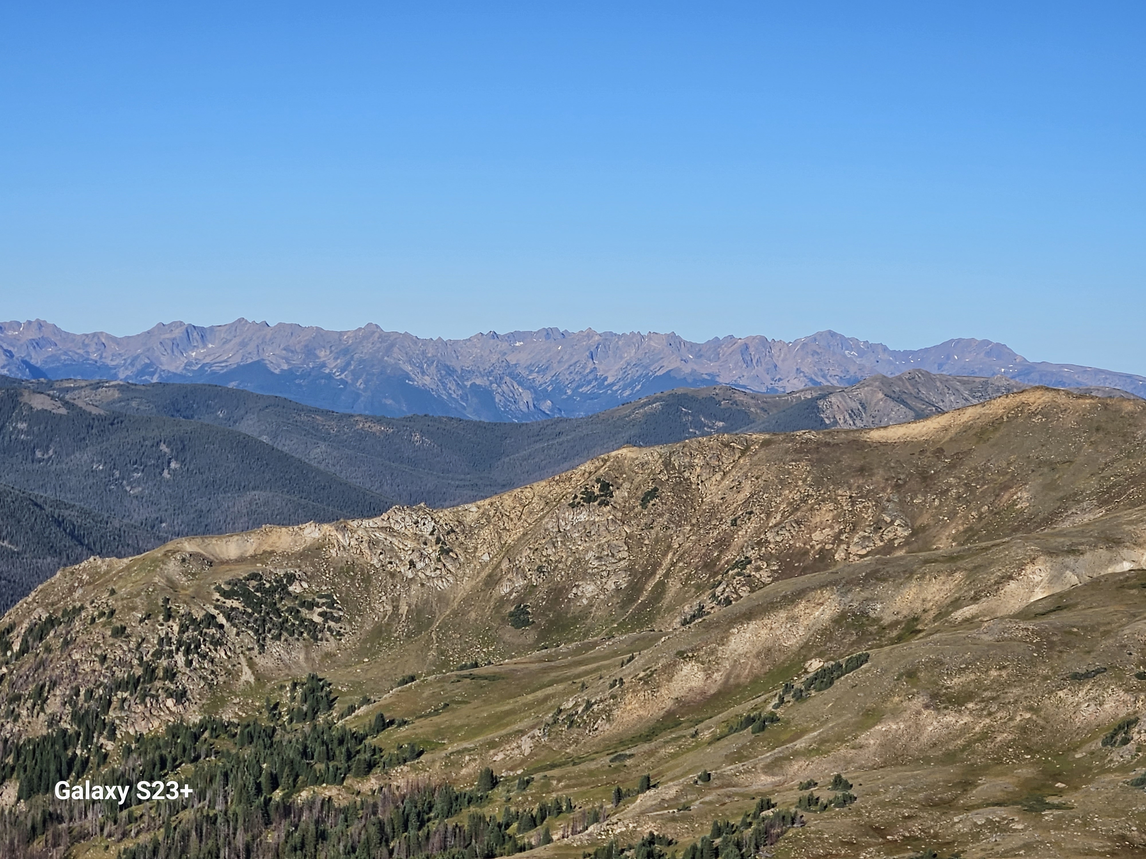
The CDT continues along the High Lonesome Trail on Rollins Pass then connects to Rogers Pass Road above Heart Lake. Countless other lakes could be seen below the cliff line on the way up. After a very short road walk the CDT heads back uphill, then turns into a sidehill cairn-to-cairn trail on soft dirt, high grass clumps and hidden rocks. The weather was clear and I had hoped get up & over James Peak today, but the sketchy footing had left me exhausted. I decided to look for a spot to camp. There was no ground even close to flat below the ridge, so I ended up pitching my tent on a windy saddle.


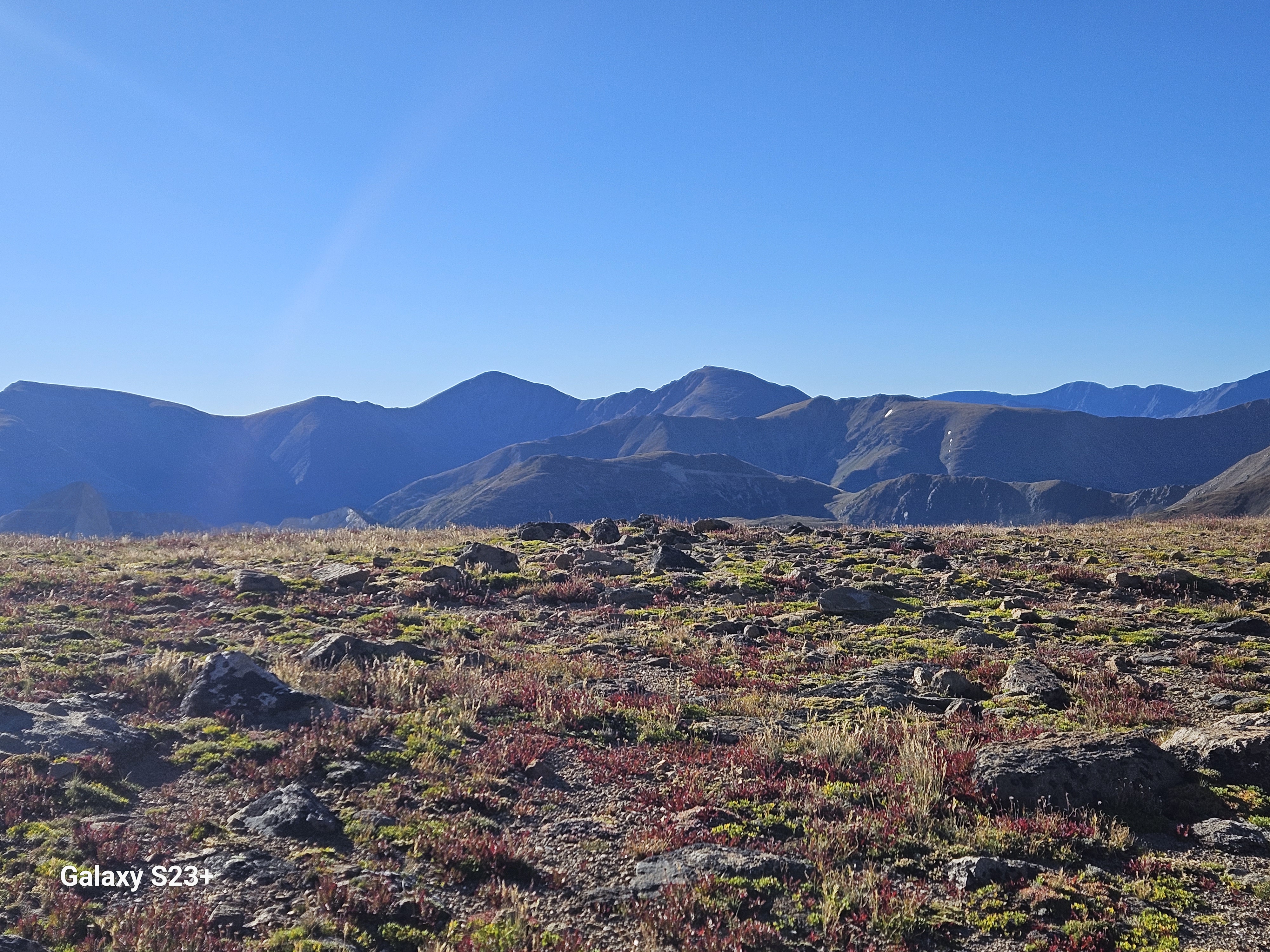
I knew I had some serious climbing ahead the next day, so I was up and out of camp at dawn. It was cold and windy, and I was really missing those lost gloves. I was happy to be making the climb up James Peak with some at least slightly fresher legs. I had the early morning summit of all to myself and it was pretty spectacular.
I had some cell service and was able to connect with my wife Maria. It was fun to share my hike with her; she doesn’t quite get how I love doing this so much but she does seem to appreciate the joy it brings me. I met a few cheerful hikers who had left from the 13er’s trailhead, and was happy to find some water as the Far Out comments had indicated.
After a long downhill hike I finally reached the stream ahead of Mt. Flora. The weather forecast was good so I stopped for a good break and hot lunch before my second 13er ascent of the day. I chatted with some fun & friendly Swedish SOBO thru-hikers, Swede & Whitney, that passed by. The CDT follows the side of the mountain to the far end, then reverses course past multiple false summits. I wasn’t even surprised at this point to see a little steeper pitch up what was finally the last climb.

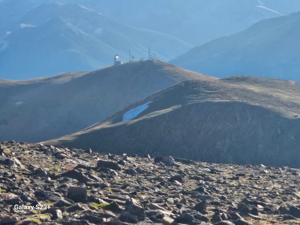
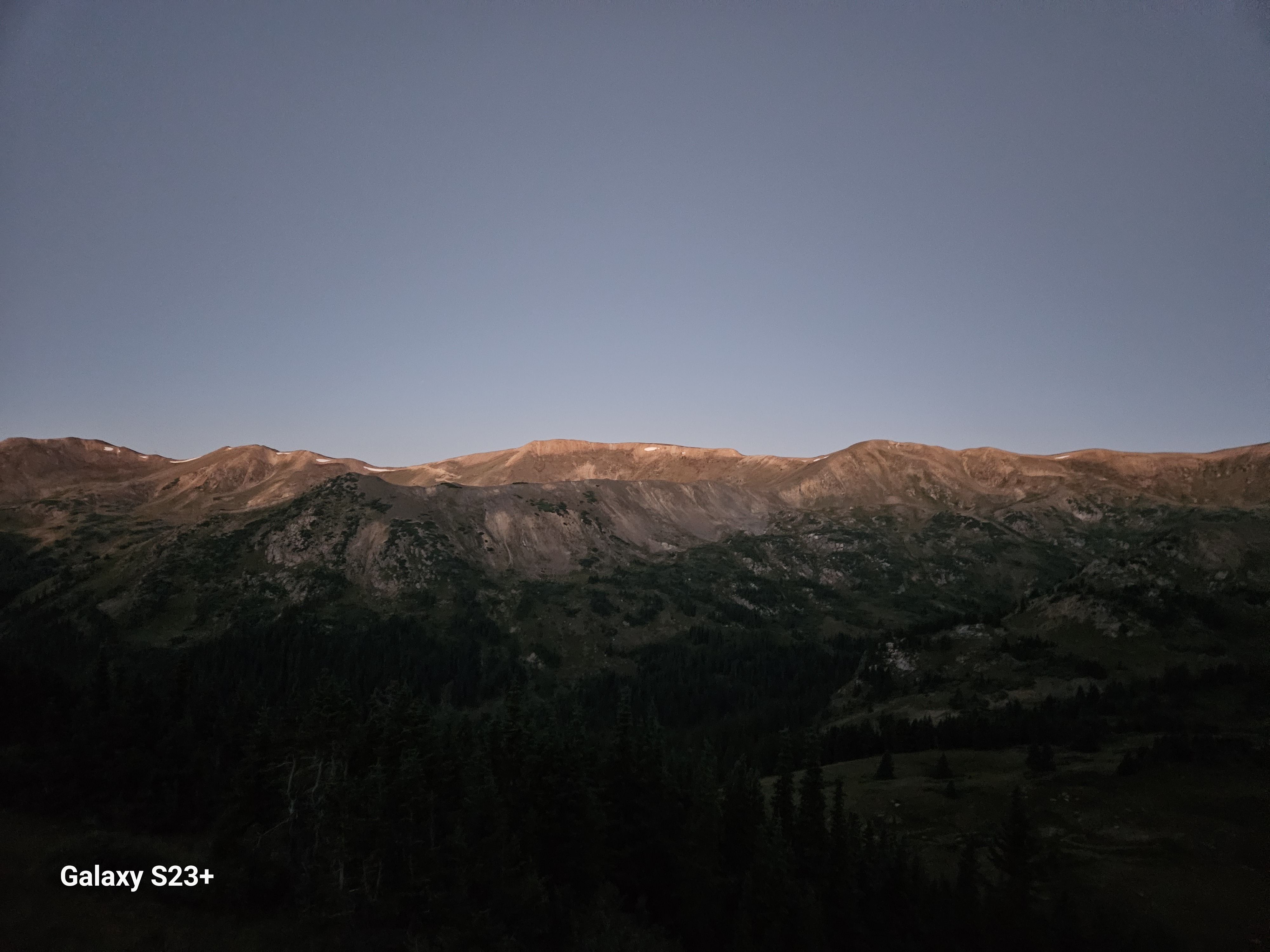
I descended through the talus then finally reached some better footing on dirt trail. After all today’s climbing and descending I was ready to find a camp that left me a short hike down to Berthoud Pass for the next day’s resupply trip to Winter Park. I ended up camping on another windy saddle, and could both see and hear the buzz of machinery from the Berthoud weather & communications station. This made a fun reference point later as I could easily see the saddle where I had camped from Berthoud Pass below.
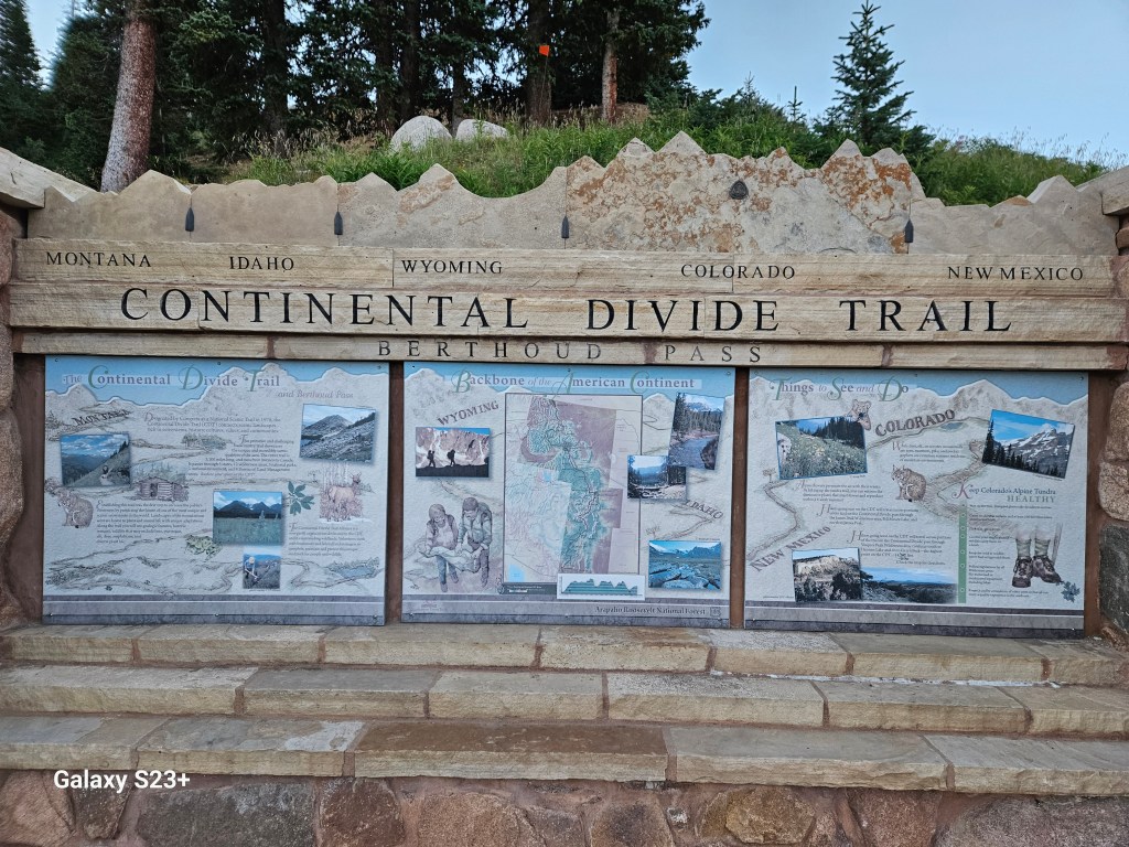
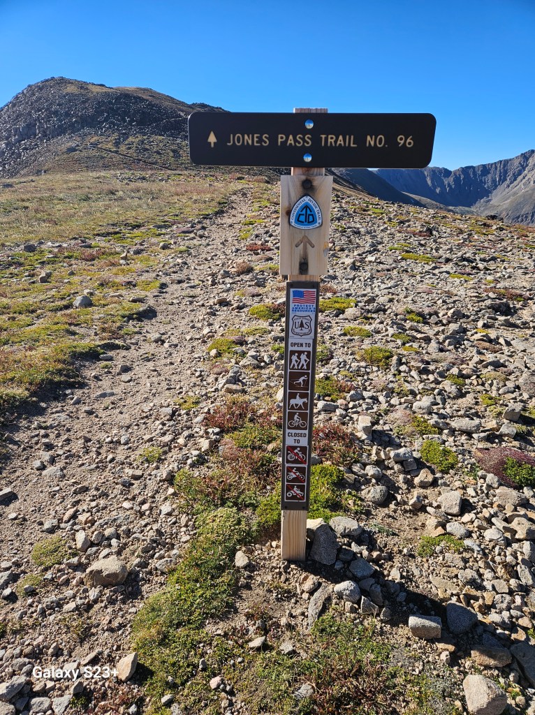
As I hiked towards Berthoud Pass the next morning I felt a bit discouraged at my progress and days that seemed to all end at just 13 miles. At this pace I was unsure I could make it to Grays Peak ahead of the rain/snow storm that was predicted in about two days. But when I saw the CDT sign at Berthoud Pass I found myself choked up again with gratitude for all that this trail has meant to me, both this week and over the past three years.
After trying for about an hour I finally got a hitch, from an elk bow hunter name Doug, to Winter Park to pick up my resupply. It was fun to see Swede and Whitney again at breakfast. Thankfully I found some affordable lightweight gloves at the local gear shop to replace those I had lost. While picking up my resupply at the post office I met a SOBO thru-hiker named John from Cincinnati. We had chatted briefly the day before as he breezed past me on the way up Mt. Flora.
Winter Park was my simplest exit point – I could easily hitch back to my truck in Grand Lake from here, and I certainly thought about it. Thankfully I packed up my resupply and recalibrated my plan to carry on. I would need to hike another 5 miles to camp tonight, then cover 20 miles the next day. That would leave me about a 5-mile climb to reach the Grays summit, hopefully ahead of the storm on Saturday morning.
I walked just past the ski area parking lot, thinking I could get a quick hitch back to trail. After about an hour I sat down, said a quick prayer, and sent a couple ‘how ya doing” messages to friends back home. I didn’t even have my thumb out when a young mountain biker named Denali stopped to offer a ride. It turned out Denali was his real name given by his adventurous parents.
As I neared the end of the first climb from Highway 40 towards Vasquez Pass, John again cruised past me. He could see the pained look on my face as he playfully teased, “looks what ahead!”
I smiled back as I saw the switchbacks up the short but pretty steep hill waiting for us. After knocking out James Peak & Mt. Flora the day before this wasn’t so bad, but I was still impressed at how quickly John danced up those switchbacks.
This turned out to be fun afternoon hike, with a plan to get to bed early then get on trail before 4am the next morning. Comments on my Far Out app described my ideal camp site – near water, just ahead of the next climb. I was super happy to find that site available. The comments had also accurately warned about the constant humming of the nearby Henderson molybdenum mine, a surprisingly massive operation.

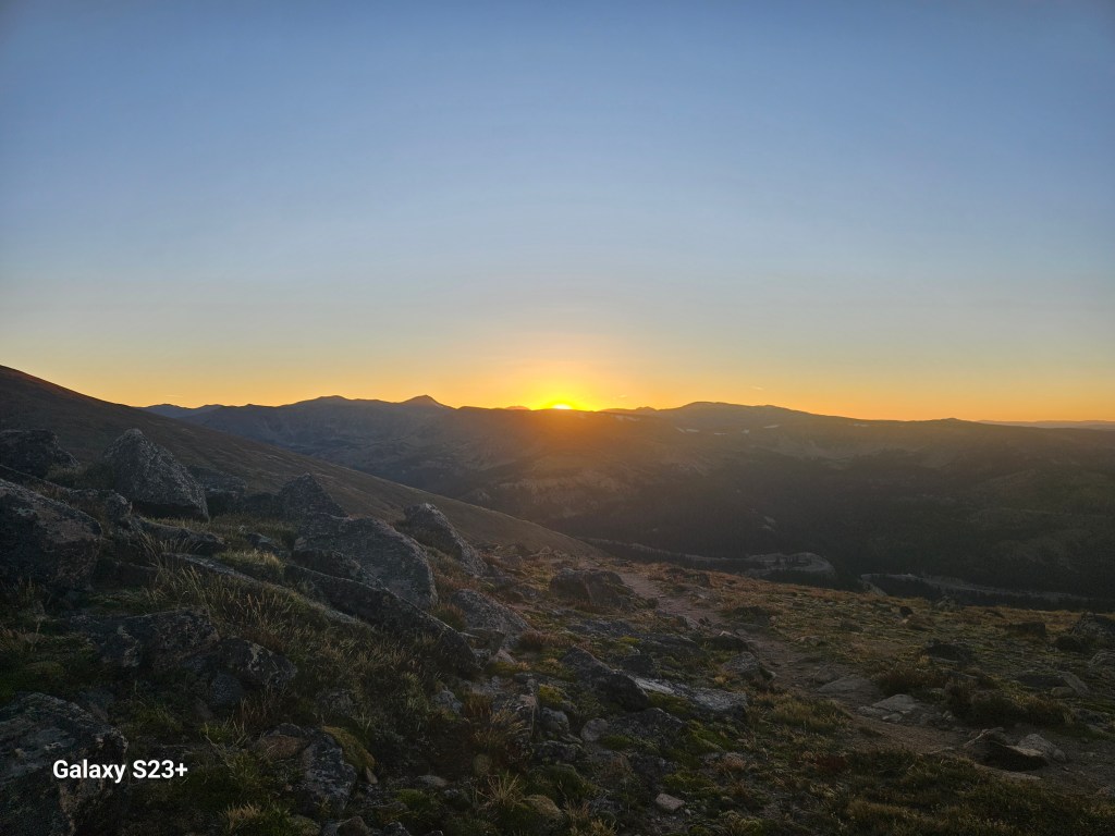
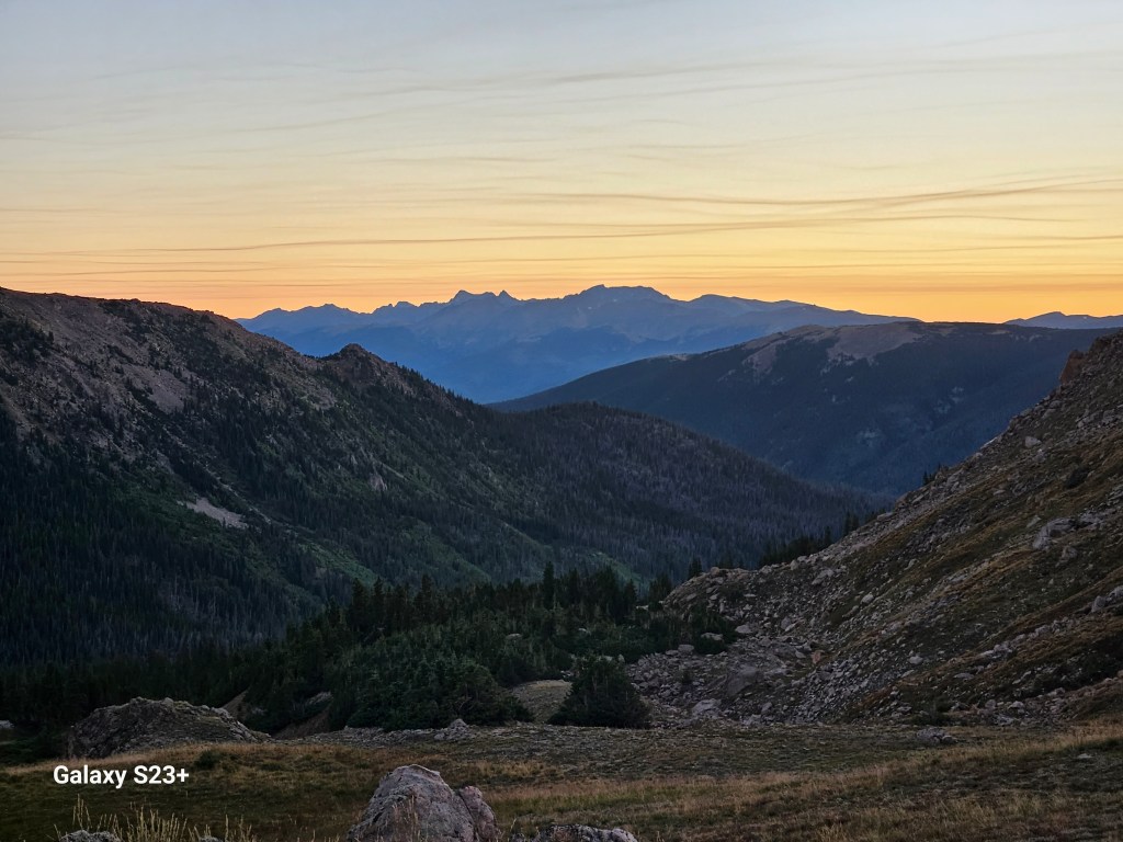
I woke up to a stunning, clear, starry morning. I absolutely love these times on trail, when it’s just me starting a climb in the dark and feeling excited for the day ahead.

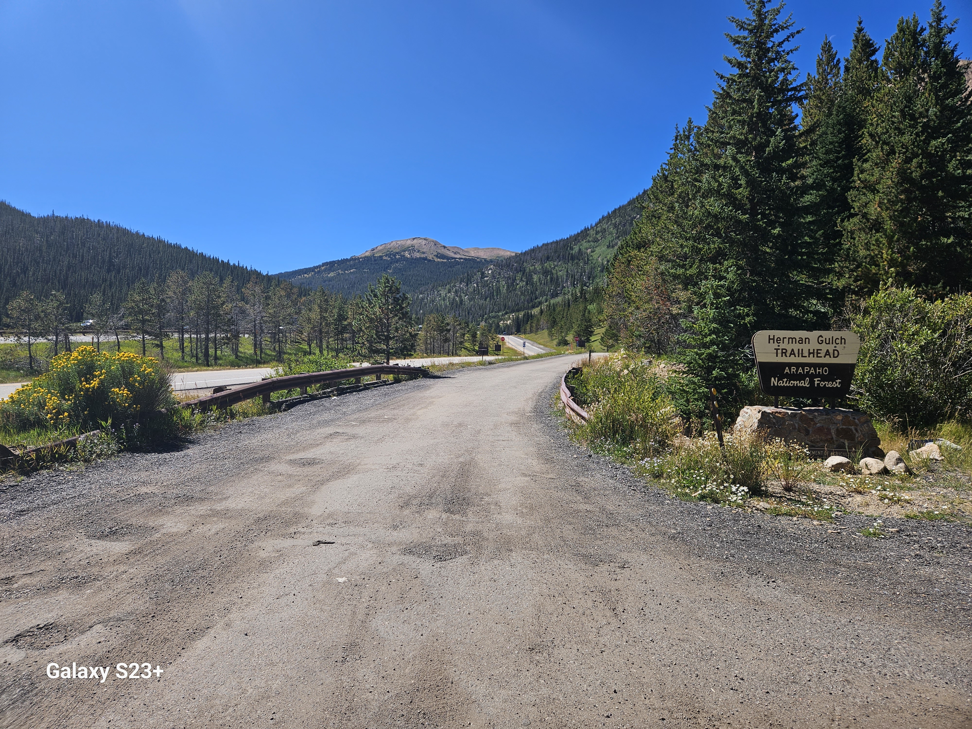
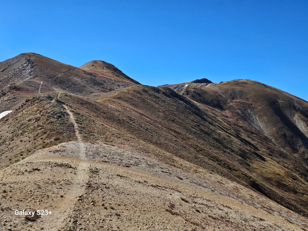
I knew I had a long morning climb with around 3500 feet elevation gain to Mt. Hassell, another 13er, followed by an even bigger 4500 foot decent to reach Herman Gulch at I-70. It was easy to stay inspired this morning with high mountain vistas in about every direction. This section of the CDT is bit more maintained than other Colorado sections I’ve hiked, alternating between nicely arranged talus and actual trail across rolling meadows. I was making great progress today and felt committed to make the 20 miles to the Grays Peak trailhead, a daily distance I hadn’t come close to covering since hiking Colorado Trail two years earlier.
I finally got some cell reception to call Maria. She was visiting her family in Mexico and her son was due to have surgery the next day. She mentioned she wanted me to go home today; I initially took that to mean she just didn’t get why I was out here. But after I lost cell reception and hiked on, I realized she had never asked me to get off trail like that. Then it hit me that Maria was worried about her son, and even though I wouldn’t physically be there with her in Mexico, she just needed me to be available for her if she needed me. When I finally got cell reception again I let her know I understood, and that I had decided to get off trail at I-70. I still needed to hustle to be able to hitch to Idaho Springs (IS) to make the daily Bustang shuttle that could get me to Granby, then catch another hitch back to my truck in Grand Lake.
The final climb up Mt. Hassell looked a bit intimidating from Jones Pass below. Then a group of mountain bikers passed me and I watched them carry their mountain bikes up the talus ascent. I even saw a couple of trail runners on the climb. It was fun to chat with a fellow CDT section hiker called Nine Lives, who was doing much of her Colorado mileage as out & back hikes. The descent was relentlessly long, and I could now see why those mountain bikers looked so eager to reach the Mt. Hassell summit. I finally reached the Herman Gulch trailhead around 2pm, then after a couple easy hitches (thanks Ron & Scott!) and a bus ride I was in my truck and headed back to Steamboat.

On my drive home, I reflected on how I’d gotten my hitch back to trail, then my hitch leaving trail, when I didn’t even have my thumb out. Both must have been meant to happen. I had pushed myself that day to make 15 miles by 2pm so I would have made the extra 5 miles to camp at the Grays trailhead, but that also got me to IS in time for my bus. I was comfortable and grateful about my choice get off trail, and I that I was available for my wife. Thankfully all went well with her son’s surgery. In the end, the trail had already given me a way more meaningful experience on this trip then I had imagined. More importantly, I gained the perspective that as much as I love being out there, enjoying my family and being present when they need me is what really matters. More will be revealed next summer with my hike up & over Grays to connect back to Georgia Pass and the Colorado Trail.