Sawtooth Range in background
I had been looking to hike this section of trail for years, after gazing countless times at the peaks in the Mt Zirkel Wilderness from Steamboat. I’ve done some backpacking on the west and east sides of the area, and loved the idea of making a north to south traverse on the CDT. I was super excited that my buddy Art would be joining me, as he did two summers earlier for a couple sections of the Colorado Trail.
Art’s wife Teresa was kind enough to help us shuttle vehicles, as we left my truck at the Summit Lake parking lot where we planned to finish. This was no small ask, as the west side of Buffalo Pass is a rough, generally ungraded 4-wheel drive road; she probably spent six hours shuttling us up Buff Pass then back to our starting point on Seedhouse Road near Clark.
I tracked our location on my Far Out app while we drove, looking for our starting point at the barely visible northbound Wyoming Trail marker. That will be my connection back to trail when I hopefully hike the Wyoming section of the CDT in 2025. We started our section hike at this seemingly random spot on Seedhouse, then turned south on the road towards the Three Island Lake trailhead. After about 1.5 miles the CDT leaves the road at another subtle trail marker, then rejoins the same road towards the North Lake trailhead. We met a super fit trail runner who kindly shared with us that she’d once had a mountain lion encounter on that connector trail. She was the only other person we saw on trail that first day.
The North Lake trailhead was the halfway point on our planned 8-mile first day, which seemed reasonable given our early afternoon start. I had hiked to North Lake a few years back and remembered a nice campsite just out of site of the trail, alongside a handy grandstand rock formation. It’s a pretty steady uphill hike from the trailhead to the lake, with about 2000 feet to gain over 4 miles. The CDT passes through an eerie burn zone which at least confirmed we were getting close. From there it’s short decent through some marshy woods then a final uphill push to North Lake. We were able to camp at the same familiar spot with no one else at the lake.
I have a habit of collecting my water at night in my CNOC bag, then hanging the bag to gravity filter it though my Sawyer Squeeze as I break down camp in the morning. I repeated this routine the next morning and it started out flowing like usual. I felt foolish as I turned back around and watched the water freeze on both ends of my filter, meaning the filter fibers had likely frozen, broken and were unreliable. This turned out to be a bad early morning practice for a fall hike in Colorado at 10,000 feet. I had brought along a backup Katadyn filter & bag, which thankfully was still in my puffy coat pocket.
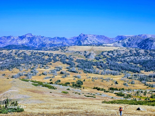
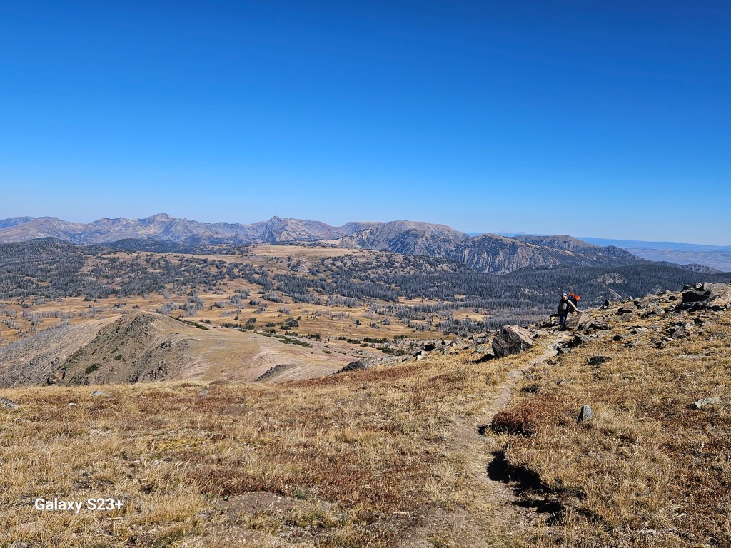
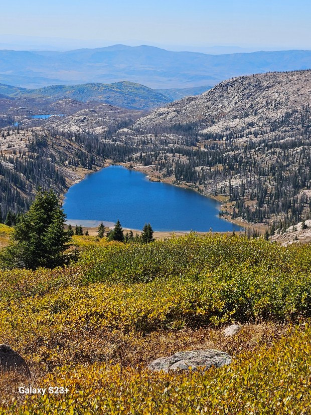
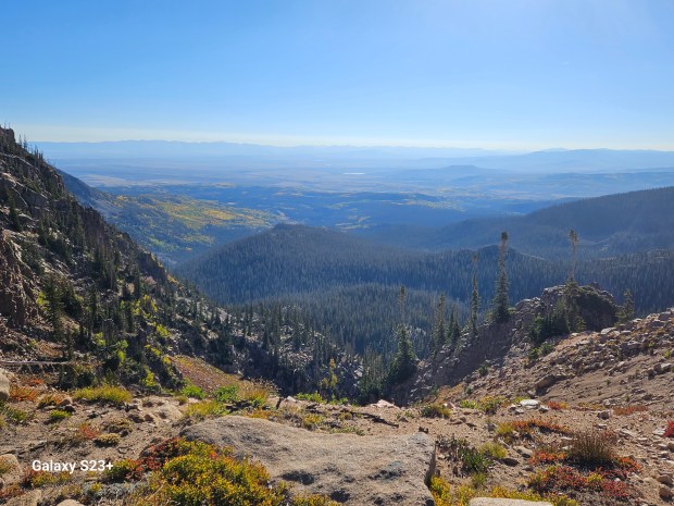
On my last visit I had hiked up to the Divide, where the CDT rejoins the Wyoming Trail and heads south towards Rabbit Ears Pass. I had stopped at that junction, and remember thinking how cool it would be to follow the trail across the alpine tundra up and over Lost Ranger Peak. Today was the day. I hadn’t even imagined the view looking back towards the Sawtooth Range from the top of Lost Ranger Peak.

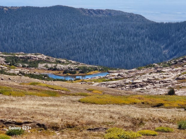
After Lost Ranger Peak the trail crosses Rainbow Lakes trail. A few years earlier I had taken a backpacking trip to Rainbow Lakes then hiked to Slide Lakes, and it was cool to see these from above on the CDT. The trail continues on below Mt Ethel then passes above post-card worthy Luna Lake.
The trail was faint after Luna Lake and we had to back track a bit, a couple of times. After passing all these lakes, and even a small stream, I just assumed we’d continue to have plenty of water along the trail. About a mile past the stream Art gently asked me, “Larry where’s the next water?”. “Ummm…”, I answered as I discovered there was none reported on Far Out for a couple more miles and until after the next climb, well beyond where we planned to stop for the night. We were both running low on water but decided to carry on rather than backtrack a mile, and worst case we’d just have to make that climb. Thankfully Art spotted a small, unnoted pond about a quarter mile off trail. After filling up we hiked to the start of the climb and stopped after about 10 miles for the day.
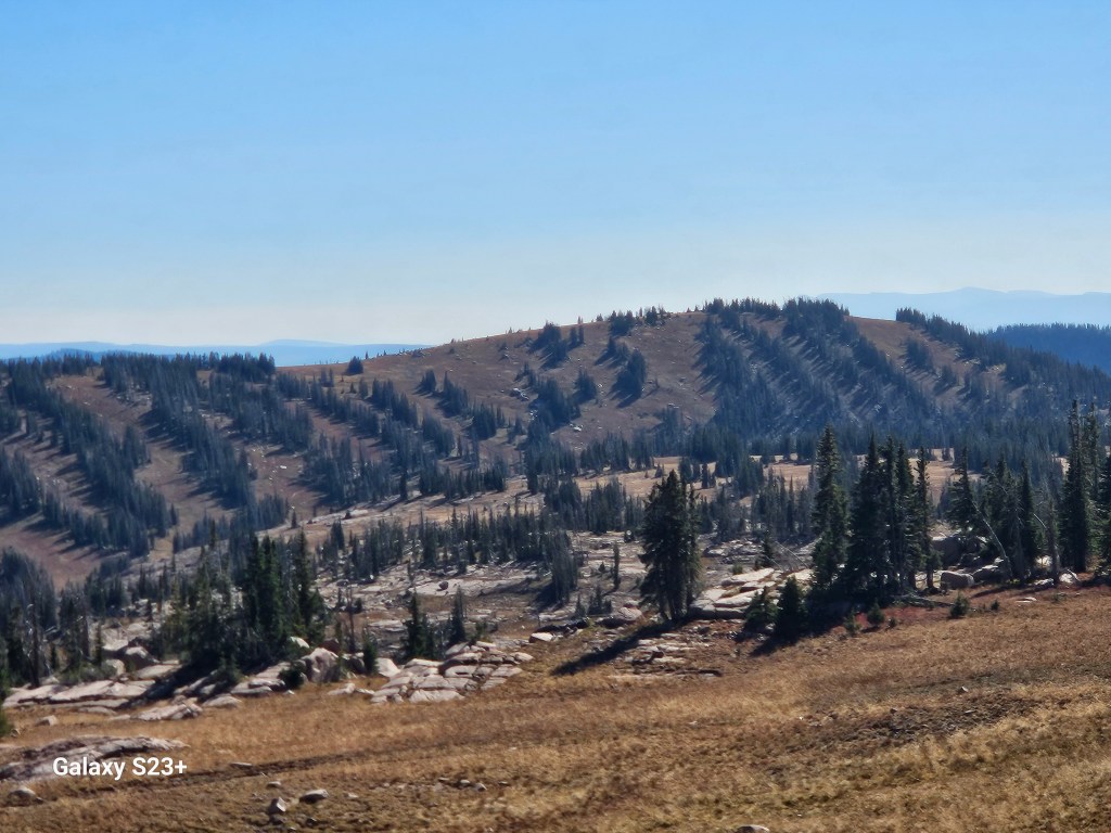
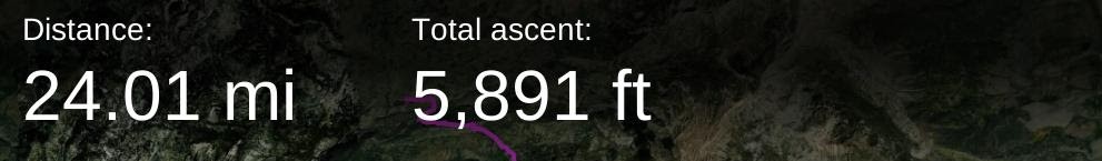
It was nice to still have a bit of daylight so we didn’t have to rush in camp, although I got a little too comfortable. As I sat down while boiling water for dinner I tipped over my pot and badly scalded an ankle – ouch! The next morning we knocked out the first climb pretty easily, then it was rolling hills and some great views as we hiked the last 6 miles back to my truck at Buff Pass. We also took note of some nice camping spots within just a few miles of Summit Lake that would be perfect for a short overnight trip.

We hadn’t seen anyone the day before but met several friendly elk bow hunters that morning. Our good spirits apparently had us chirping a bit too loudly as one of the hunters (kindly) let us know we’d spooked an elk away from the trail. I didn’t notice until we finished our hike that the drive up Buff Pass had shaken the topper on my Tundra back about 4 inches. We ended up driving back on the east side of the pass, a bit longer mileage but also a much smoother ride home. As Art and I celebrated our adventure with our traditional cheeseburger & Coke back in Steamboat, we began planning next year’s hike from Herman Gulch, over Grays Peak, then on to Georgia Pass.
