CDT-CO: Seedhouse Campground to Rawlins (Aug 1-9, 2025) 125 miles

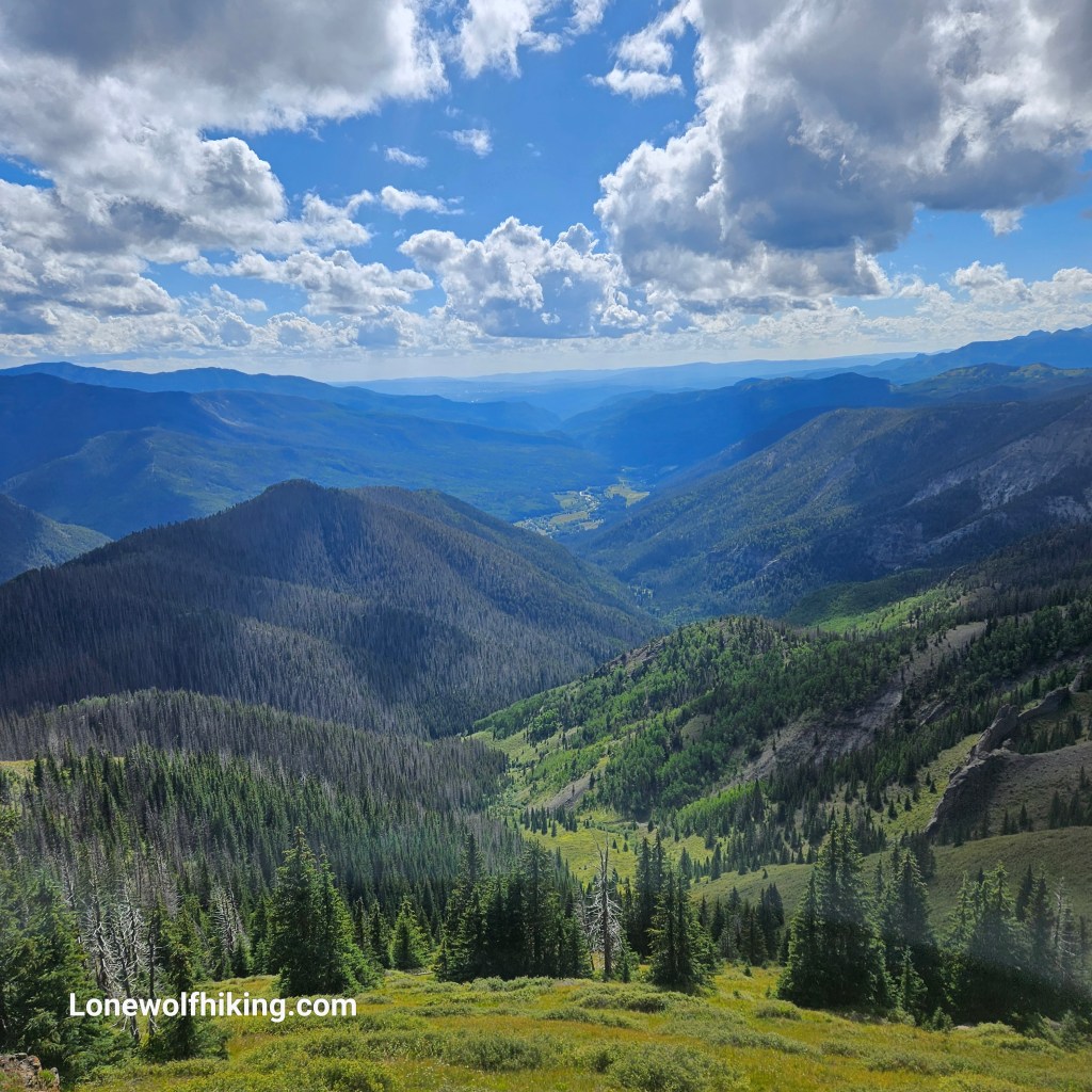
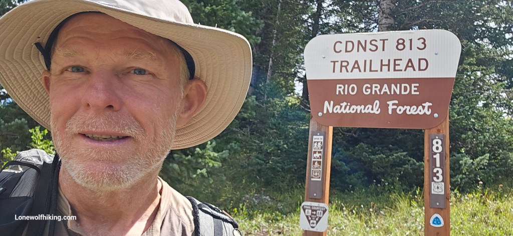
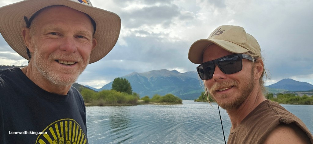
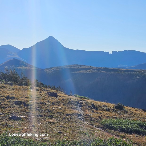
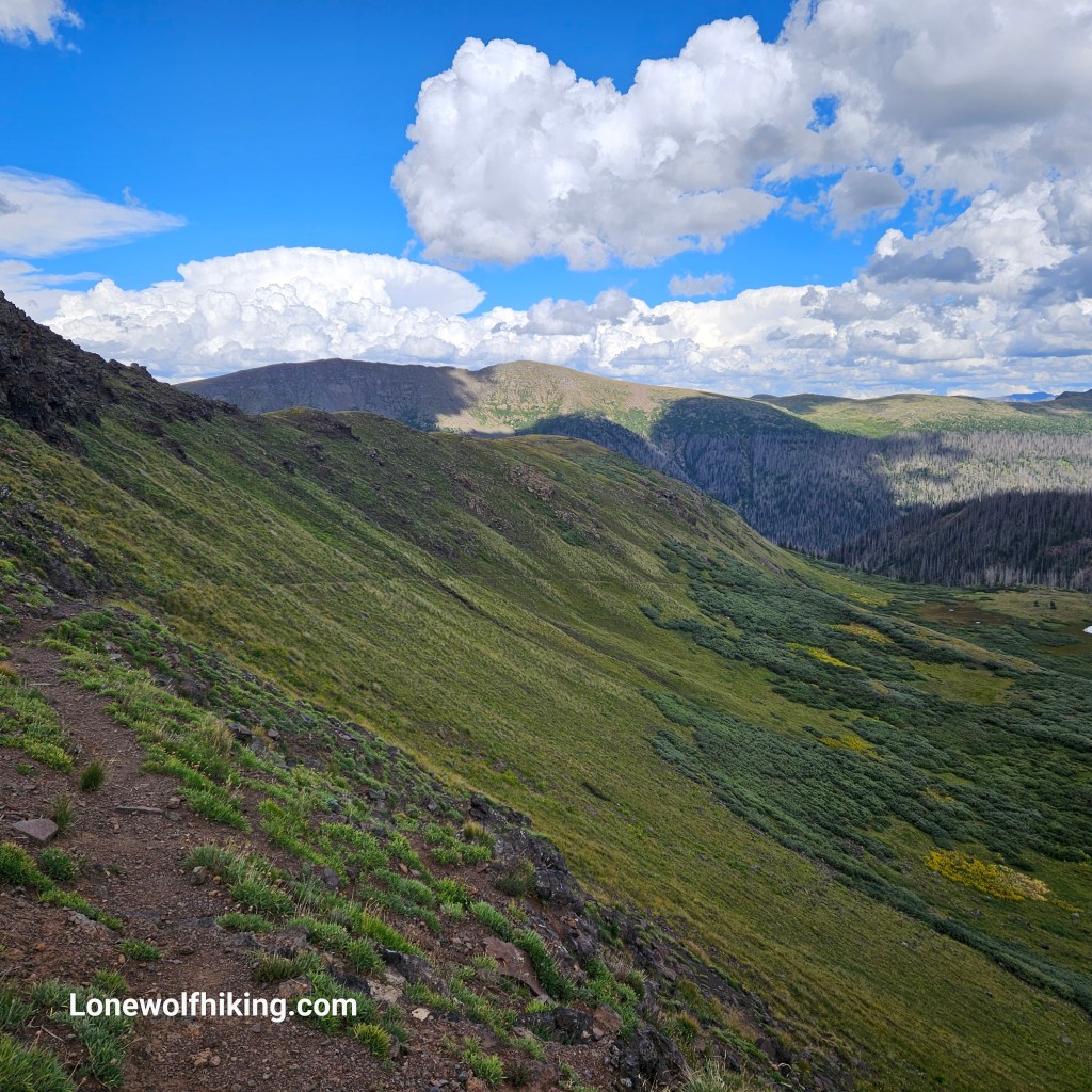
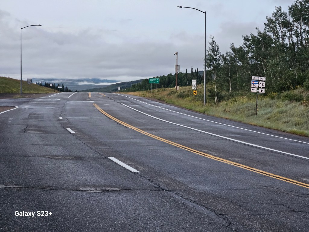
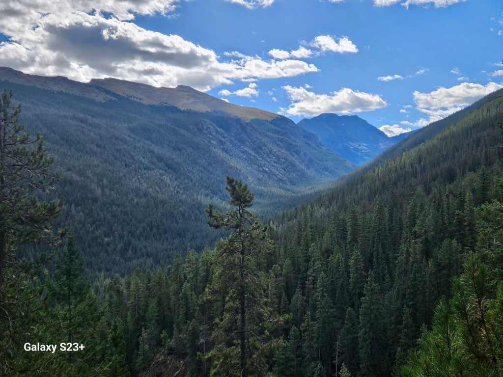
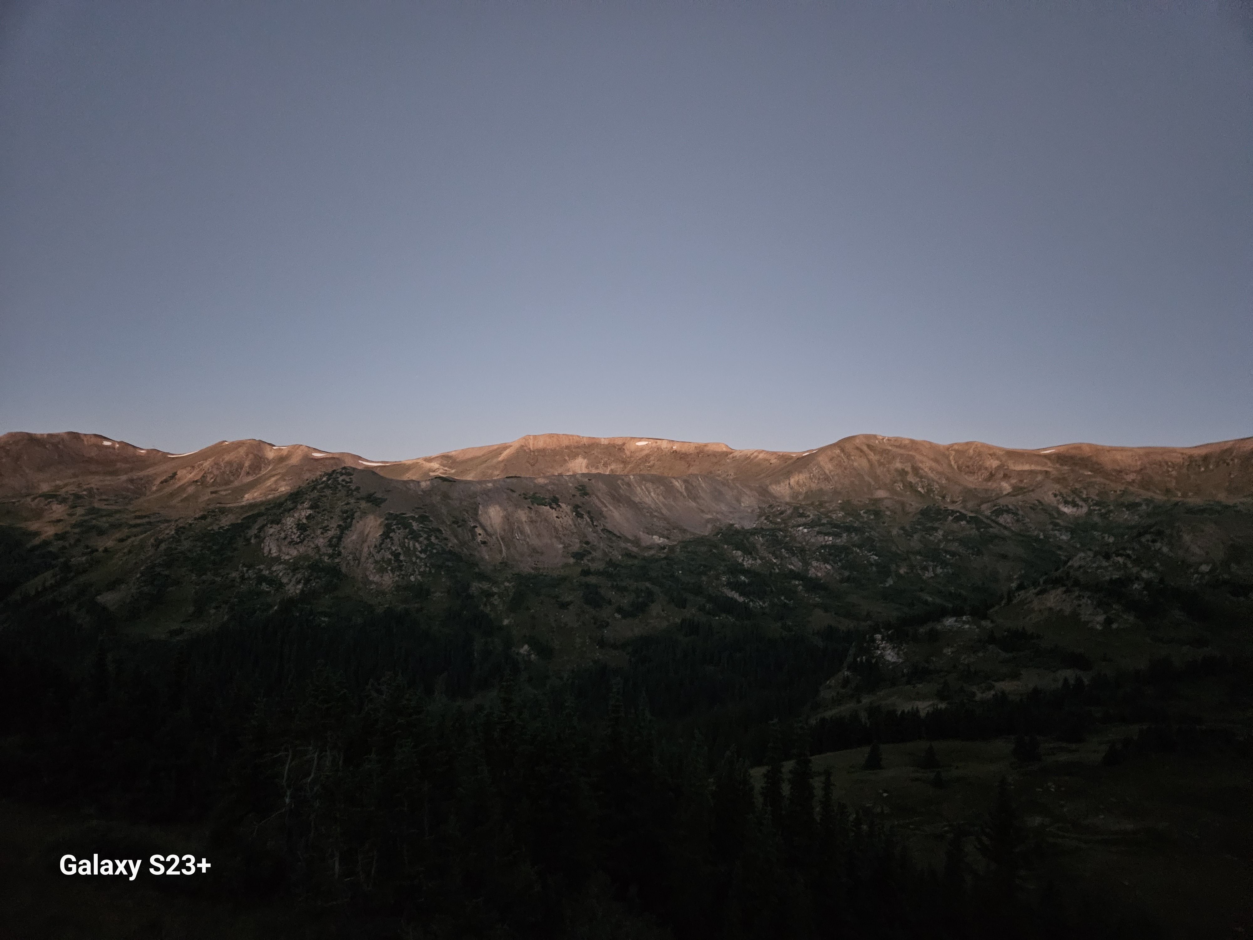
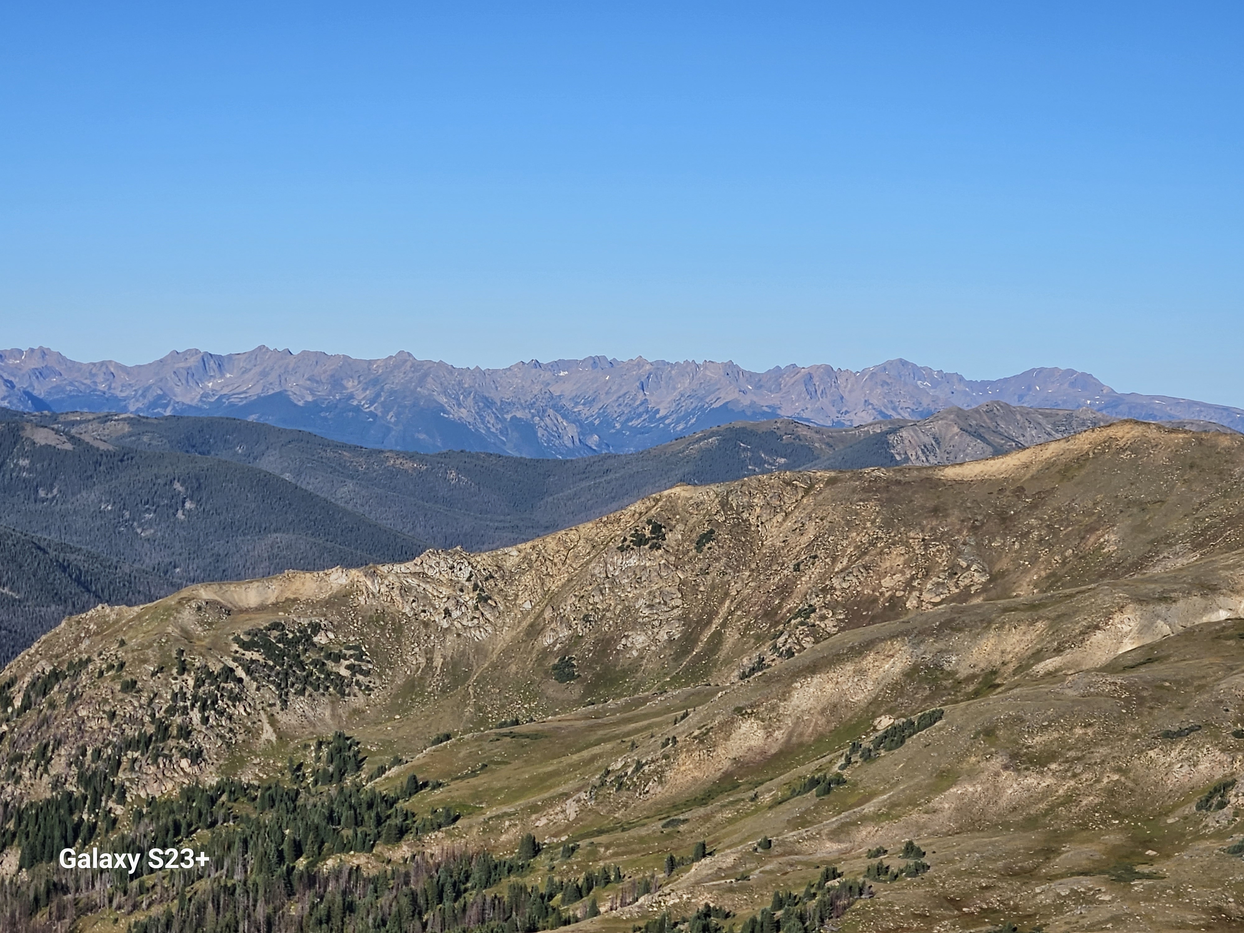
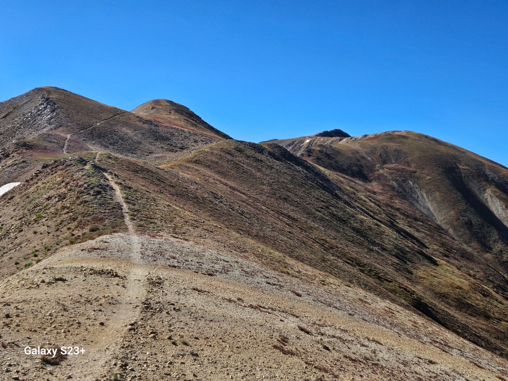
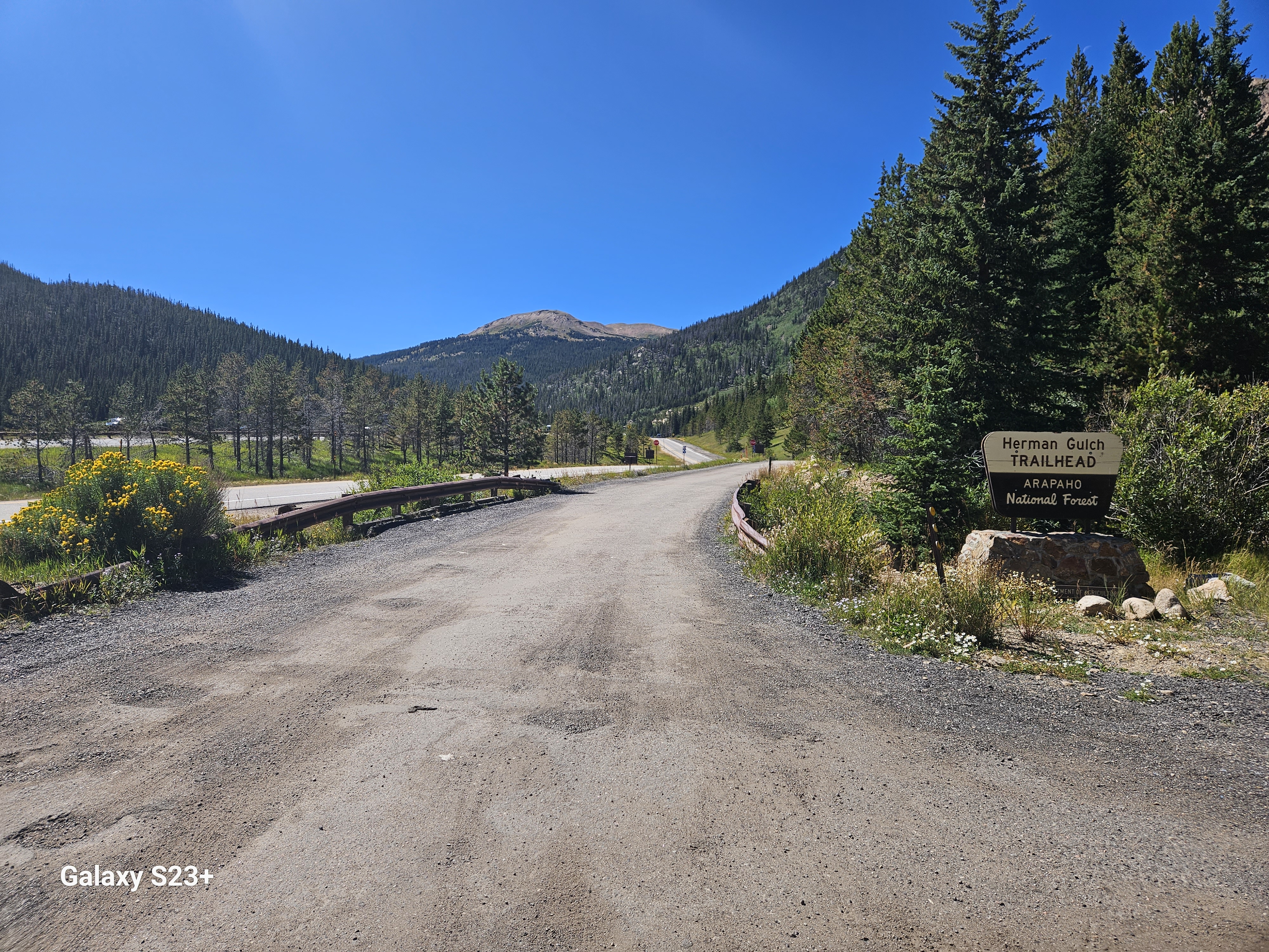
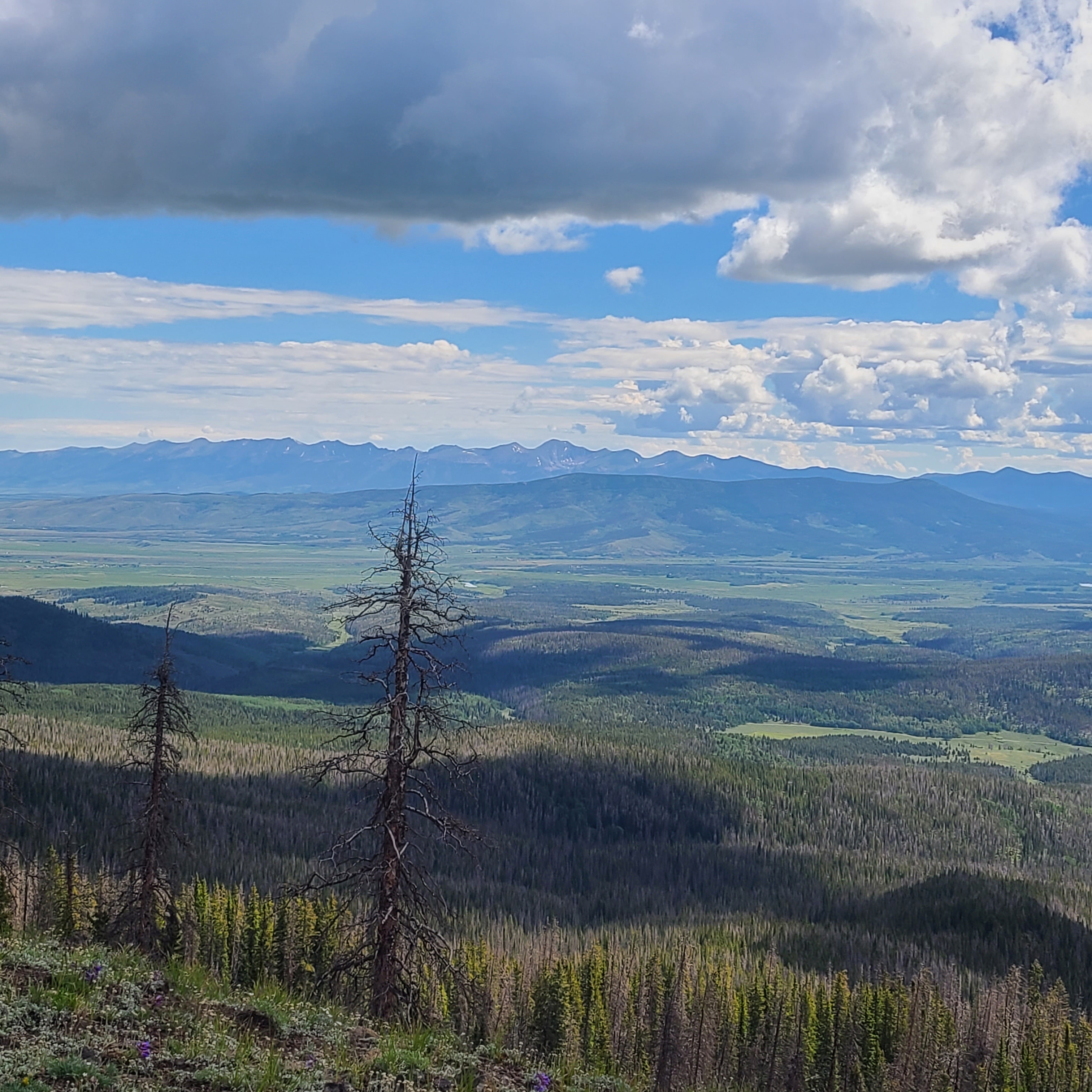
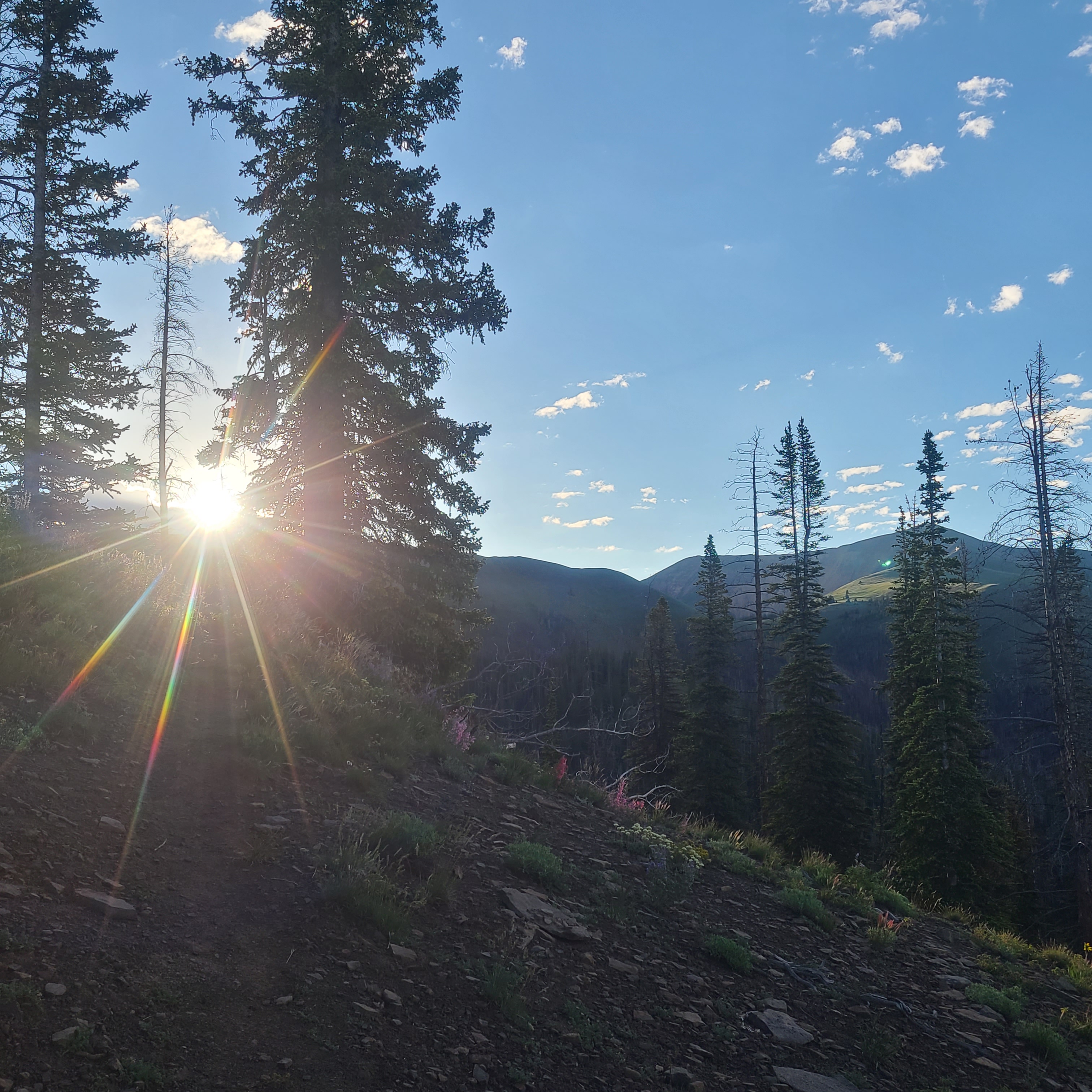
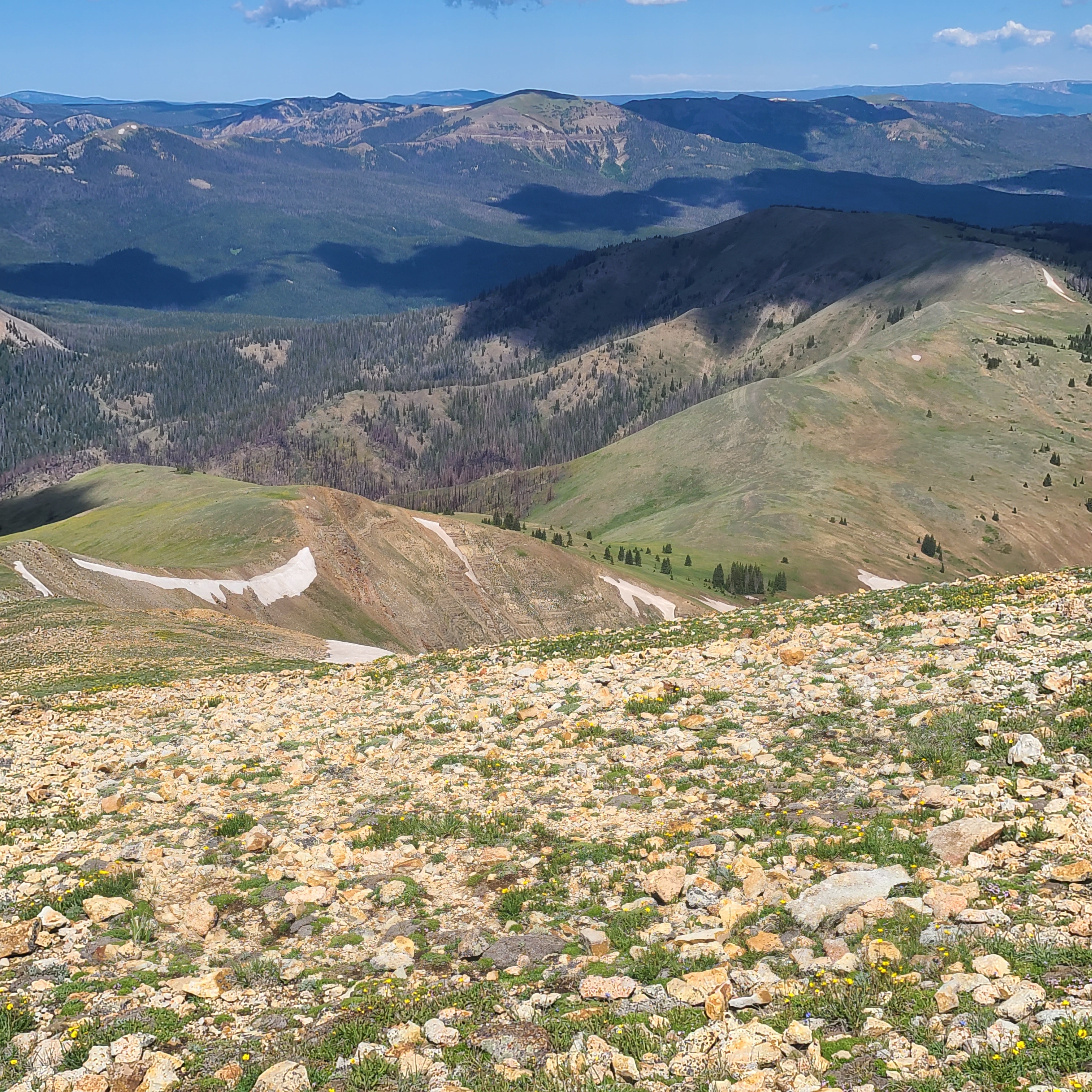
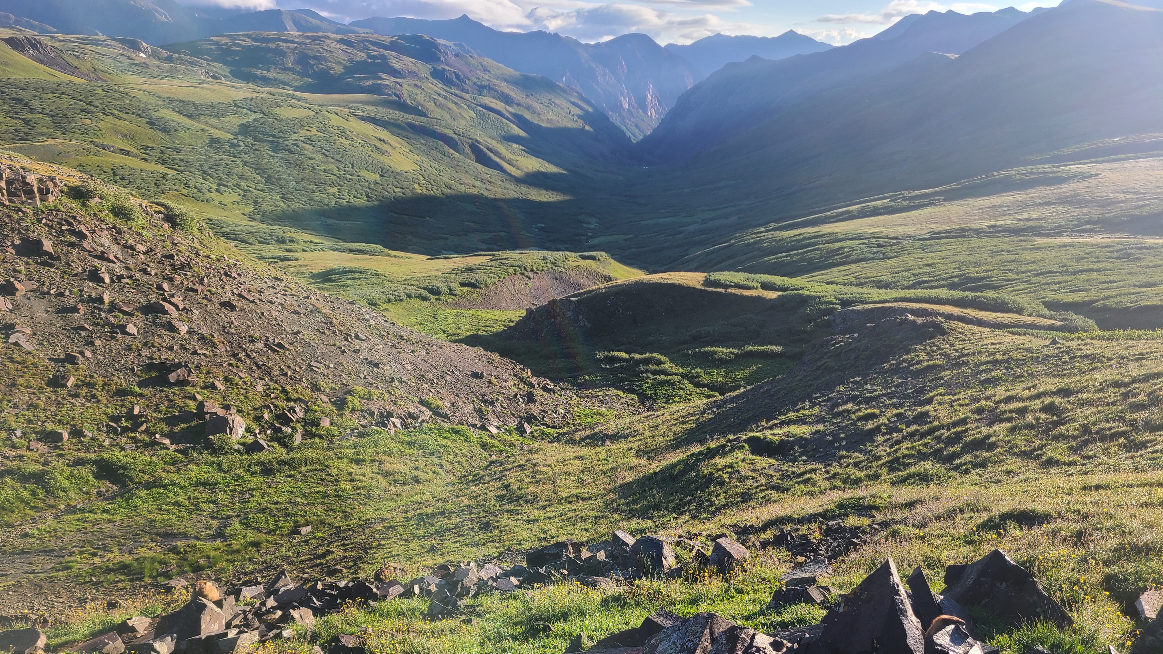
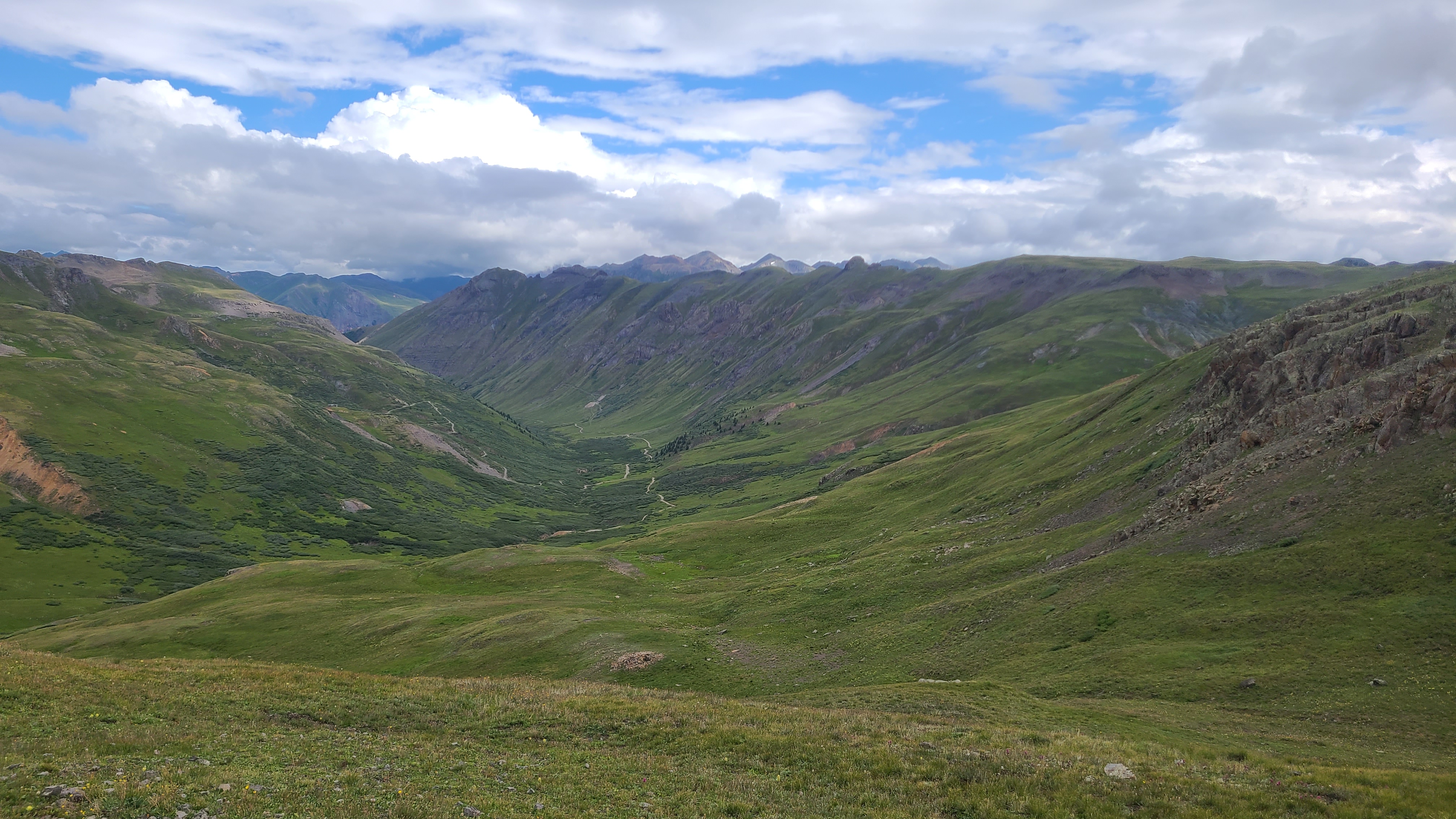
Thankfully my buddy Art is able to join me most years to hike a section of the CDT. It’s handy that he lives in North Routt County and his wife Teresa was kind enough to drop us at the modest trailhead near the Seedhouse Campground. She had left us at the same spot a couple years earlier for our southbound section hike on the CDT to Buffalo Pass. We let a pair of already well-conditioned NOBO thru-hikers go by as we started our hike, and we leap-frogged them a few times that day.

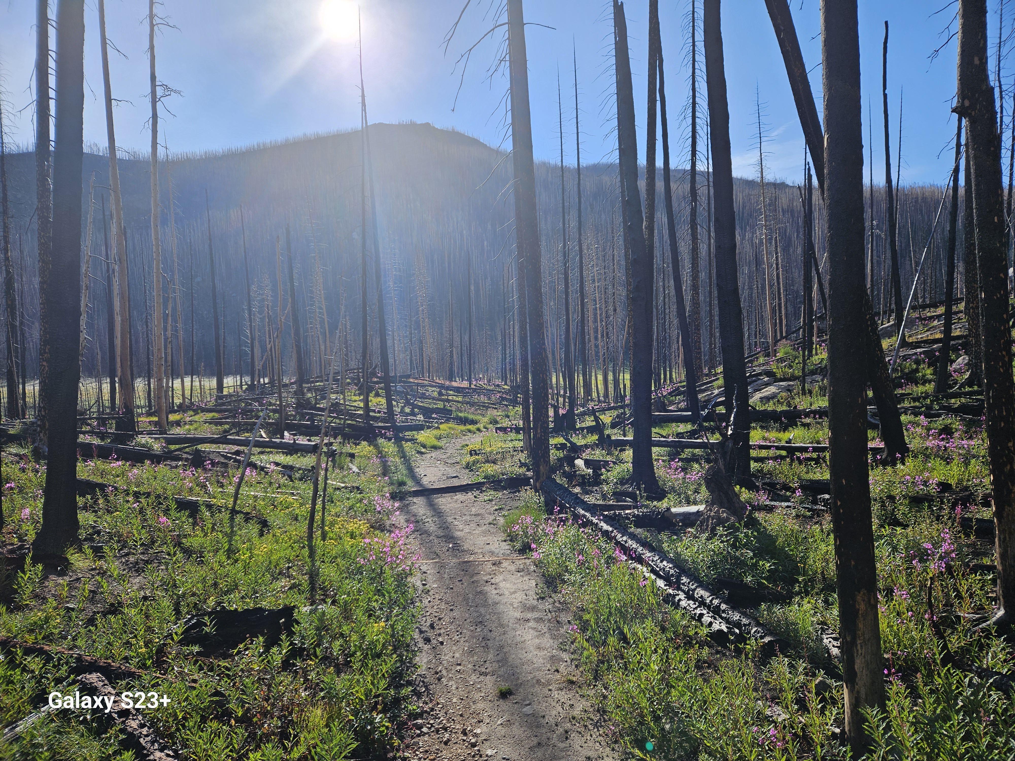
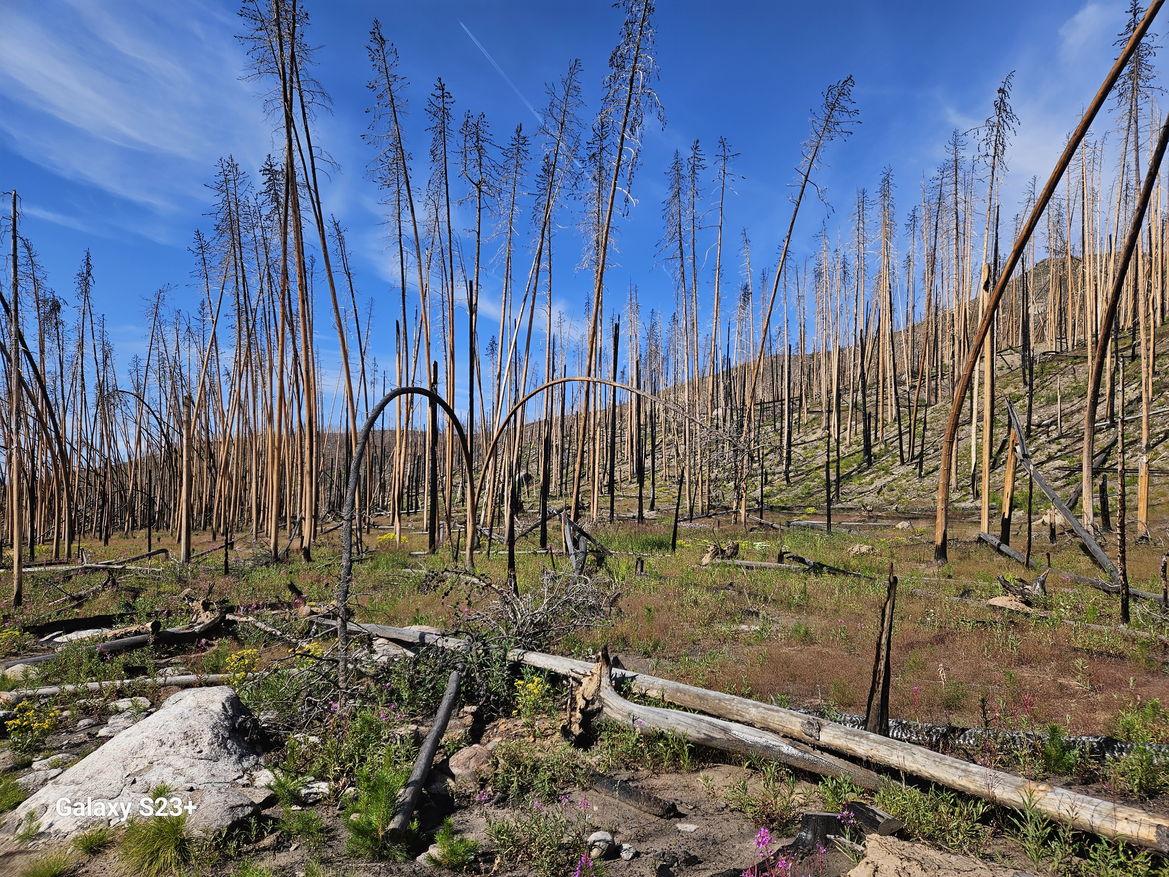
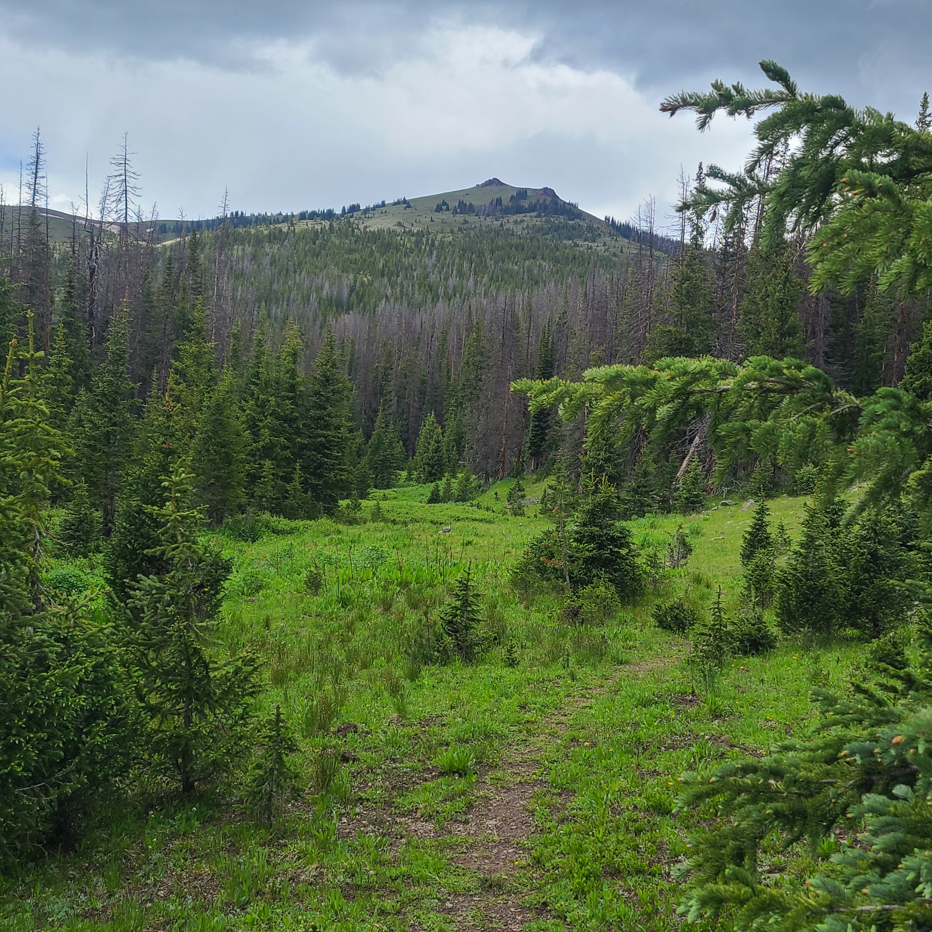
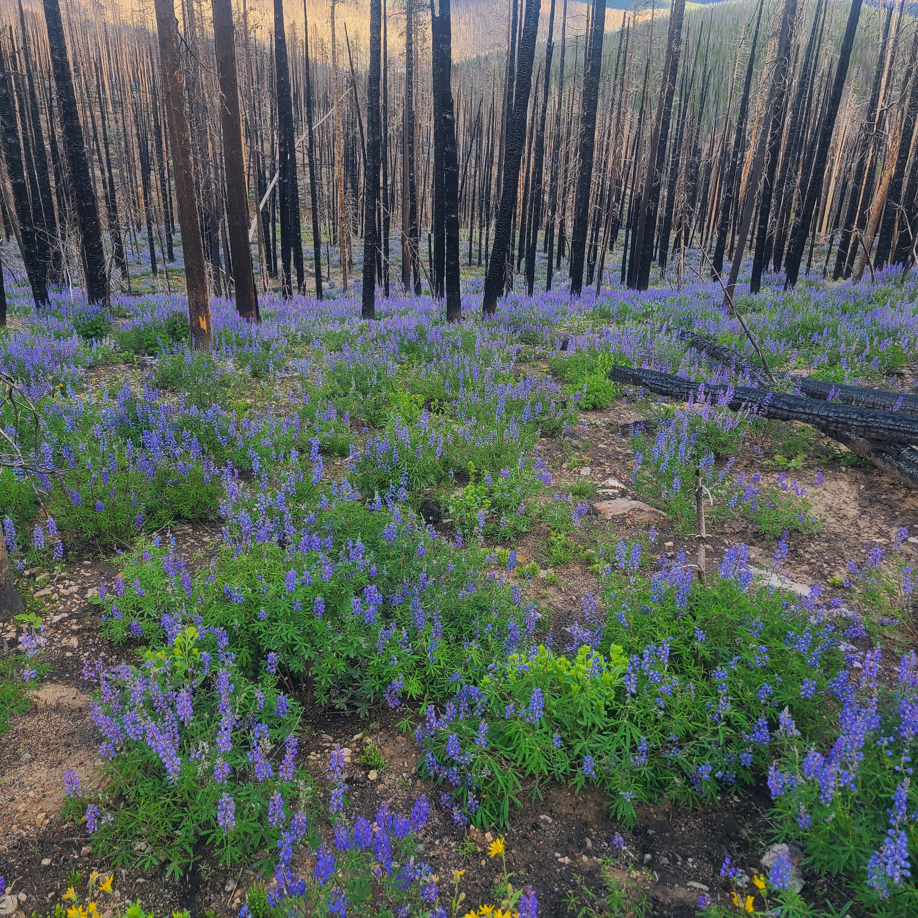
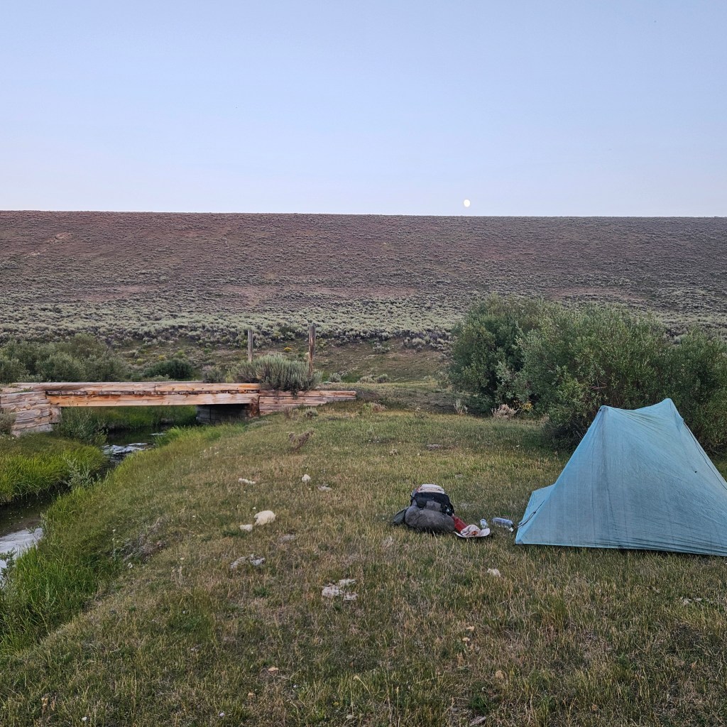
About ten miles in I started to get some intense right ankle pain and had to stop every mile or less the rest of the day. I was already wondering if I could even make the 42 miles to Battle Pass, let alone the distance to Rawlins and beyond. We also had a bit more climbing than expected but still managed 14 miles for the first day. Art spotted a nice little meadow to camp at that was mostly clear of widow maker beetle-killed trees. We stopped at a slow-trickling creek about a mile before camp, and I later regretted not having had the patience to fill a couple more liters there. We had met Volcano, a SOBO section hiker from the UK who hinted at trail magic ahead, but we weren’t sure how far that was or what to expect.

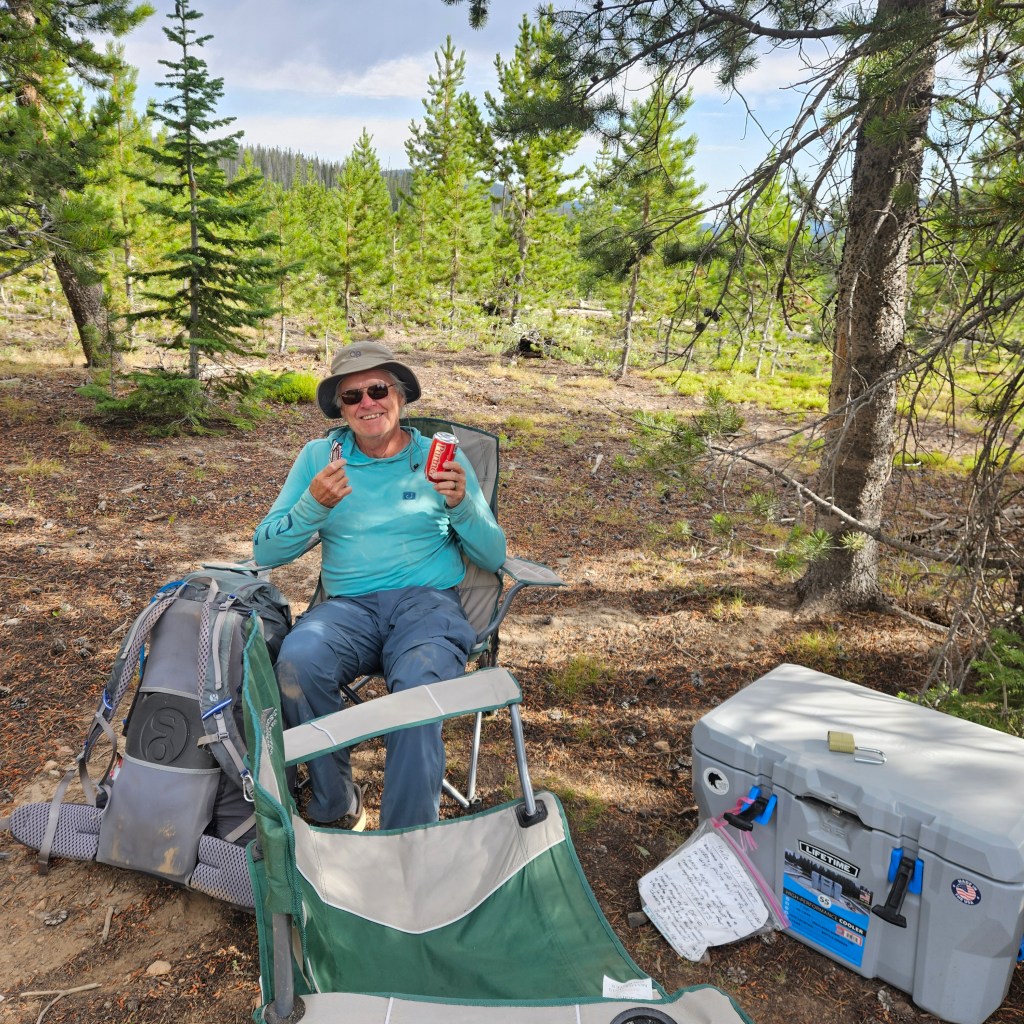
The next morning were very happy to see a pair of large coolers with a nice drink selection and some snacks, even my favorite Butterfinger, after the first mile. We each took a single bottle water to go, wanting to make sure we left plenty for other hikers. FarOut comments indicated a still-flowing water source at the Wyoming border.

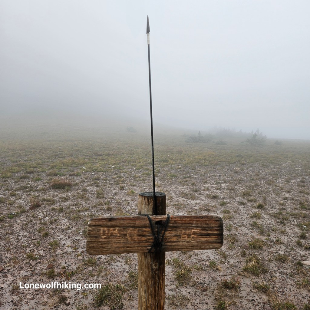
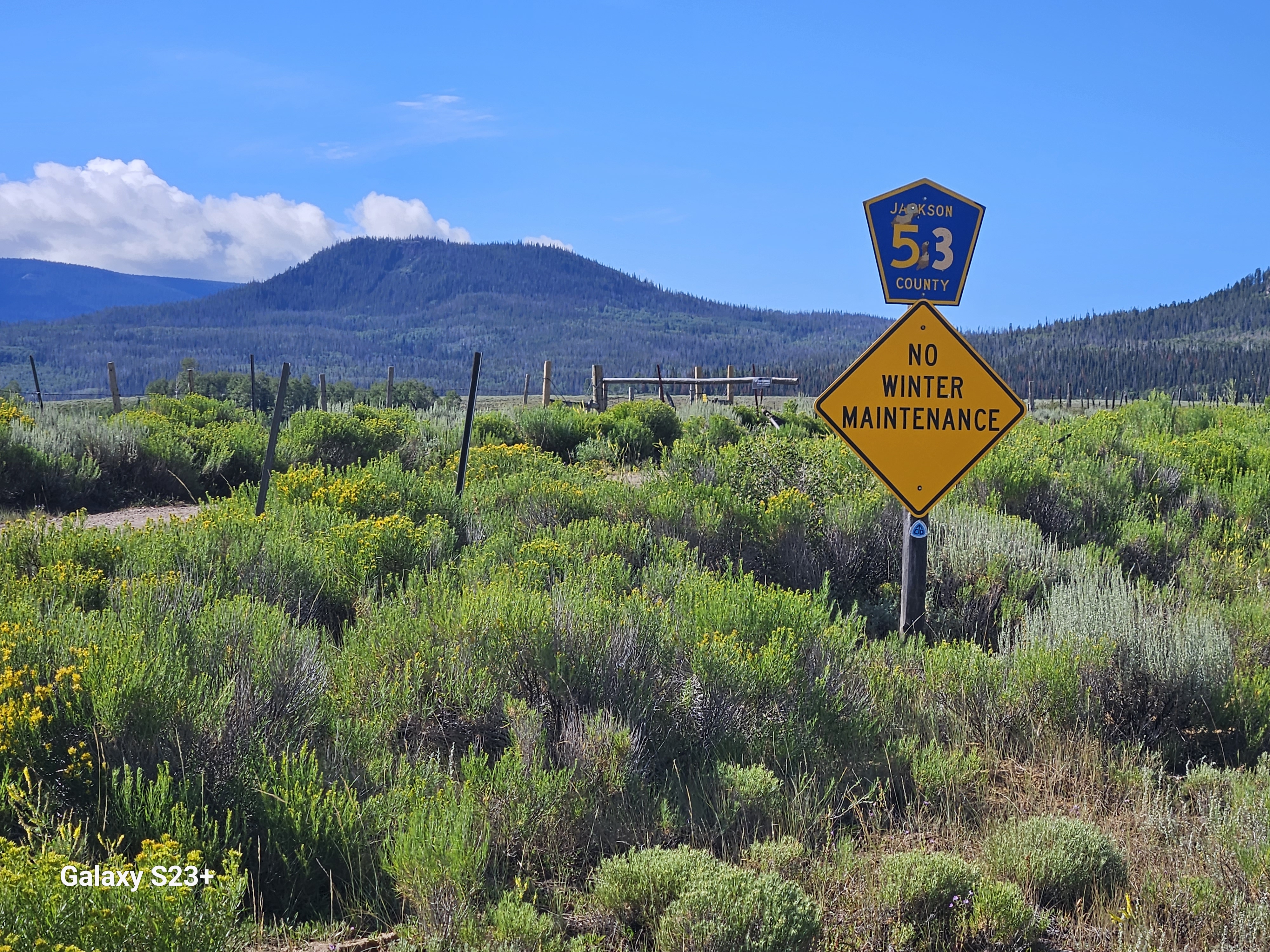
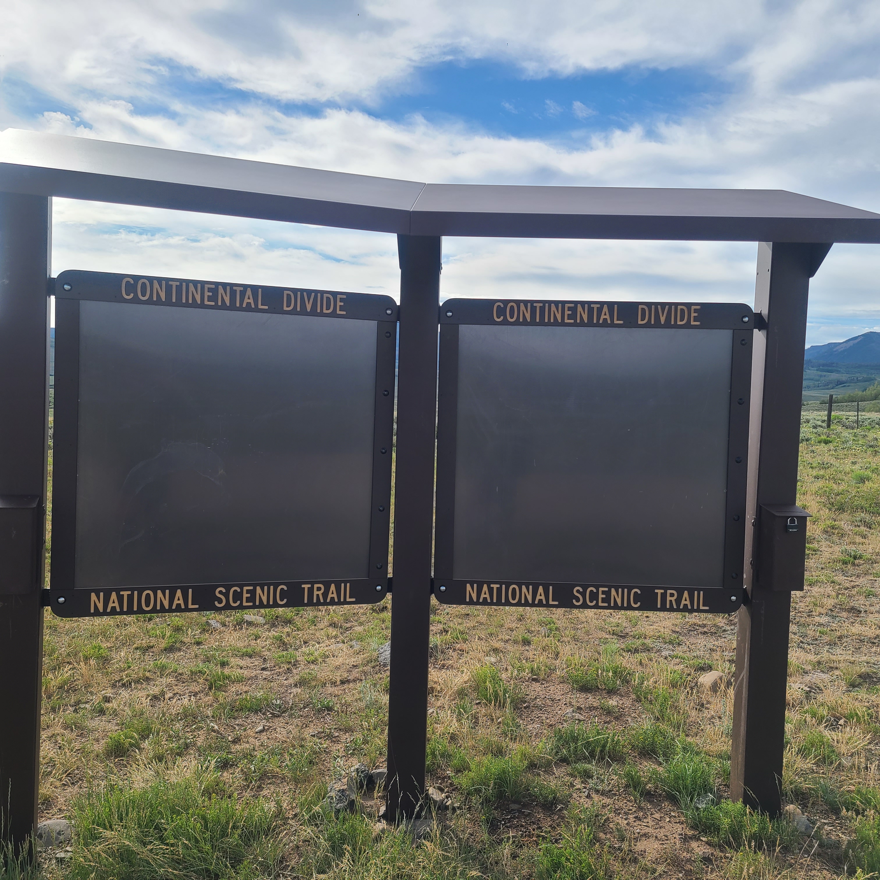
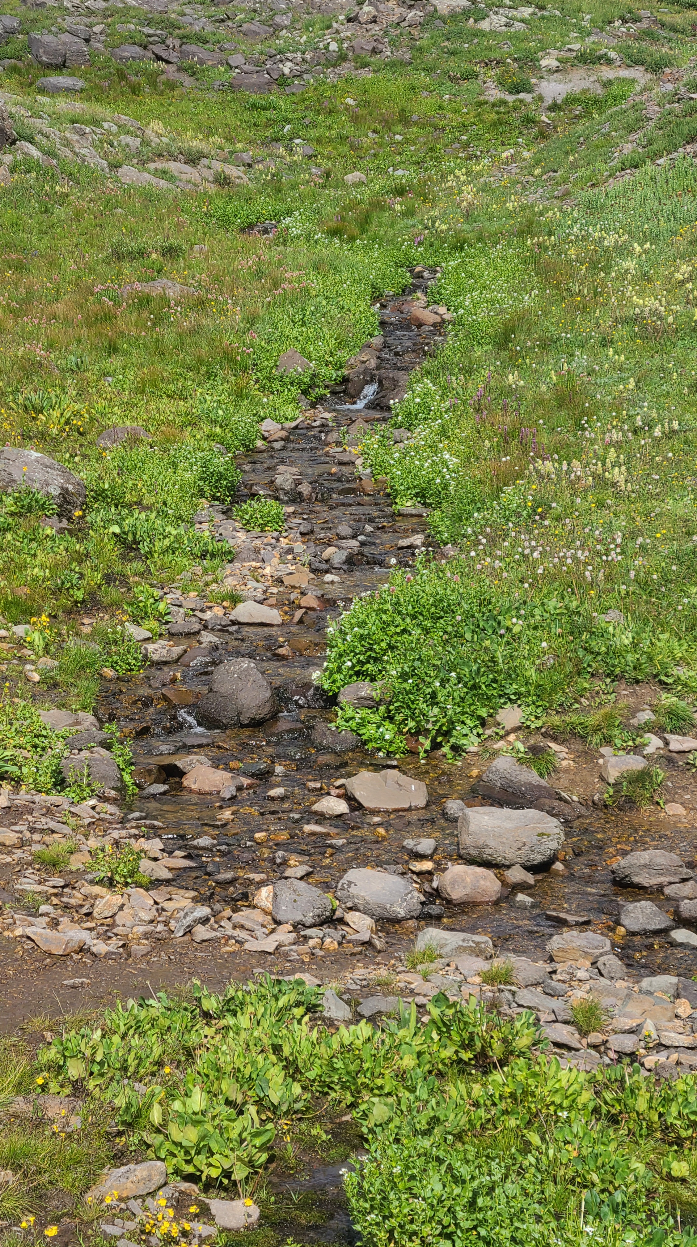
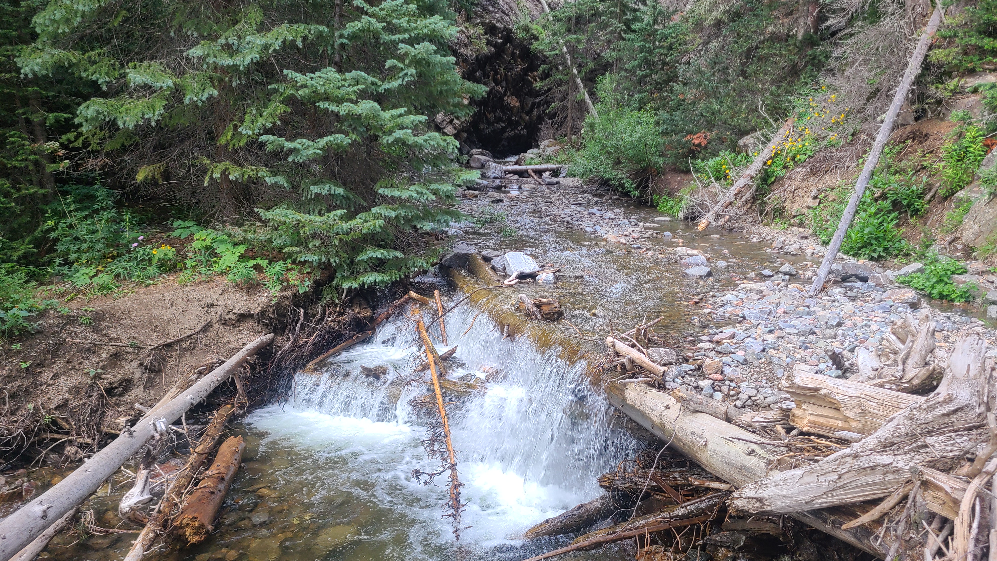
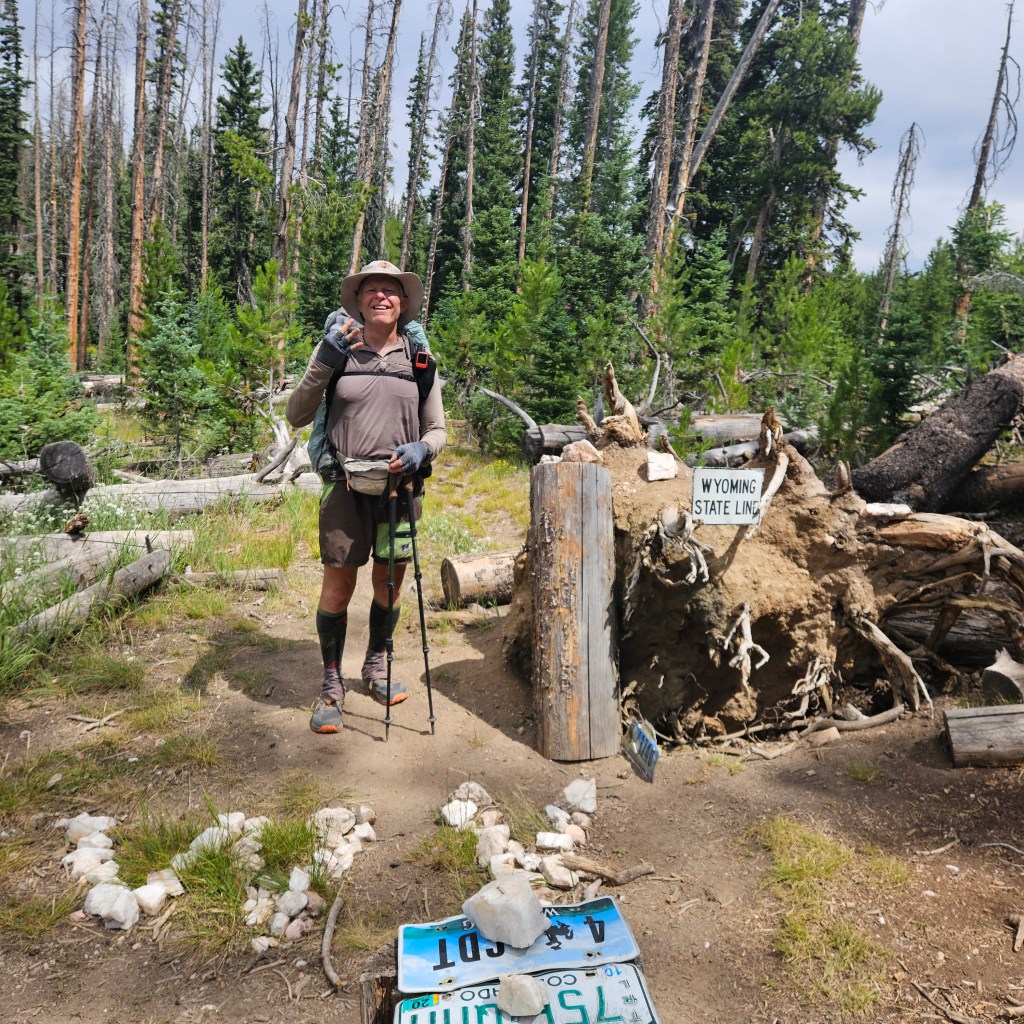
I’ve been section hiking the CDT in Colorado since 2021 and it felt good to finally cross into another state. That day, August 2, also happened to mark an anniversary milestone in my addiction recovery journey. Unfortunately the only water source we found near the state line was super shallow and muddy, but I was at least able to filter about a quarter liter. The next water source at Whiskey Creek was a couple miles ahead and turned out to be even muddier. We lost probably an hour as I waded my way into the bog and tried filtering from the mud. As usual Art talked some sense into me, worst case we’d just have to hike another 7 or 8 miles for more certain water. Art led the way through the bog, then suddenly stopped and turned around with his signature grin. A couple of wood blocks had been imbedded on either side of the trail, allowing clear water to collect there. We joyfully filled up our water bottles with relief.

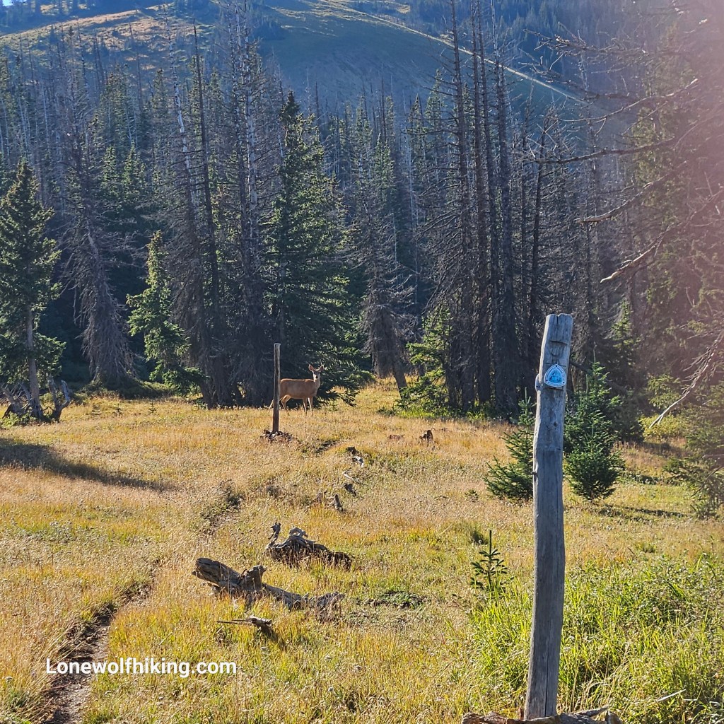
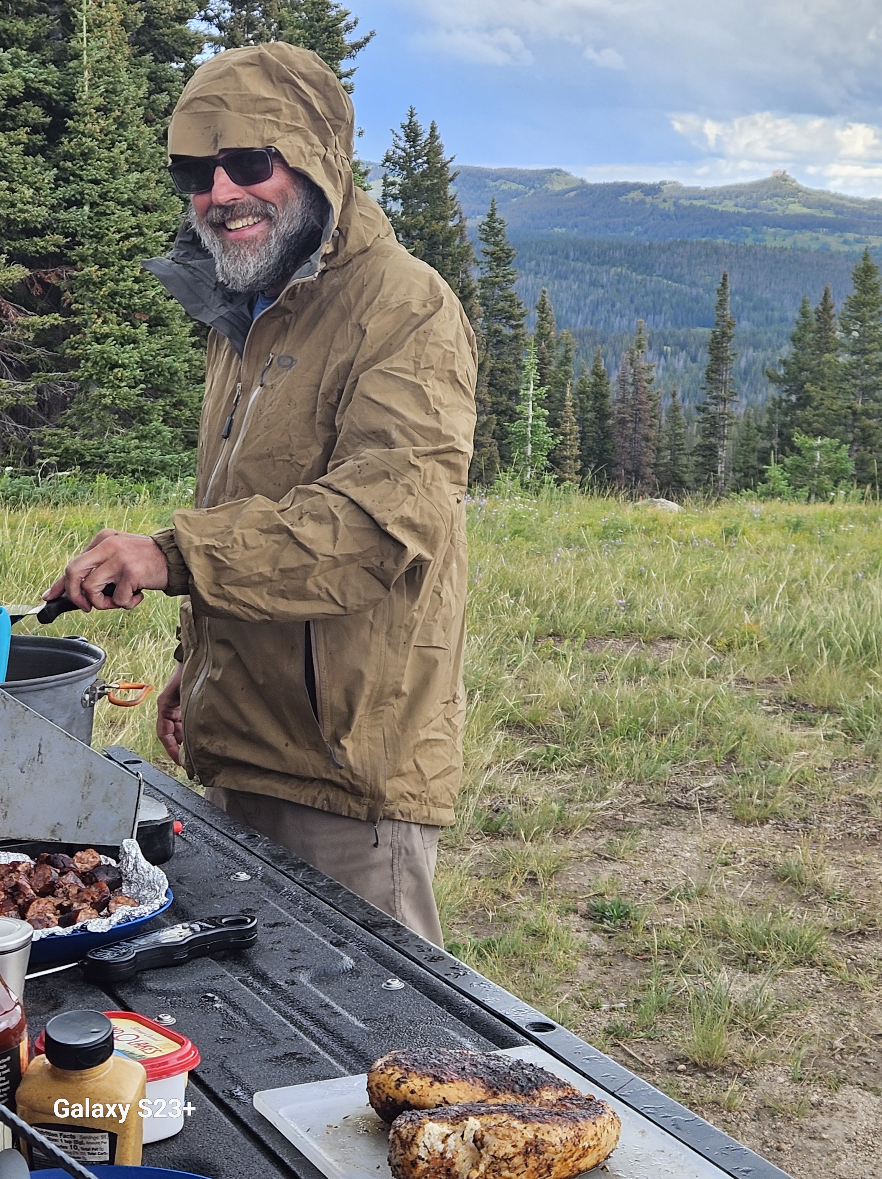
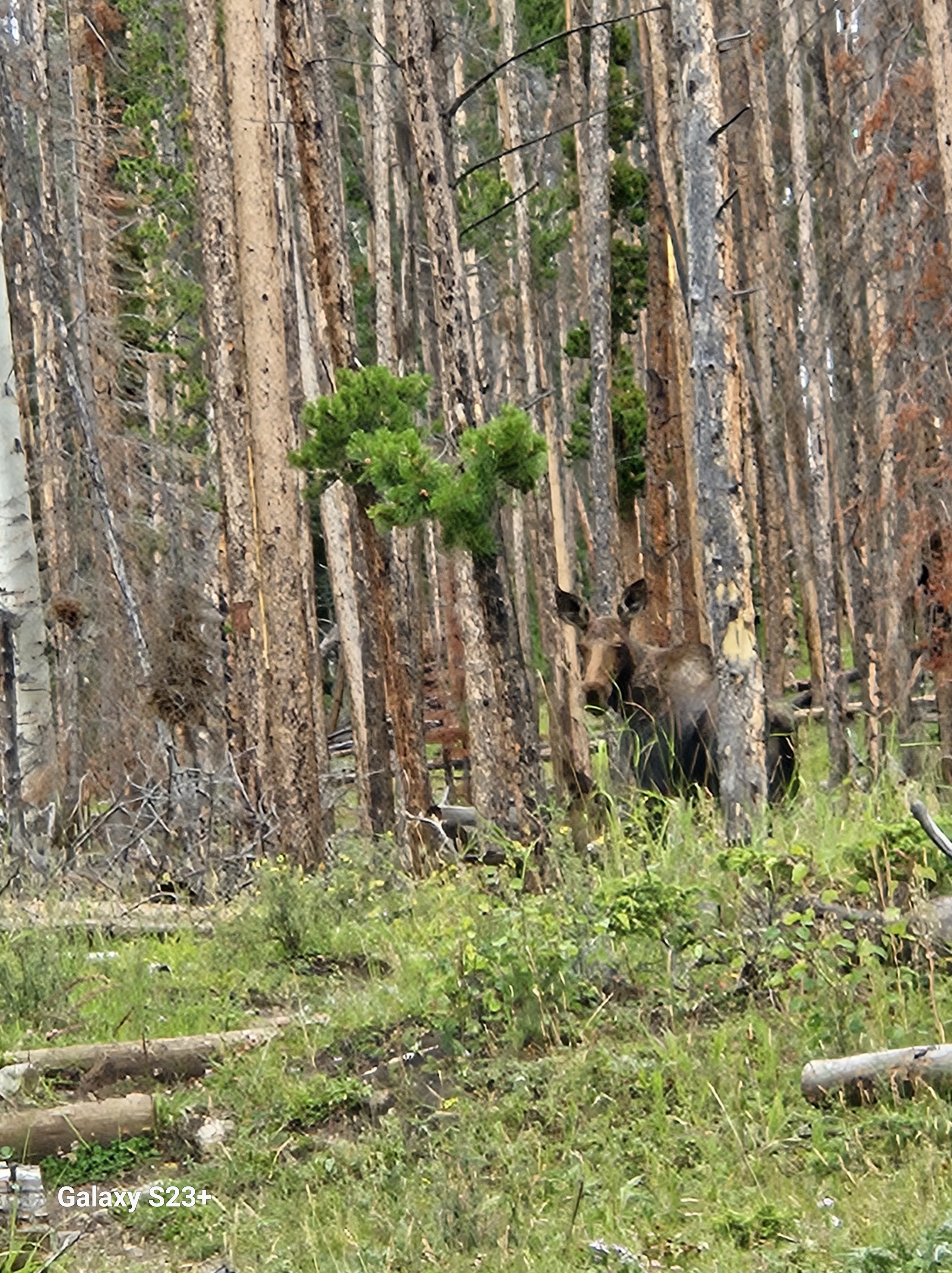
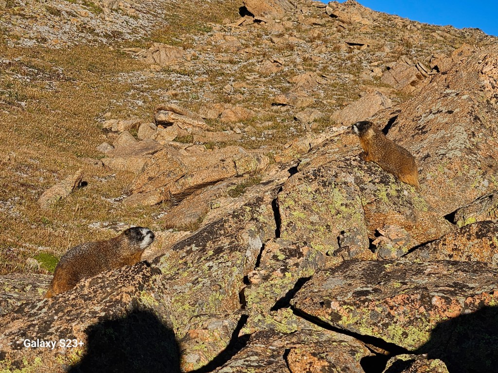
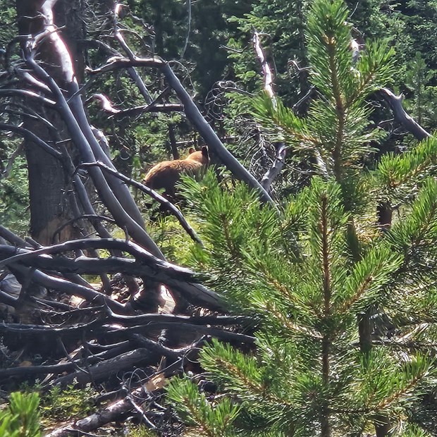
Art had already done the math and realized if we kept our 14 mile-a-day pace we could make it to Battle Pass by tomorrow afternoon, in time to meet Teresa on her birthday. He led the way and was out of sight, then marched back towards me with his poles in the air. He and a bear had surprised each other on the trail. We slowly went back up the trail together until I saw what at first looked like a mom & cub in the woods. After taking a good look, we could see it was just one really big bear that was now thankfully walking away.

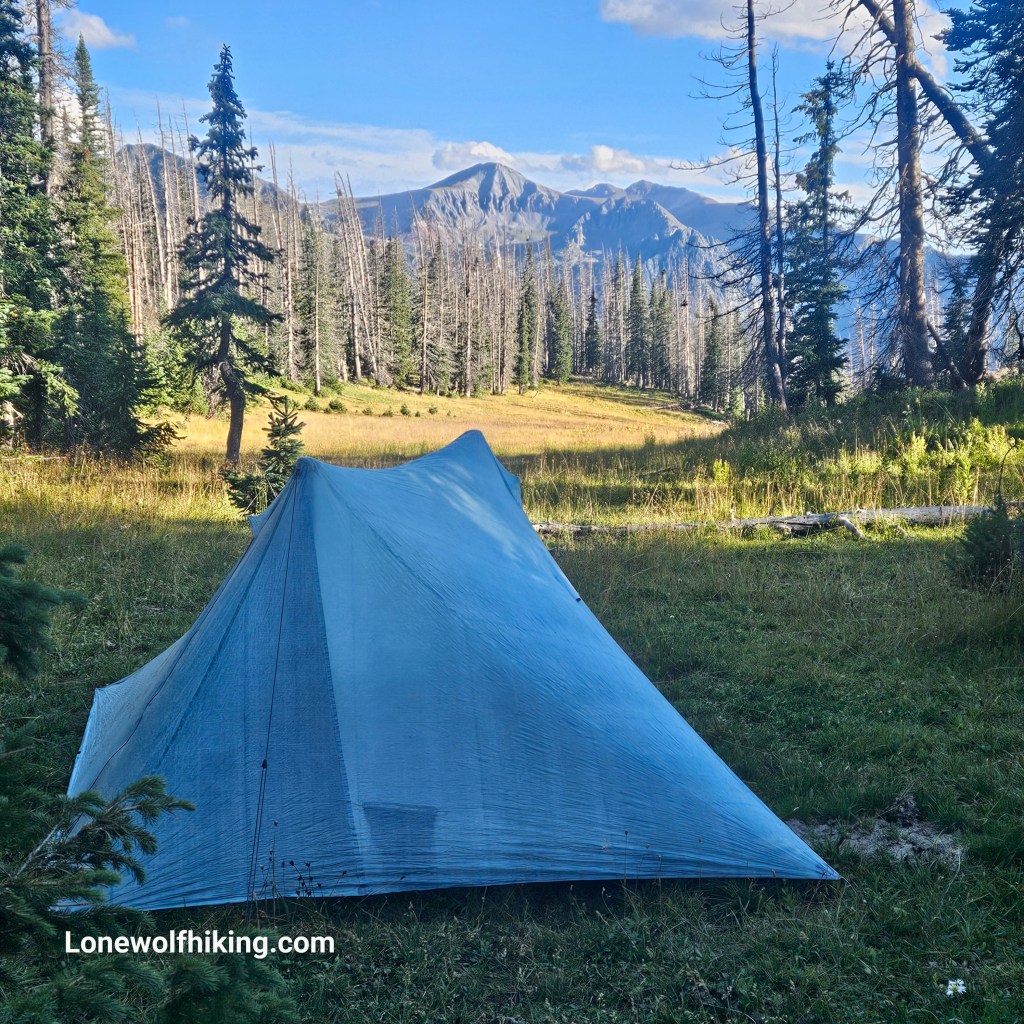
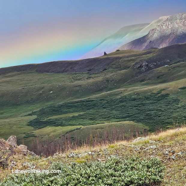
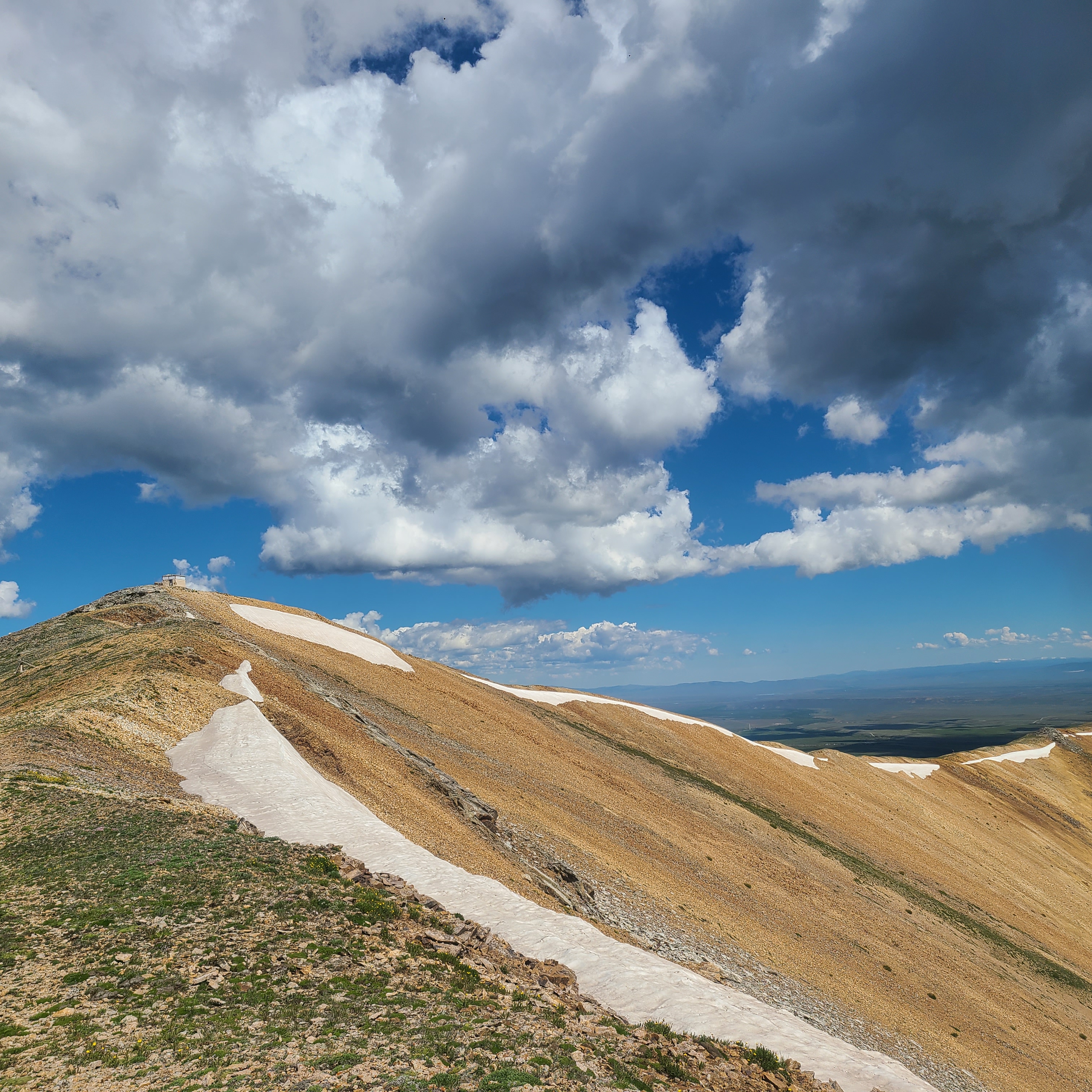
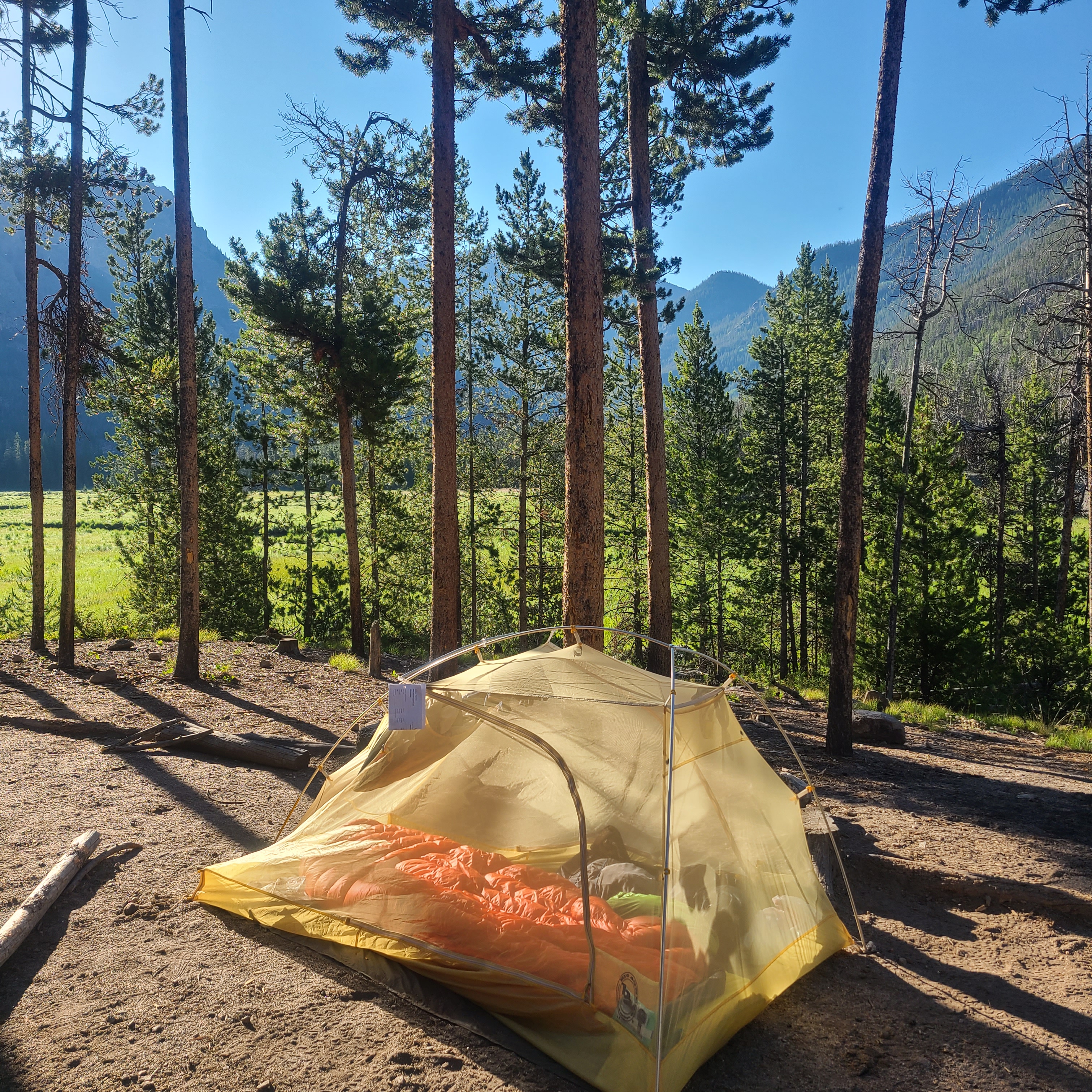
It seemed like a full day already when we heard some thunder in the distance and could see dark clouds ahead. Then we felt a sudden, familiar chill in the air and decided to set up my X-Mid to wait out the storm. After lots of practice escaping last summer’s monsoon storms in the San Juans, that tent sets up fast. We crawled in just as the heavy rain and a bit of hail started. It didn’t keep up long but we were happy to have stayed dry.

I had started taking ibuprofen that morning and then again early afternoon, and that seemed to keep my ankle pain tolerable the rest of the day. I repeated this daily ibuprofen routine for the rest of the hike, realizing I had skipped my annual series of manual physical therapy ankle treatments this summer.

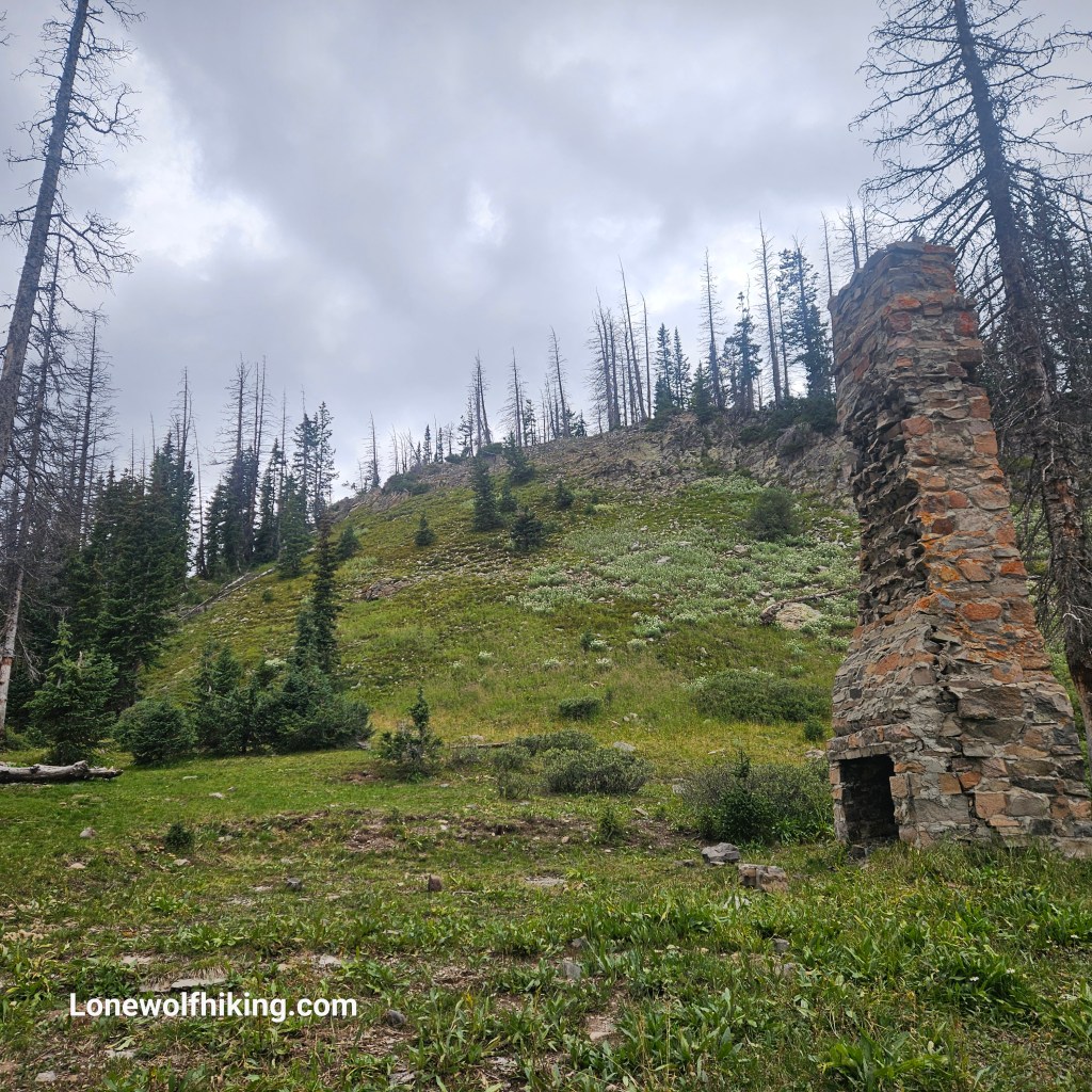
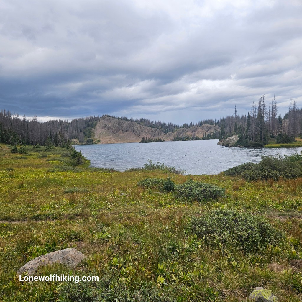
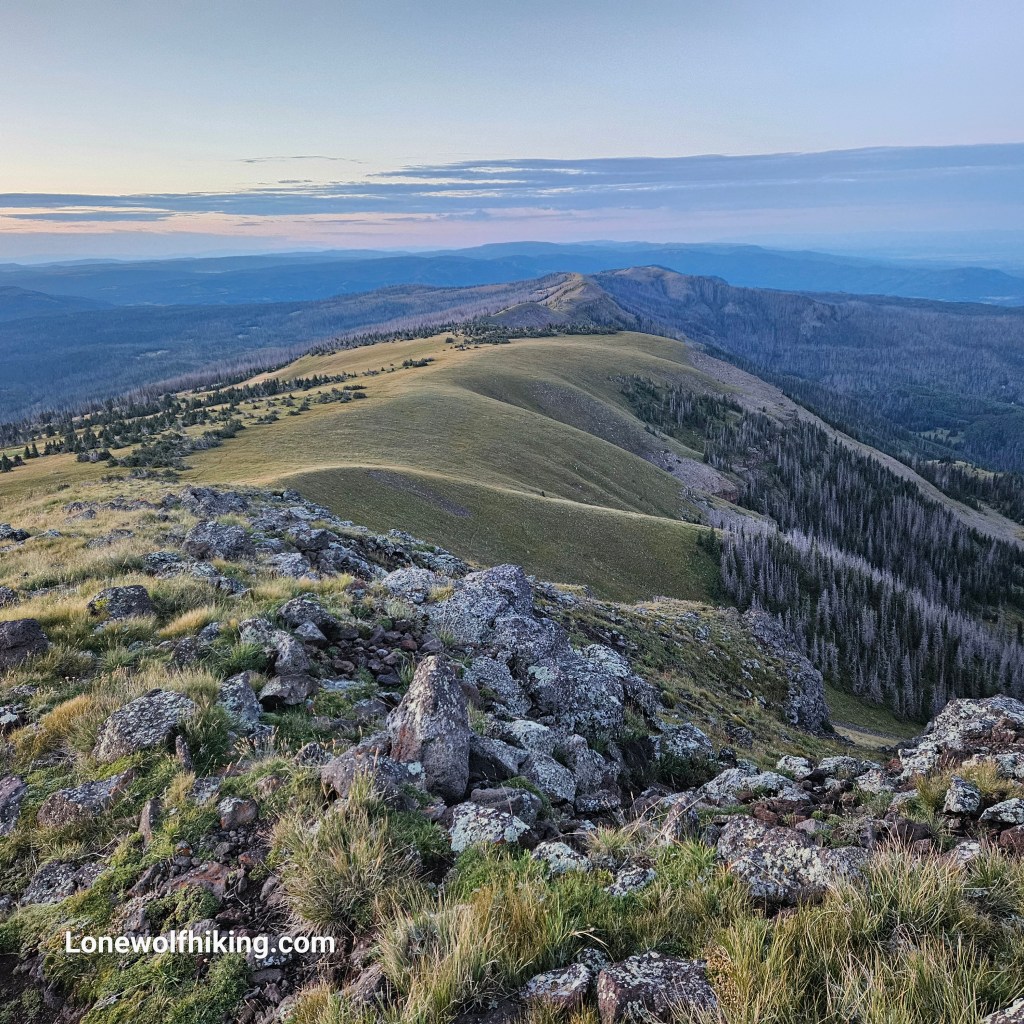
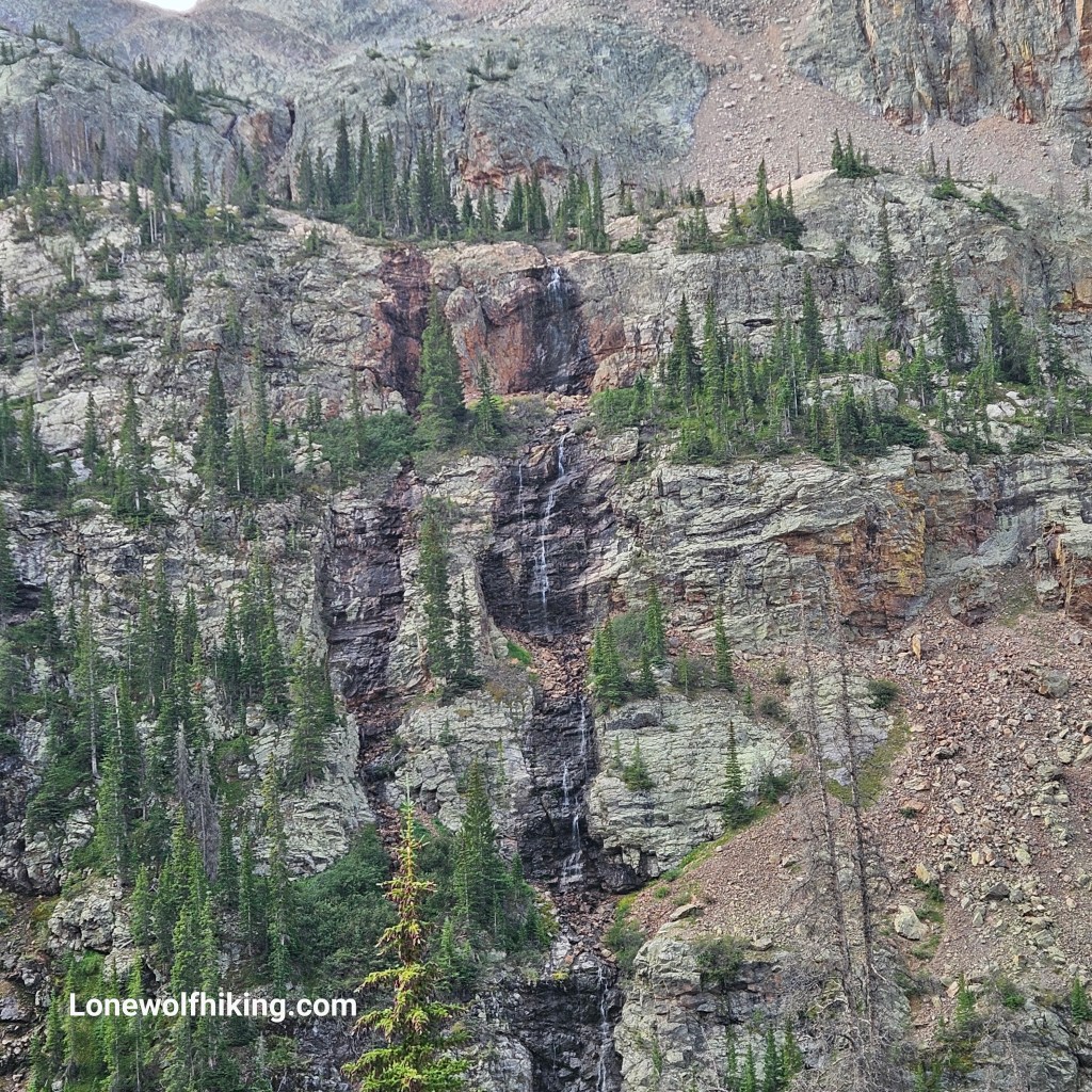
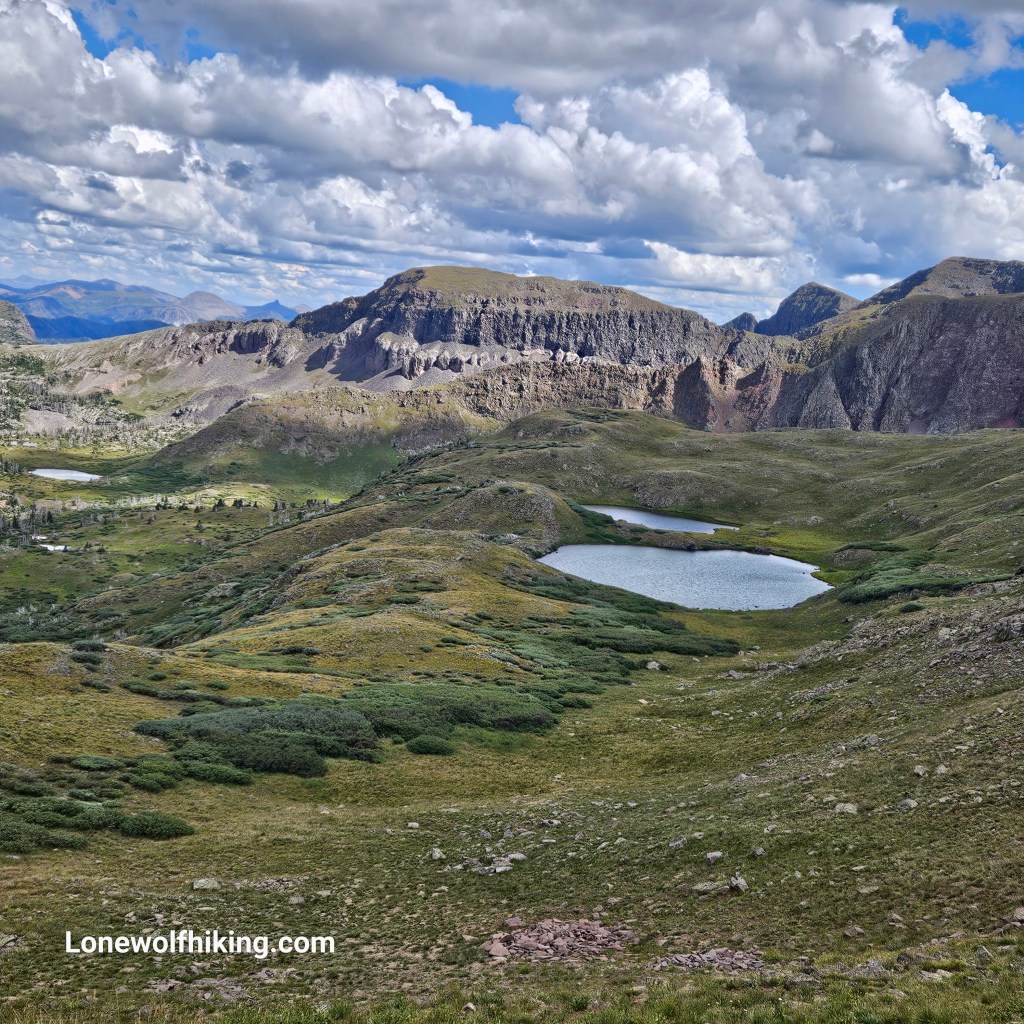
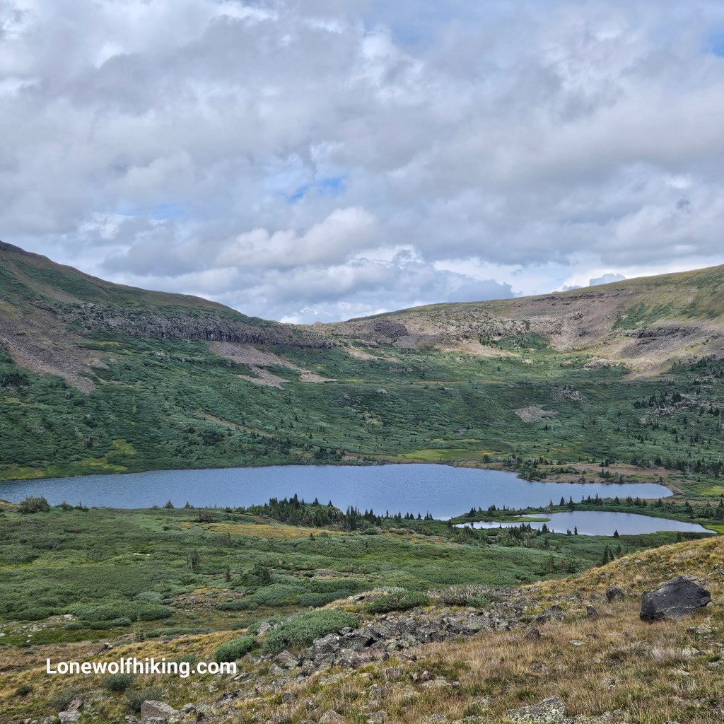
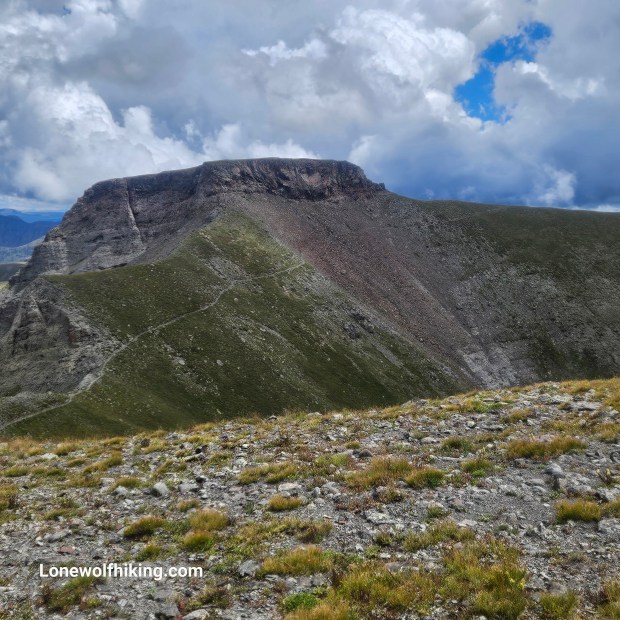
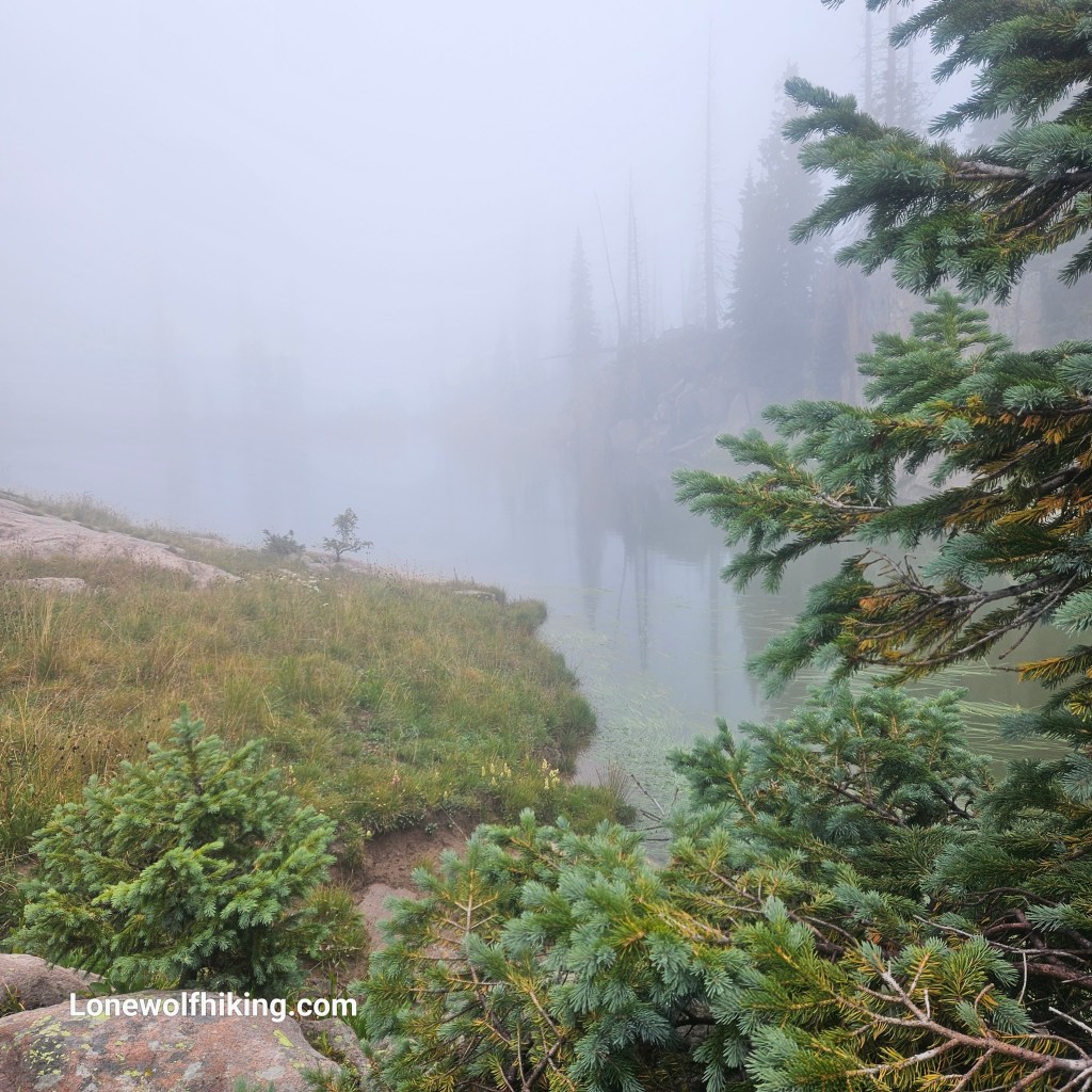
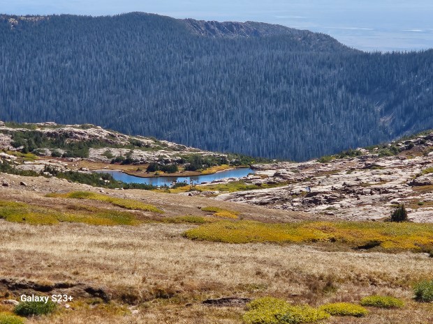
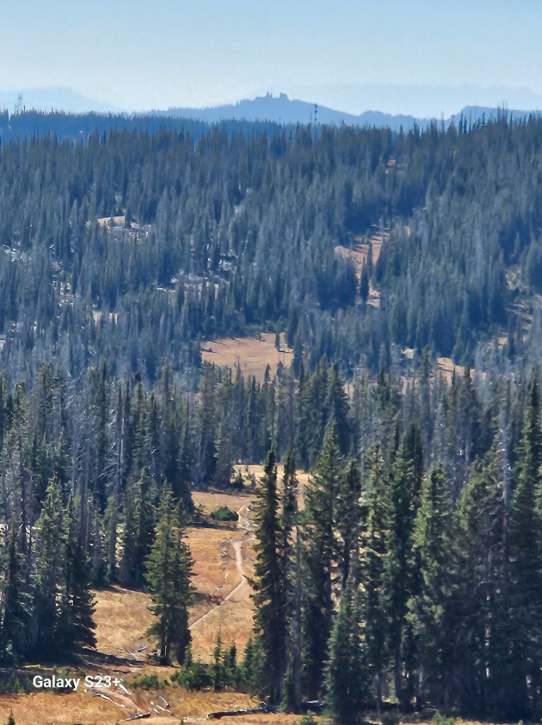
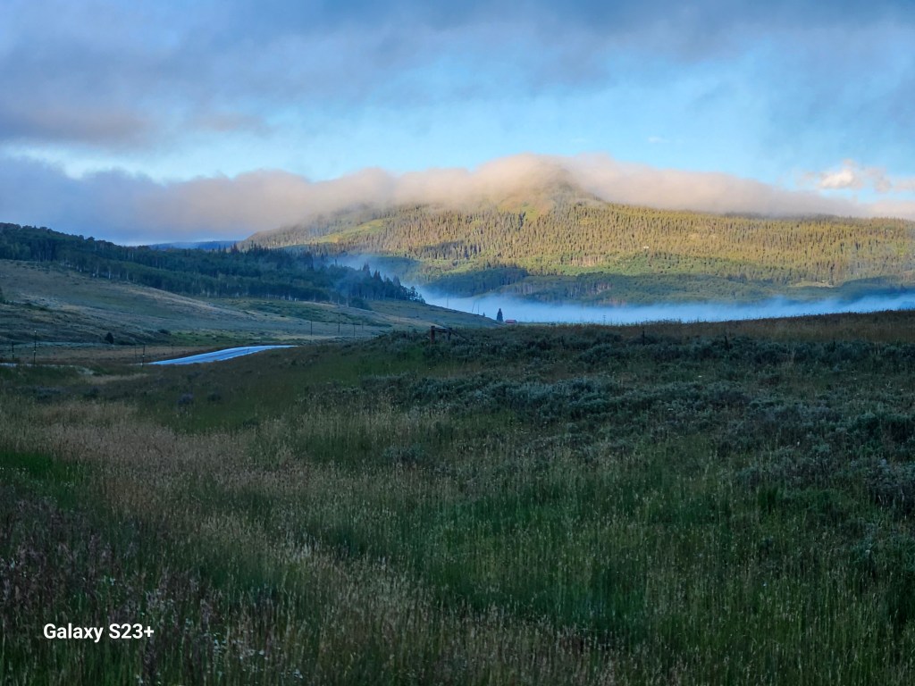
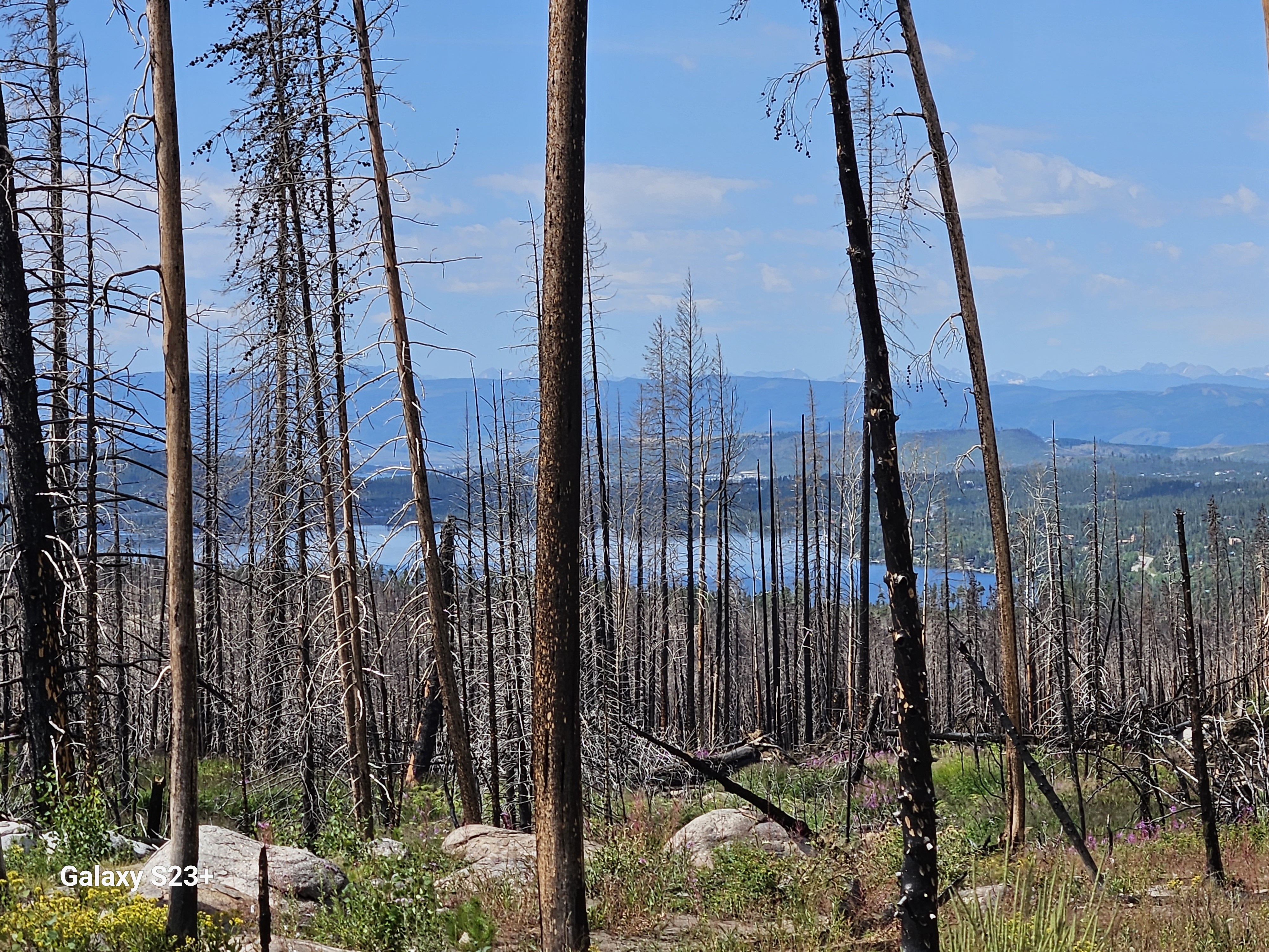
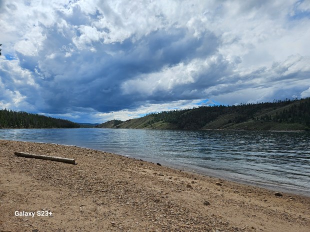
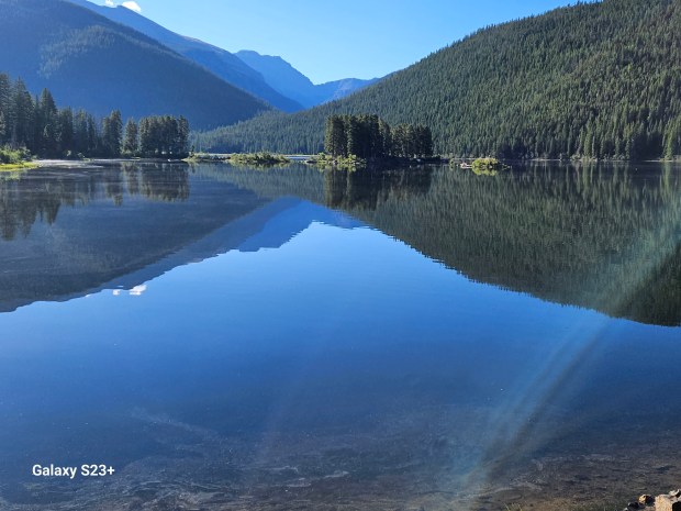
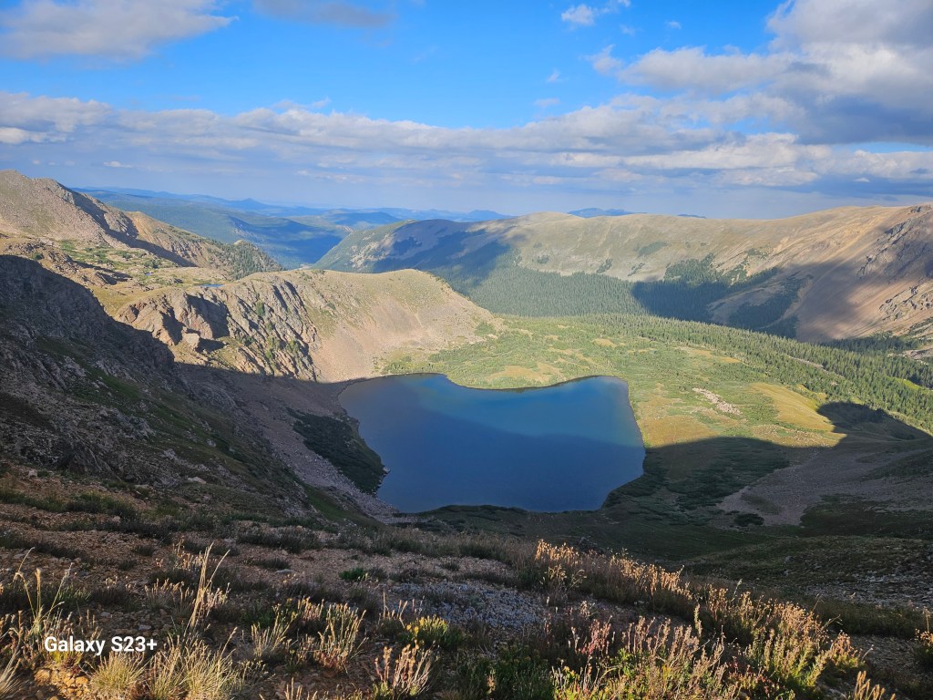
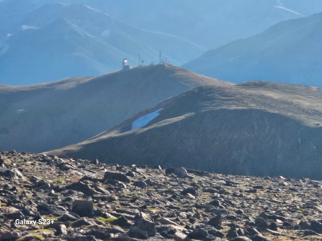
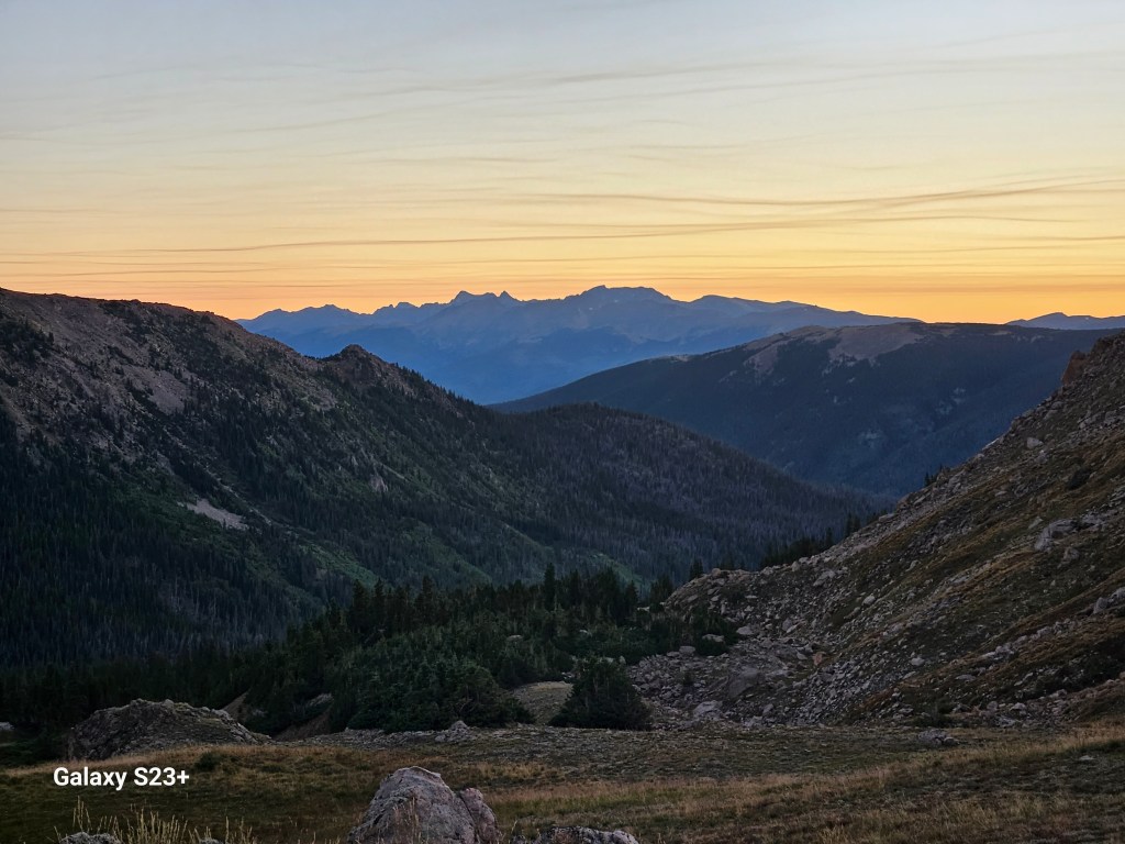
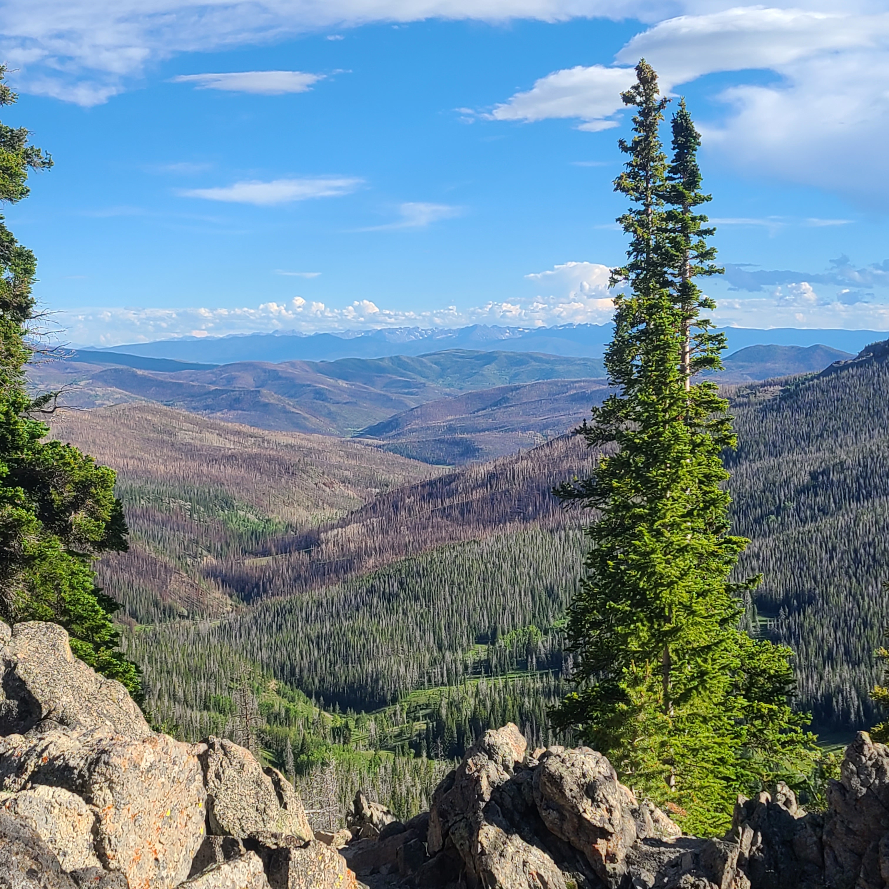
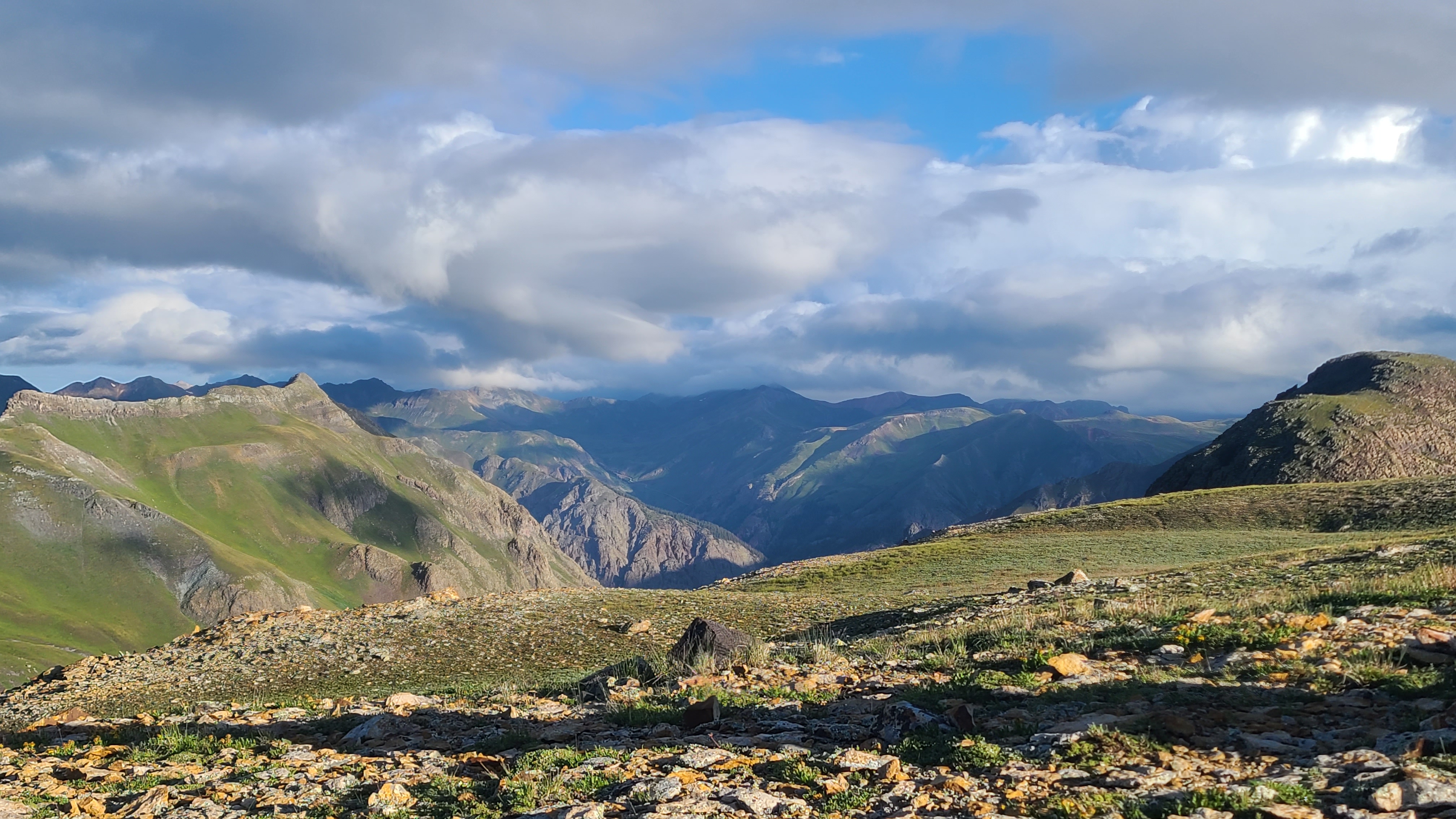
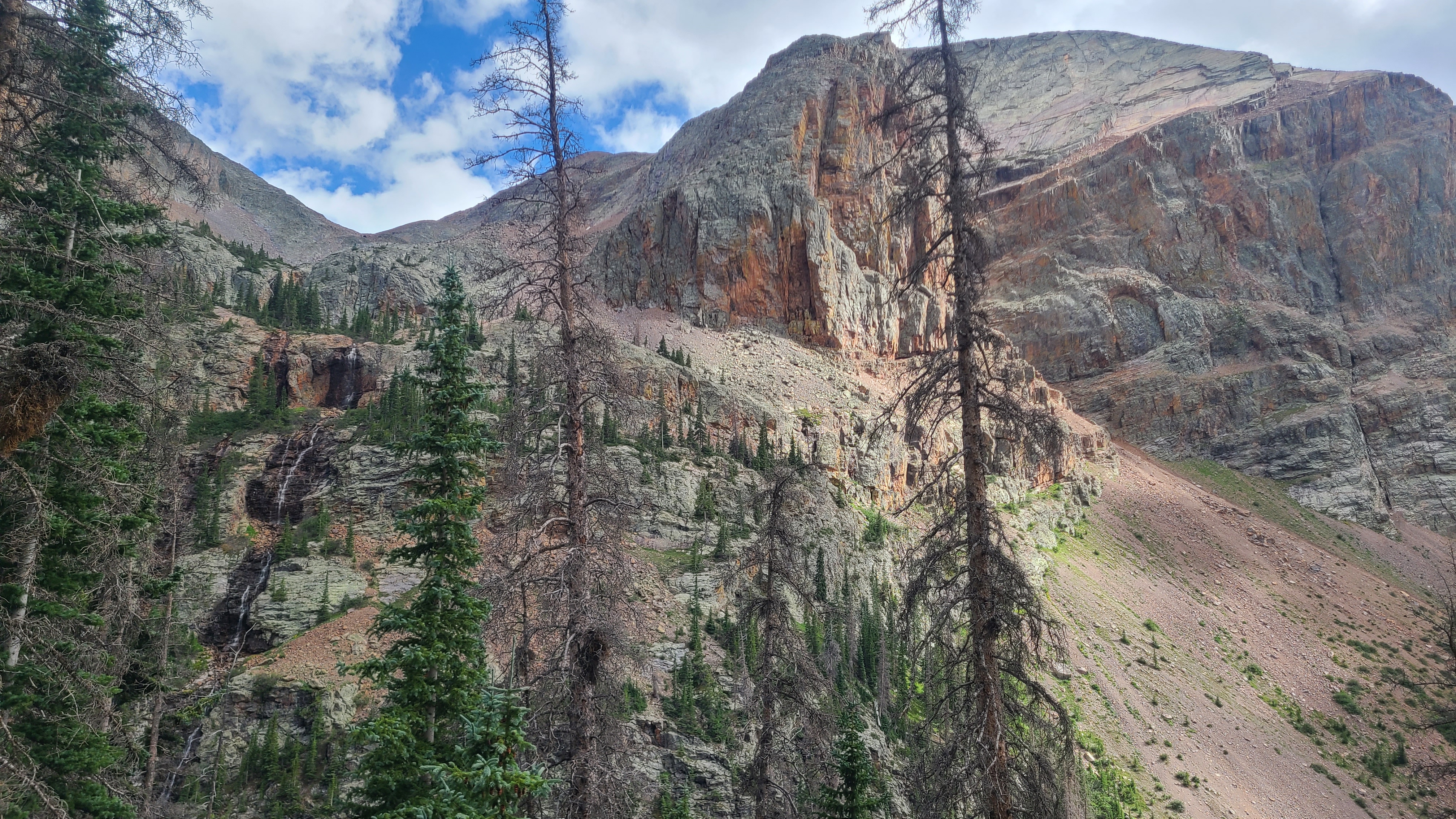
We were headed downhill with a mile or two left to reach our 14 for the day when we saw a van parked alongside a dirt road. I tall fellow came out and happily waived us over. We met Lorax who shared some fresh cherries and trail insights with us. He’s a trail maintainer volunteer, and said he had built the water collection feature in the bog that we had enjoyed earlier. He let us know there was good camping “just up the hill”, but we started to get skeptical after a hard uphill mile. Then Art saw a good flat spot with nice view of Hogg Park Reservoir. That nice view turned spectacular as fog blanketed the lake the next morning.

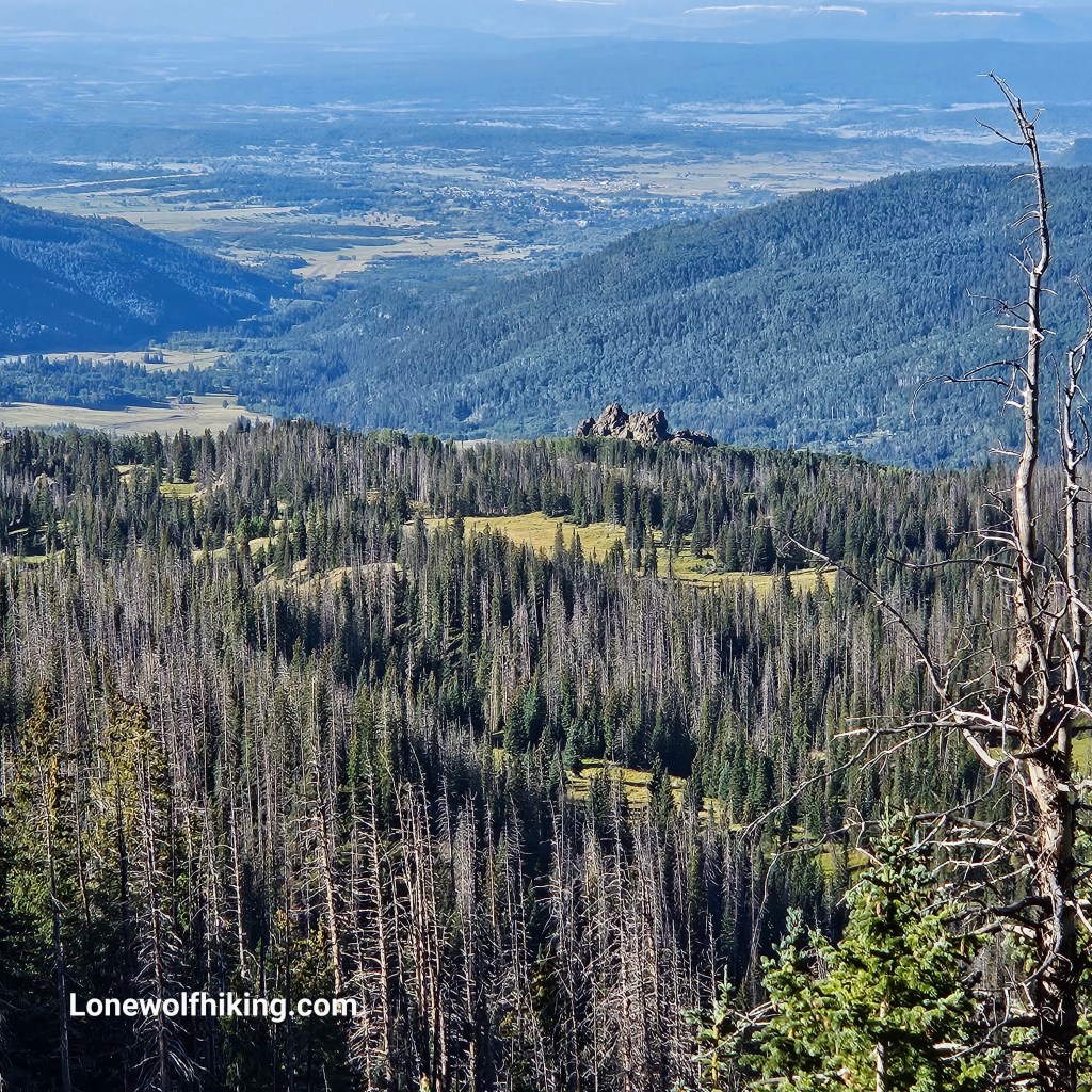
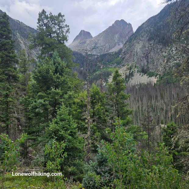
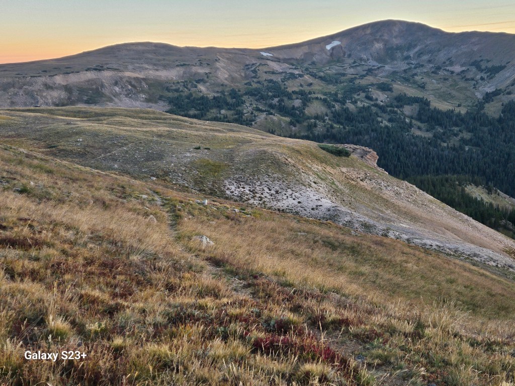
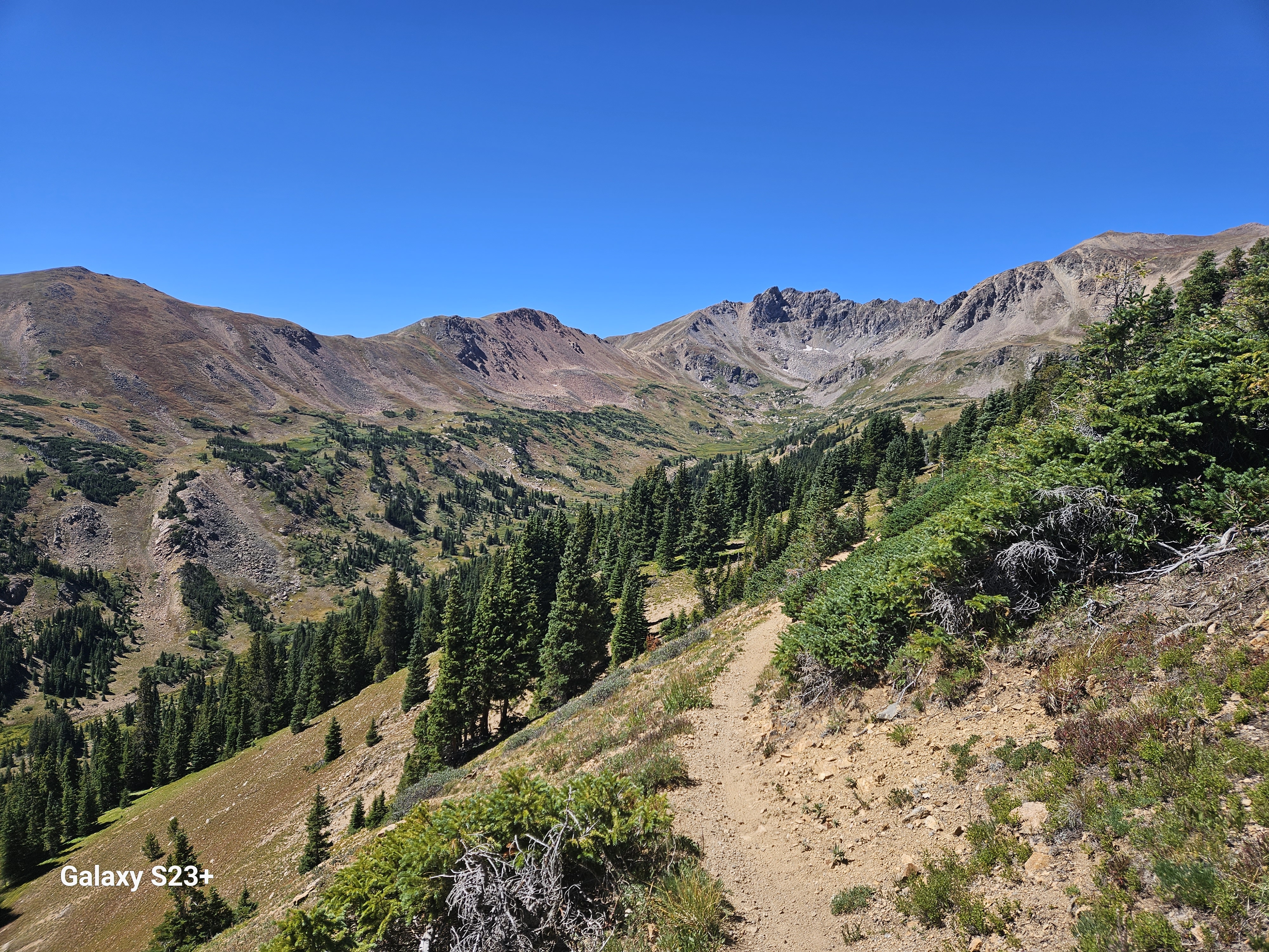
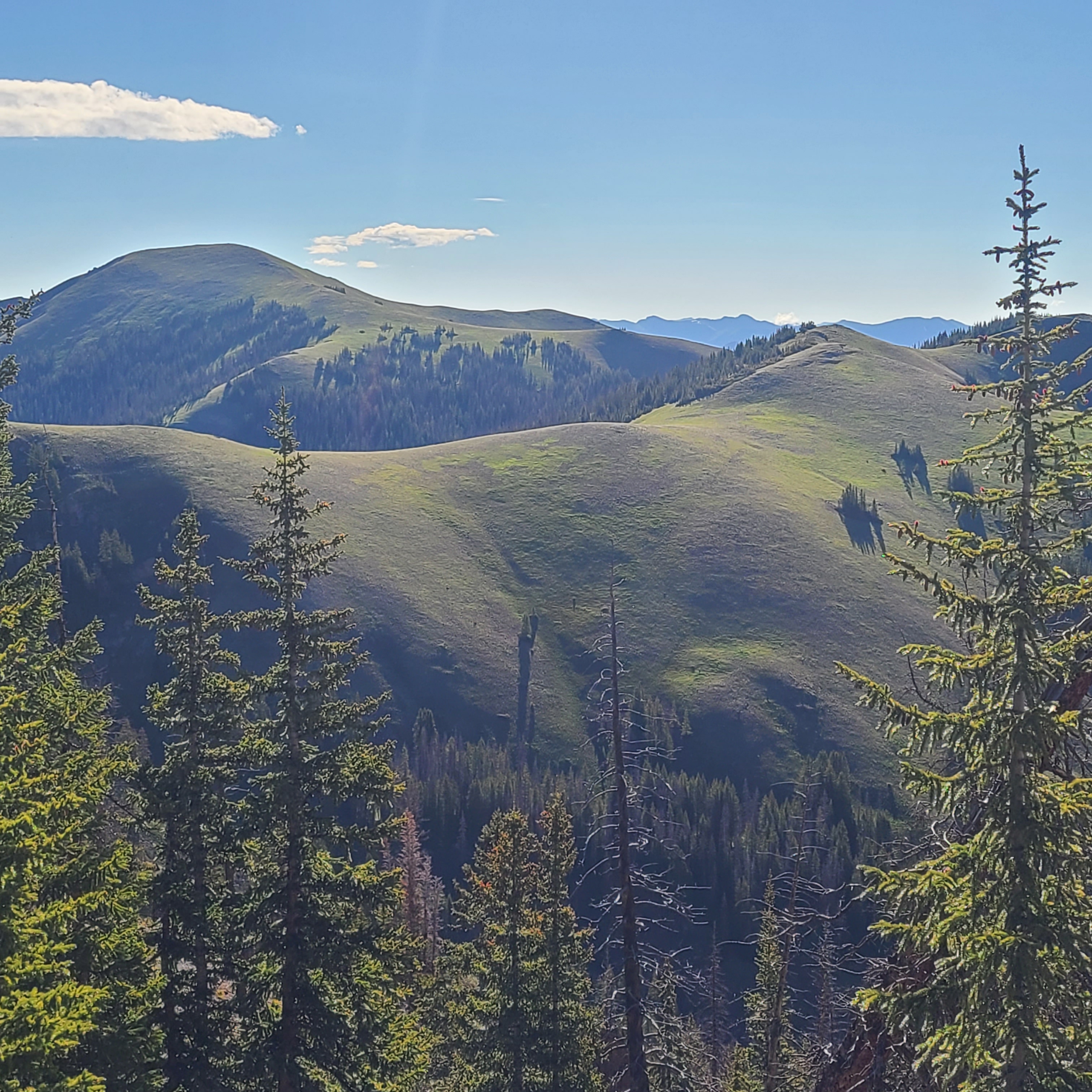
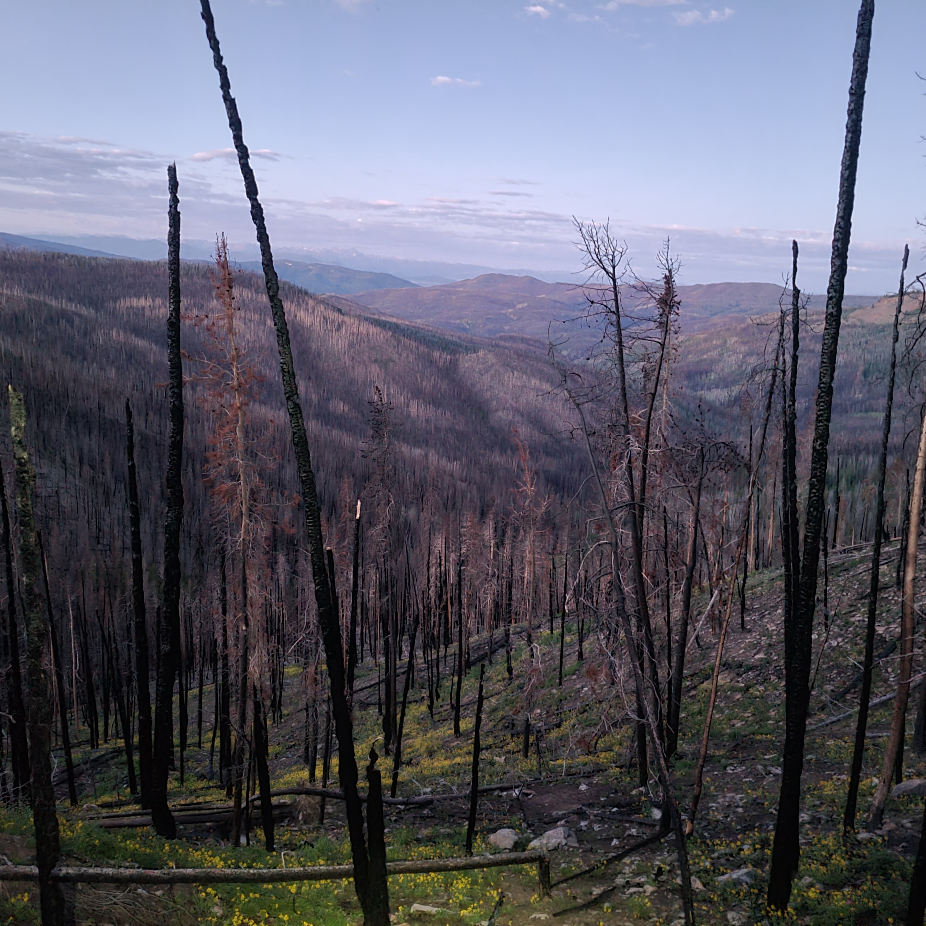
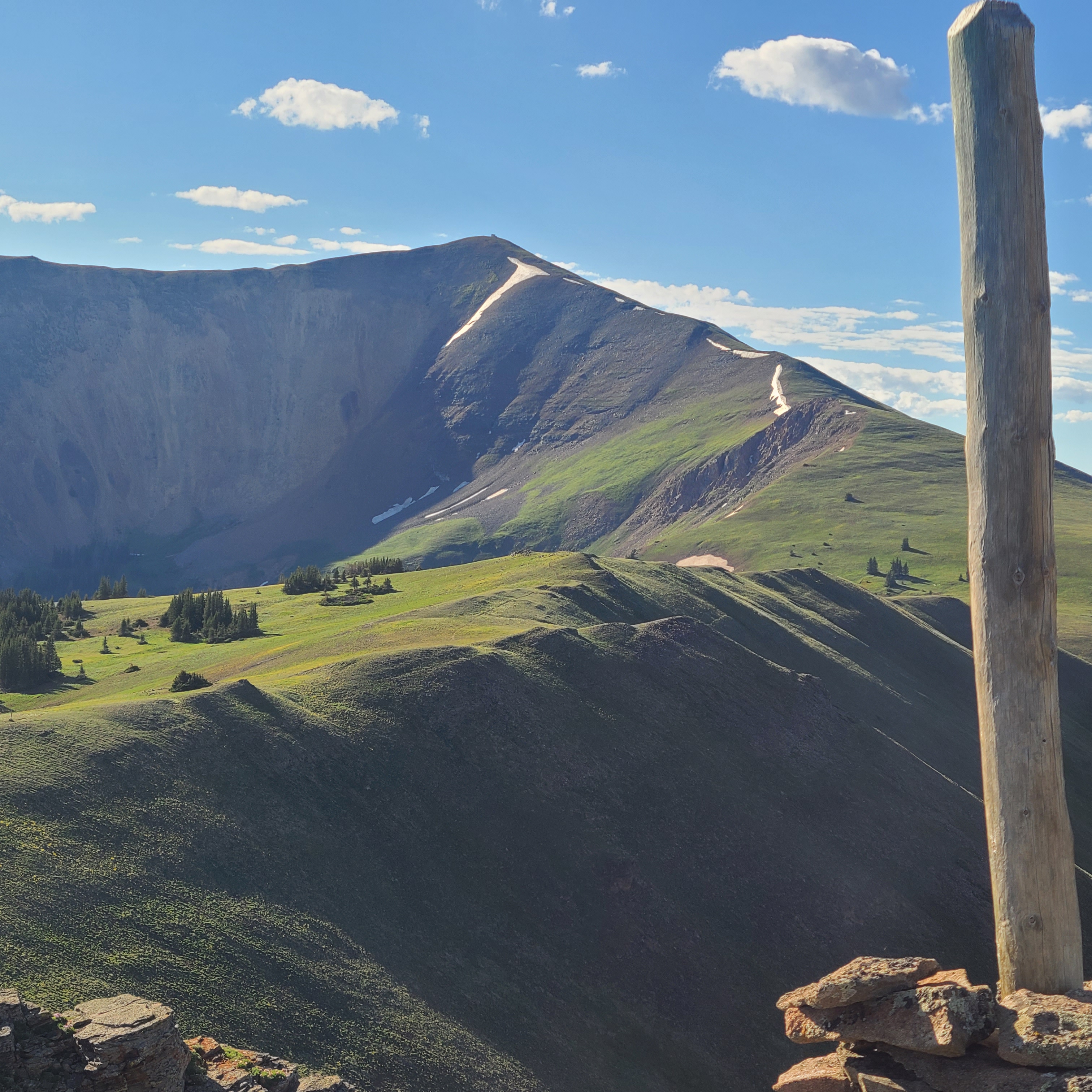
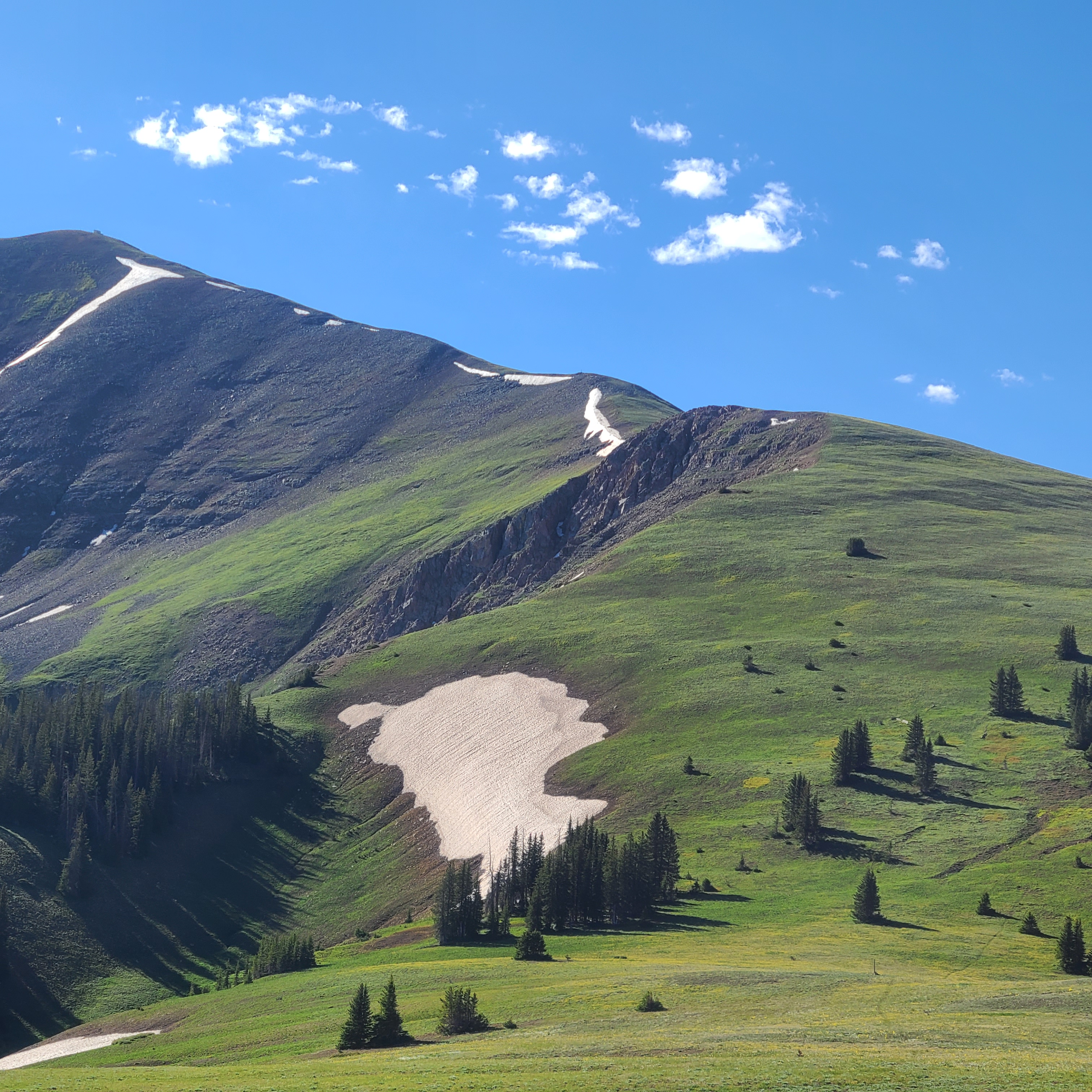
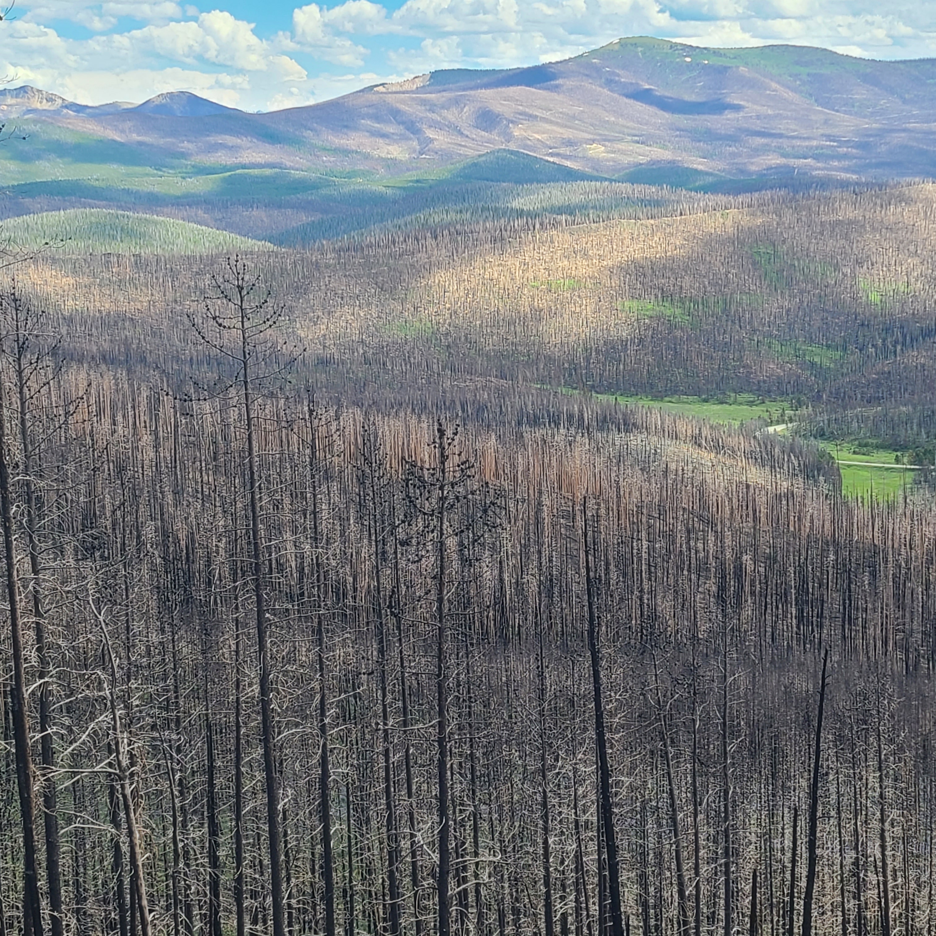
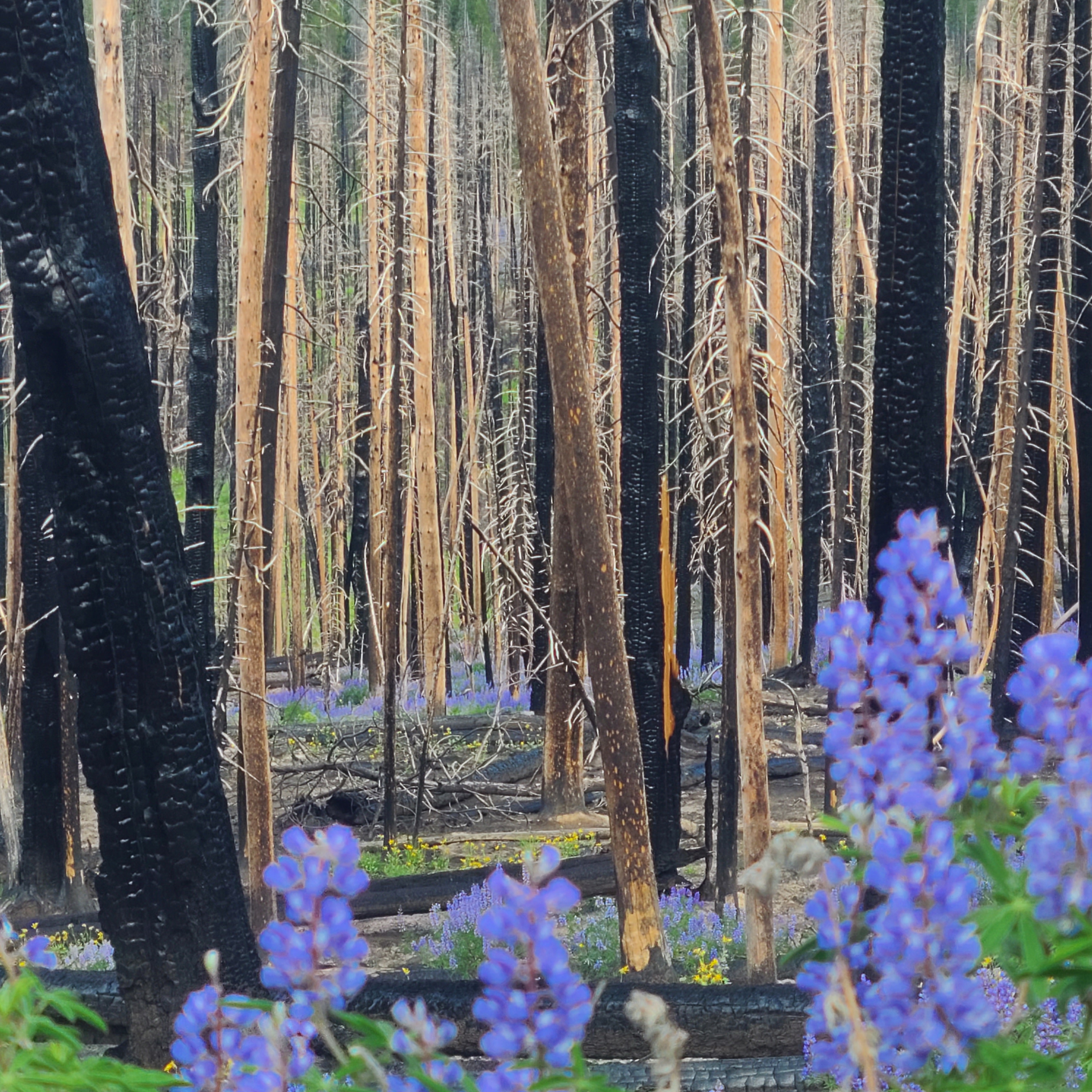
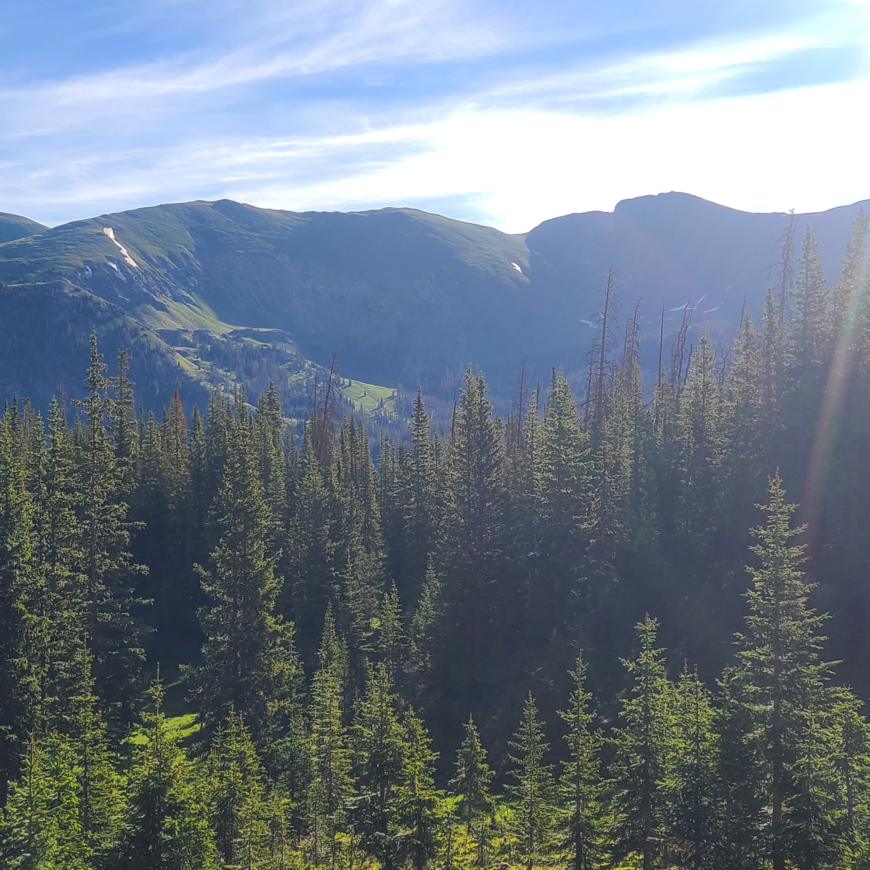
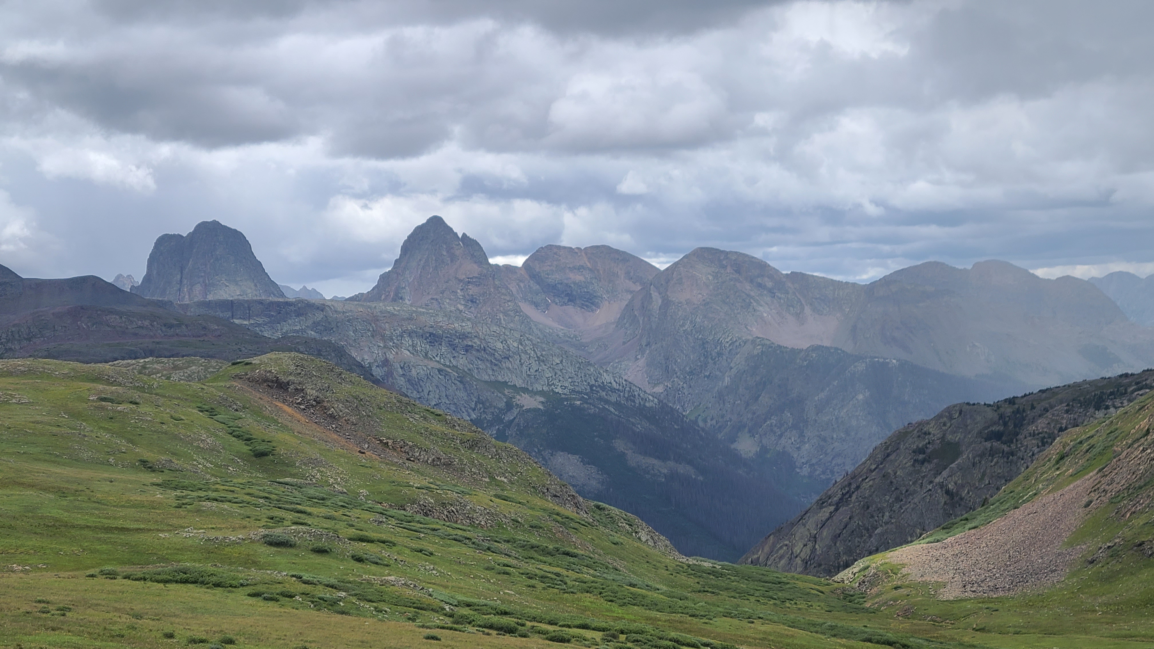
Lorax had mentioned that we’d be hiking through a rain forest the next day, and the lush terrain was a nice trade-off for the seemingly all-day climb towards Battle Pass. We meet a trio of NOBO thru-hikers as we filled up water at a shady creek crossing. One of them noticed I carried a St. Bernard medallion on my pack, and showed me the same medallion on a hand-woven yucca necklace that an artisan had gifted her in New Mexico. They were convinced the patron saint of hikers had helped them through some challenges on their hike.

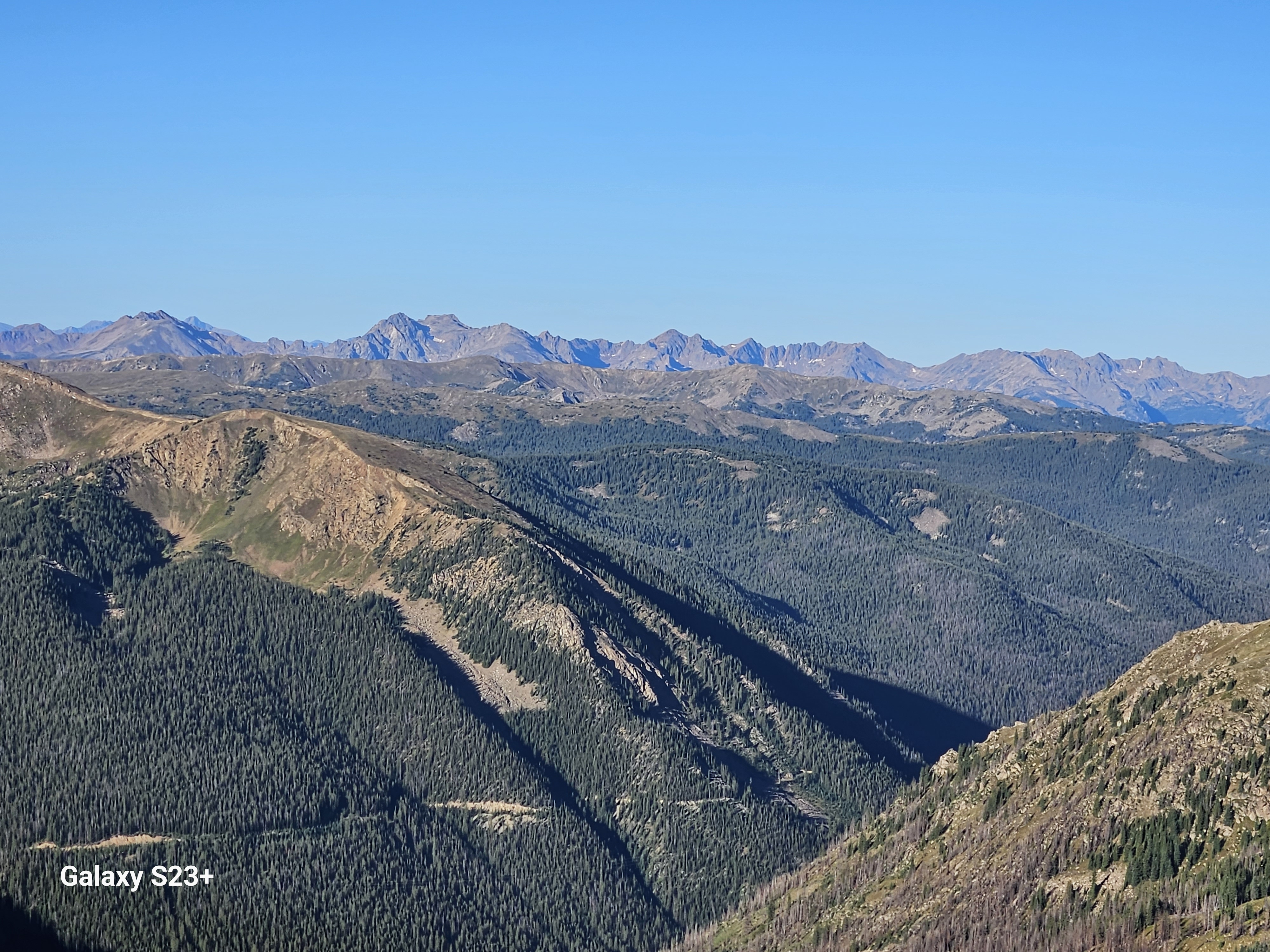
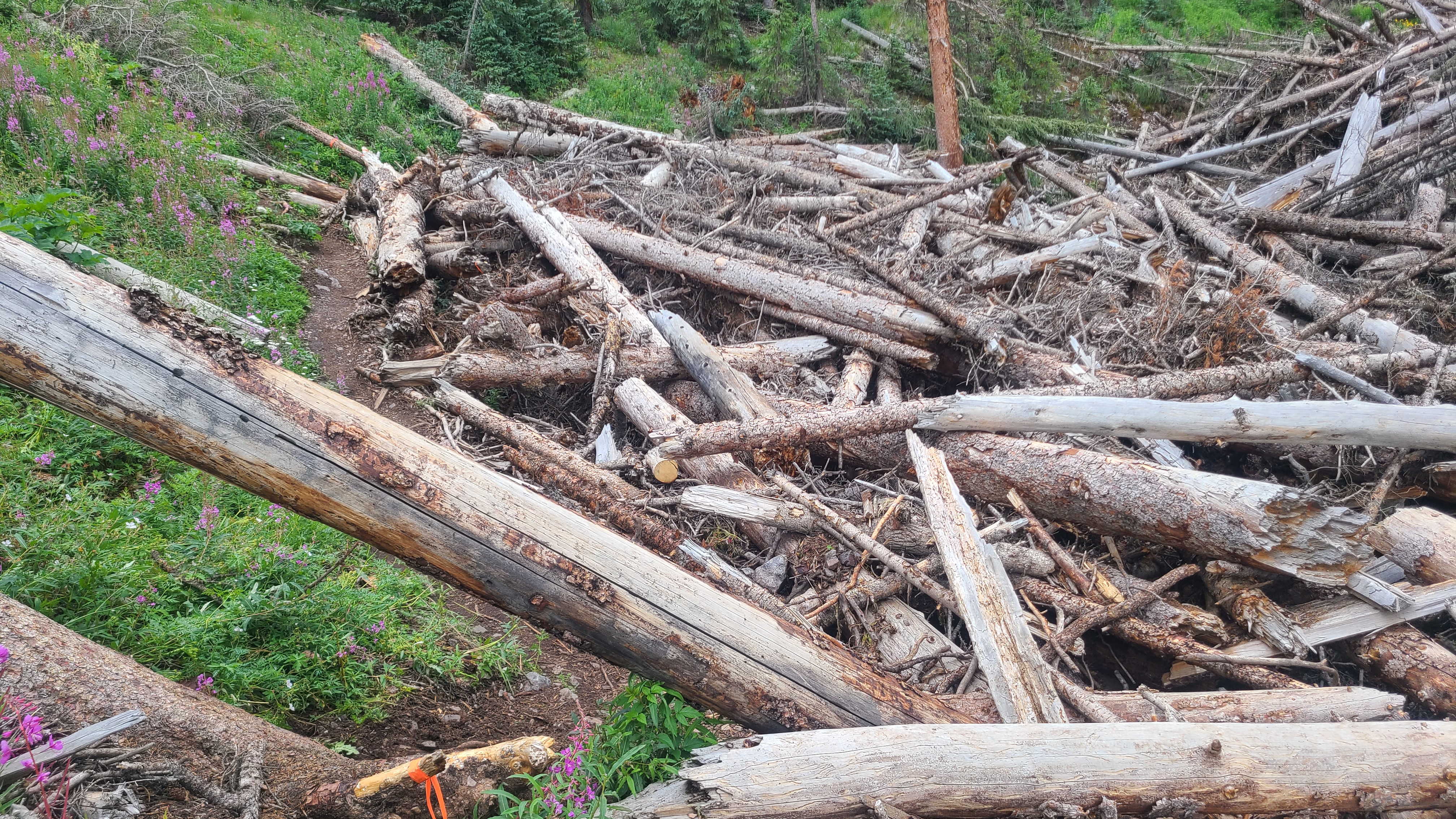
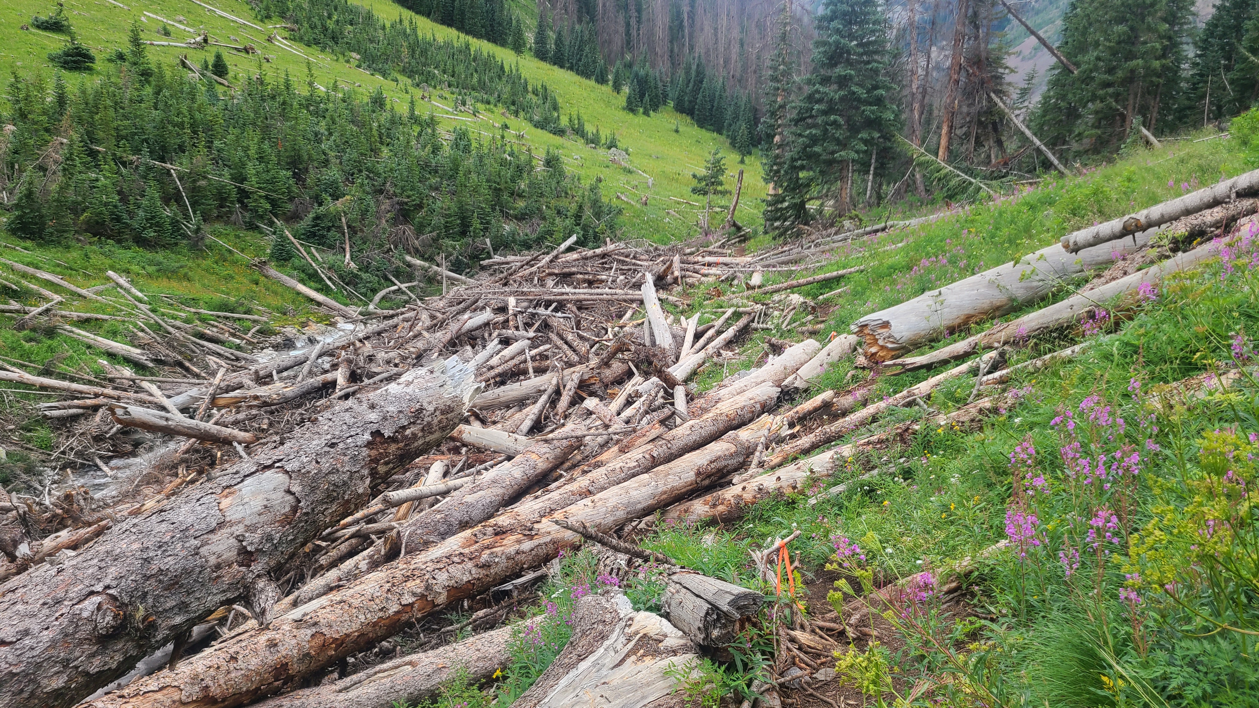
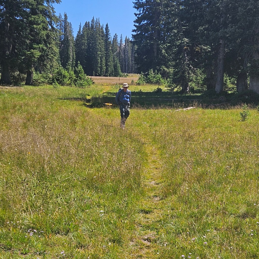
Water was plentiful all day, and we criss-crossed several natural canals winding through the bogs. Some had bridges built across them with heavy wooden beams, and additional piles awaited future construction. We wondered how these had been transported, then we saw horse rider leading a mule, carrying several beams strapped on each side. About a mile later, an anxious little dog came running towards us, then turned around as he obviously wanted to lead us back up the trail. We followed him to his owner, another single rider whose mule had lost his load of beams. He nodded and answered a somber, “Yep” when Art asked if he needed help. He directed us on loading the beams back onto his mule as he strapped them into place.

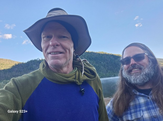
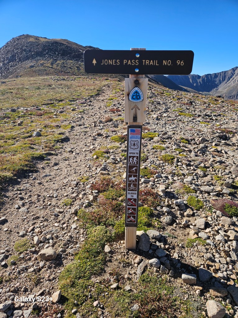
Lorax met us a couple miles from Battle Pass, thinking we might need a ride to town. He shared some fascinating tales of vampires and the Krill people on the way to the trailhead. Another hiker caught us, and he got a ride with Lorax. We were very happy to see Teresa waiting for us at the small parking lot with some snacks and cold drinks, along with my resupply box.

I rented a room at the updated and comfortable Pine Lodge in Encampment, and they kindly offered me access to their laundry room. The agent recommended the Divide restaurant right next door, and we enjoyed an upscale burger there. Art & Teresa invited me to join them at the nearby Hippy Hot Springs, and I later regretted not going. I had a nice talk with my wife Maria in Mexico who really, really wanted me to get back for us to spend some more time together in her town. That re-affirmed my decision to end this year’s trek at Rawlins.

The 307 restaurant served a nice breakfast the next morning, and I went back for lunch as I procrastinated my return to trail. Local diners grinned knowingly as some trail-ripe hikers came in and were quickly directed out to the covered patio. The hitch back to trail was surprisingly easy, as there was a bench seat at the highway intersection and the first car picked me up.

Downtown Encampment

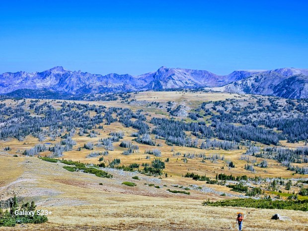
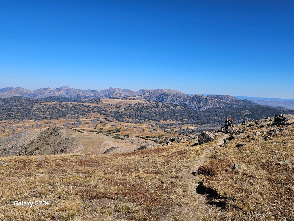
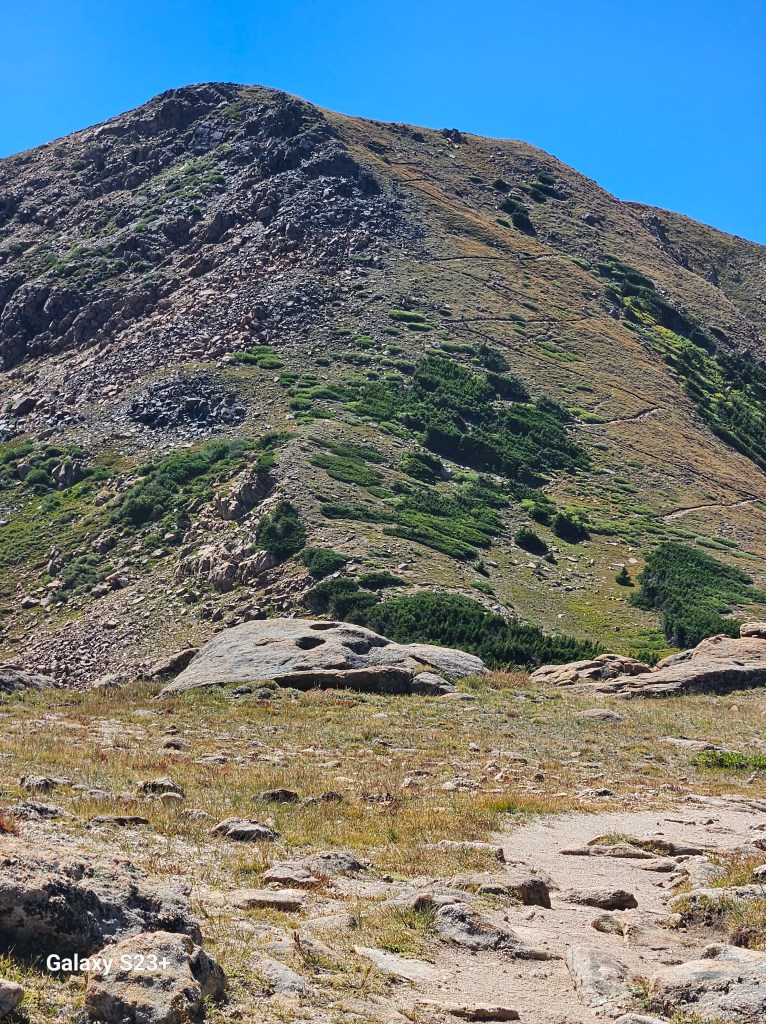
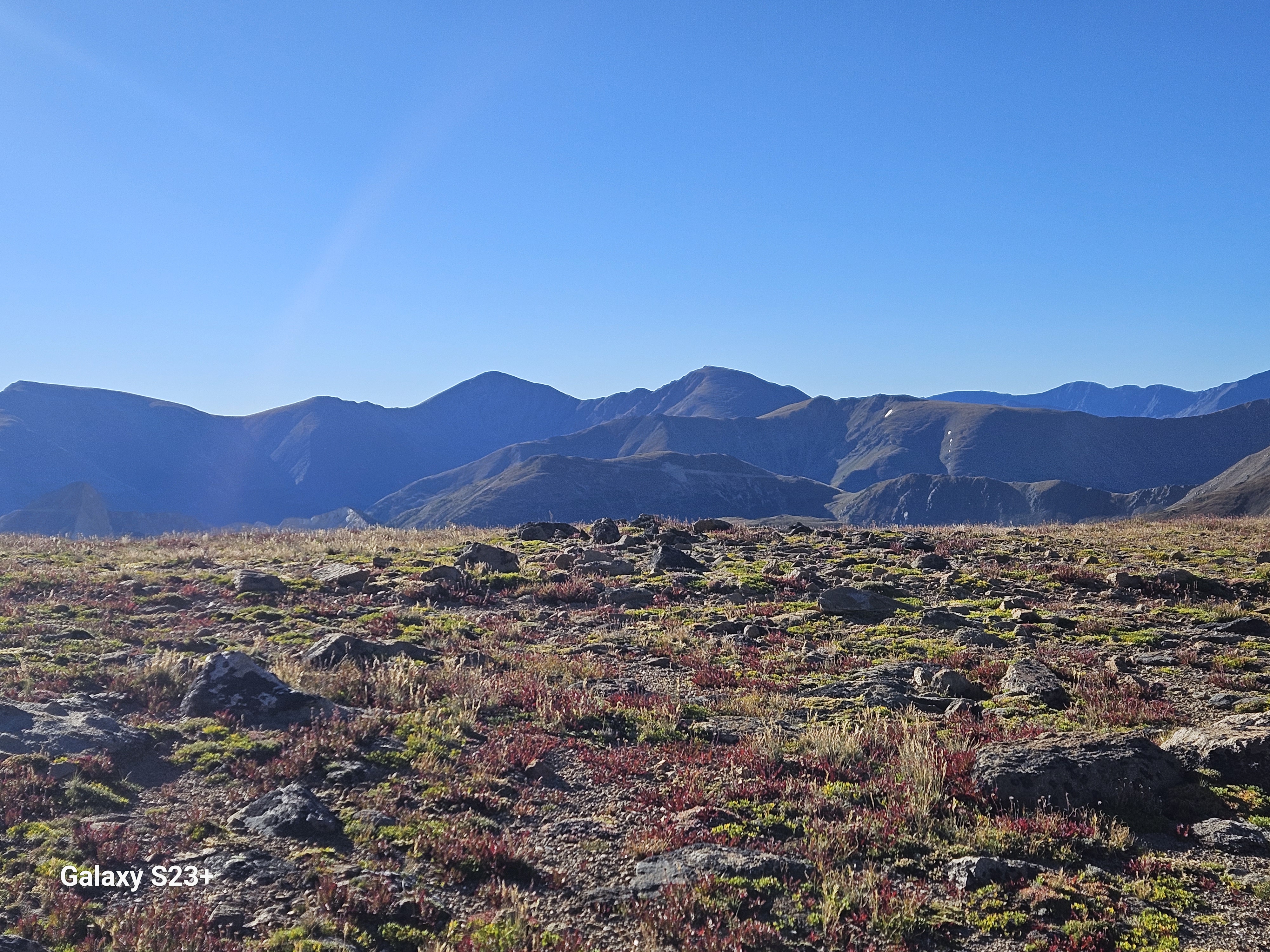
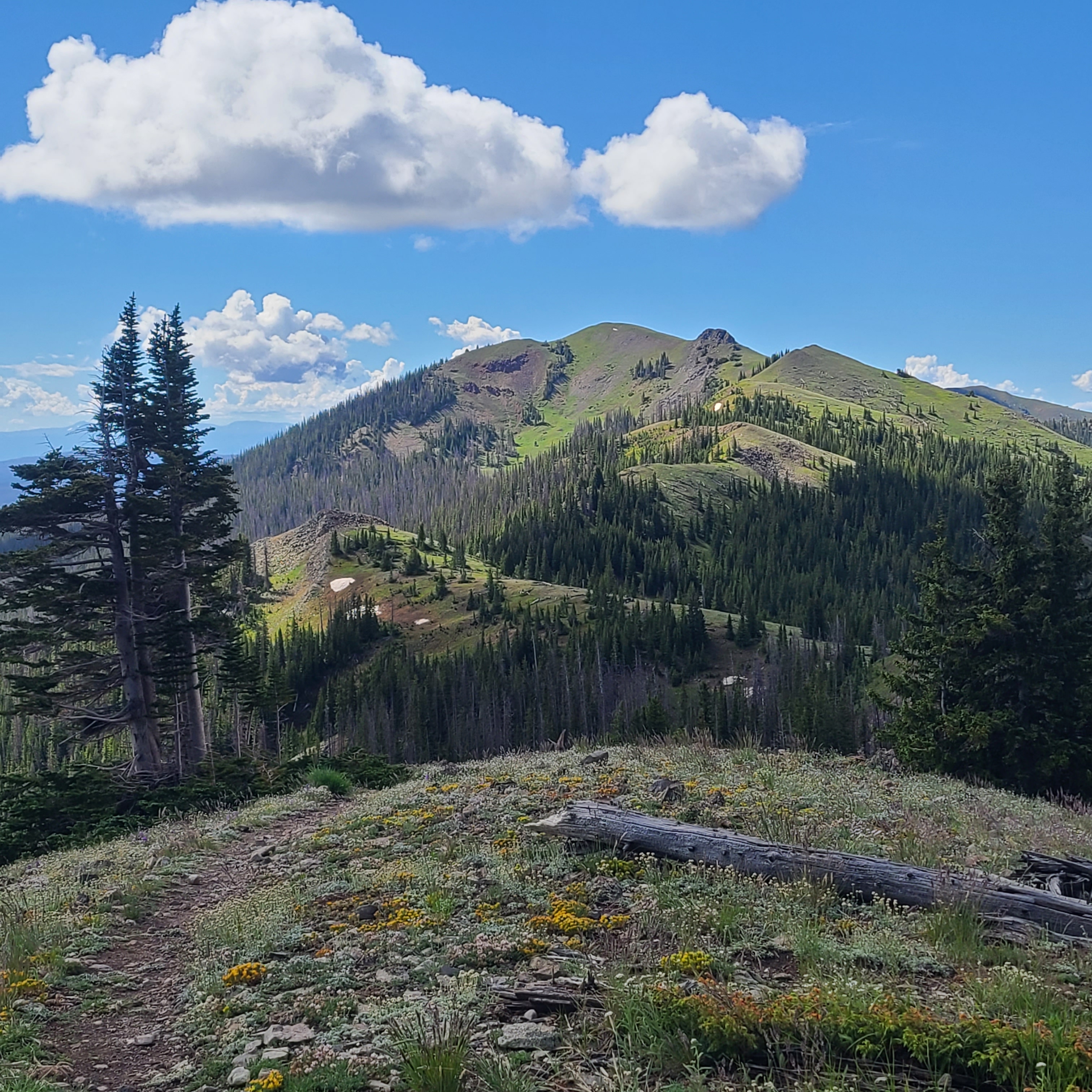
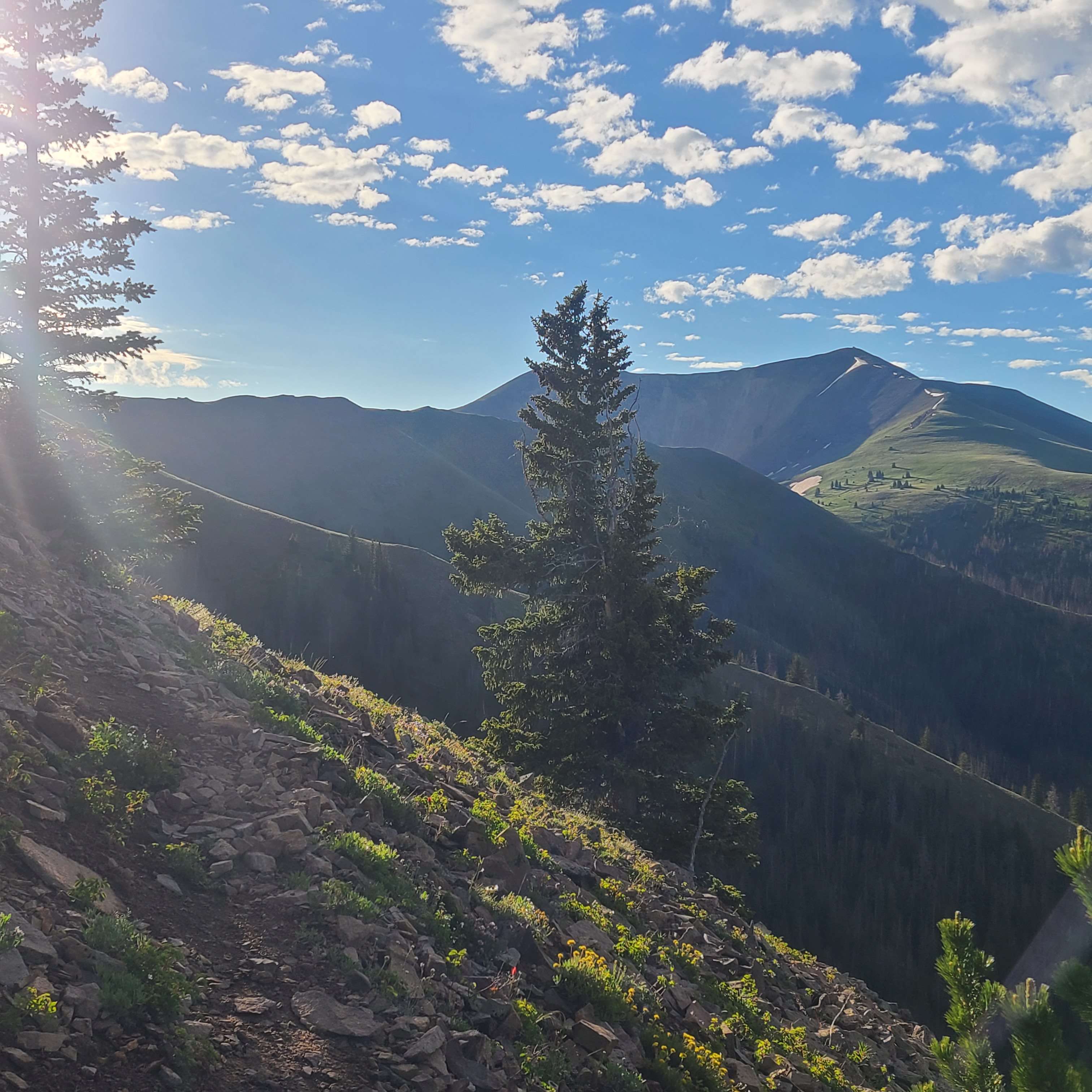
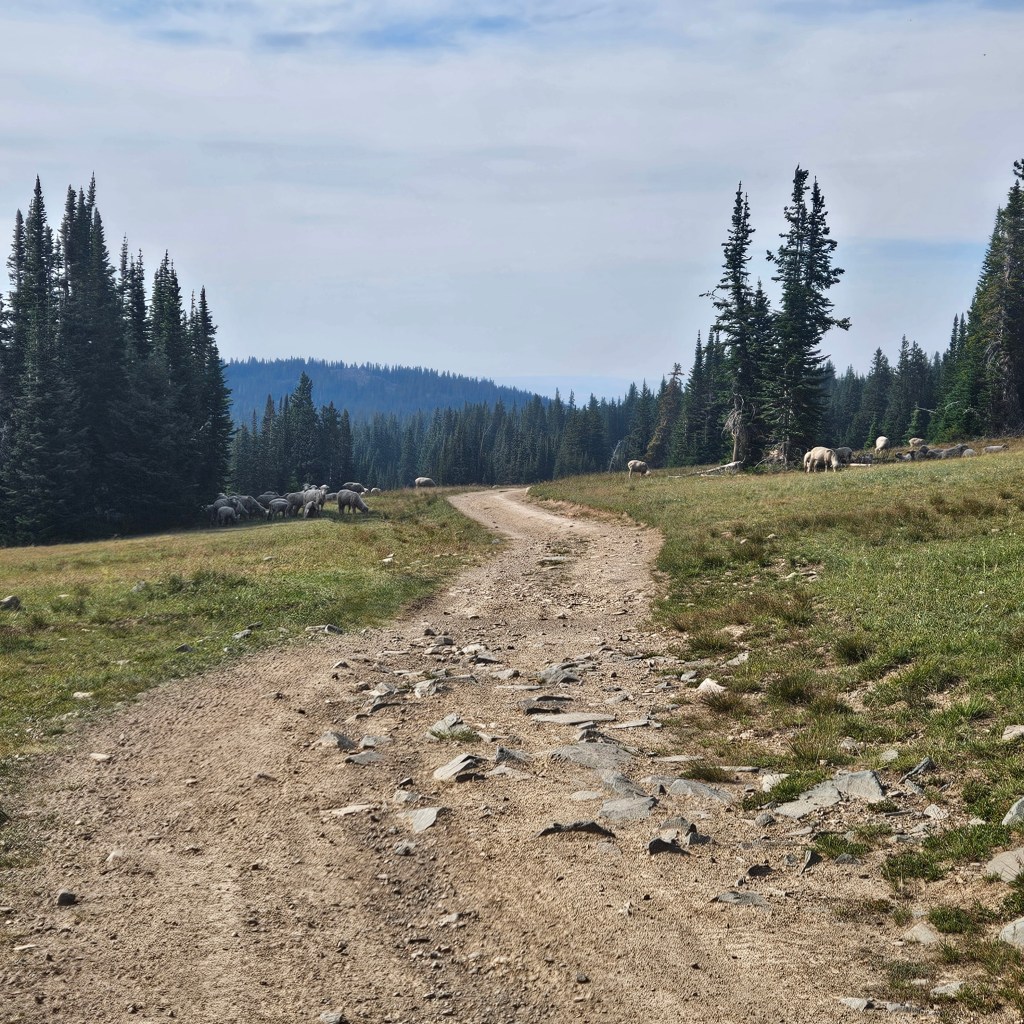
I usually struggle to get back on trail after a night in town, and I got a late start. The road climbed about five miles towards Bridger Peak. The trail broke off around the summit, then flattened out as it rejoined the road. I didn’t see any hikers that day, just a couple of side-by-sides and lots of sheep. FarOut comments had mentioned some decent water puddles along the road, but I was skeptical with all the sheep. I finally found a little deeper puddle without too much sheep poo and it filtered ok. I managed about 10 miles, and thankfully the last couple were downhill. The FarOut comments accurately directed me to a nice flat camping spot.

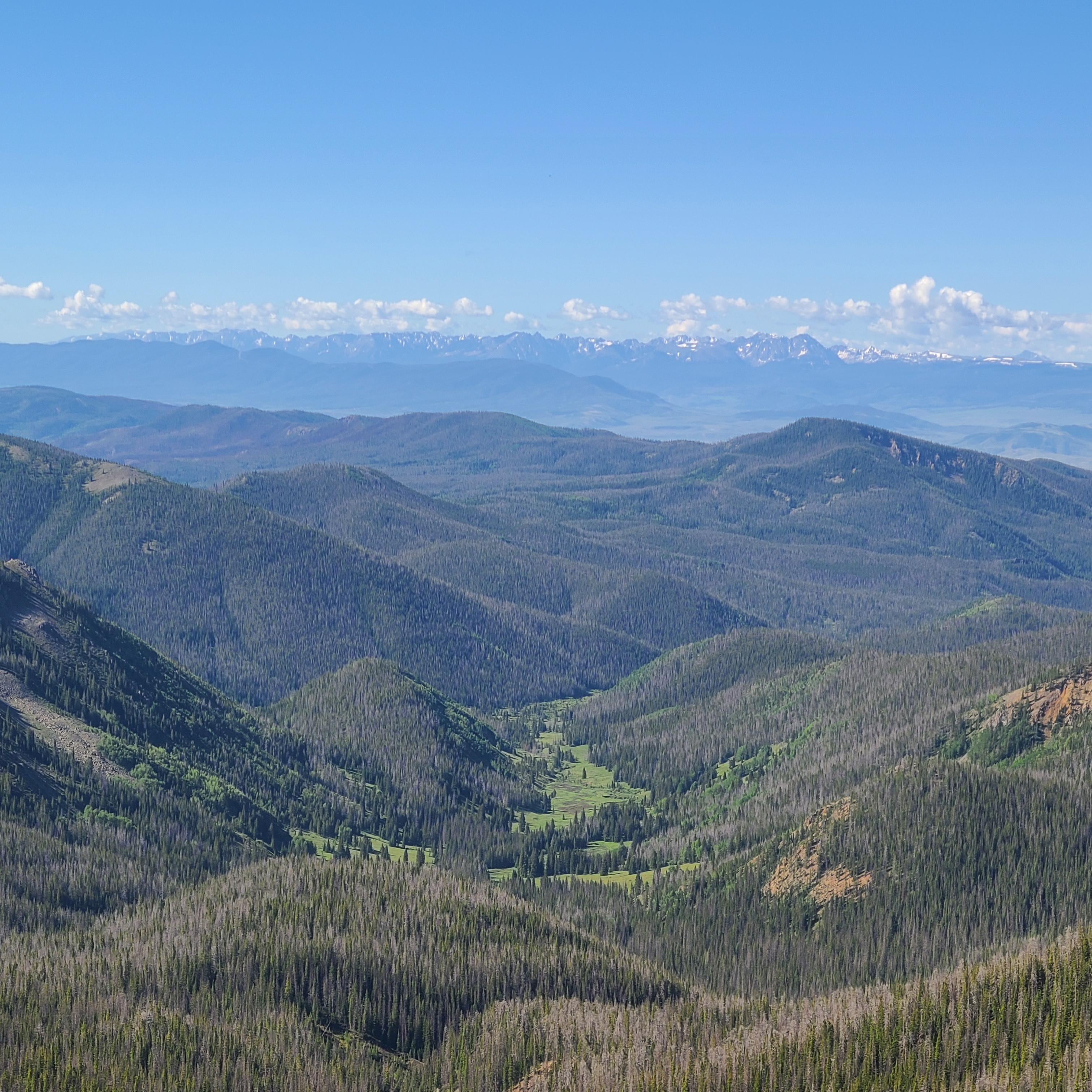
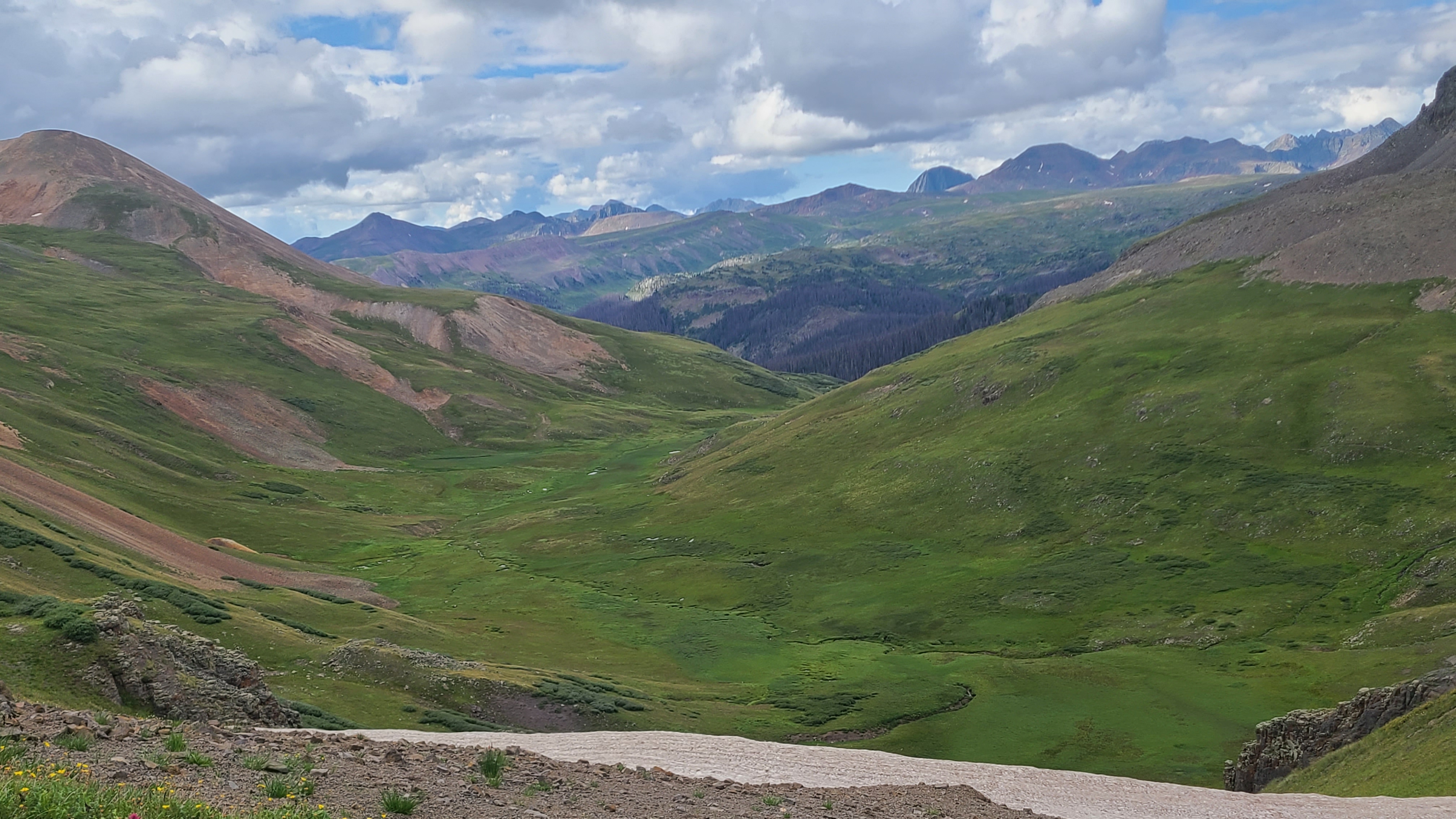
I was happy to find a decent creek to fill up water in the first mile the next morning. I could see the woods disappearing behind me although there was a lot more climbing than expected as I entered the Great Basin. After about 16 miles there was a perfect grassy campsite alongside the North Fork of Savery Creek.

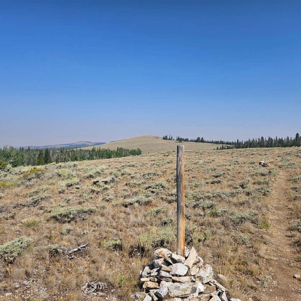
The next day was a grind, and I didn’t see a soul that day. I filled up my 3 liter Cnoc bag at the piped spring, and decided against taking the bushwack short cut which might have saved a couple miles. After about 18 miles I camped at a little parking area near Muddy Creek. Someone had made a little dam in the creek with clear water flowing over, so I used that and saved my water from the spring. I realized that night that sleeping alongside a lonely dirt road is way more spooky than camping alone in the woods.

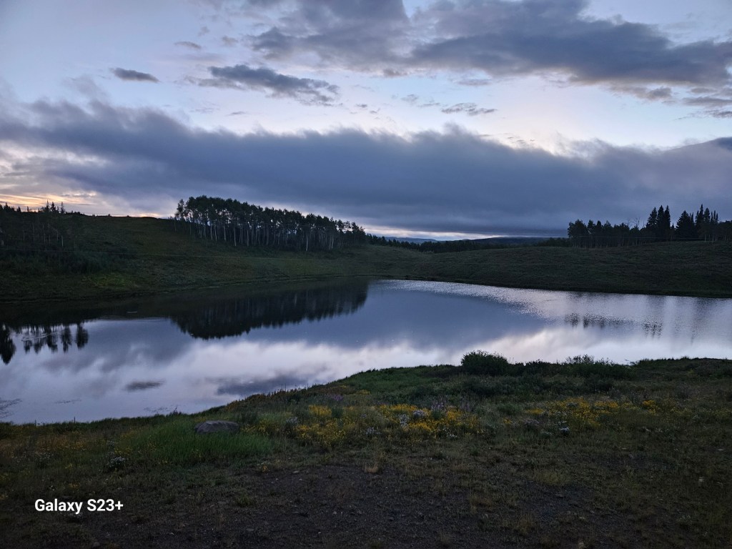
A NOBO thru-hiker named Stix walked by the next morning as I broke camp and it was nice to have a little chat with someone. Later that day I met SOBO hiker Firehusband, who shared the good news that there’s a flowing spring up the hill the from recreation area, about 10 miles before Rawlins. That meant I didn’t need to lug around all that extra water the last day. I think I unwillingly carry the expression of a suffering hiker on trail, and some super nice father & son fishermen stopped on the road to give me a cold water, Gatorade, & spicy McChicken. I stopped at a murky pond to fill up a liter when I saw Stix and met her companion Sky High. When I saw them together I realized they were the same couple who passed us at the Seedhouse trailhead back in Colorado. They might have been better off had I not told them about my lucky trail magic from the fishermen. But that bit of kindness helped get me to 20 miles as I reached another murky pond to camp by on my last night.

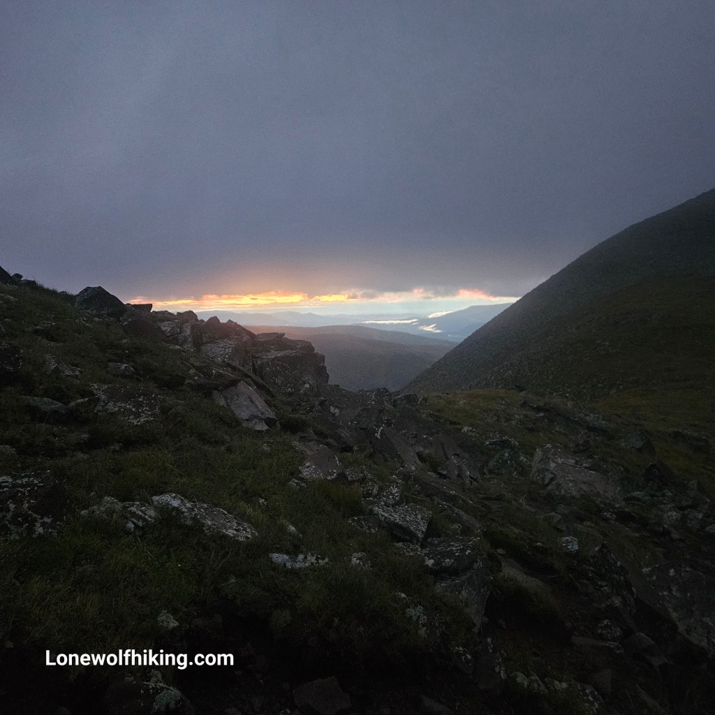
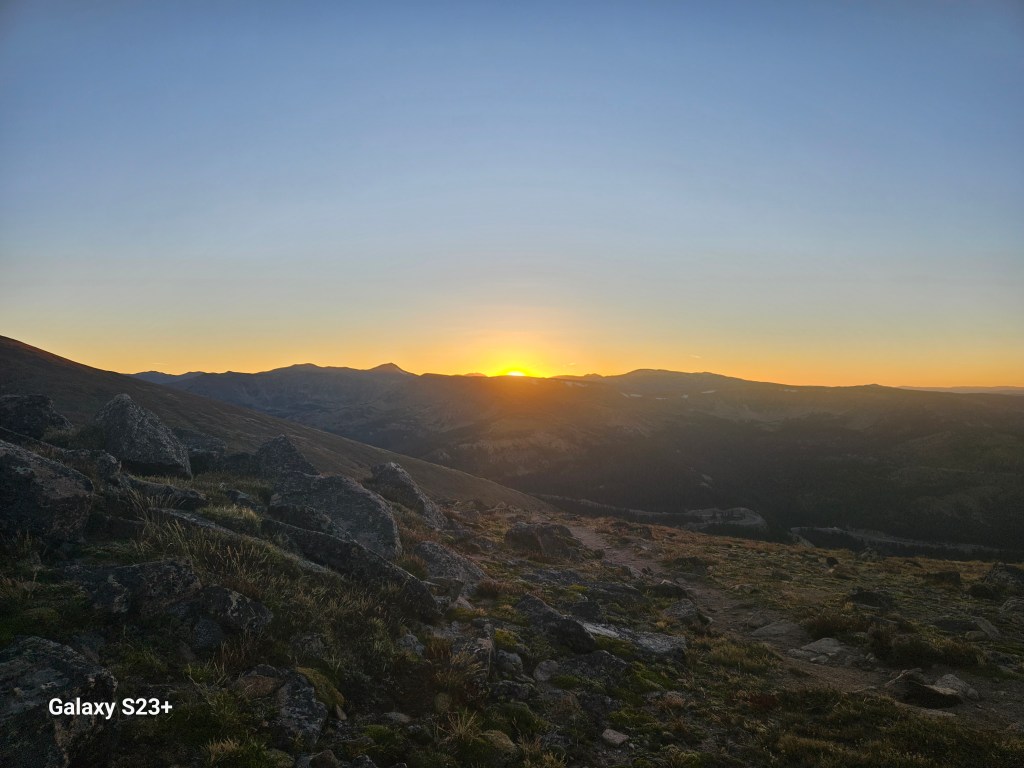
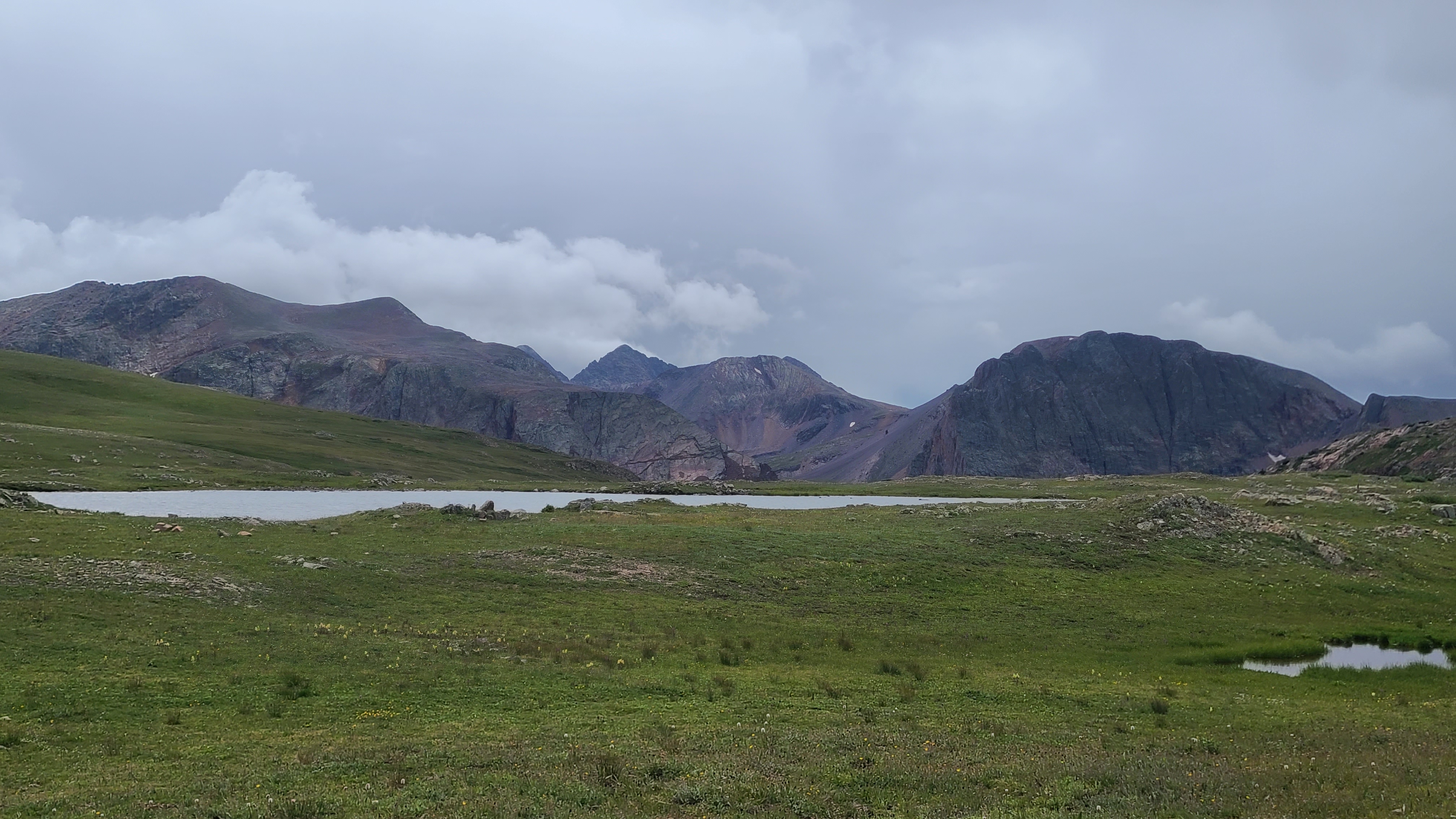
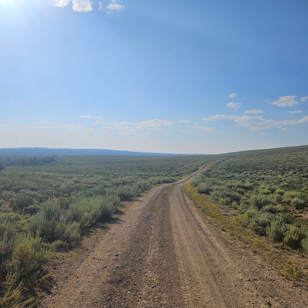
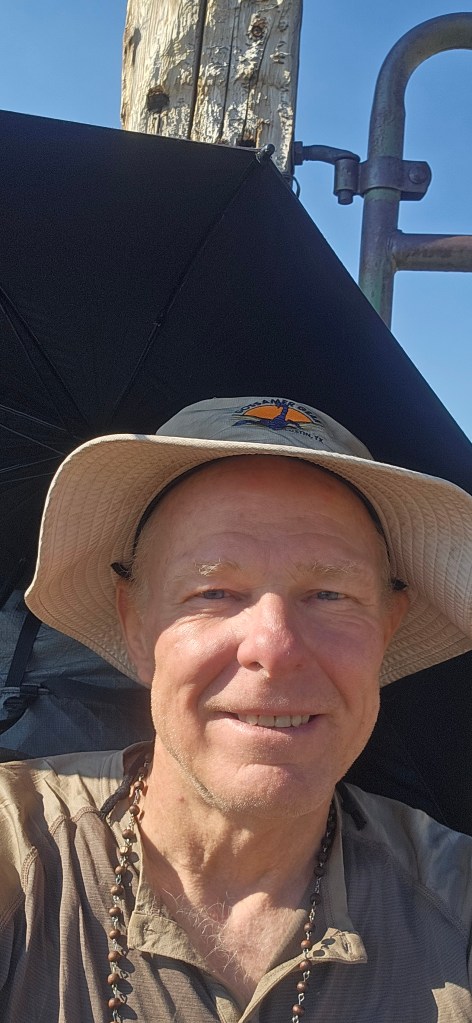
I had enjoyed a gentle wind most the of week, which at least psychologically mitigated the heat. I brought a sun umbrella which I quickly discovered is pretty useless in the wind. But when I set up camp that last night the wind became violent, and was not kind to my X-Mid as I tried staking down the corners and doors. The next morning was calm as I got up for an early start, and the murky pond was stunning at sunrise.

Stix & Sky High had camped on the other side of the lake, and they passed me when I stopped to filter the piped spring water I’d been carrying. They mentioned they were taking a shorter route to town on the road, but I stuck to the redline as I would need to refill at the natural spring Firehusband had told of. I was soon very relieved to be alone in the sagebush as I had no cover when that 3-day old spring water attacked my insides without warning. I hiked as fast as I could those next 7-8 miles, with many surprise stops along the way. I had not seen any rattlesnakes and was especially glad to not see any that day with all my detours off trail. I finally reached the vault toilets at the recreation area, and they were clean and stocked with TP. Water in the nearby murky lakes did not look appealing given my current condition.

From the recreation area it’s a steep climb up the trail where it passes the by the natural spring. There’s no marking to the spring, so I had to take a surprise bushwack to find it. But I was pretty desperate for some decent water and was able to collect the water as it flowed out from the rocks. I still had close to 10 miles left to Rawlins, and as a I got closer to town there was no place for an emergency stop. The redline winds through a residential area then into downtown, and I finally made it to Bucks Sports Grill in Rawlins with no time to spare. I was also starving by now and they serve a nice-sized cheeseburger. I settled into the hiker friendly Brickyard Inn for the night. I had planned to take the Greyhound to Denver then the Bustang back to Steamboat. It turned out Art & Teresa needed to take a trip to Cheyenne (I think maybe they just wanted to make sure I had a way back), so I ended up with an easy and fun ride home.

CDT-CO: Wolf Creek Pass to Cumbres Pass (Aug 26-30, 2024) 70 miles

I learned over the weekend that Pagosa Springs has a Monday-Friday daytime bus, which was handy to get to the east end of town to hitch back up to Wolf Creek Pass. A cool mountain biker named Pablo from Colorado Springs picked me up after about 30 minutes and we had a nice chat on the way back to the pass. The weather forecast for the South San Juans look looked much better than last week’s daily thunderstorms in the Weminuche, although the morning was foggy and overcast.

I started down the wrong trail from CDT sign trail and immediately was rewarded with wet feet as I connected back to the right trail. Ugh. At least it wasn’t raining and the trail was free of those pesky willows. A trail runner passed me on the way up into ski area, which had a bunch of old ski area machinery laying about.

I Met Lil Lazy Boy from Utah who mentioned his section hike from Ghost Ranch to Wolf Creek had left him exhausted. He warned of blowdowns ahead and no water for miles. He even offered me some of his water. Later I felt bad I didn’t offer him some food, and made a note to be better about this to fellow hikers (like Jeemac had been to me on Bowen Pass a couple years earlier). I stopped at the ski area warming hut for lunch and to top off my phone battery. The blowdowns weren’t so bad and actually kind of fun to climb around, and I was happy to finally see some sunshine that afternoon.

I had made it about 12 miles before stopping to camp, not bad for the first day out of town. The first CDT Sobo thru hikers of the season passed my camp. It was fun to meet Krispy & Mads, and they let me know the past week in the Weminuche was the worst weather they had encountered on the entire trail. In the coming days I would appreciate them leaving me a bit of trail to follow through some difficult to navigate grassy terrain.

I was happy to wake up to a clear morning. I saw a deer then a bear cross the trail in front of me. That afternoon I chatted with a couple who had climbed Montezuma Peak, and then passed by impressive Summit Peak. I was surprised to find cell service and in dealing with some personal stuff back home I forget to check the weather (a bad habit). The route finding was challenging as I hiked down to the Adams Fork / Conejos River to camp. FarOut had warned the trail was tricky through here, so I made sure I found where the trail would cross the creek in the morning before setting up camp.

The next morning was a rough one, and I lost a lot of time with the difficult route finding uphill. I still managed about 14 miles, not bad for a section hiker but well short of the 17-20 I felt I could do by now. I chatted with full loaded backpacker hiker named Tim, who told me the locals called these mountains the Conejos rather than the South San Juans. He promised amazing views to come, I just had to get over that “little hump” that lied ahead. Tim also mentioned he had seen Krispy and Mads, who were now about half a day ahead.

Just as a made it up the saddle, I could see some walls of rain in the distance, and they looked to be headed the same direction as I was. I hurried down the long descent towards Blue Lake, which didn’t offer great camping on the near side. I decided to race the storm to the SOBO side of the lake, where FarOut mentioned there were plenty of good campsites. The rain hit just as I reached the other side, and I was again lucky to get in my tent ahead of worst of the storm.

I was out of camp before sunrise, as this would be my last full day on trail. It was overcast all day and I was thankful for my early start. I was making decent time despite all the blowdowns around Dipping Lakes, and I felt confident I could cover at least 17 miles today. That would leave me relatively short hike to Cumbres Pass tomorrow to start my long and uncertain hitch back to Silverton. I walked past a near perfect established campsite by the lake, and chatted briefly with a NOBO section hiker headed towards Wolf Creek Pass. I felt overdressed in my raingear as she just wore a short sleeve t-shirt.

It seemed my last few climbs were a struggle, so I decided I would embrace this last climb and try to have fun with it. But just as I started uphill I could hear the chatter of hail racing towards me through the woods. Now I was thankful I still had on my raingear. I decided my best option would be just to hike up through the protection of the woods to the next saddle. The combination of wind, heavy rain, blowdowns, and close by thunder all around made this climb anything but fun. I finally reached the saddle and there was no break in the storm. My rain gear was fully wetted out. I sat inside a tree and re-assessed, and decided I just needed to pitch my tent despite covering less that 13 miles so far. I’d had a good cell connection earlier that day to check the weather forecast, which was clearing skies overnight. I was still frustrated that I had 14 miles left to get to Cumbres Pass the next day.

I set my alarm for 1:30 am but didn’t get up until after 3:00. I hadn’t slept well, dreading getting up and packing with much of my gear still wet. The skies had cleared, but I was surprised to find the condensation inside my tent frosted over. There was a mist in the air which made it difficult to see even with my headlight. I couldn’t see the bent tree marking where the trail picked up. I found my way to the trail but was so disoriented in the mist that I couldn’t tell which way to go, and had to check FarOut. I then realized the sliver of moon was still on my left, which at least confirmed I was headed in the right direction.

I was now out of water but didn’t want to backtrack when I realized I had by-passed the next water source. I said a little prayer to my patron saint, St. Bernard, to help me find some water (my prayer for no rain the afternoon before hadn’t turned out as I had hoped). Not long after, I looked down at the wet grassy trail and saw a trickle of water. That was just enough half fill my Bfree filter bottle a couple times, which gave me at least enough to reach the next water source about 6 miles way. It turned out that next water source was at a lake well downhill and off-trail, so I was super thankful for the little water I had. I had been worried about my headlight also, as I didn’t have enough battery left overnight to fully charge it, but it died out just as the first light of dawn appeared.

As a started my descent to Cumbres Pass water was abundent and I crossed the stream several times. I was pushing my pace a bit too much and fell hard in some deep & slippery mud about 3 miles from the pass, yard-saling all across the trail. I had already decided I wouldn’t hike the 3 or so miles to the New Mexico border and back as that was at least two hours of potential hitches from Cumbres Pass I might miss (I found my way back the next year to tag the New Mexico license plate marker at the state line). When I finally reached the highway a mushroom hunter stopped to ask if I’d seen his favorite chanterelles, and offer some tips on identifying edible mushrooms.

I saw a pickup approach and stuck out my thumb for my first try, expecting a long wait for a ride. But the pickup stopped and a super nice fellow named Ricky brought me to Chama, acting as my tour guide along the way to town. He dropped me at the intersection towards Pagosa and recommended nearby Fina’s as a good spot for lunch. Fina’s Mexican Hamburger was a hiker’s dream and they didn’t mind me charging my phone while I had lunch. When I went out to the highway, I didn’t even have time to text my son that I had finished before a super nice live-in van traveler named Jeanie picked me up. She ended up taking me all the way to Silverton, and after an engaging and surprisingly spiritual ride I was thrilled (and a bit surprised) to see my truck where I’d left it. I have hitchhiked to and from trail a lot over the years and have never had anything like that kind of luck. And I realized those rides only lined up so perfectly because I got caught in that thunderstorm the day before.

All told, I hiked 14 miles, hitched 160, then drove almost 300 back to my son Erik’s house in Leadville – what a day! We spent the next day together fishing at Twin Lakes, some welcome Type 1 fun after a Type 2 adventure.

CDT-CO: Silverton/Elk Park to Wolf Creek Pass (Aug 18-24, 2024) 85 miles

I left Steamboat on Sunday morning right after my graveyard shift ended, and after a 6-hour drive I arrived in Silverton ahead of the afternoon train departure. I had previously called the Sheriff and chamber of commerce offices, who had both told me it would be ok to leave my truck parked on one of the dirt side streets in Silverton. After about a half-hour ride the train dropped me at the Elk Park stop near the Colorado Trail (CT). I recognized the bridge crossing the Animas River as we pulled up, and the conductor directed me to the “Y’ in the train tracks to connect to the trail. I think he meant to follow the tracks back to where the CT crossed over, but I instead went looking for a phantom connector trail shown in the FarOut app on my phone. There was a group camped near the stop, but rather than have them see me backtrack I did a short bushwhack through the woods uphill to the CT. That was probably a bad decision but turned out to be kind of fun, and was a good confidence builder for what was waiting for me once I reached the CDT. After about 5 miles I found a nice camp spot near the creek, not far from where I had camped on my 2021 CT thru-hike.

The next morning I was glad to have already covered part of the climb up Elk Creek. I remembered it being a difficult descent 2021, and since then had been dreading this climb back up to CDT. It was fun to see some happy CT thru-hikers nearing the end of their journey, along with several other backpackers exploring the Weminuche Wilderness. I had a nice chat with a fellow Durston gear fan named Bubba, no trail name needed, drying out his X-Mid. In the end, the climb wasn’t so bad and I even enjoyed the final 20+ switchbacks up to the saddle (I lost count).

As expected the trail grew faint once I reached the CDT. As I started up towards Hunchback Pass I felt some colder wind & raindrops, and (thankfully) decided to set up my tent to wait out what turned into a long thunderstorm. A fellow section hiker coming from Wolf Creek passed by when I peaked out during a lull, and he mentioned this was the first bad weather he had encountered. I hiked on a couple more miles after the storm finally passed, but ended up just covering about 8 miles for the day. I caught my first glimpse of what I later learned are The Window and the Rio Grande Pyramid. I found a FarOut reported semi-flat camp site near a creek, ahead of the next day’s climb.

Rio Grande Pyramid & The Window

I hoped to cover around 15 miles so was out of camp as the sun rose. The willows were thick and shoulder-high going past the Ute Lakes. I took a quick lunch break to dry out my tent, then soon found myself facing another thunderstorm as I climbed towards the La Osa Trail junction. The nearest somewhat flat spot alongside some willows also hosted a creepy pile of bones but I didn’t have time be picky. It was a pain to set up my tent mid-day again but I didn’t mind the chance for an afternoon nap.

The trail passed around and just below the Window and it was cool to see it from the other side. It was a long, relentless descent down to camp, and I was at least thankful I wasn’t going NOBO uphill. I had read on FarOut that the deer tended to hang around camp here, and saw that as I watched a younger deer casually stroll past a camp already set up in the meadow. Jim & Allen didn’t mind me camping nearby and suggested a nice spot they had seen in the woods. They were a friendly father and son duo planning to hike up and look through the Window the next day (that looks to be a bit of a bushwhack after a long uphill climb, but one I decided to add to my bucket list). An even smaller deer lingered by my camp, kind of creepily leering at me all evening. This was the only night on this trip that I camped with anyone else nearby.

I did better on the next morning’s climbs. It was fun to chat with fellow CDT section called hiker Gezer, 75 years old. He mentioned he had hiked the extra few miles to tag the New Mexico border after hiking SOBO to Cumbres Pass, which seemed like a good idea. The willows were thick across a long meadow and uphill climb, and I missed the water source. When I finally got above the willows I could feel the wind increase, temperature drop, and a few raindrops as the trail crossed a surprise creek. I was thankfully able to fill a bottle of water and get my tent set up on an almost flat spot ahead of the storm. This was the third day in a row I had to wait out a thunderstorm. I had a short climb after the storm let up, then another long descent through the willows. My legs in shorts were getting pretty torn up by these willows that had overgrown much of the trail with all the summer rain. But it seemed whenever the trail left the willows, the route-finding became even more challenging. I was happy to find a nice campsite alongside a creek at Squaw Pass.

I was out of camp at around sunrise, which turned out to be a long way from sunshine as I was hiking up the east side of the drainage. Hiking uphill in the morning shade through the relentless, soaking wet, shoulder-high willows was absolutely miserable. I also had the Knife Edge looming ahead. After I finally reached sunshine I had a nice visit with Zig Zag, a 70 year-old super fit section hiker headed NOBO. The sun faded out quickly, and I had to set up my tent for a couple hours to wait out another thunderstorm. I slipped and fell down into the uphill side of a sketchy side slope before reaching the Knife Edge. This feature turned out not to be a big deal with the snow long-gone, and Zig Zag had given me a good heads up of what to expect.

As I approached the next climb up towards the Indian Creek Trail junction, I was mystified by a big arrowhead stone above a cliff with another similar shape appearing to be carved out of the wall below it. I was thankful to see the willows finally subsiding a bit. That evening I had dinner on a big rock near my campsite and noticed it had a random USGS plug and cell service! I was so happy to finally call my wife Maria that I forgot to check the weather. The worst morning on trail had turned into one of the better days.

The next morning was overcast and it stayed that way all day. There were some good climbs with unprotected terrain, and this was a good day to not have thunderstorms. I decided to not press my luck so I set up camp before 5pm that afternoon, at a saddle ahead of the climb to the Creede Cutoff junction. This turned out to be a lucky move, as I climbed into my tent just after 6pm. Less than ten minutes later a long, all evening storm hit.

I still had 15 miles left to get to Wolf Creek Pass, so I was up early and out of camp just after 4am. It was again overcast and I knew the monsoon would likely hit again today. I met met Stagecoach, who was headed NOBO on a CDT LASH. We both lamented the nasty weather. He mentioned the next week’s forecast looked much the same. I hurried my pace and was 10 miles in just after 10am. Then the thunderstorm hit and and didn’t stop until my final descent down to the highway. I was surprised to see a pair of backpackers starting out in this weather. My rain gear was wetted out but I kept moving and stayed warm. I was learning that I could stand at least a couple hours hiking through heavy rain. I reached Wolf Creek Pass by about 12:30 pm, and still had a fighting chance to get to the post office to pick up my resupply ahead of their Saturday 2pm closing time.

I hoped that standing soaking wet and desperate looking alongside the highway might get me an easier sympathy hitch. Thankfully a fellow hiker called Snack stopped after about 10 minutes and dropped me at the downtown post office. I had read that Pagosa was pretty spread out but I somehow missed the fact that my motel was almost 3 miles away, uphill, from the post office. I tried to hitch but didn’t have any luck. At least it was now sunny in town and I could warm up along the way. About a mile from my motel I passed the Break Room bar & grill, and saw they had outside seating. Just as I sat down a one-man band country singer named Johnny began to play on the patio, and I enjoyed a fun & tasty outdoor lunch. The final walk to the Alpine Inn wasn’t so bad now that I was in a better mood. I ended up having a great stay at the motel, and the laundromat was nearby. On Sunday the motel owner John found I was on foot and loaned me his bike to go downtown for Mass. I enjoyed the chance to connect with some folks back home, and the weather was now looking a bit better for next week’s hike from Wolf Creek to Cumbres Pass.

CDT-CO: Mt Zirkel Wilderness / Seedhouse Rd to Buffalo Pass (Sept 24-26, 2023) 24 miles

Art hiking up Lost Ranger Peak
Sawtooth Range in background

I had been looking to hike this section of trail for years, after gazing countless times at the peaks in the Mt Zirkel Wilderness from Steamboat. I’ve done some backpacking on the west and east sides of the area, and loved the idea of making a north to south traverse on the CDT. I was super excited that my buddy Art would be joining me, as he did two summers earlier for a couple sections of the Colorado Trail.

GAIA GPS link to route

Art’s wife Teresa was kind enough to help us shuttle vehicles, as we left my truck at the Summit Lake parking lot where we planned to finish. This was no small ask, as the west side of Buffalo Pass is a rough, generally ungraded 4-wheel drive road; she probably spent six hours shuttling us up Buff Pass then back to our starting point on Seedhouse Road near Clark.

I tracked our location on my Far Out app while we drove, looking for our starting point at the barely visible northbound Wyoming Trail marker. That will be my connection back to trail when I hopefully hike the Wyoming section of the CDT in 2025. We started our section hike at this seemingly random spot on Seedhouse, then turned south on the road towards the Three Island Lake trailhead. After about 1.5 miles the CDT leaves the road at another subtle trail marker, then rejoins the same road towards the North Lake trailhead. We met a super fit trail runner who kindly shared with us that she’d once had a mountain lion encounter on that connector trail. She was the only other person we saw on trail that first day.

The North Lake trailhead was the halfway point on our planned 8-mile first day, which seemed reasonable given our early afternoon start. I had hiked to North Lake a few years back and remembered a nice campsite just out of site of the trail, alongside a handy grandstand rock formation. It’s a pretty steady uphill hike from the trailhead to the lake, with about 2000 feet to gain over 4 miles. The CDT passes through an eerie burn zone which at least confirmed we were getting close. From there it’s short decent through some marshy woods then a final uphill push to North Lake. We were able to camp at the same familiar spot with no one else at the lake.

I have a habit of collecting my water at night in my CNOC bag, then hanging the bag to gravity filter it though my Sawyer Squeeze as I break down camp in the morning. I repeated this routine the next morning and it started out flowing like usual. I felt foolish as I turned back around and watched the water freeze on both ends of my filter, meaning the filter fibers had likely frozen, broken and were unreliable. This turned out to be a bad early morning practice for a fall hike in Colorado at 10,000 feet. I had brought along a backup Katadyn filter & bag, which thankfully was still in my puffy coat pocket.

On my last visit I had hiked up to the Divide, where the CDT rejoins the Wyoming Trail and heads south towards Rabbit Ears Pass. I had stopped at that junction, and remember thinking how cool it would be to follow the trail across the alpine tundra up and over Lost Ranger Peak. Today was the day. I hadn’t even imagined the view looking back towards the Sawtooth Range from the top of Lost Ranger Peak.

Lost Ranger Peak

After Lost Ranger Peak the trail crosses Rainbow Lakes trail. A few years earlier I had taken a backpacking trip to Rainbow Lakes then hiked to Slide Lakes, and it was cool to see these from above on the CDT. The trail continues on below Mt Ethel then passes above post-card worthy Luna Lake.

Upper Slide Lake
Luna Lake

The trail was faint after Luna Lake and we had to back track a bit, a couple of times. After passing all these lakes, and even a small stream, I just assumed we’d continue to have plenty of water along the trail. About a mile past the stream Art gently asked me, “Larry where’s the next water?”. “Ummm…”, I answered as I discovered there was none reported on Far Out for a couple more miles and until after the next climb, well beyond where we planned to stop for the night. We were both running low on water but decided to carry on rather than backtrack a mile, and worst case we’d just have to make that climb. Thankfully Art spotted a small, unnoted pond about a quarter mile off trail. After filling up we hiked to the start of the climb and stopped after about 10 miles for the day.

It was nice to still have a bit of daylight so we didn’t have to rush in camp, although I got a little too comfortable. As I sat down while boiling water for dinner I tipped over my pot and badly scalded an ankle – ouch! The next morning we knocked out the first climb pretty easily, then it was rolling hills and some great views as we hiked the last 6 miles back to my truck at Buff Pass. We also took note of some nice camping spots within just a few miles of Summit Lake that would be perfect for a short overnight trip.

We hadn’t seen anyone the day before but met several friendly elk bow hunters that morning. Our good spirits apparently had us chirping a bit too loudly as one of the hunters (kindly) let us know we’d spooked an elk away from the trail. I didn’t notice until we finished our hike that the drive up Buff Pass had shaken the topper on my Tundra back about 4 inches. We ended up driving back on the east side of the pass, a bit longer mileage but also a much smoother ride home. As Art and I celebrated our adventure with our traditional cheeseburger & Coke back in Steamboat, we began planning next year’s hike from Herman Gulch, over Grays Peak, then on to Georgia Pass.

CDT-CO: Muddy Pass Gap (Aug 3, 2023) 12 miles

The Muddy Pass gap road walk starts where the CDT joins Highway 40, about 2 miles west of the Highways 14 & 40 intersection on Rabbit Ears Pass, then turns north on 14 for another 10 miles until the trail heads southeast on the dirt road at County Rd 53. I had hiked to the Highway 40 trail junction a couple years earlier, and started my prior year’s southbound CDT section hike at County Rd 53.

I was celebrating an addiction recovery milestone, and someone who knows me well suggested that gap as nice way to mark the date. I’m not sure how important that 12 miles of pavement is for a section hiker, but I wanted the whole CDT experience. It was also pretty convenient for me to make the short drive from Steamboat to trail on a cherry-picked clear, early weekday morning.

I parked my truck at the Old Columbine trailhead and could see the moon still out as I started my hike. At a walking pace I could appreciate the morning sky reflecting off Muddy Pass Lake.

As I finished the first 2 miles I smiled looking at the little parking lot at the 14 & 40 intersection. I’ve driven past this spot a least hundred times over the years, but in the last couple years I often stop here for a moment of prayer and reflection. The CDT has become such a spiritual experience for me that I’ve adopted this humble dirt lot as my personal sanctuary.

The day really was ideal for this walk, and morning fog blanketed the rolling hills ahead. I had planned the early morning to minimize vehicle encounters on this 2-lane highway, where drivers tend to move fast and might not be used to seeing hikers on the narrow shoulders. The vehicles I did see for the most part saw me also and pulled around to provide a little safety buffer. I hustled through sketchiest section, a guard-railed curve around a blind corner, with virtually no shoulder.

This turned out to be a nice, long walk and it was cool to appreciate the scenery I usually missed on a hurried drive towards Walden. I also appreciated my choice of almost new, cushioned road running shoes that a thru-hiker probably wouldn’t have the luxury to change into.

I recognized the final long, curvy hill towards County Rd 53, and was now realizing that hiking with virtually no traffic might also mean a long wait for a hitch back to my truck. I’d made a tentative plan to meet up with my nomadic buddy Chris on Rabbit Ears Pass if he made it over from Denver, so for a change was in really no rush.

I was probably a quarter mile from the finish when a loaded down 4-Runner crested the hill. Chris! We had no formal plan, he wasn’t even sure when I’d be hiking, and he just happened to take the long way from the front range. His vehicle is rigged for overlanding and not passengers, so I gave him my truck keys so he could come back to pick me up. The wait gave me some time to sit and reflect on the day that really couldn’t have gone more perfectly. Chris worked his magic and even topped that by pairing a picturesque campsite on Rabbit Ears with a gourmet backcountry supper.

CDT-CO: Rocky Mountain National Park (Aug 7-8, 2023) 11 miles

The previous summer I finished my southbound CDT section hike at the Bowen Gulch Trailhead near Grand Lake. At the time I had considered making the 7 mile road walk on Trail Ridge Road to Grand Lake, but I ended up taking an easy hitch with a park ranger to town. Later this summer I planned to continue hiking south starting in Grand Lake, so that left me a gap to fill in order to keep a connected footpath on the trail.

The CDT redline follows about a 27 mile loop through the park, but campsites generally fill quickly after the March 1 reservation opening date. The East Troublesome Fire had forced the National Park Service to close the the more popular CDT “shortcut” through the park on the Green Mountain Trail for the past few years. I think most thru-hikers just do the road walk or hike the 27 miles in a single day to avoid needing a wilderness camping permit (and the required bear can). That distance through challenging terrain in one day just isn’t realistic for me as a section hiker. The Green Mountain Trail had re-opened this summer, but trail access was limited to only those with a RMNP wilderness camping permit. The catch is that all the camp sites on the Green Mountain Trail were still closed to protect the area as it continues to recover from massive fire damage.

From earlier research I knew the Onahu Creek Trail connected to the Green Mountain Trail, and just a couple weeks before I was surprised to find an Onahu Creek campsite available online. I would have to hike about 3 extra miles north to camp, then could hike 6.5 miles south to finish in Grand Lake, all on actual trail. I booked the campsite, then called the RMNP Wilderness Office to make sure I understood the rules correctly.

I parked my truck at the Onahu Creek Trailhead and wasn’t and even a mile into my hike when I spotted a young moose near the trail. I was more concerned that there might be a protective momma moose nearby, but this one thankfully ran off. I meet a couple friendly day hikers on the first short day and for once beat the rain to camp. I had a nice reserved spot that featured a convenient dining area off a side trail near the creek.

The next morning the trail started out through a fair amount of beetle-killed woods. As the CDT entered the massive burn scar, I could hear the loud, squeaky sounds of what must have been a marmot (aka whistle pig) echoing across the valley. I had seen plenty of marmots running around the talus on higher peaks but never heard them, and I didn’t realize they also live in the woodlands. Hearing the rhythmic whistle was eerily similar to that iconic scene in the “The Warriors” movie, as the unseen marmot repeatedly invited me to “come out to play-ayyy”. I could understand why access to this area was so limited and I felt really fortunate to have this experience.

Other than a trail crew I was all alone the entire way to Grand Lake. It was cool to watch the lake get closer and closer as I neared town. I had stayed over a couple extra nights after my hike last year and really enjoy Grand Lake.

After a big breakfast and coffee, I walked through town and back up to Trail Ridge Road. I had found Grand Lake to be super hiker-friendly and assumed I’d get an easy hitch back, but waited nearly two hours without any luck. Early on a pick-up going the other way slowed and the driver gave me a rubber-necked look. He came back over an hour later to see if I was still there, and drove me completely out of his way back to Bowen Gulch. He was a super friendly roofer from Grand Lake, and he cautioned me that the former town mayor had been mauled to death by a moose. I appreciated him understanding that I didn’t want to be dropped at my truck, but at Bowen Gulch so I could hike the last 1.5 mile gap back to Onahu Creek.

CDT-CO: Grand Lake to Herman Gulch (Sept 3-8, 2023) 75 miles

After anticipating and planning my 115 mile CDT section hike from Grand Lake to Georgia Pass since the previous summer, I was feeling a sense of anxiety that something in my non-trail life might prevent me from being able to go. I then had the comforting realization that even if I did have to cancel for some reason, the real gift of this hike was the past year of preparation, training, hope, and excitement that I had already experienced. I wouldn’t have done that early morning run on the Malecón de Mazatlán in April. I wouldn’t have missed that turn on a July trail race and still finished even, though I had to run a couple extra miles. And I wouldn’t have been inspired by all those still excited and grinning Colorado Trail thru-hikers on my Tennessee Pass training hike just a few weeks earlier. This hike would certainly be a challenge, but I’d already had so many hard and wonderful moments before I even started out on the trail.

As I clocked out after my Saturday night graveyard shift, I got bit choked up with gratitude that I was I getting back on the CDT. Making it even better would be camping with my nomadic buddy Chris at Lake Granby the first night on trail. This committed me to cover about 13 miles, thankfully without much climbing but still a respectable first day on a section hike. I drove straight from work in Steamboat to the Grand Lake rec center, where I had made a previous arrangement to leave my vehicle during my hike. I stopped in the rec center to grab a parking permit then started my hike into downtown Grand Lake. I turned south to follow the CDT over the bridge alongside Shadow Mountain Lake.

Shadow Mountain Lake

I had grabbed a convenience store breakfast burrito on my drive to Grand Lake, and I could already feel the regret in my stomach. I was super relieved to find restrooms at the recreation area after crossing the bridge. That first bad burrito decision continued to haunt me most of the morning, but that at least kept my thoughts off the trailhead sign that warned of mountain lions in the area.

Colorado River forming Lake Granby

The trail crosses a swampy meadow after Shadow Mountain Lake, then follows along a narrow Colorado River as it turns into expansive Lake Granby. I’d not been at the this lake before, but even more impressive than its size is the scenic shoreline with the Indian Peaks for a backdrop. The CDT parallels above the lake with several seemingly unnecessary ups & downs, but from the higher vantage I could at least see what looked to be our very scenic campground.

Lake Granby looking toward Arapahoe Bay Campground

Per my usual luck (and as predicted in the weather forecast), the rain began right as I reached camp. Thankfully it wasn’t a big storm but my single-wall Xmid tent still ended up with record-level condensation overnight after camping alongside the big lake. Chris & I have camped a bunch together over the past few years and his influence played a big part in finding my love for backpacking. It was cool to be able to camp on the CDT with him now that he is not able to do much backpacking.

I got my usual early start the next morning and was happy to see Chris get up for a nice goodbye. The Indian Peaks looked impressive and I had heard plenty about the climbs ahead. The CDT follows a nicely grated dirt road to Monarch Lake, and along the way I met some fellow CDT section hikers heading northbound.

Monarch Lake

I’m not sure how I had never heard of Monarch Lake – it’s one of the prettiest lakes, is accessible by car, and features a long loop around the lake. I hope to make it back there some time for an ambitious trail run. The CDT joins the High Lonesome Trail and passes through a corner of the Indian Peaks Wilderness beyond the lake. I had hung my wetted-out gloves off my backpack and they fell off somewhere early that morning – that was a mistake I would regret in the coming days.

Only a limited number of advance camping permits are allowed in each zone of the wilderness area. My plan for the day was to make about 13 miles, with a fair amount of climbing, to camp near water just ahead of the Devil’s Thumb burn zone and outside of the Indian Peaks Wilderness protected zones. Some advance planning really paid off here.

I thought a lot about my young grandson Silas in Wisconsin that I’m not able to see much, and the need to make him a bigger priority in my life. If I can be so committed and perseverant about hiking, I can certainly do more to find a way to be present for Silas.

By late afternoon I made it to the Far Out-promised campsite near a small stream, and was relieved to be able to set up camp without rain. A couple fast-moving but friendly SOBO thru-hikers passed by, their pace indicating they were far from done for the day.

I started out the next morning hiking through the Devil’s Thumb fire burn zone that had closed that part of the CDT for much of the summer. This had involved an extra 20 mile reroute around the closure, and I was relieved to see that closure lifted just a few weeks ahead of my hike. I was impressed they re-opened that section the same summer, as the CDT crosses directly through the fire damage.

I gained some new perspective on my life almost every day on trail, and today’s was the realization that I wasn’t trying to escape from my “regular ” life anymore, and how grateful I am for that. Lessons from the past few seasons on the Colorado Trail and CDT had played a huge role in showing me the person I want to become, and my newfound love / obsession for hiking had given me a passion and greater reason to actually make some change. On every trip I realized almost immediately that the hike only had meaning with the gratitude I felt for my family, especially my wife, son, and granddaughter.

The CDT continues along the High Lonesome Trail on Rollins Pass then connects to Rogers Pass Road above Heart Lake. Countless other lakes could be seen below the cliff line on the way up. After a very short road walk the CDT heads back uphill, then turns into a sidehill cairn-to-cairn trail on soft dirt, high grass clumps and hidden rocks. The weather was clear and I had hoped get up & over James Peak today, but the sketchy footing had left me exhausted. I decided to look for a spot to camp. There was no ground even close to flat below the ridge, so I ended up pitching my tent on a windy saddle.

I knew I had some serious climbing ahead the next day, so I was up and out of camp at dawn. It was cold and windy, and I was really missing those lost gloves. I was happy to be making the climb up James Peak with some at least slightly fresher legs. I had the early morning summit of all to myself and it was pretty spectacular.

I had some cell service and was able to connect with my wife Maria. It was fun to share my hike with her; she doesn’t quite get how I love doing this so much but she does seem to appreciate the joy it brings me. I met a few cheerful hikers who had left from the 13er’s trailhead, and was happy to find some water as the Far Out comments had indicated.

After a long downhill hike I finally reached the stream ahead of Mt. Flora. The weather forecast was good so I stopped for a good break and hot lunch before my second 13er ascent of the day. I chatted with some fun & friendly Swedish SOBO thru-hikers, Swede & Whitney, that passed by. The CDT follows the side of the mountain to the far end, then reverses course past multiple false summits. I wasn’t even surprised at this point to see a little steeper pitch up what was finally the last climb.

I descended through the talus then finally reached some better footing on dirt trail. After all today’s climbing and descending I was ready to find a camp that left me a short hike down to Berthoud Pass for the next day’s resupply trip to Winter Park. I ended up camping on another windy saddle, and could both see and hear the buzz of machinery from the Berthoud weather & communications station. This made a fun reference point later as I could easily see the saddle where I had camped from Berthoud Pass below.

As I hiked towards Berthoud Pass the next morning I felt a bit discouraged at my progress and days that seemed to all end at just 13 miles. At this pace I was unsure I could make it to Grays Peak ahead of the rain/snow storm that was predicted in about two days. But when I saw the CDT sign at Berthoud Pass I found myself choked up again with gratitude for all that this trail has meant to me, both this week and over the past three years.

After trying for about an hour I finally got a hitch, from an elk bow hunter name Doug, to Winter Park to pick up my resupply. It was fun to see Swede and Whitney again at breakfast. Thankfully I found some affordable lightweight gloves at the local gear shop to replace those I had lost. While picking up my resupply at the post office I met a SOBO thru-hiker named John from Cincinnati. We had chatted briefly the day before as he breezed past me on the way up Mt. Flora.

Winter Park was my simplest exit point – I could easily hitch back to my truck in Grand Lake from here, and I certainly thought about it. Thankfully I packed up my resupply and recalibrated my plan to carry on. I would need to hike another 5 miles to camp tonight, then cover 20 miles the next day. That would leave me about a 5-mile climb to reach the Grays summit, hopefully ahead of the storm on Saturday morning.

I walked just past the ski area parking lot, thinking I could get a quick hitch back to trail. After about an hour I sat down, said a quick prayer, and sent a couple ‘how ya doing” messages to friends back home. I didn’t even have my thumb out when a young mountain biker named Denali stopped to offer a ride. It turned out Denali was his real name given by his adventurous parents.

As I neared the end of the first climb from Highway 40 towards Vasquez Pass, John again cruised past me. He could see the pained look on my face as he playfully teased, “looks what ahead!”

I smiled back as I saw the switchbacks up the short but pretty steep hill waiting for us. After knocking out James Peak & Mt. Flora the day before this wasn’t so bad, but I was still impressed at how quickly John danced up those switchbacks.

This turned out to be fun afternoon hike, with a plan to get to bed early then get on trail before 4am the next morning. Comments on my Far Out app described my ideal camp site – near water, just ahead of the next climb. I was super happy to find that site available. The comments had also accurately warned about the constant humming of the nearby Henderson molybdenum mine, a surprisingly massive operation.

I woke up to a stunning, clear, starry morning. I absolutely love these times on trail, when it’s just me starting a climb in the dark and feeling excited for the day ahead.

I knew I had a long morning climb with around 3500 feet elevation gain to Mt. Hassell, another 13er, followed by an even bigger 4500 foot decent to reach Herman Gulch at I-70. It was easy to stay inspired this morning with high mountain vistas in about every direction. This section of the CDT is bit more maintained than other Colorado sections I’ve hiked, alternating between nicely arranged talus and actual trail across rolling meadows. I was making great progress today and felt committed to make the 20 miles to the Grays Peak trailhead, a daily distance I hadn’t come close to covering since hiking Colorado Trail two years earlier.

I finally got some cell reception to call Maria. She was visiting her family in Mexico and her son was due to have surgery the next day. She mentioned she wanted me to go home today; I initially took that to mean she just didn’t get why I was out here. But after I lost cell reception and hiked on, I realized she had never asked me to get off trail like that. Then it hit me that Maria was worried about her son, and even though I wouldn’t physically be there with her in Mexico, she just needed me to be available for her if she needed me. When I finally got cell reception again I let her know I understood, and that I had decided to get off trail at I-70. I still needed to hustle to be able to hitch to Idaho Springs (IS) to make the daily Bustang shuttle that could get me to Granby, then catch another hitch back to my truck in Grand Lake.

The final climb up Mt. Hassell looked a bit intimidating from Jones Pass below. Then a group of mountain bikers passed me and I watched them carry their mountain bikes up the talus ascent. I even saw a couple of trail runners on the climb. It was fun to chat with a fellow CDT section hiker called Nine Lives, who was doing much of her Colorado mileage as out & back hikes. The descent was relentlessly long, and I could now see why those mountain bikers looked so eager to reach the Mt. Hassell summit. I finally reached the Herman Gulch trailhead around 2pm, then after a couple easy hitches (thanks Ron & Scott!) and a bus ride I was in my truck and headed back to Steamboat.

Mt. Hassell

On my drive home, I reflected on how I’d gotten my hitch back to trail, then my hitch leaving trail, when I didn’t even have my thumb out. Both must have been meant to happen. I had pushed myself that day to make 15 miles by 2pm so I would have made the extra 5 miles to camp at the Grays trailhead, but that also got me to IS in time for my bus. I was comfortable and grateful about my choice get off trail, and I that I was available for my wife. Thankfully all went well with her son’s surgery. In the end, the trail had already given me a way more meaningful experience on this trip then I had imagined. More importantly, I gained the perspective that as much as I love being out there, enjoying my family and being present when they need me is what really matters. More will be revealed next summer with my hike up & over Grays to connect back to Georgia Pass and the Colorado Trail.

CDT-CO: Muddy Pass to RMNP (July 5-9, 2022) 58 miles

My buddy Patrick dropped me at the trailhead just off Highway 14, about 10 miles north of Muddy Pass & Rabbit Ears Pass. I had expected to be about the only southbound hiker, but was surprised as we passed four or five northbound Continental Divide Trail thru-hikers alongside the highway to the trailhead that morning. I probably crossed paths with dozen or more NOBOs on each of my 5 days through this section, and in the end I think my brief chats with so many of these folks was the best part of my hike.

I managed about 12 miles on the first day, following a quiet dirt road through rolling wooded hills. After just a few miles I met a nice pair of Czech CDT NOBOs, Kate & Day Dreamer, followed by Lemonhope and Swiss Monkey. The road passes by some private ranches and what appeared to be hunting lodges for the first five or so miles. Fairly early on I was surprised by the sweeping views looking back west towards the Mt. Zirkel Wilderness and north to the Medicine Bow Mountains. The dirt road trail eventually turned into national forest and started a gentle climb through a long, pretty aspen grove. The climb got a bit steeper, but I passed on a dry campsite featuring a nice scenic overlook. After another mile I found the small spring along the trail, as promised by my FarOut navigation app. I could see the afternoon rain was coming and was grateful for a nice established campsite nearby.

After around 5 miles the next morning, I chatted for a few minutes with a NOBO section hiker. He seemed a bit discouraged by some of the challenging climbs and blowdowns he’d hiked through. I think just about every thru-hiker I had encountered on this trip was super up-beat and seemed genuinely happy to be there. As I hiked on I could totally relate to my section hiker counterpart; we spend the first few days of our trip struggling to hike relatively low miles and by the time we begin to build some decent trail conditioning our hike is nearly over. On these shorter trips it’s hard to settle into a daily hiking routine and set aside my obsession with all the details of off-trail life. In my contemplation I of course walked right by the unmarked trail that finally left the dirt road, and was probably half a mile past that before I realized. I somewhat foolishly decided I could navigate to the trail rather than backtrack, but thankfully found the trail after a fairly steep downhill bushwhack. Finding the trail then negotiating a handful of blowdowns turned out to be a nice confidence boost.

I was a bit gun-shy of the afternoon thunderstorms after getting pummeled a few times during last year’s epic monsoon season on the Colorado Trail. I now check the weather whenever I get a cell signal, and the forecast for the day said thunderstorms after noon with an 80% chance of rain. I decided to call it an early day after just seven miles when I crossed a nice stream with nearby camping ahead of the next climb. Sure enough a hail storm hit right as I climbed into my tent. The weather cleared up in the afternoon and I met a few more NOBOs who walking by, and a nice fellow called Good Monk set up camp nearby.

I was a little discouraged having just covered 7 miles, so I tried to get an early start the next morning. Despite all the NOBO thru-hikers I had met, the trail was still fairly faint so a kept a close watch on FarOut to make sure I stayed on-trail today. As a climbed through the woods and above treeline, I realized I had made a good judgement not pushing my pace the day before. I chatted with a super friendly NOBO named Shredder who was finishing up his triple crown this summer. There were a number of blowdowns through this section, but these weren’t nearly as bad as I had expected. Once above treeline the views were pretty amazing in every direction and I began to anticipate what it must be like atop the next day’s climb, Parkview Mountain.

I was happy to chat with a super friendly bunch of NOBOs that morning, and it was fun to meet Sos who had been a frequent contributor to the Backpacker Radio podcast that I listen to regularly. A couple miles later I met her friend Switch. I again checked my weather forecast and thunderstorms were expected after 2:00 pm. So this time I decided to set up my tent at the next established site, wait out the storm, then hike a bit more into the early evening. I was almost disappointed that the storm barely sprinkled where I was and I finally convinced myself to pack up and keep going. As a started up I met another nice NOBO couple named Happy and Gourmet, and they seemed to appreciate me sharing I thought that a great combination.

I passed the Troublesome Campground and FarOut reported there was water about a mile ahead. I was nearly out of water so I decided worst case I could backtrack here to camp. I hiked on to the stream and I filled up my CNOC to start filtering water. I then saw a happy young boy hike up with his dad, and as some other kids followed I realized this must by “the family” hiking the CDT together. When I had first heard about them this spring, I wasn’t sure what I thought about a family with young children on the CDT. But almost immediately I could tell these kids were completely content and in their element on the trail. Without prompting one of the daughters who was about 8 even ran over to hold up the filter on the end of my CNOC bag while I changed water bottles. Dad doled out side dishes as the kids cooked up their own meals without missing a beat. Then mom walked up carrying the one-year old and the other kids took turns looking after her. I spent at least 45 minutes visiting with this lovely family, and thoroughly enjoyed every minute. They even shared the welcome news that there was plenty of camping ahead and I wouldn’t need to backtrack.

Feeling invigorated, I continued uphill for about a mile to a near perfect camping spot. There was a rock formation I could hike around that gave me a good enough signal to call my wife. I had covered nine miles today, again well short of what I had hoped but I’d had a really fun day on the trail. And I knew I was well rested for the big climb tomorrow up Parkview Mountain.

The next morning I was up and out of camp early. I knew I had a long day ahead, and along with the climb up Parkview I would need to log around 15 miles to have even a chance of reaching Grand Lake the day after. I passed through the big, eerie burn scar from the East Troublesome fire ahead of sunrise. I worked my way around Haystack Mountain, and Parkview came into view right as the sun came up. It was a decent climb just reaching the saddle below the final ascent, I and was thankful I had been conservative on my miles the day before. It was a beautiful morning, and I had the trail all to myself.

Parkview Mountain revealed itself like a miles-long par 5 golf hole. The saddle was green and lush. As I had heard from hikers the day before there were no switchbacks to the summit, just hiking from one wooden marker post to the next. The final mile gained about a thousand feet. The little summit shelter slowly got closer and closer, and I crossed paths with the first other hikers that day just before the summit.

I reached the top and unfortunately didn’t resist the urge to take a panorama video. Had I taken a look around to enjoy the view first, I would have noticed the trail following the saddle to the north. After I ducked into the shelter I had a quick snack at the summit and kept my cork-handled poles in site with an aggressive pair of squirrels nearby. Then I started down the only trail I had noticed along the ridgeline to the southeast. I had gone about 3/10 of mile when I checked FarOut and realized I was off the CDT. Fortunately I hadn’t lost much elevation, but I really hate backtracking after a wrong turn. The only thing worse is when a thru-hiker sees you having to backtrack, and I could see some other hikers reach the summit just in time to watch me sheepishly hike back. There was a super cheery British-sounding fellow named Pirate waiting for me, and I could see he was recording on his phone to memorialize my wrong turn. I then met Swiss Chris and Nature, and Pirate let me know Mr. Fabulous would be next to the summit. I’d been following Mr. Fabulous’ CDT thru-hike on Instagram while listening to his book, The Unlikely Thru-Hiker, and probably fan-boy’d him a little too closely as he summited up through the scree. Still he was a very gracious fellow and was happy to chat for a bit. As I continued down the correct trail, I met their other companion Buckwild. It turns out Buckwild and Pirate are documenting their CDT thru-hike on YouTube; I’m a still bit nervous to see if my wrong turn makes it onto their Parkview summit video.

As I continued down Parkview, with plenty of switchbacks in this direction, I could see the hike from this side was much longer. I now understood why Pirate seemed so happy at the summit. I had a few more blowdowns to negotiate when I finally made it down below treeline. I took a lunch break at a creek and then passed through another long burn scar. Hiking through this seemingly unending burn area felt brutally hot in the late afternoon sun. It was still oddly beautiful through here, with seas of wildflowers growing among the devastation.

I finally got past the burn scar and entered a swampy area with some possible camping ahead. I had made it 15 miles and was worn out, and was happy to reach a small established site. It was nice to be close to water but I knew my Tiger Wall sil-nylon tent would be soaked with condensation the next day. I crawled into my tent before dark and not long after heard a quiet rustling nearby. I have a probably bad habit of growling out loud to calm my irrational fear of wild predators waiting outside my tent to devour me. I felt kind of guilty when I finally peaked outside to see another tent not far away – this poor fellow hiker must of thought I was quite a jerk to growl at him as he very quietly and politely set up his camp with barely a sound.

The next morning I was again up and out of camp before daylight. I knew I had another long climb ahead up Bowen Pass, and needed to cover 15 miles again today to reach Trail Ridge Road. Today’s hike was a grind from the start, especially after Parkview the day before. Thankfully I met a very kind NOBO named Jeemac who correctly read the look of despair on my face. He stopped to make sure I had plenty of food and water to get through the day – I must have looked pretty bad! Still his kindness without being condescending perked me up for the day’s hike. We coincidently met a few days later back in Steamboat, and I was really happy I had the chance to return his kindness with a ride back up to the CDT from town.

I had some challenging blowdowns to maneuver over, under, and around approaching Bowen Pass. A couple times I had to crawl through on my stomach and elbows. Still I thought the trail overall was in great shape and much better than what I had heard. I finally reached the saddle, and met a fun mix of thru-hikers, day hikers, fishermen, and section hikers on my way down. I wasn’t sure how my hitch to Grand Lake might go but the positive vibe a got from my fellow hikers was letting me know it would be ok. Right as I reached the trailhead near Trail Ridge a National Park Service truck drove by. I must have been wearing the same expression on my face as when I met Jeemac in the morning – the ranger pulled up thinking I might be in some distress. I said I was good but took the opportunity to ask if it was ok to hitch along Trail Ridge Road to get to town. He responded that it was not a problem and to go ahead and toss my stuff in the cab. Before I’d even had the chance to take off my backpack I had a ride to town. This very kind man turned out the be one of the more senior park rangers and he graciously gave me a ride right to my hostel.

Shadowcliff Hostel far exceeded my expectations and had a pretty awesome view of town and the lake from the lodge gathering room. I even somehow managed to get the hostel room to myself for the night. It was Saturday and my long time backpacking friend Bill was meeting me for a quick overnight trip into Rocky Mountain National Park on Monday. Shadowcliff was sold out Sunday and a CDT trail angel named Cairn was kind enough to let me camp out in her backyard. I had never spent much time in Grand Lake but ending up having a really fun couple days hanging out downtown and by the lake. Pretty much everyone I encountered was really accommodating & welcoming to hikers, and I quietly wished my home town of Steamboat was more that way. I vowed to bring my wife back here soon for a summer weekend getaway.

After a nice but quick overnight backpacking trip into RMNP with Bill, I again got lucky with an easy hitch from Granby back to Steamboat. And I’d heard a great message in the local church over the weekend, that the highest form of praise we can offer our higher power is to treat our fellow humans with kindness. I certainly felt that kindness over these few days on the CDT.

CDT-CO: Rabbit Ears Pass to Buffalo Pass (Oct 7-8, 2021) 15 miles

Last pitch of my trusty X-Mid tent at Grizzly Lake

Living in Steamboat Springs made this 15-mile section hike of the CDT from Rabbit Ears Pass to Buffalo Pass logistically fairly simple. I drove my pick-up truck up to the Buffalo Pass parking area near Summit Lake, then rode my mountain bike back down Buffalo Pass and to our place in downtown Steamboat. The next morning my nephew Korillo dropped me at the Wyoming Trail/CDT trailhead near Dumont Lake.

GAIA GPS link – Rabbit Ears Pass to Buffalo Pass on Wyoming Trail #1101/CDT

I hiked a fairly easy 12 miles with some gentle up and downs through the woods the first day. I had hoped for some nice views of Pleasant Valley below Rabbit Ears Pass, but the trail didn’t quite reach the ridgeline. It was an early October weekday, so I had the all trail almost all to myself. The only others I saw on this section were some Big Agnes staff hiking back to Base Camp after an overnight gear-testing trip. I made camp at an established scenic spot near Grizzly Lake.

After a relaxing solo overnight at the lake I hiked the remaining 3 miles up to Buffalo Pass and my truck and made note of where the CDT leaves the road and heads towards Diamond Park, my next planned section of the CDT for the following summer. This was a nice way for me to finish out an epic backpacking season, take the edge off a bit of post-trail depression after the Colorado Trail, and get my mindset looking forward to section hiking more of CDT in Colorado the following summer.

I didn’t realize at the time this would be my last pitch of my Durston X-Mid 2p. This had been a great tent for the Colorado Trail but I found the footprint too large in a couple smaller camp spots and wanted something a bit lighter as well. The Durston X-Mid Pro looks to fit the bill so I sold my OG X-Mid to help offset some of my nearly $700 investment in the Pro version. I also feel some loyalty to my home town Big Agnes brand, who also makes great tents, and will be carrying my Tiger Wall until the X-Mid Pro finally arrives.

Coming up for the summer of 2022 I’m planning a SOBO section hike the on the CDT from Rabbit Ears Pass to Rocky Mountain National Park.

CT Day 32/CDT: Cataract Lake to Elk Creek

I hadn’t made 20 miles in a day since starting the San Juans, and hoped to reach that mark today. It was Tuesday and I had 105 miles left to complete the trail in Durango by Sunday. I was out of camp before daylight and began hiking over a series of saddles.

Not long after daylight I stopped to take in the view as the trail passed above Cuba Gulch.

A nice couple of hikers called Sunshine and Toyota leap frogged with me a bit, and I saw them stop to dry out their tent from last night’s rain. They seemed to know what they were doing and it looked like more rain was coming our way, so not long after I stopped to do the same. I was happy to reach the high point, although the morning’s scenery took the edge off the first 7 miles of climbing up and down saddles.

A saw a lone horse looking a bit out of place quite a ways below the saddle. I descended a bit, but not much, on the other side as the trail followed the mountainside above the drainage.

The trail crosses a surprisingly small creek that marks the headwaters of the Rio Grande, then bottoms out at Stony Pass Road. Toyota and Sunshine passed me for the last time as the road climbed back up a short hill, before breaking off again into single track. I had hiked around 12 miles by noon and felt strong until the next couple miles of dry terrain. I crossed paths with a group of hikers using pack mules to carry the their gear and provisions, which they cheerfully pointed out. I then had a short climb to a large rolling green mesa with some small lakes. I would have enjoyed this earlier in the morning, but I was now dragging and could see a wave of rain rolling in. There was no cover here, but the lightning was still off in the distance and thankfully most of the rain missed me. I had one final rolling hill to climb before the CDT broke away from the Colorado Trail and towards New Mexico.

I recognized the view below me from the cover of the Colorado Trail Guidebook. Another hiker had warned me about the switchbacks into the Elk Creek drainage being a challenge, and they did not disappoint. I later heard there is one switchback representing each of the 28 segments of the Colorado Trail. I made room for an uphill hiker hiker who was surprisingly friendly despite being only half way up.

After the switchbacks the trail down was rocky and steep, and I had to scoot belly down over a couple of the sketchier spots. This downhill section felt harder than all of the day’s earlier climbs. At least I’ll never have to climb this, I thought, until I realized that my plan to someday hike the rest of the Colorado sections of the CDT would mean hiking back up that hill.

Towards the bottom of the drainage, orange ribbons marked the suggested but dicey routes across large avalanche debris fields. What appeared to be the worst of these had been cleared thankfully; this must have been a huge undertaking.

I reached a large open campsite alongside Elk Creek right at the 400 mile mark from Denver. Expecting to be out of camp before daylight the next morning, I followed the trail to find where to cross the creek. I didn’t see the crossing, but thankfully some other hikers came along and were able to follow the route across. I was further humbled after a lanky, athletic hiker, who I later met as Danimal, rock-hopped over the creek in two or three long, easy strides.

I was happy to finally set up camp after a rough 20-mile day, hiking over what seemed like every possible type of terrain. I friendly hiker named Paperback came along told me she was waiting for some friends. I let her know there was plenty of room in the campsite as she sat down and of course read a paperback while she waited. Her happy bunch of friends called Puff, Lightning Rod, Trout, & Nightcrawler soon followed and set up camp. It was nice to chat a bit with some nice folks after a long day on the trail.