
I needed to make up some miles today after logging just 9 trail miles the day before. It was Sunday and I had packed enough in my resupply to last until Thursday, when I also had a bed reserved at the hostel in Lake City. That was still 90 miles away, which meant averaging 20 miles a day through Wednesday with 10 miles left for Thursday morning to catch the the noon shuttle from Spring Creek Pass. I was a bit disappointed to leave the hikers I had camped with last night, but the only way I could get in the miles I needed with the anticipated storms ahead was to leave camp by around 4:00 every day. I was now used to leaving camp in the dark and looked forward to having the trail all to myself at my favorite time of the day.
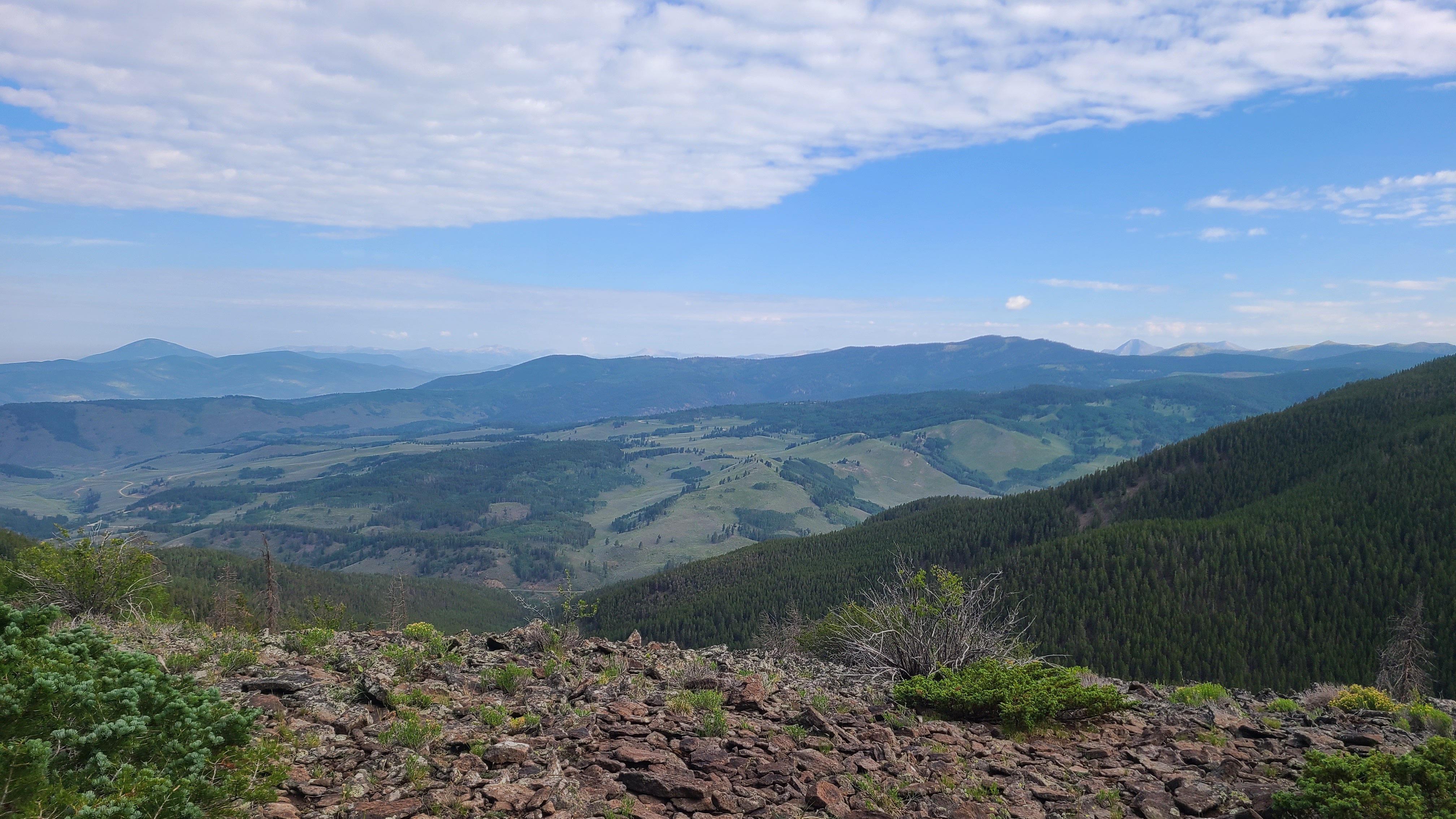
Marshall Pass is a well-used, mult-use trail and was rough hiking, especially on the chopped-up downhill sections. I was still making good time and planned to stop at the Soldierstone monument on Sargents Mesa. By early afternoon I had nearly reached the the mesa when dark skies quickly turned into heavy rain and lightning flashed at the top of the climb. I dashed into a grouping of trees which provided surprisingly good shelter from the rain. I could see there was no cover on the open mesa and felt lucky to have reached these trees, despite ample evidence that the nearby cows had recently taken refuge here. I waived a few other passing hikers over to share this spot through the worst of the rain. I was happy to hear one of them report that the next on-trail potential water source at Razer Creek was flowing, although still 10 miles away. One by one we eventually decided the lessening rain was preferable to the surrounding mounds of cow poo and I hiked up to the mesa. I saw a trail marker on the far end of the meadow and assumed that must be the trail to Soldierstone. As it turned out, I had passed by the unmarked and barely worn path to the monument at the front edge of the mesa. I was about 15 miles in for the day and already tired & wet, and just couldn’t see myself backtracking. I promised myself I would return one day and continued on to hopefully find a campsite after another 5 miles.


I leapfrogged for the next few miles with a fun and encouraging group of hikers, Moxie, Legs, & Jingles. The Databook listed Baldy Lake as the next good camping, but I didn’t really want to hike a half mile downhill off trail to camp. Eventually the hiker trio drew further ahead and out of site, and I reached the Baldy Lake trail intersection after about 22 miles for the day. I hadn’t seen any decent campsites, so I turned down towards the lake despite feeling exhausted. Thankfully it was a much easier hike down than expected. I was happy to see Moxie, Legs, & Jingles had set up their camp by the scenic lake, and they welcomed to set up my camp nearby. A friendly group of bikepackers soon followed me down, and I thought how I didn’t envy their ride back up the hill to trail the next morning.

Amazing photo! Looks like a great hike
LikeLike
Thanks for checking it out!
LikeLike