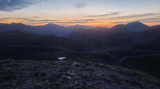
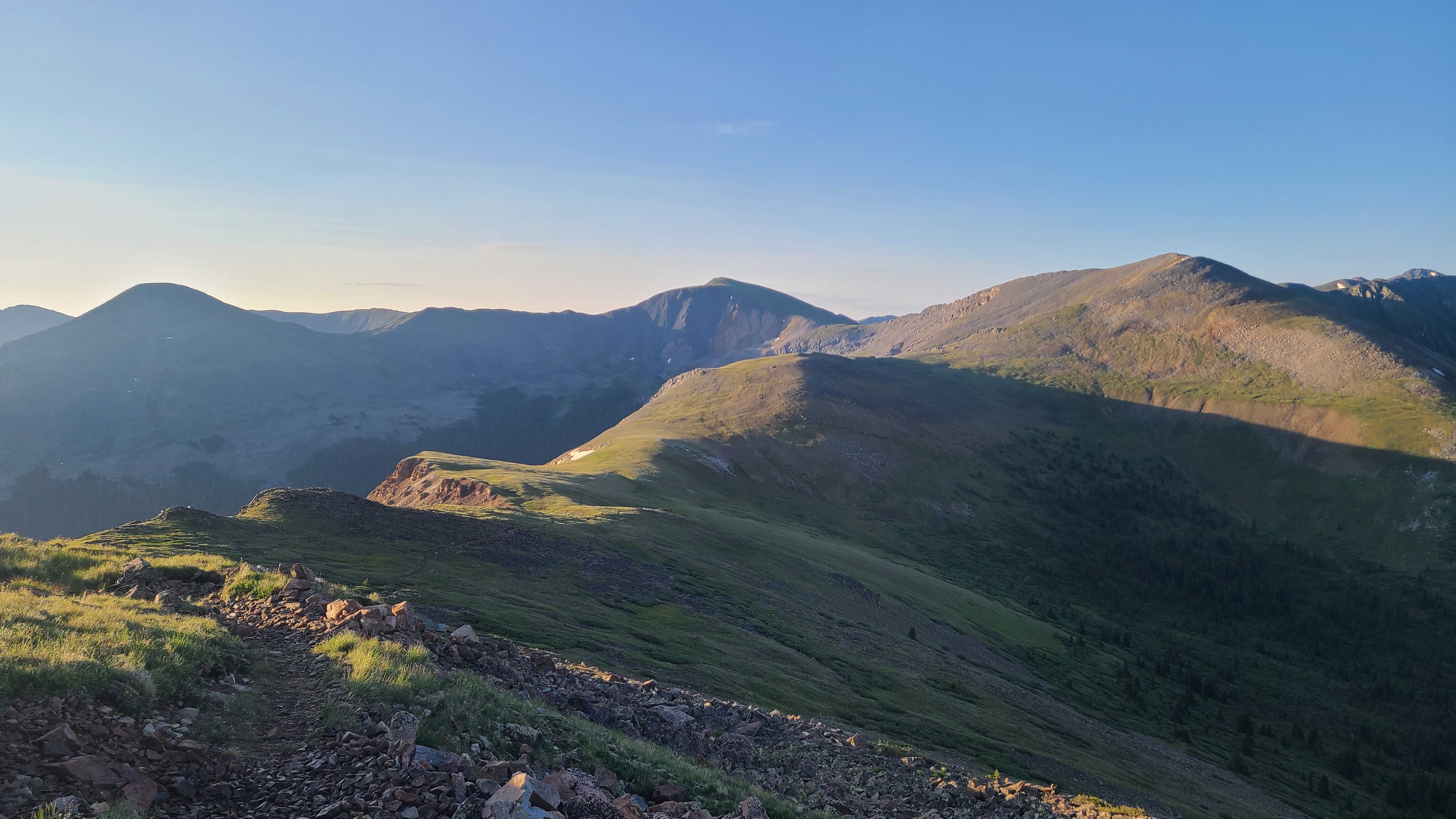
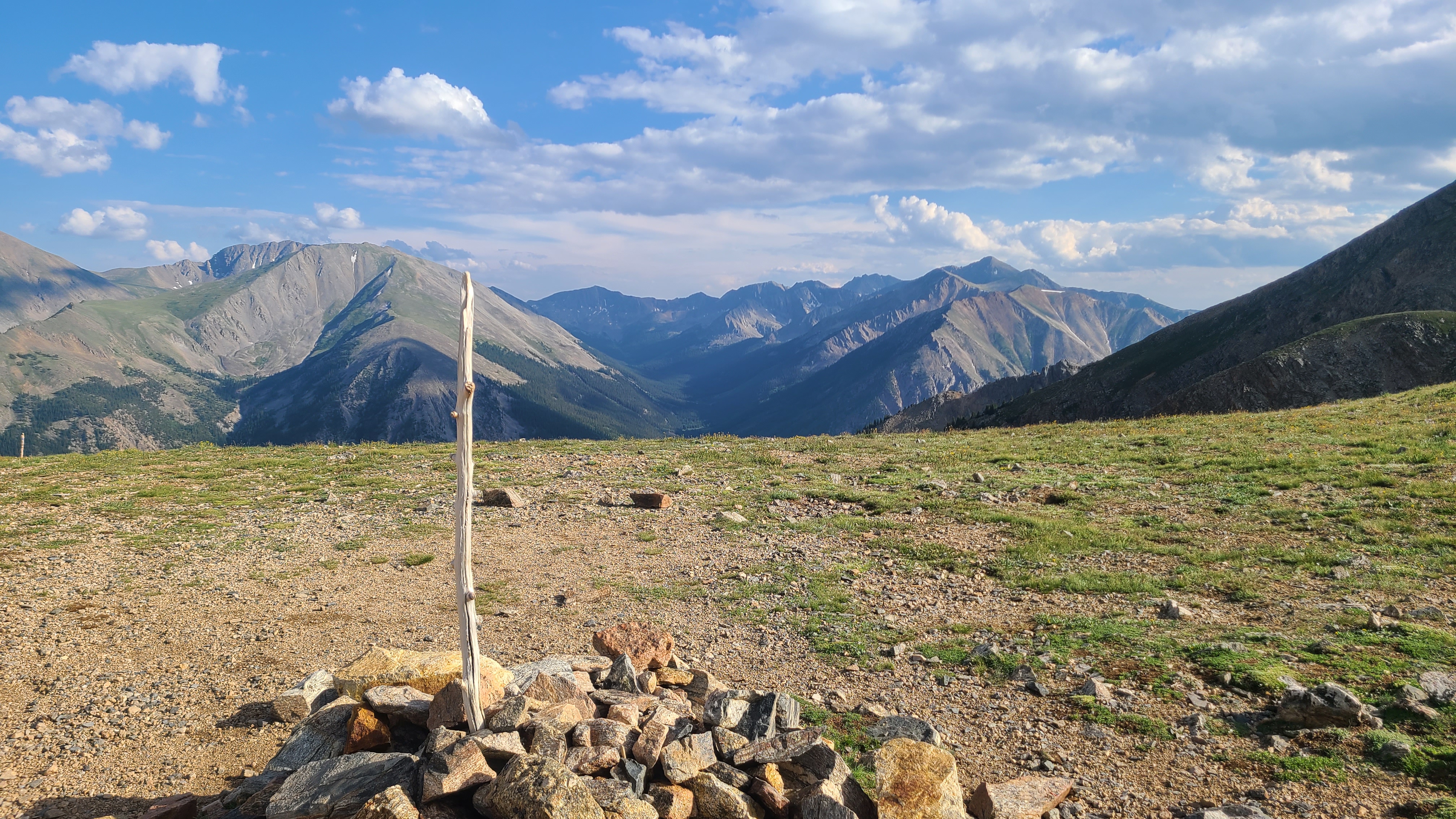
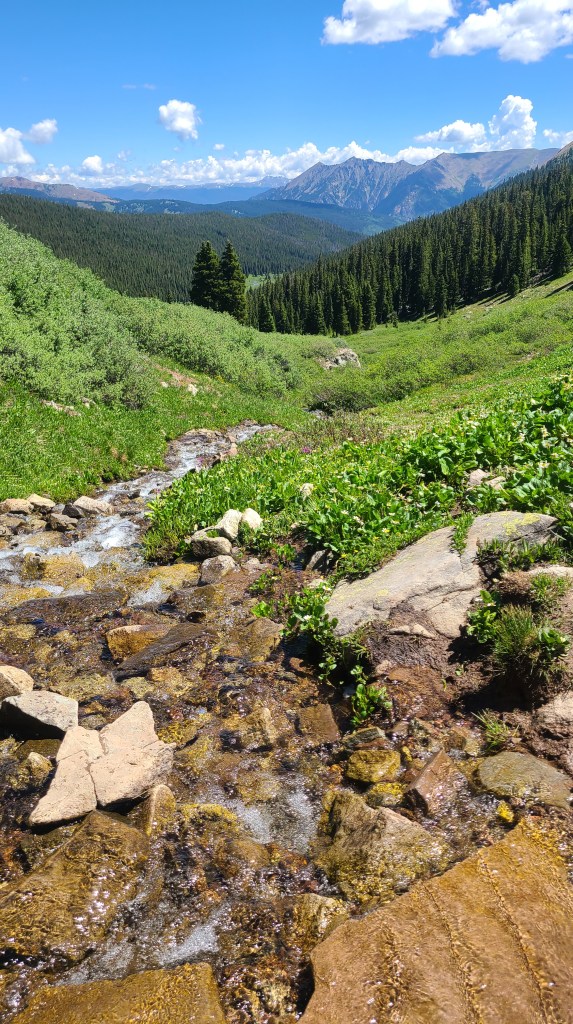
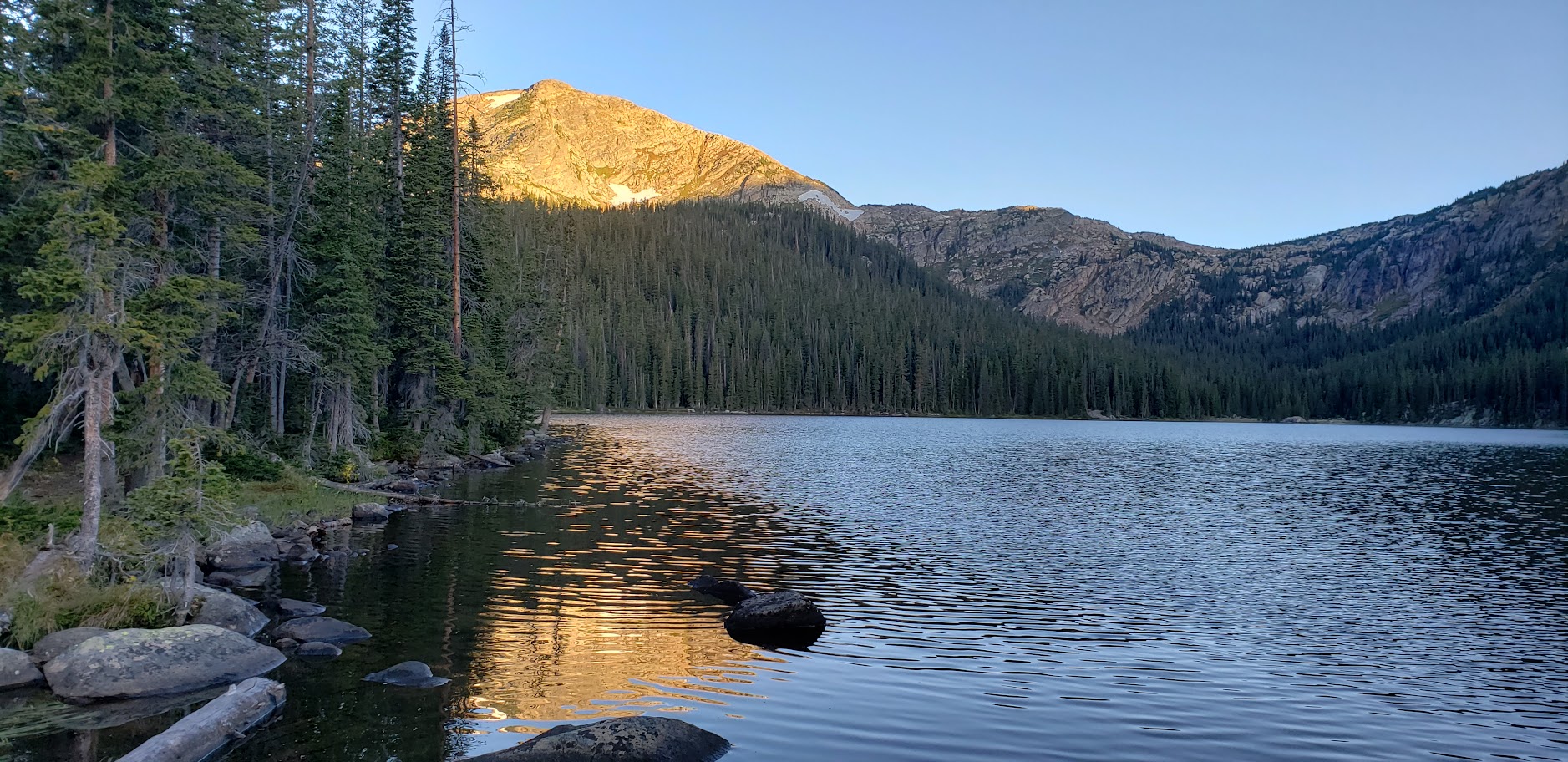
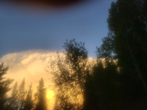
It always seemed to take me longer than expected to get out if camp, and today was no exception. I’d had a close call with lightning on Cottonwood Pass the day before, so I set my alarm for 2:30 this morning to get a jump on today’s climbs. I didn’t get up with my alarm, and eventually took advantage of camping all alone by blasting Guns N Roses on my phone to get me motivated & out of my tent. I still had to I walk up the marshy shore of the small lake below the overlook to fill my CNOC bag , so I started out the day with wet shoes. The wooden fence lining the parking lot was handy to hang the bag and filter water into my bottles. Despite my early start, it was already well after 5:00 am – I could see that I needed to be more disciplined about doing all my camp chores like filtering water at night before going to sleep. It was a pretty steep climb up to the high point but I got there in time to see the dawn skyline over the the mountains behind the lake. It was really windy at the top, but previous hikers had built a little walled fort with the nearby rocks that offered with some protection. I had cell reception here and was able to make a quick check-in call with my wife Maria. I sat down with my pack without thinking about my one liter BeFree in my pack’s side pocket. As soon as I felt I was sitting on wet pants a realized my error – the sharp rocks had poked a hole in my BeFree bottle. Another lesson learned, I thought, as I left the little fort to hike on in the cold, windy morning with the bottom of my pack and seat of my pants soaking wet.
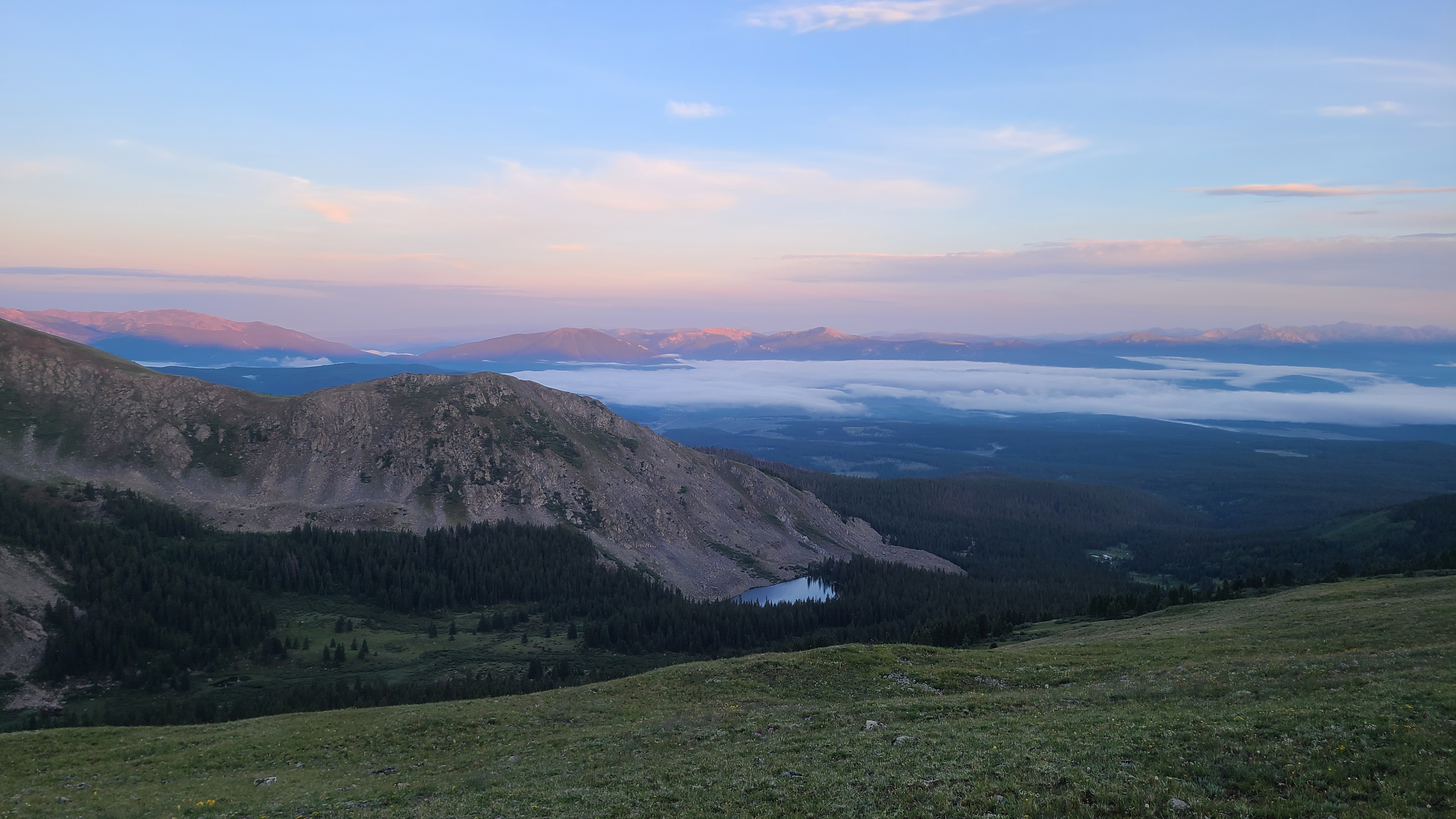
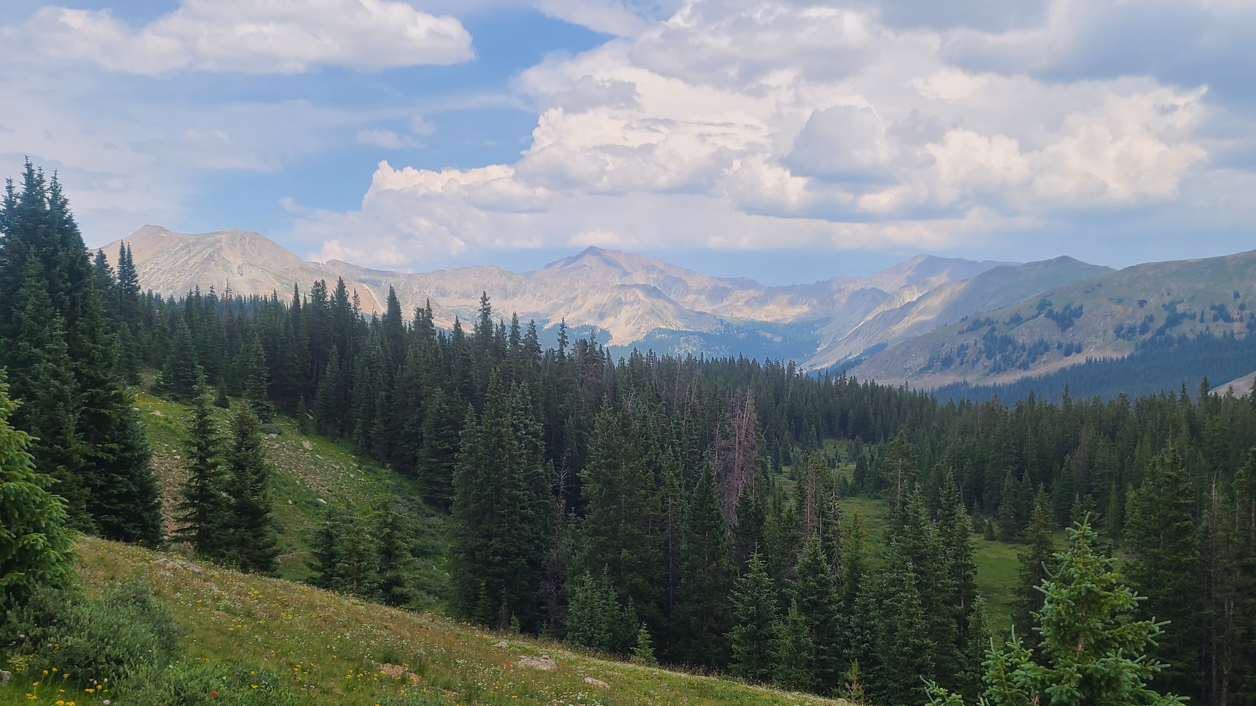
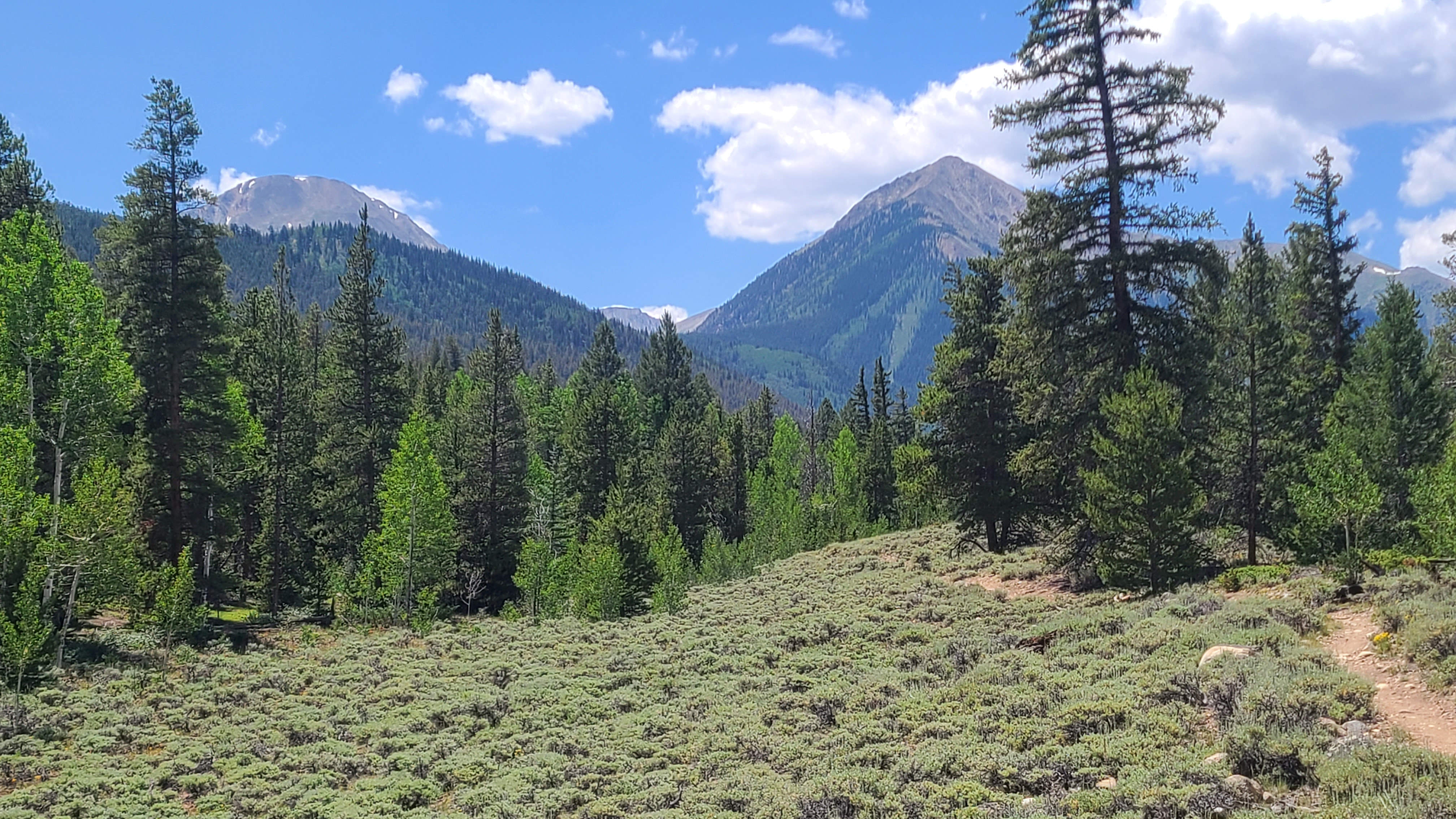
It was Wednesday and I needed to keep up my pace of at least 15 miles a day over today’s four climbs. I had arranged to meet my son Erik on Friday morning at Monarch Pass, and that was still more than 40 miles away. I was all alone for the first couple of miles and I had a pretty amazing view in every direction all to myself. The sun finally rose over a nearby peak overlooking some small lakes. The green terraced mountaintops looked like a fantasy golf course. I thought my childhood friend Kerry, who had made a career in the golf industry, might like to play a round here.
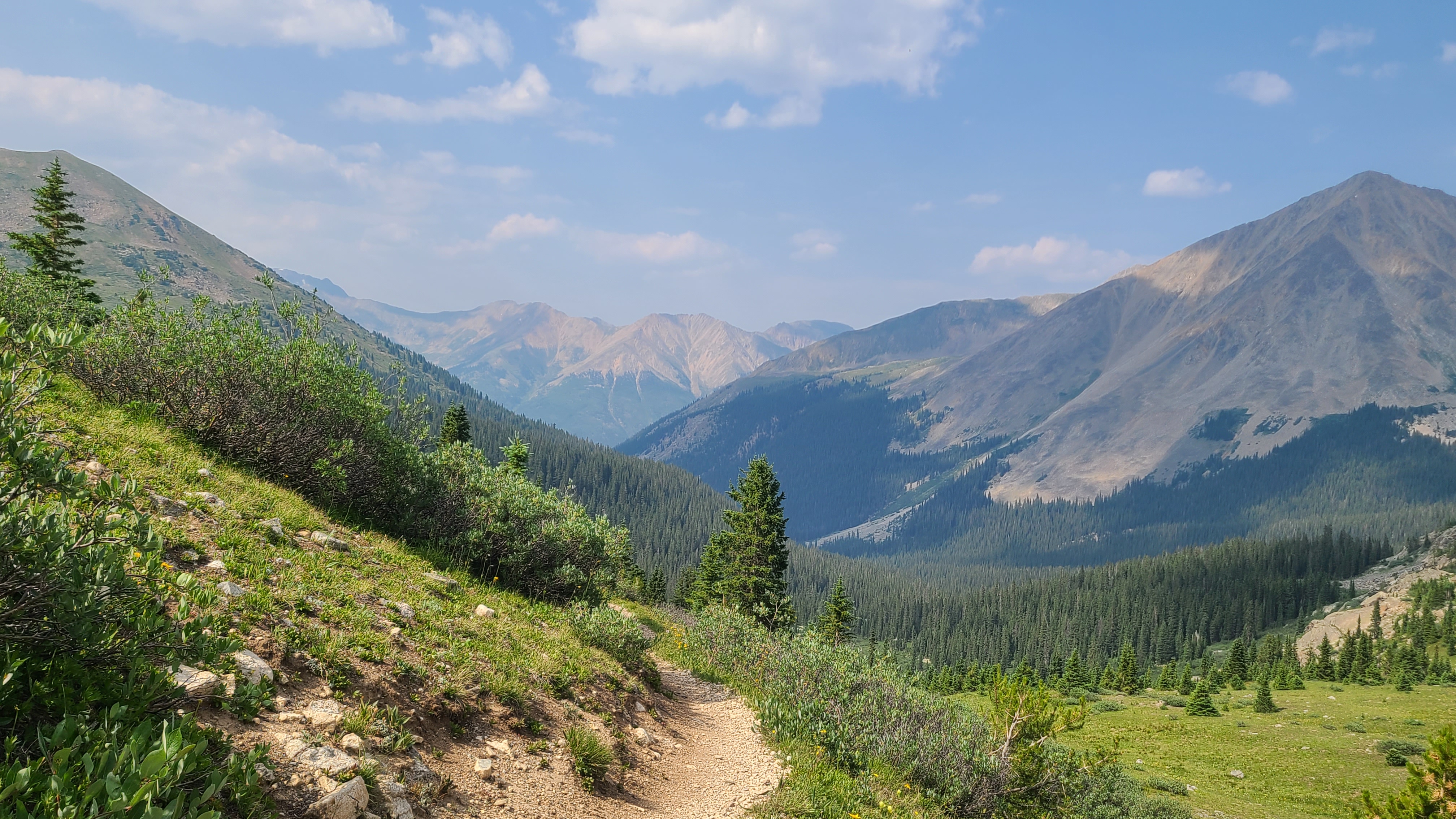
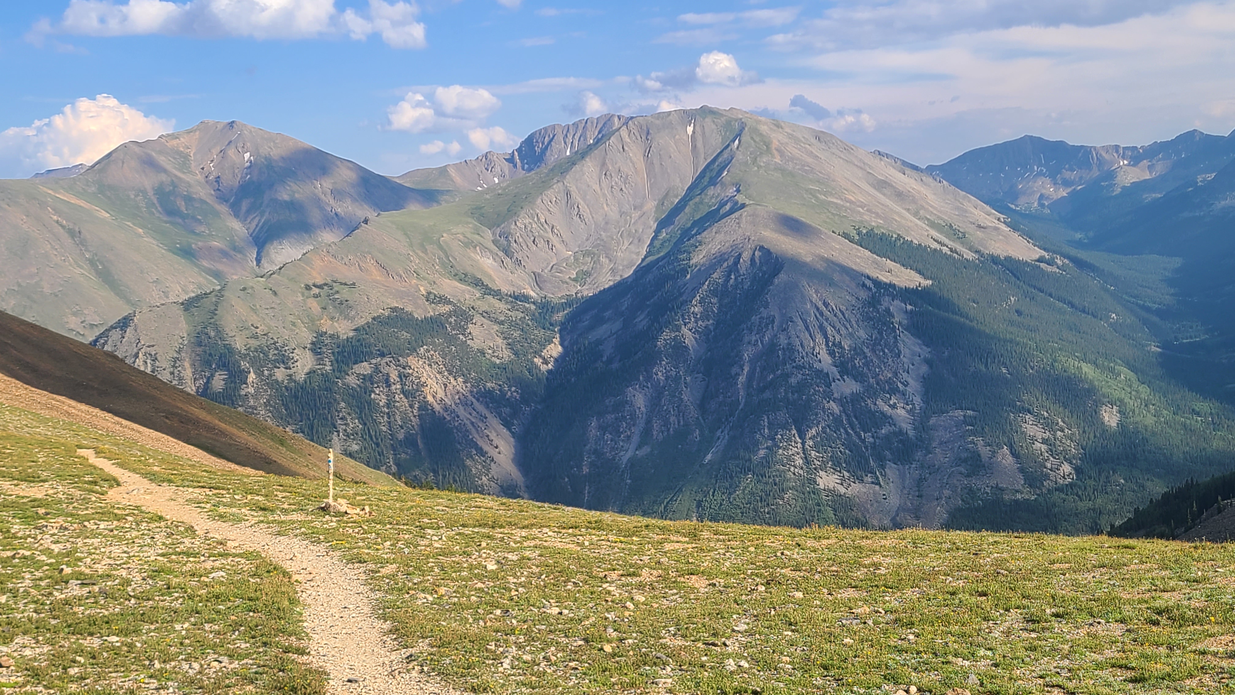
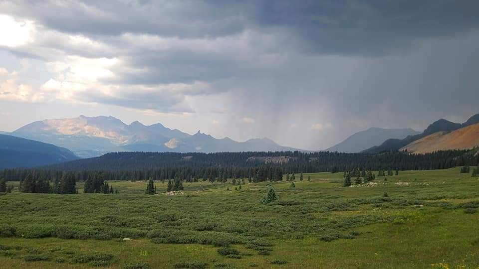
The trail descended a bit, then rose up towards the next pass. A pair of hikers I had leap-frogged with the day before passed me again. We shared our respective war stories about dodging yesterday’s lightning storm on Cottonwood Pass and were happy we all all got through safely. The next two descents and climbs followed impressive trail built across large rockslide areas. One of the drainages bottomed out at some odd looking ponds surrounded by copper-colored rocks. I could see thunderstorms a few ridges away, and I was relieved that to see that I would be over my last pass for the day before they reached me. Towards the top of the last climb I met I met a hiker dressed in blue called Laker. Another fast moving hiker carrying just one pole squeezed past me as a took a break along the rockslide trail. I reminded myself that I needed to stop my bad habit of taking breaks right alongside the narrow trail as I began my final and longest descent of the day. It began to rain as I reached the woods into the Woodchopper Creek drainage, but I passed by a couple nice campsites to get my 15 miles in for the day. There were several established campsites at the bottom alongside the creek and Tincup Pass Road. I was liking this approach of getting up early and starting the day with a climb, then ending at the bottom of the last climb near a water source. The Colorado Trail seemed to be laid out nicely, usually but not always, to support this tactic.
I was out of camp by around 6:00 am this morning, expecting that my luck avoiding the afternoon thunderstorms was bound to run out. A friendly but faster hiker passed me as I kept my slow but steady pace for the first 3 miles or so. Then I somehow irritated a swarm of bees that circled me for at least a mile down the trail. I think I was close to a jog before they finally let me go on what had to be my fastest mile on the whole trail. Thankfully I was spared any bee stings; I was a bit worried as my last bee sting in Mexico had left me with a sports fan foam finger-sized hand for several days.
I hiked up over a small hill then down into the next drainage and found a nice spot for a break. I had been saving one of the those freeze-dried ice cream sandwiches, and this seemed the perfect time for this surprisingly tasty treat. Another hiker who had been doing the Collegiate Loop in the other direction stopped by for a visit, and shared with me the unwelcome news that he had crossed over 5 passes since the day before. My first two days in the Collegiates had just one big, hard climb each which was already about all I thought I could handle.
The trail eventually bottomed out around 10,000 feet I as reached small meadow then began hiking alongside the meadow into the woods. I wasn’t sure if it was the climbs from the past two days or my apprehension about all the passes ahead, but the relatively easy first 7-8 miles were a struggle today, and I found myself stopping for a break about anytime I could find a decent log to sit on. I had a little trouble finding the crossing across Texas Creek, and I felt bad as 3 friendly hikers had too squeeze by me as I sat on a log right alongside the trail. I finally got myself moving again and soon saw the same hikers stopped near a swifter crossing of the creek, rinsing out their clothes and taking a creek bath. They were 2 younger females and a male; I was a bit embarrassed and tried not to look at their near-nakedness as I stopped to fill some water. Thankfully they were all still friendly.
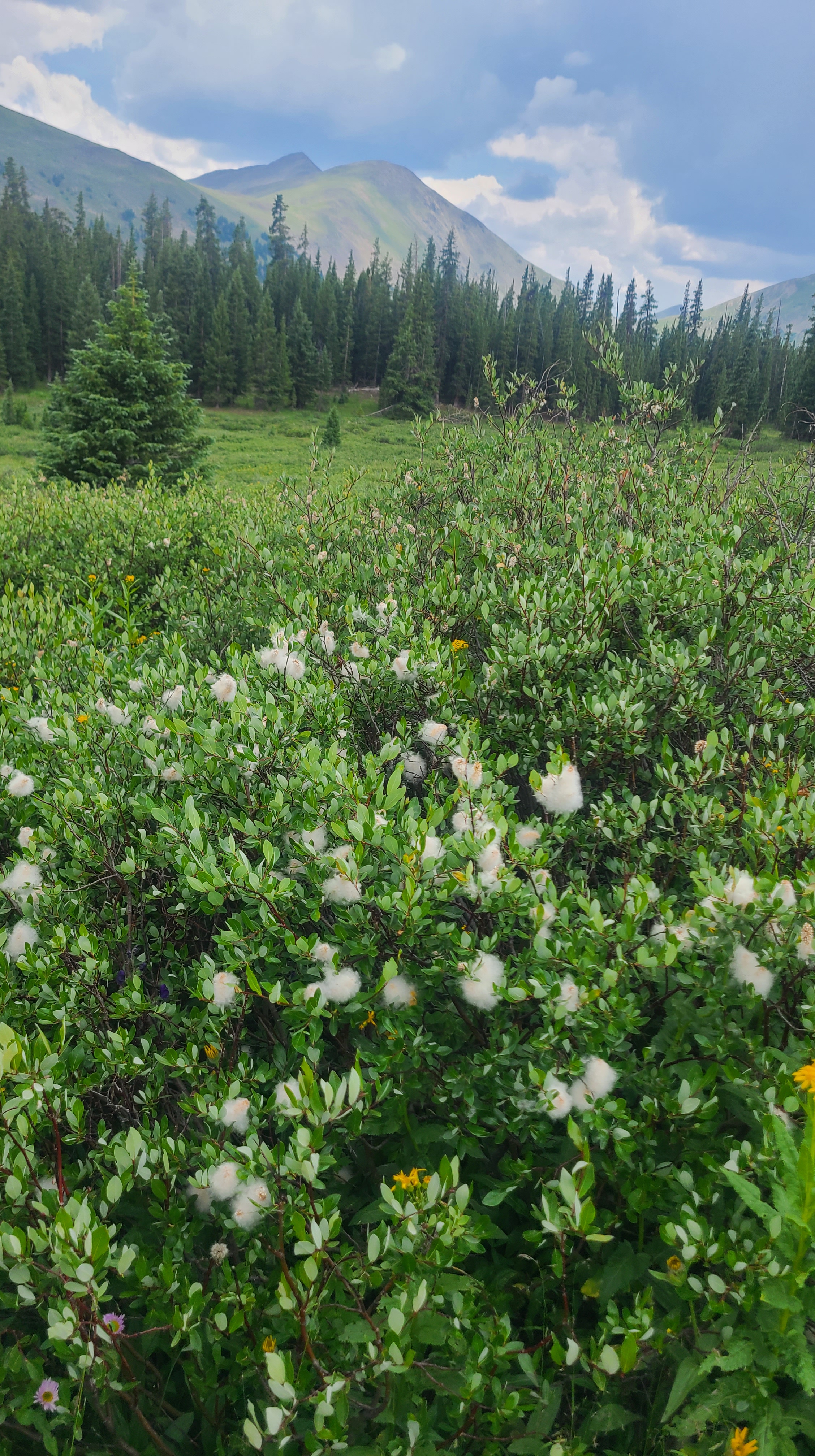
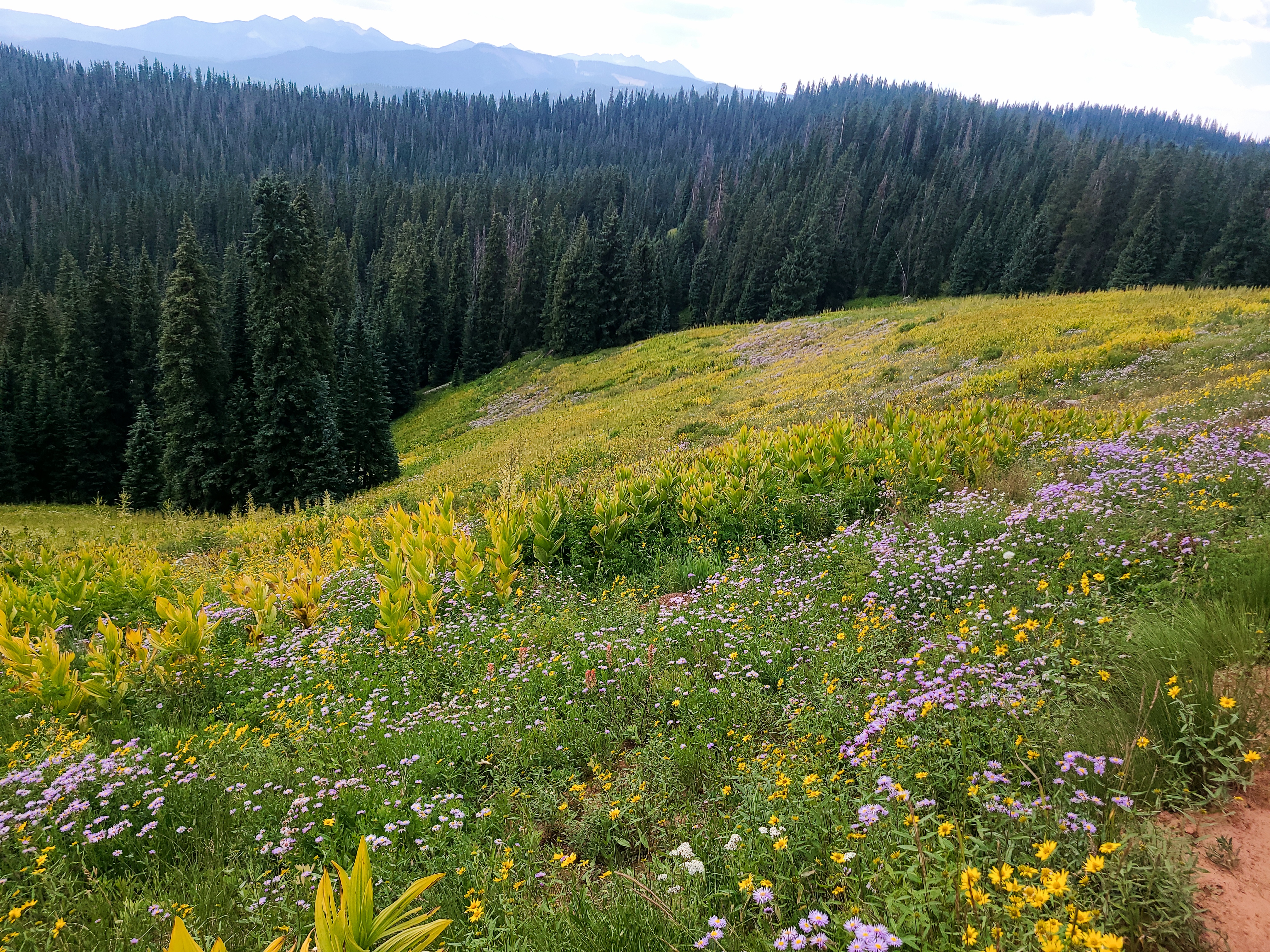
I started up the trail ahead of them and began another relentless climb up through the woods. Surprisingly I stayed ahead of the trio of hikers until we reached treeline. This clearing was filled with all colors of wildflowers and I thought of my friend Sally back in Steamboat who loved hiking through the wildflowers. The others finally caught up and passed me one-by-one, as they had spread out during the climb. I noticed the lead hiker was hiking on the balls of his feet as he seemed to spring up the climb, as he said, “up and up”.
It was early afternoon at this point, and the skies were turning grey. I could see the steeper climb up the saddle and began to hurry my pace. The rain was not yet heavy, but I could hear thunder and lightning was flashing on the horizon. The meadow towards the saddle was pretty much unprotected and I watched the 3 other hikers moving fast and further ahead of me. I was surprised to see 2 of them leave the ridge and dash back down into the meadow as one continued up. I was worried that maybe they knew something I didn’t, but I kept climbing up then onto the ridge as I could see the lightning getting closer and closer. I also noticed that my tired legs were not so tired anymore as my adrenaline kicked in. Once on the ridge I could see the cars and parking area on Cottonwood Pass below as the trail continued further along the windy ridgeline than I had hoped.
I made it down to the parking area, and was relieved that the rain never did get very heavy. There was a small lake and an established campsite below just below the parking area. I was a bit self conscious about setting up camp there with all the tourists looking over me from the viewing area above, so I ending up camping over the next small ridge and out of site. I was surprised to see no other hikers here; I thought they must have caught a hiker shuttle down to Buena Vista from the parking area. I vowed to be up super early the next morning to get over tomorrow’s 4 passes ahead of the next storm. I set my alarm for 2:30 am.
It was Monday morning and I needed to cover the next 70 miles of the Collegiates West up to Monarch by Friday morning, where I had arranged to meet my son with a resupply. That meant averaging at least 15 miles a day for the next four days to have a reasonably short hike Friday morning. I overslept this morning – working my overnight shift job in Steamboat Saturday night then hiking over Hope Pass Sunday had left me exhausted. I was lucky with weather Sunday but knew to expect thunderstorms about every afternoon during monsoon season in the Collegiates. I hurried out of camp feeling way behind on the day already.
I adjusted my pack a few times as I hiked down the trail, and within just a few minutes I broke my hip belt buckle. It took me too long to dig out my spare buckle and get it attached, but despite the lost time I was grateful that I had packed an extra. I was finally on my way again, and as I patted myself on the back for being prepared with that spare buckle, I saw a chubby cinnamon-colored bear dance across the trail not far ahead. In my laziness the night before I had skipped hanging my food, telling myself that bears probably didn’t come up to 11,500 feet looking for food. This bear seemed to want to let me know otherwise. A few days later I talked to another hiker who had seen a similar, or maybe the same, bear in this area. I think I learned something new from the trail about every day.
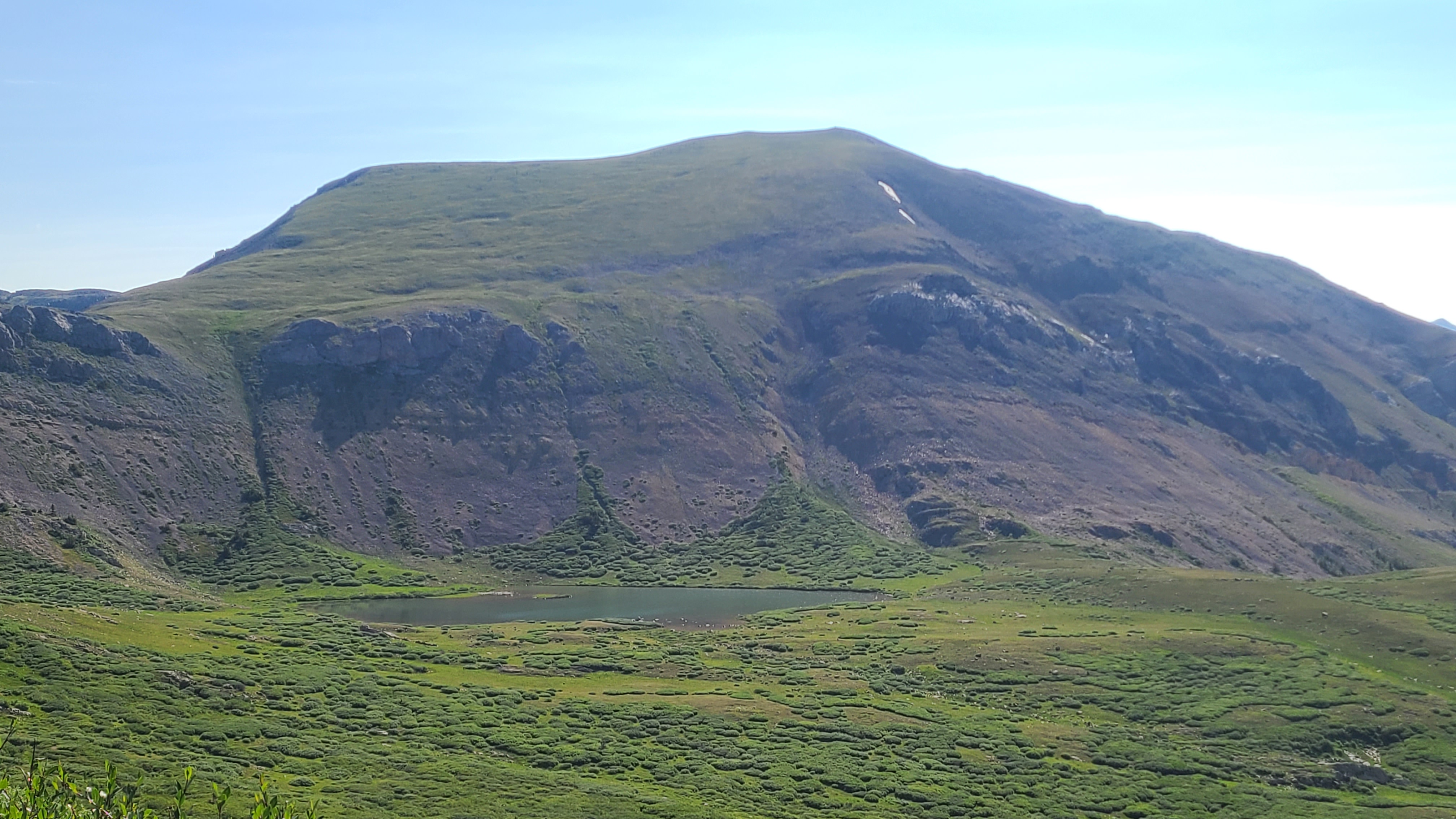
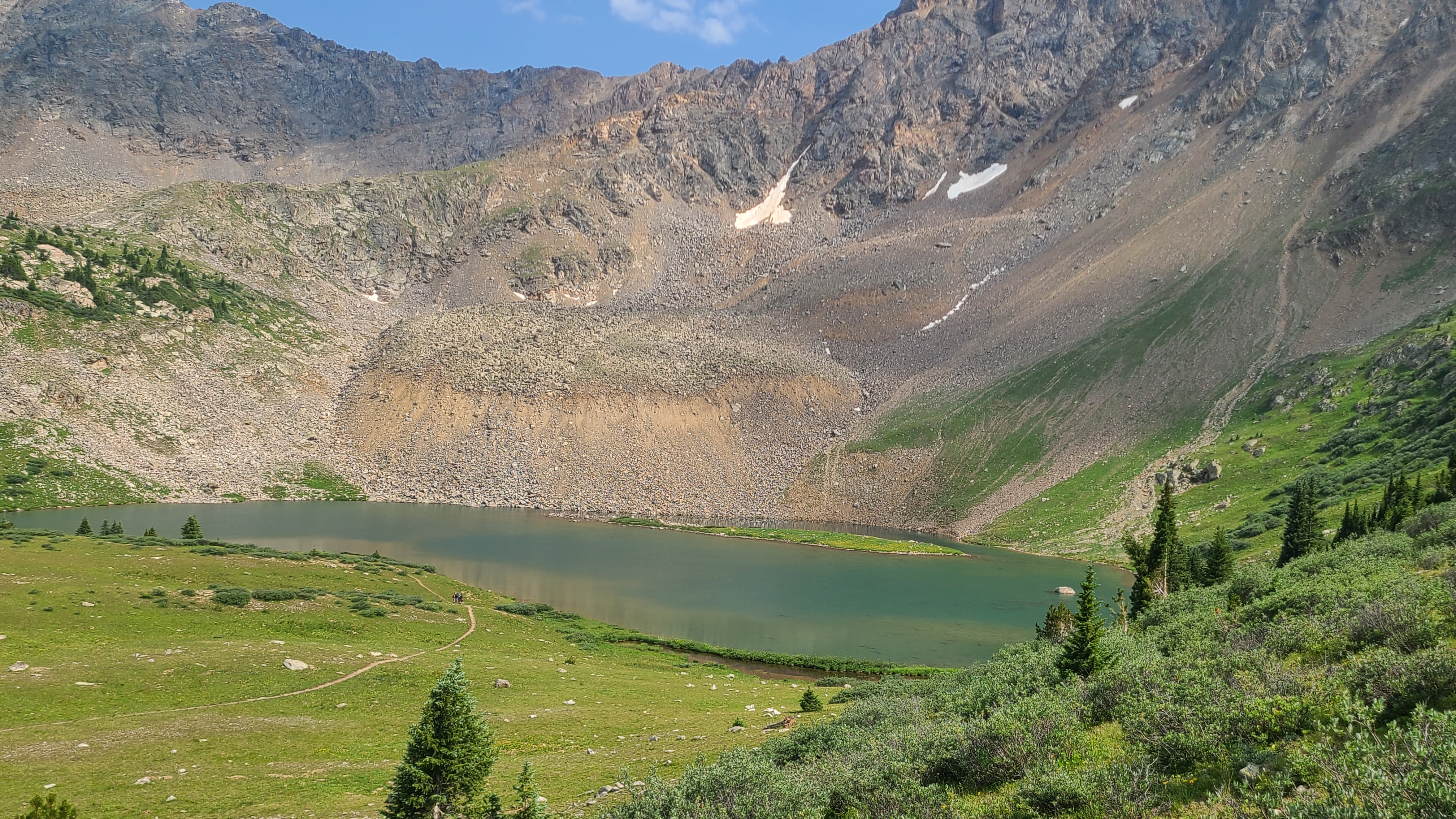
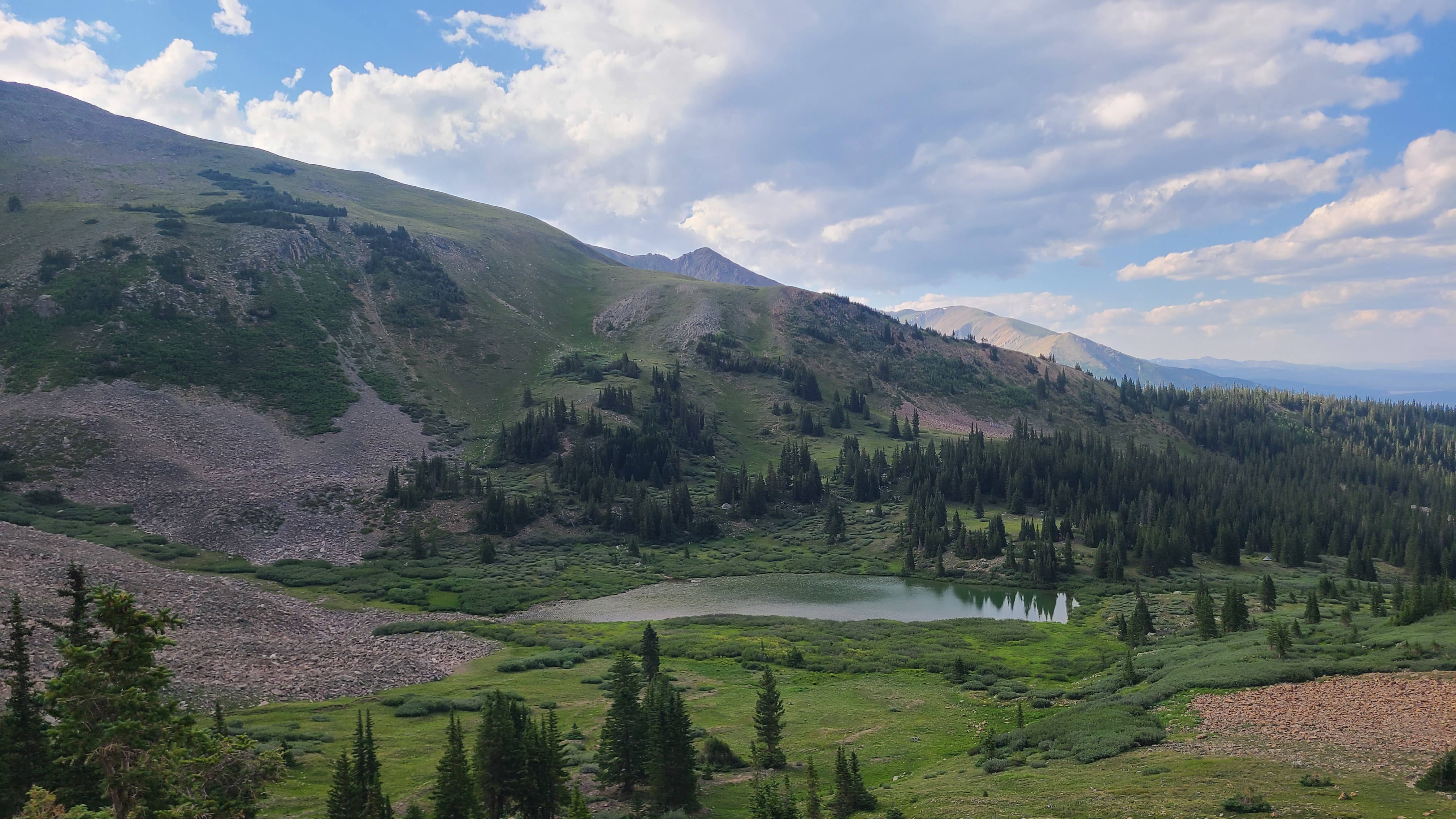
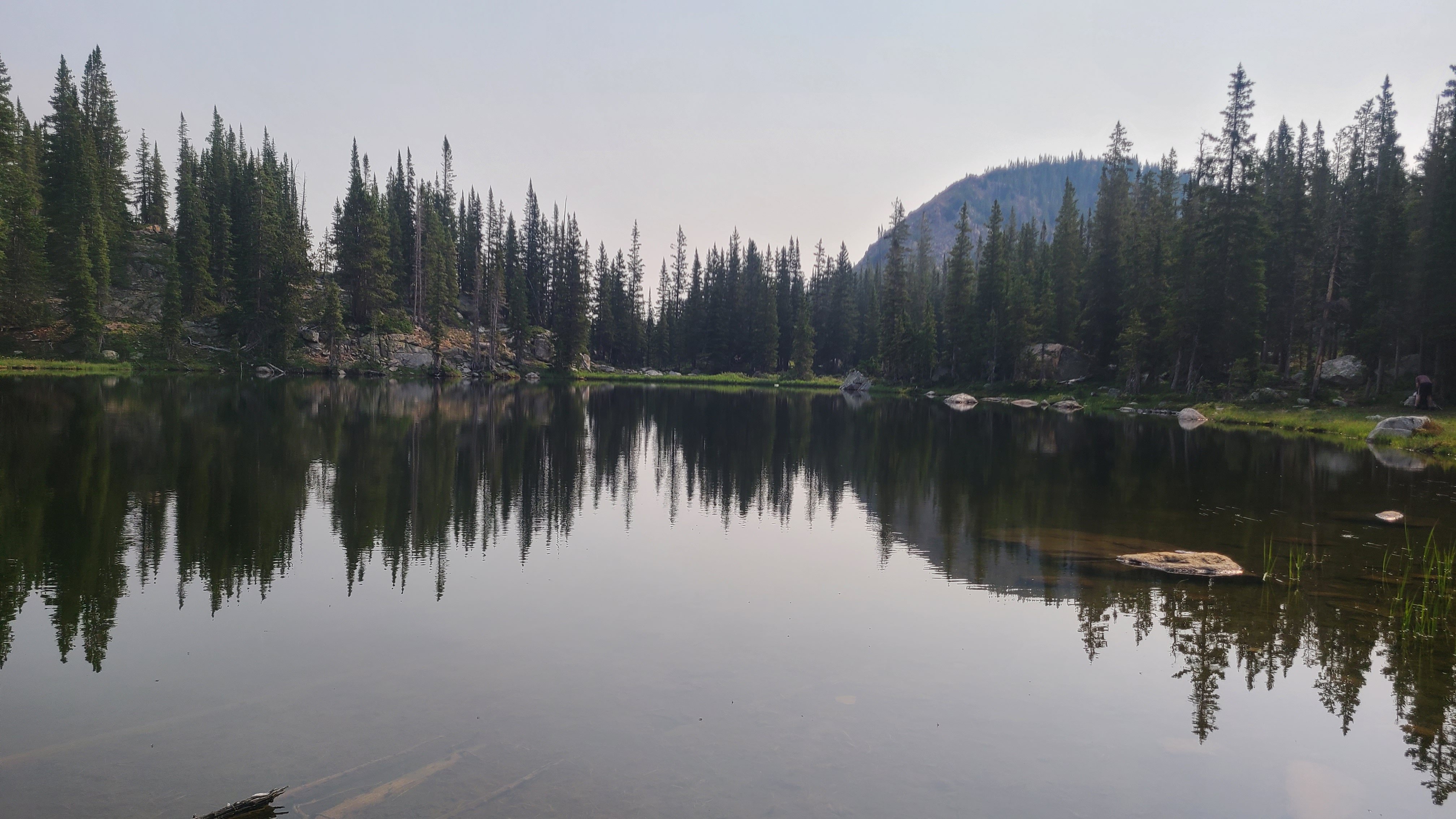
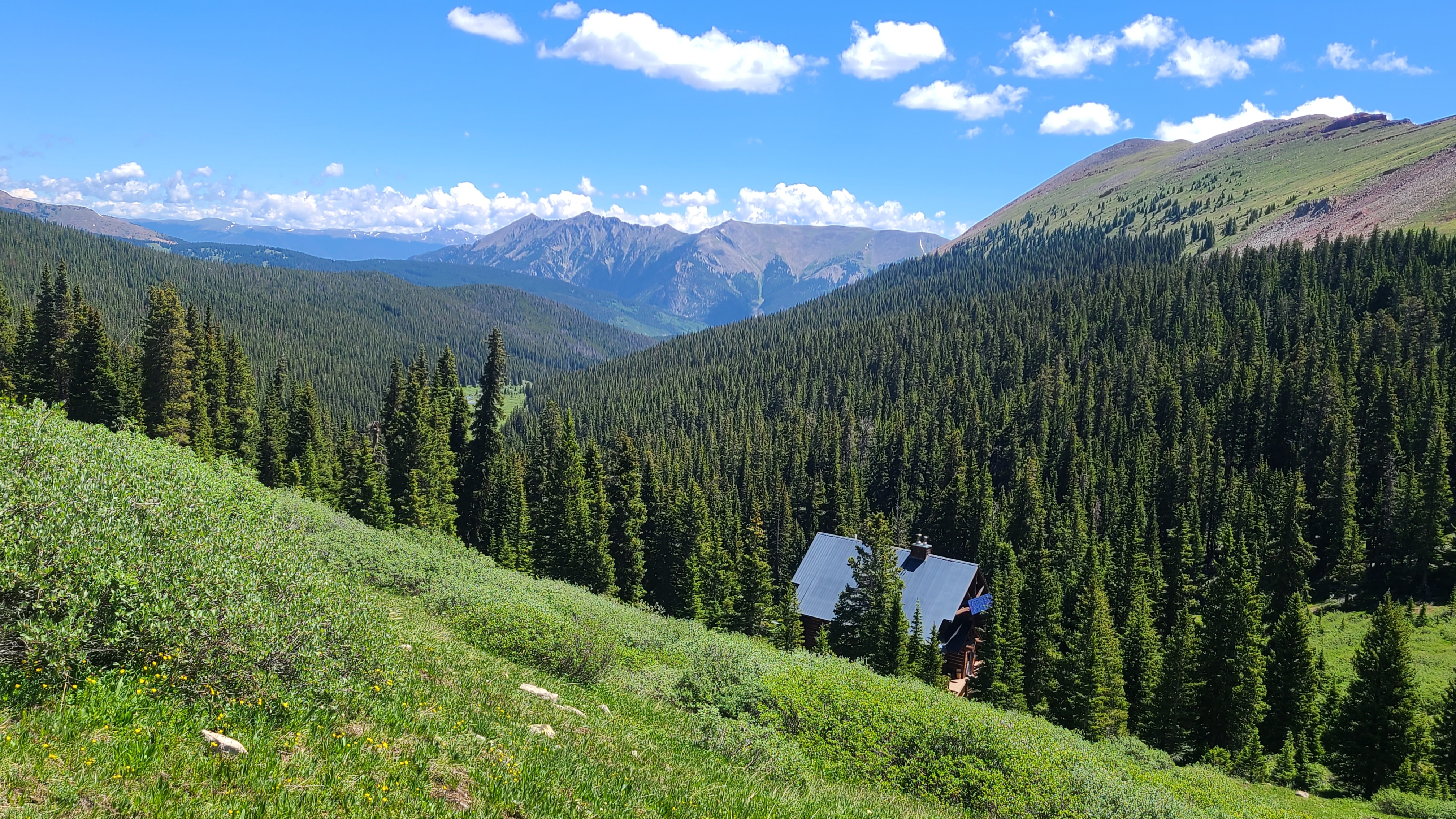
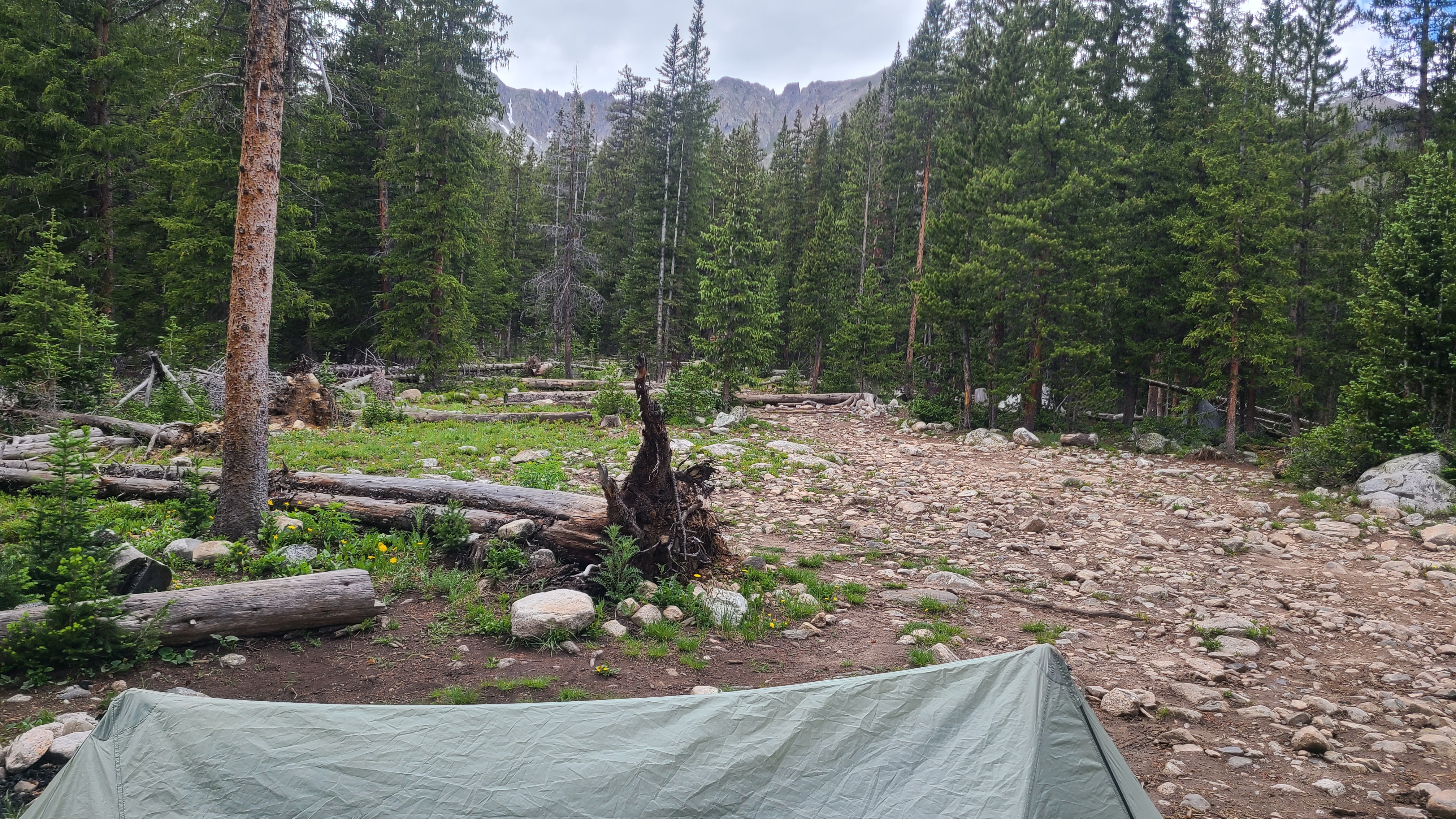
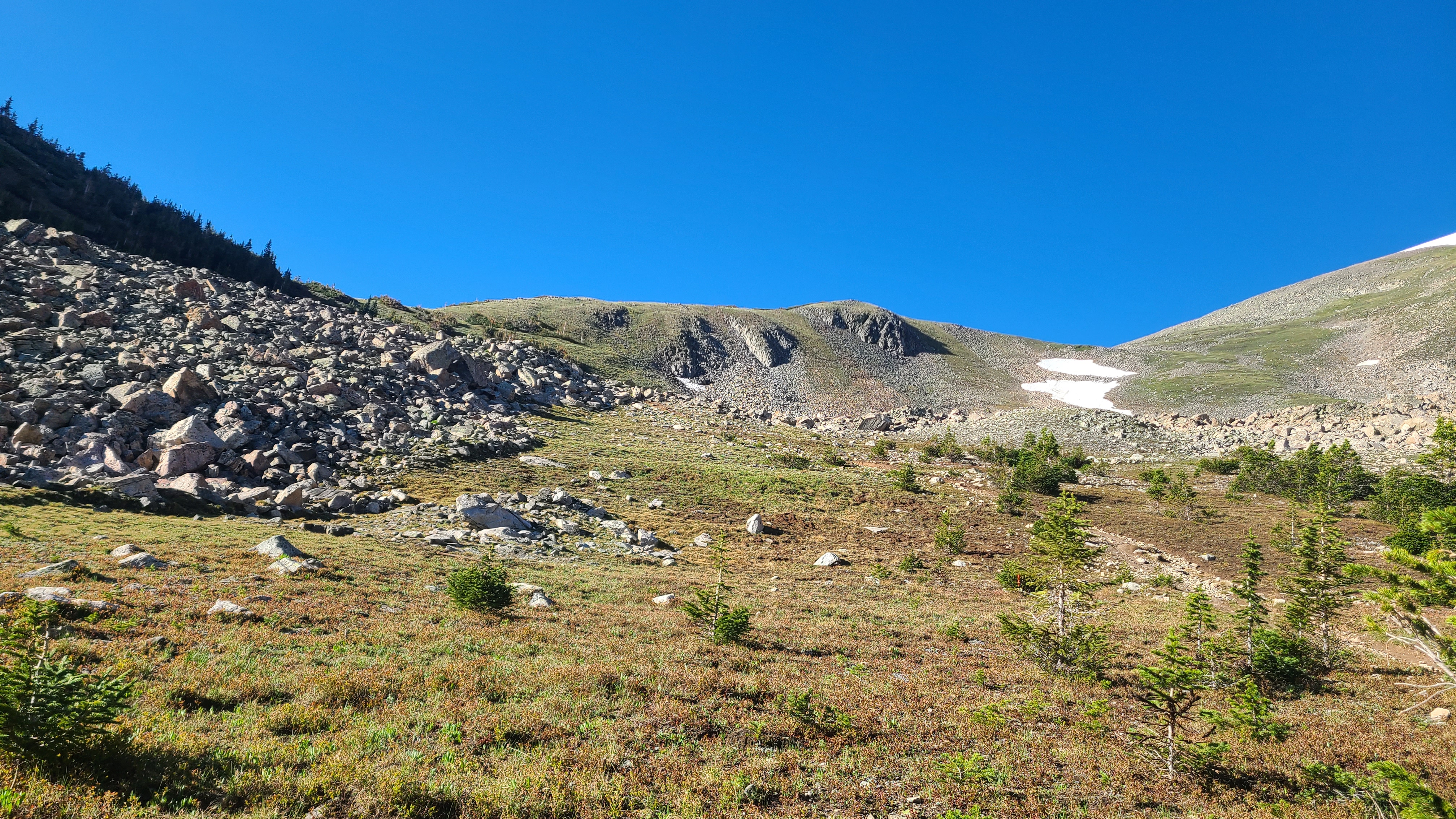
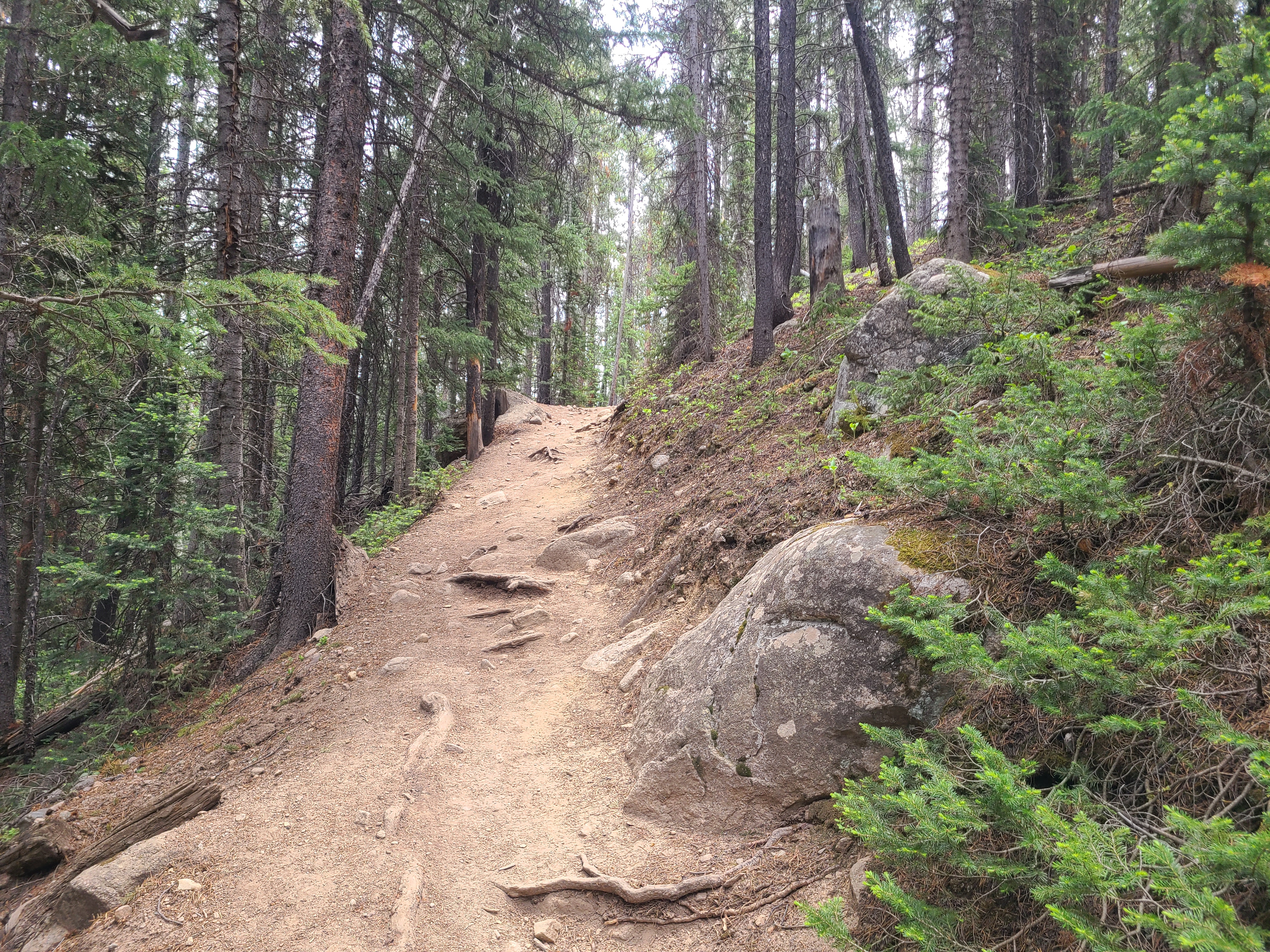
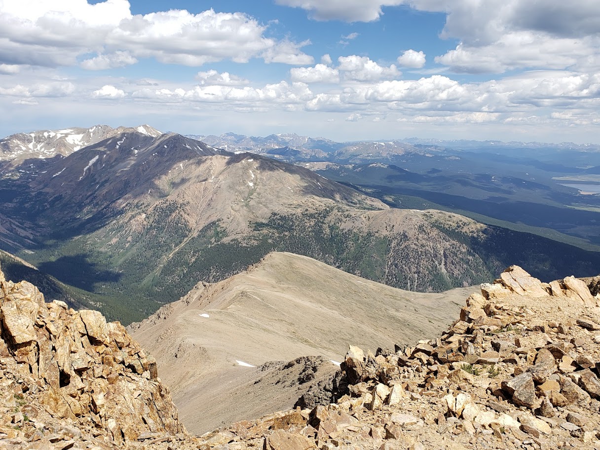
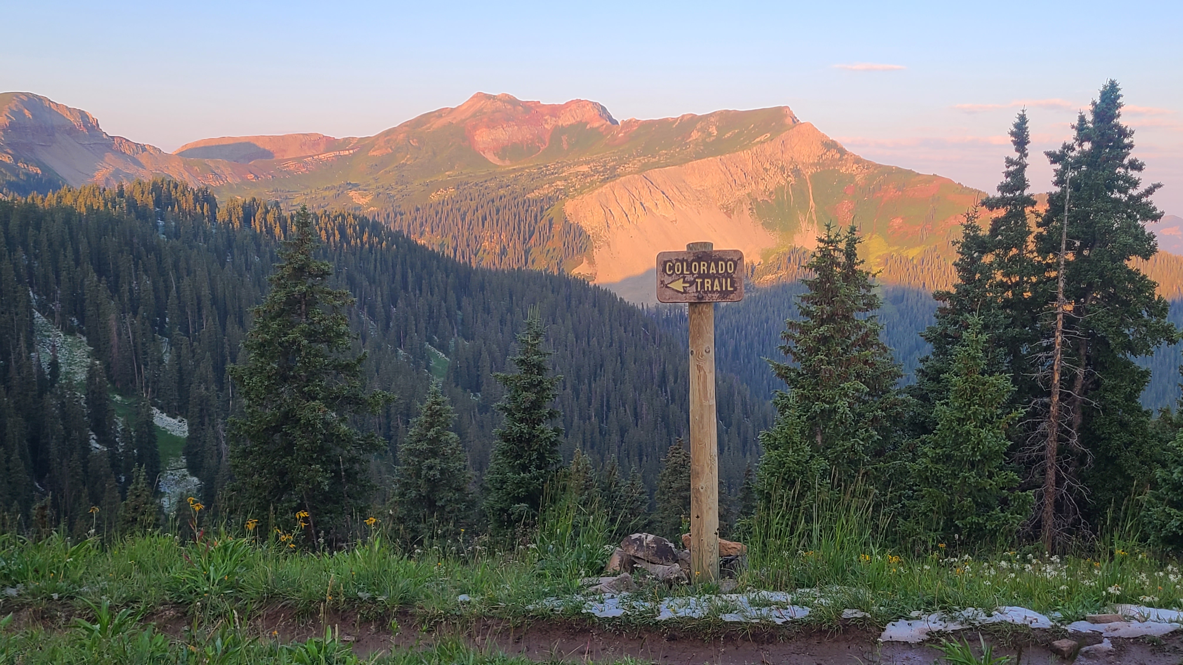
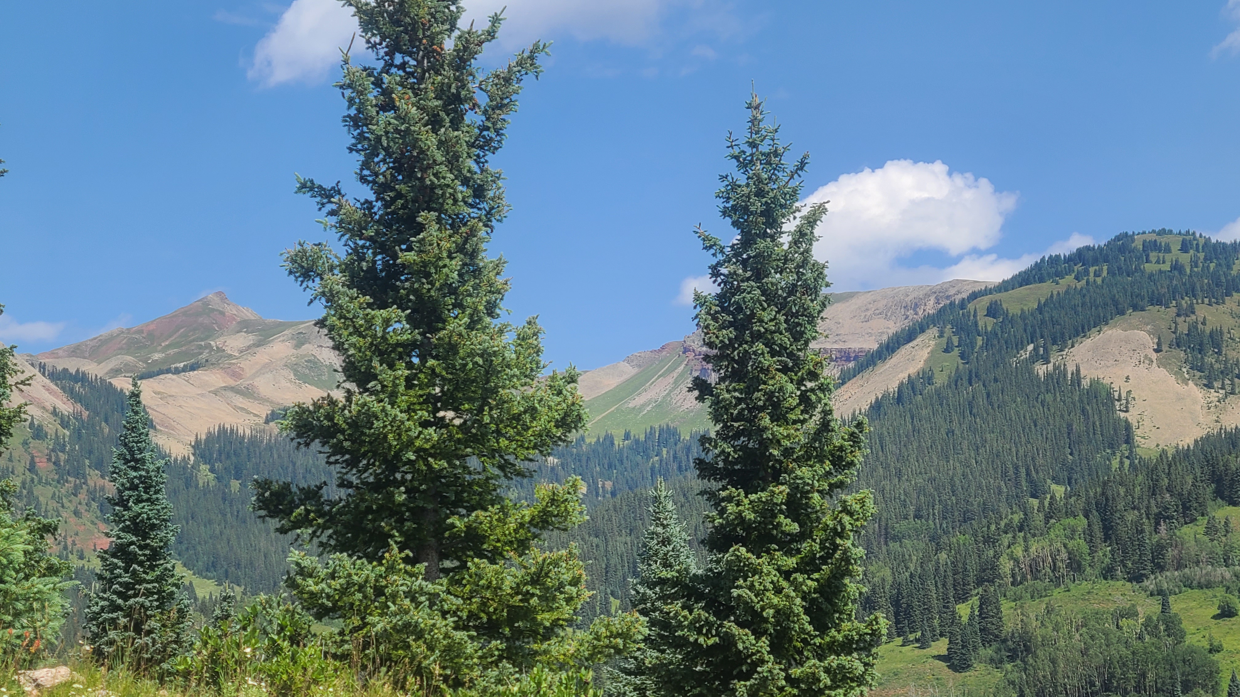
I descended to the the Sheep Gulch trailhead then started the climb back up through the woods. This was another long climb, and as I reached treeline the trail over Lake Ann Pass revealed itself just a little bit at a time. I could see the lake across a tundra meadow with few campers nearby. It just seemed to pristine to camp at, I thought, as I stayed on the trail an continued towards towards the saddle. I still couldn’t make out how I could get over that steep ridge but could eventually see a faint trail along the rim. It didn’t seem quite as exposed or steep as it looked from below, until the trail turned to talus. This was my first hike up a talus slope; the trail was established but it wasn’t easy going or easy to follow. I made a couple wrong turns going up the wrong boulders, and it was usually harder going back down than it had been going up. The last of the ascent was back on a dirt trail, then I could take a minute look back at Lake Ann and the vast mountains behind it. I crossed paths with another hiker who responded with an odd grin when I warned him of the sketchy trail. As it turned out this had been a much smaller version of many, many sections of the Colorado Trail built through the talus in the Collegiates and later in the San Juans.
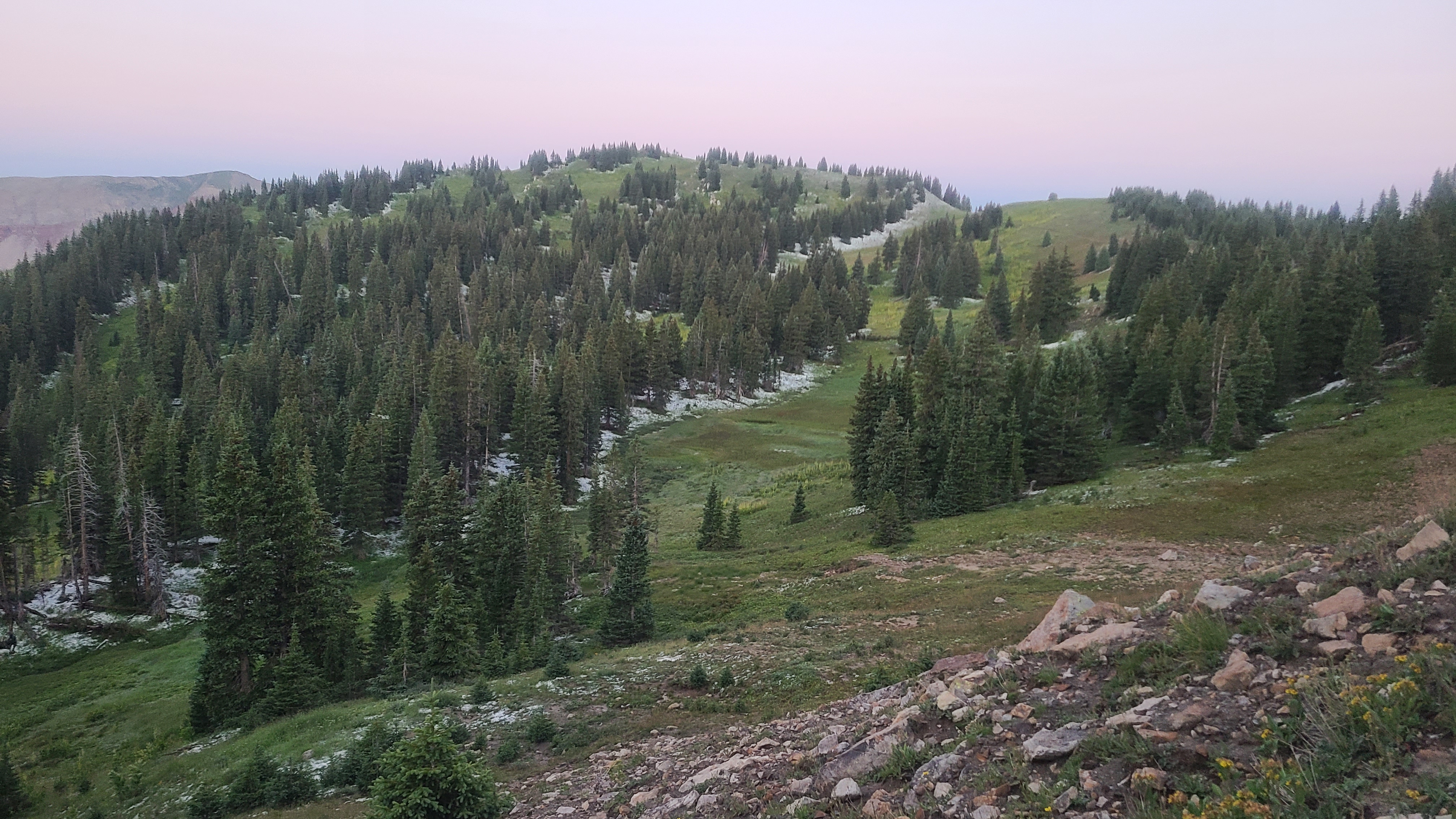
The hillsides along the trail were green and really pretty as I descended into the next drainage. I could see rain coming down in the valley below but thankfully saw no sign of lightening today. There was a final set of switchbacks on the way down, and I saw an established campsite alongside the creek below. The campsite was on the less traveled Gunnison Spur trail, right off the main trail. I thought I was all alone as I walked back to the creek crossing to get water for the night, until I was startled by the biggest white furry animal I had ever seen trotting down the trail. I was relieved to see the dog’s friendly owner emerge through the brush. I laughed at myself, wondering what other animal I thought this massive bright white dog could be. That was a fun ending to a 15-mile day with my second big climb through the Collegiates.
July 18 had been locked into my calendar for months. I had somehow managed to section hike the first 185 miles of the Colorado Trail over most of my weekends since early May, and starting today I had 3 weeks to hike the last 300 miles of the trail to Durango. All those section hikes and vehicle shuttles had turned out to be an oddly fun logistical challenge and I hoped had left me in good enough hiking shape for the first big climb up Hope Pass as I started into the Collegiates West.
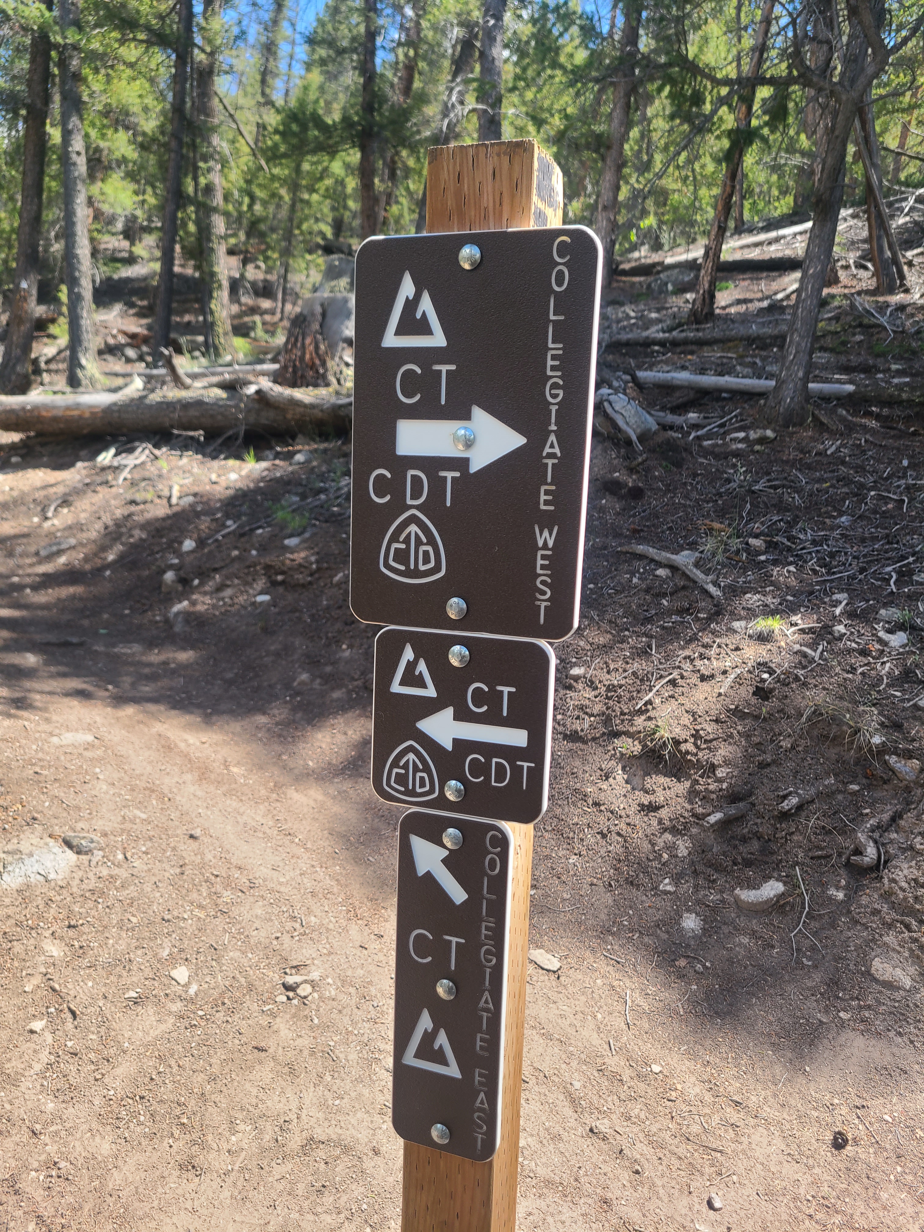
I worked my graveyard job as usual on Saturday night, then on Sunday morning I drove straight from work to my son’s house in Leadville. Erik drove me to Twin Lakes, and I think he read a bit of doubt behind my excitement. He confidently let me know, “you got this dad” as I unloaded my backpack, then I was on my way. A few weeks earlier I had hiked to the junction of the the Collegiates West & East routes on the scenic side of Twin Lakes, so at least the first 1.5 miles was familiar. I had decided to take the Collegiates West alternate that follows the CDT, with its reputation for sweeping views. It also gains about 2000 feet more in elevation than its East counterpart that features more hiking through the woods.
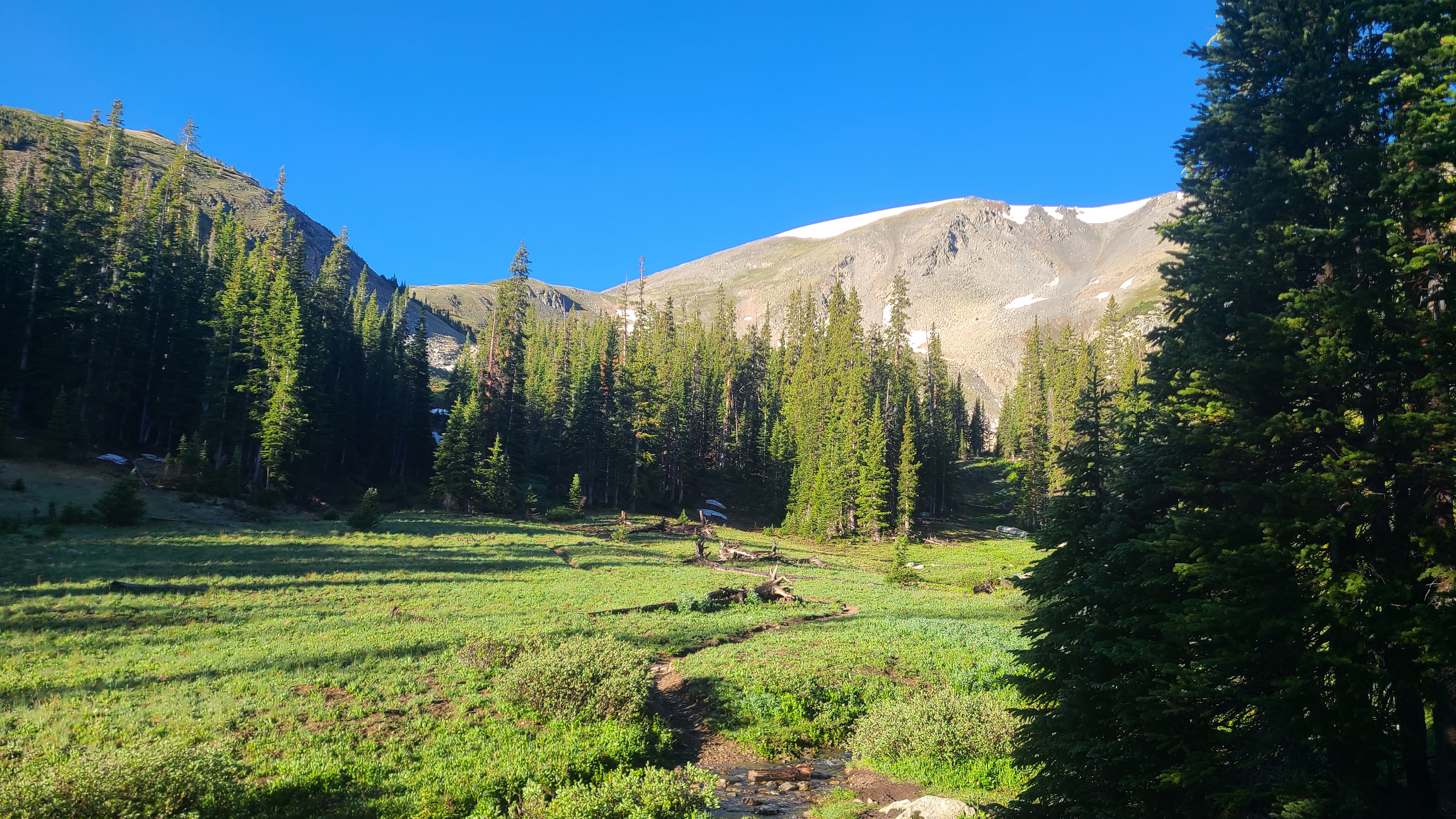
Collegiates West Segment 1 (CW1) starts out meandering though the woods past Twin Lakes reservoir for the first 3-4 miles. Then comes Hope Pass which gains 3600 feet over 4 miles and peaks out above 12,500 feet. I had read and watched lots of hikers’ commentary that Hope Pass is a beast of a climb, and it seemed a bit daunting leading up to today. Earlier in the trail I had done a pretty steep climb up the Tenmile Range from Miners Creek and a long climb up Searle Pass, but this would be both steep and long. I had also been worried about thunderstorms with my late Sunday morning start but thankfully today I got a break in the weather.
The climb was not easy and I only saw a handful of other hikers. I passed a family of fit-looking day hikers, and it was big boost for my confidence when I charged past them carrying my backpack loaded with 5 days’ provisions. When I approached treeline I could finally see the ridge of the pass. I still had some climbing ahead, but the CT Databook had let me know there was camping and water just a mile beyond the high point. I could hear some campers enjoying the scenic lake on the way up. A pair of hikers doing the Collegiate Loop passed as I approached the ridgeline. I wondered why they had slowed down, then I saw marmot along the trail that didn’t seem to be bothered by hikers. I noticed I had cell service so I made a quick video call with my wife Maria to share the scene and the nearby marmot with her.
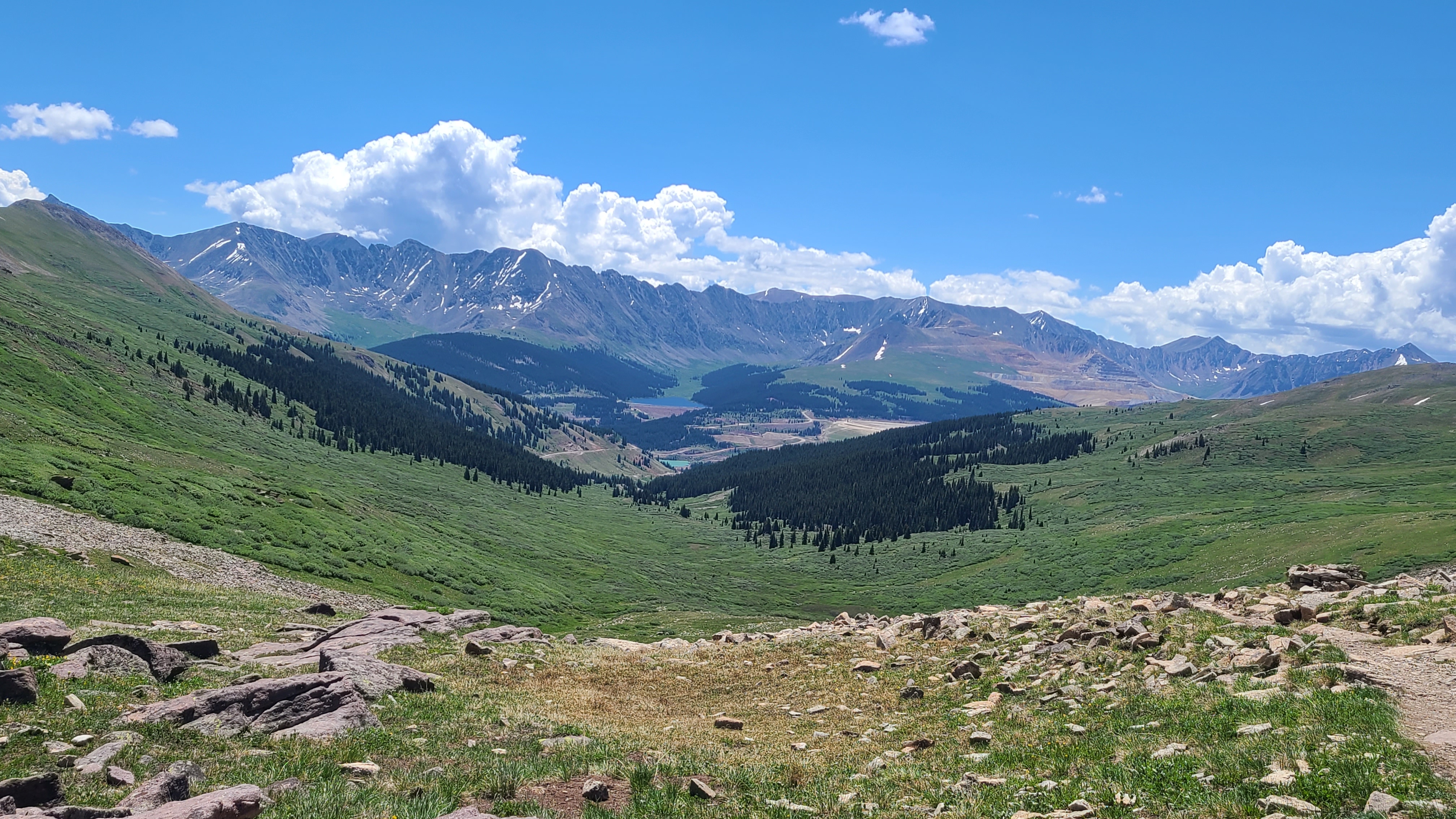
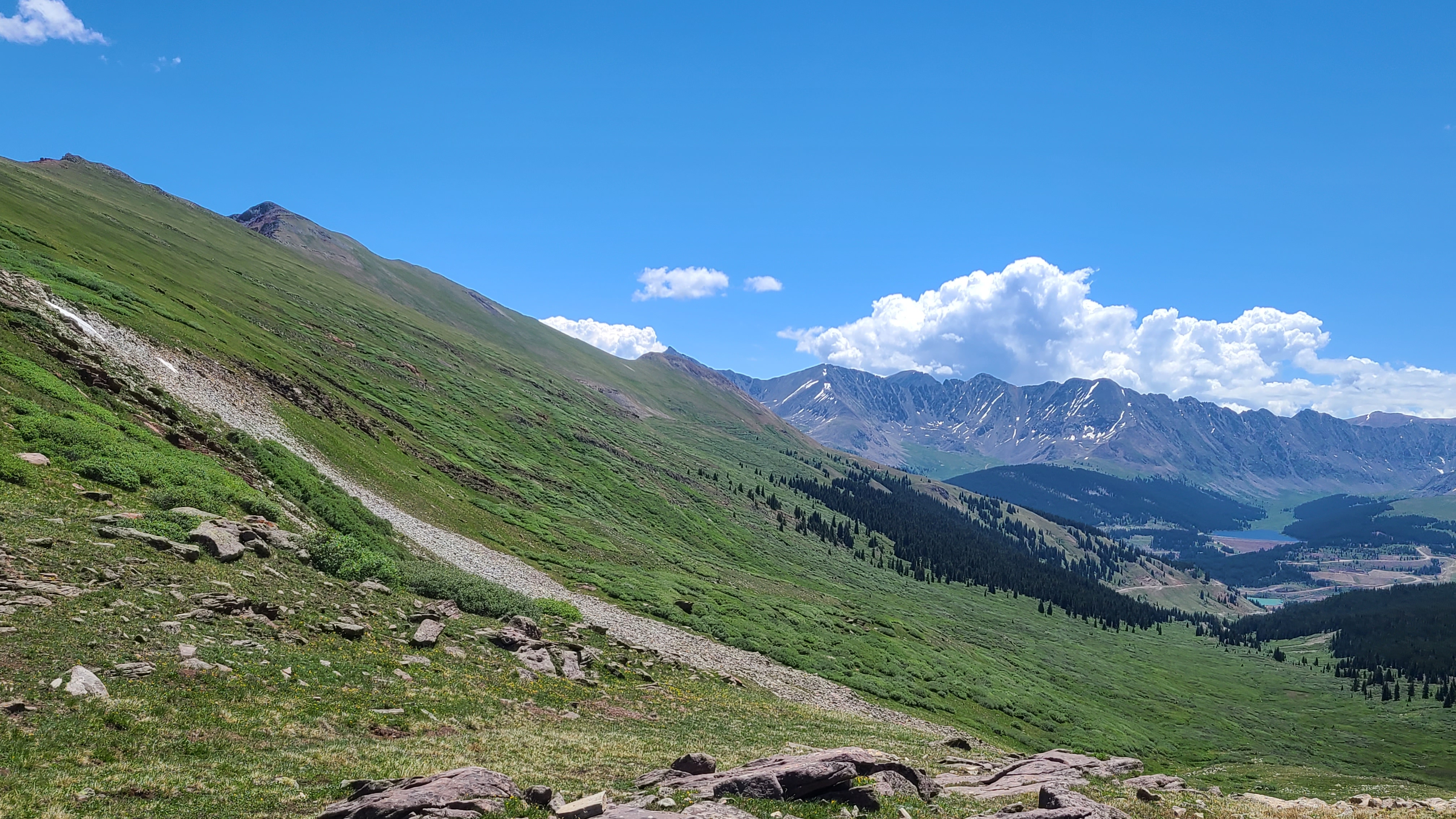
It felt pretty cool the reach the saddle – I had climbed the infamous Hope Pass! The sign post was absent the prayer flags I had seen in other pictures, but the view of the mountains ahead was a far better alter. The climb down the other side was just as steep but I did find the expected campsite and water not far below. I had hiked 10 miles the first day, but that wasn’t bad with my late start and big climb. I was nearly through CW1 and had gained ton of confidence.
Last winter I had mentioned to my son my scheme to thru-hike the Colorado Trail. I wanted to shuttle vehicles over 9 separate section hikes on my weekends starting in May to cover the first 185 miles to Twin Lakes, then finish the trail to Durango over a 3-week stretch. Erik had me bring my planning materials on my next visit to see what I was up to. After we went over my super-detailed, ever-changing spreadsheet he replied with, “DO IT” and stuck the print-out to his refrigerator. From that point he was all-in supporting this adventure. It helped that Segments 8, 9, 10, & 11 all have trailheads near Leadville, and his house there became our little command center where I left my spare gear, a resupply, and my old Dodge pickup when I was on-trail. Erik shuttled me between a bunch of trailheads and would meet me with my resupply at Monarch Pass as I finished the Collegiates West. His constant encouragement and belief that I could do this is what really made the difference, and I never would have completed the trail without him. But the best part was that Erik wanted to join me on trail for his ever first backpacking trip on Segment 9 at Tennessee Pass.
The weather forecast was clear for a change and I had mentioned to Erik that he might be more comfortable hiking in shorts and trail runners. He was pretty open to my suggestions when it came to what gear to carry, but he made it his hike when he showed up wearing Carhartt jeans & his electrical hazard boots.
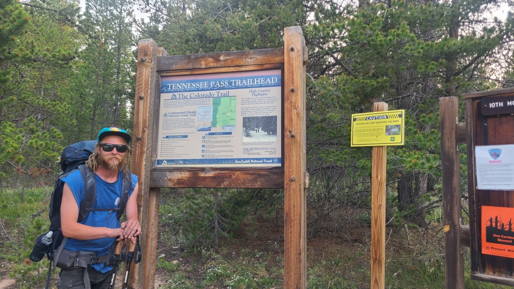
We dropped his Jeep at the Timberline Lake Trailhead and drove my pickup back to Tennessee Pass near the 10th Mountain Division Memorial. We were starting in the early evening and only had to cover about 2.5 miles that night. It starts out as a nice trail winding through the woods with some gentle ups & downs. I assumed that the taller than usual trail markers must mean this is a popular route in the winter as well. We found a nice campsite just beyond a bridge-covered creek. Erik has been 4-wheeling in these hills for years and he recognized the Jeep trail just past our campsite as Wurts Ditch road. Most of the forests on the CT were not ideal for bear hangs, so I tied my Ursack to a tree trunk far enough away from camp after dinner. It had been a really fun evening hiking & chatting in the woods.
We had about 11 miles left to the Timberline Lake trailhead, and the climbs were much steeper than I had expected. I’d already been backpacking almost every week for the past two months and felt like I was in pretty good hiking shape, but Erik led most of the way on his first time out. We had fun visiting with some other CT hikers who were also not loving today’s climbs. We met an interesting CDT hiker who had deferred last year’s hike for the pandemic, but used that time to cache his resupplies across 4 states. I was surprised I hadn’t heard of Porcupine Lake when we saw how pretty and secluded it was.
We could finally see familiar Turquoise Lake then descended down to the trailhead where we had left Erik’s Jeep. This was my last segment to complete between Denver and Twin Lakes, and the following Sunday I planned to start into the the Collegiates and beyond to hike the final 300 miles. But after Segment 9 the trail had already far exceeded any of my expectations.
I started this trip on July 6 to avoid the holiday crowds, and had stayed with my son in Leadville the night before. I left my truck at Erik’s house and caught the Lake County Link shuttle to Copper at 5:30 am. My plan this trip was to complete the 25 miles from Copper Mountain to Tennessee Pass in 2 days. I knew that most of the 4400 feet of total elevation gain would be on the first day and it helped to get an early start. The bus dropped me off near Copper and I hiked back to where the CT connected along Highway 91.
The trail then passes just above the base of the ski area, where a resort employee directed me the way to follow the the trail as it climbed southwest towards Guller Creek. I passed a friendly bunch of day hikers that knew the way better much than me. From the creek I got a glimpse of the climb that lied ahead up Searle Pass and Elk Ridge.
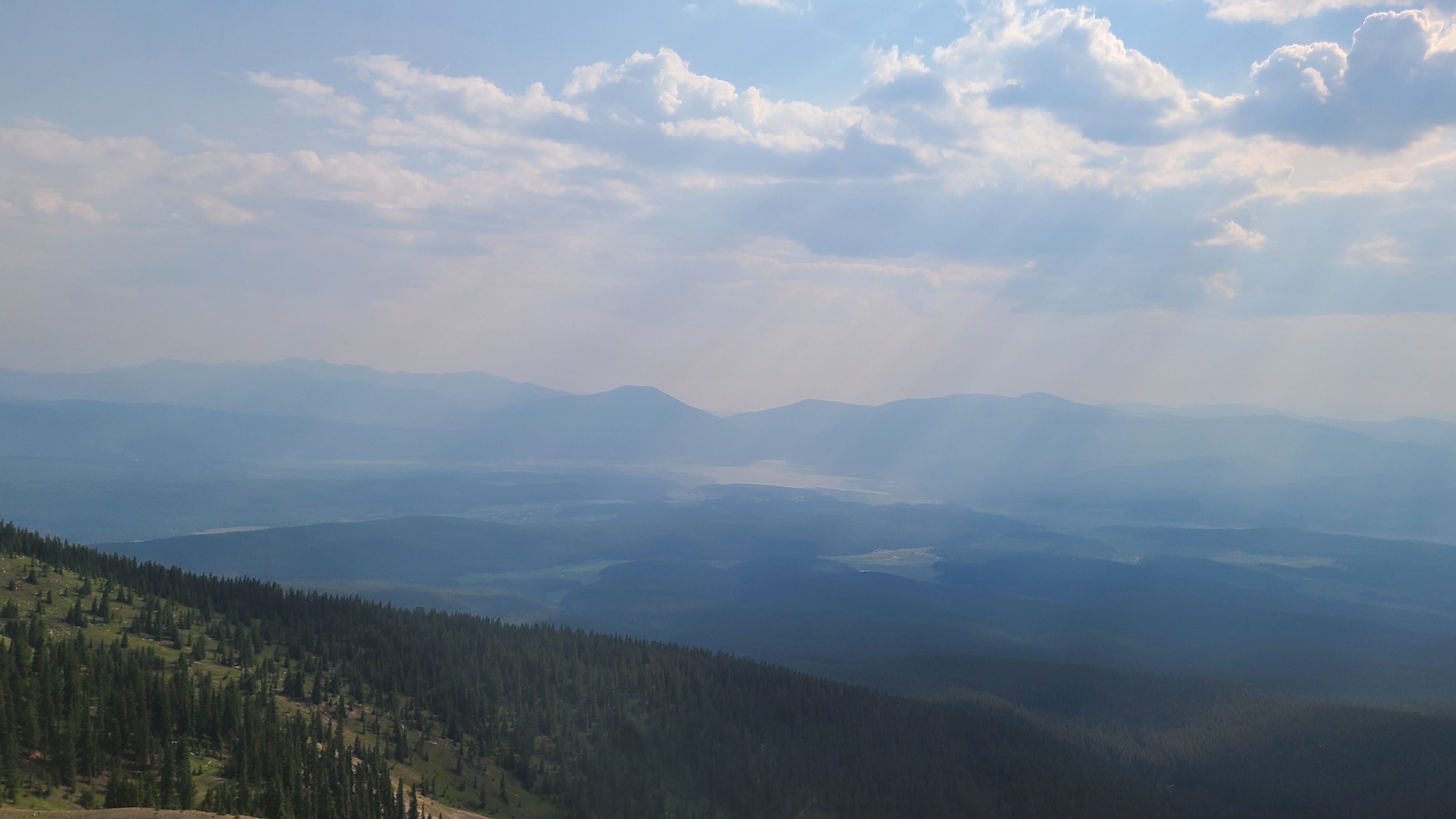
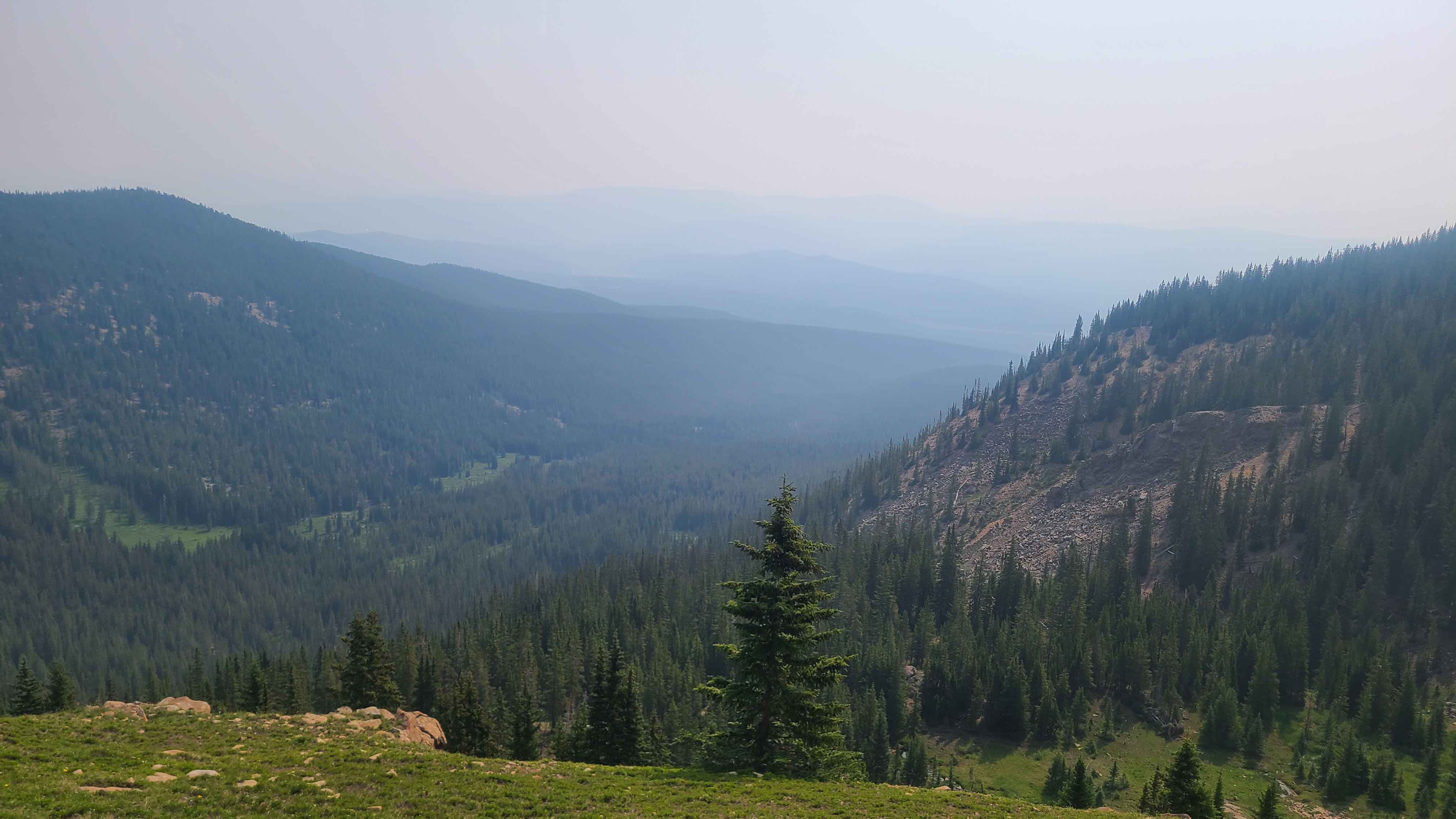
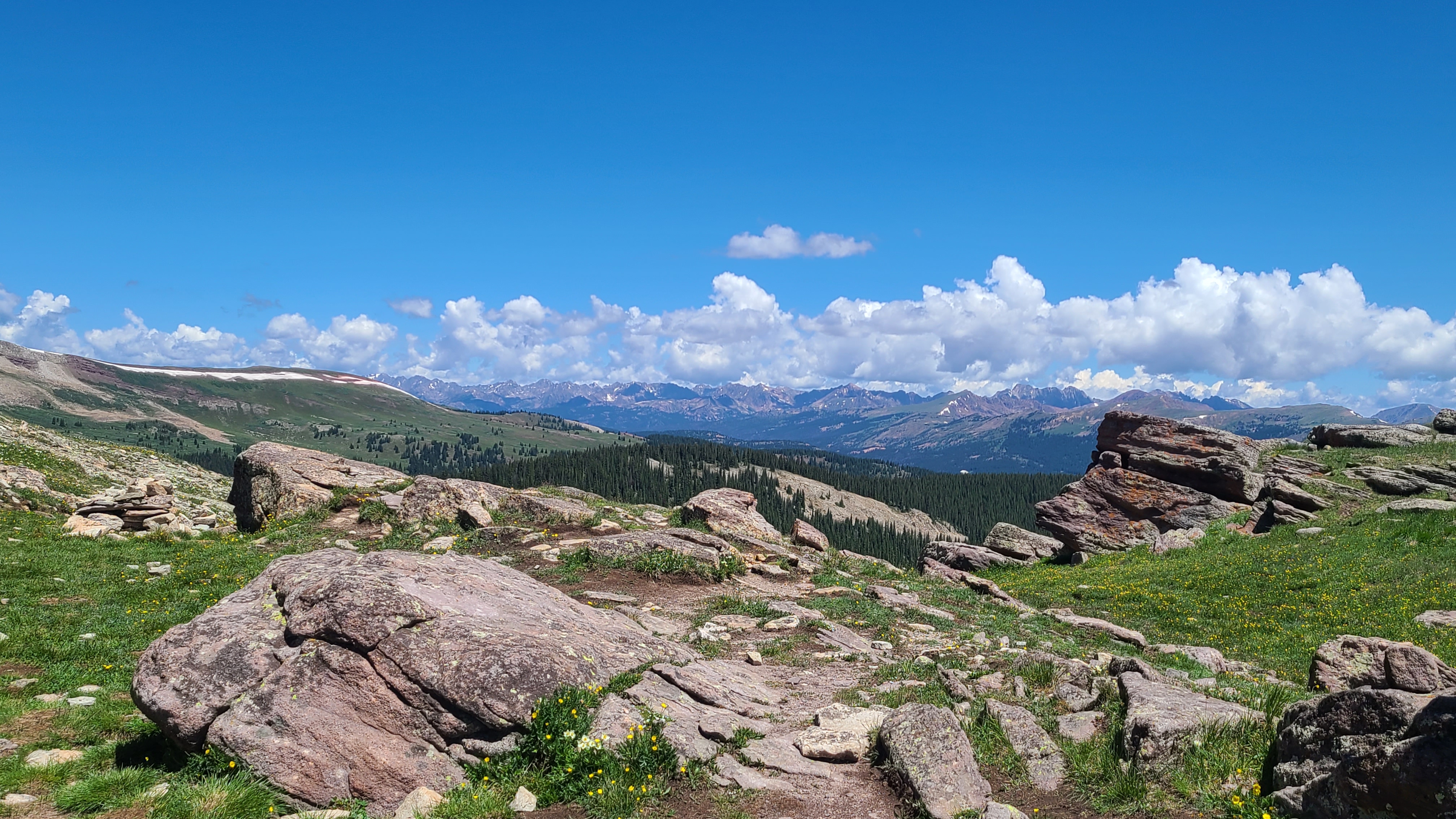
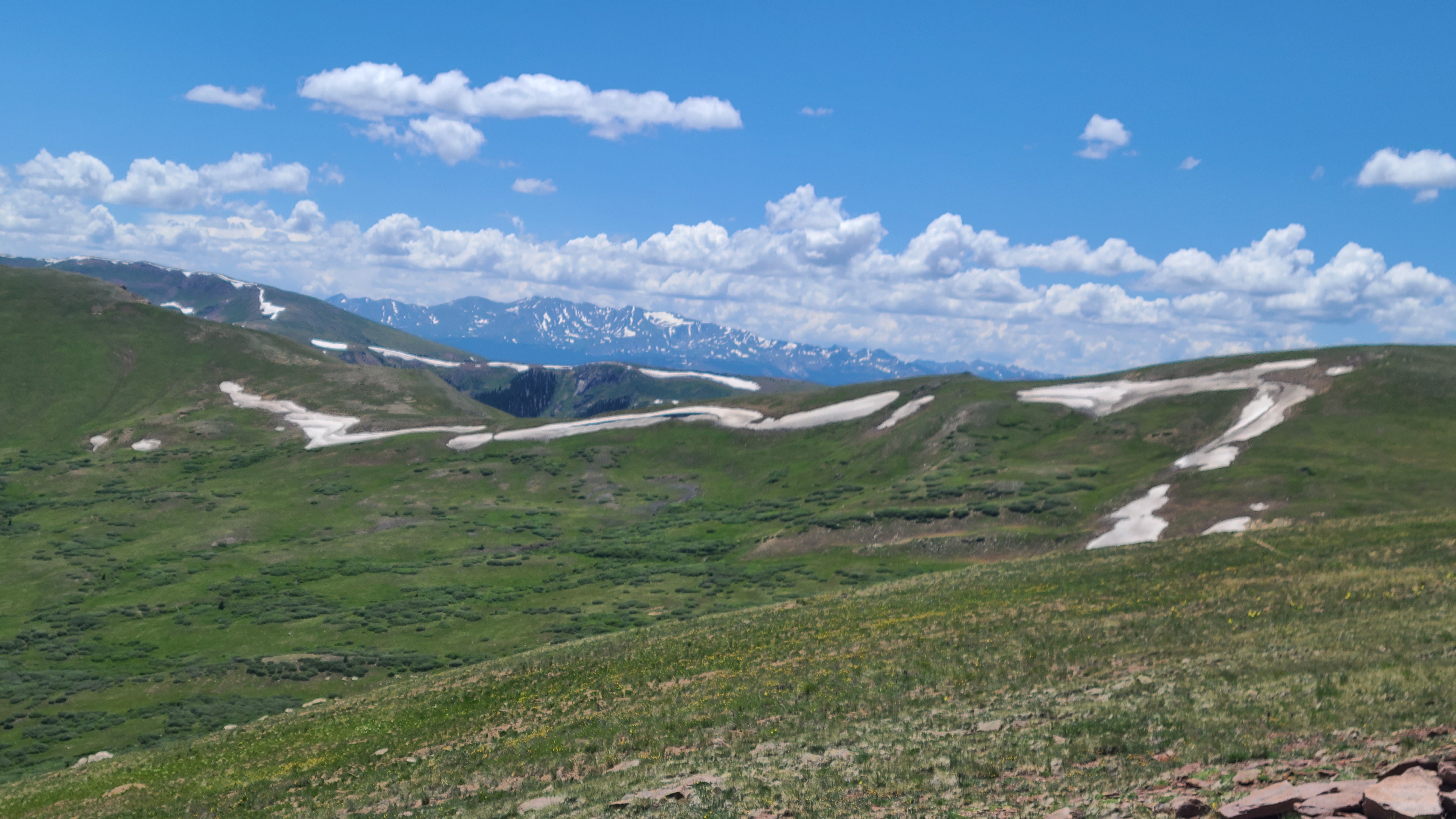
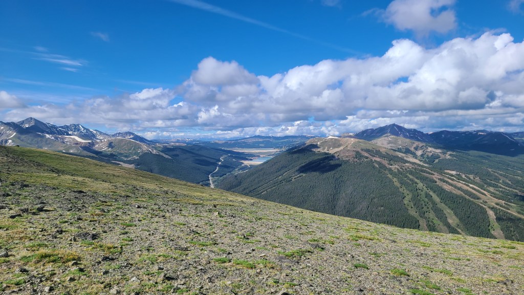
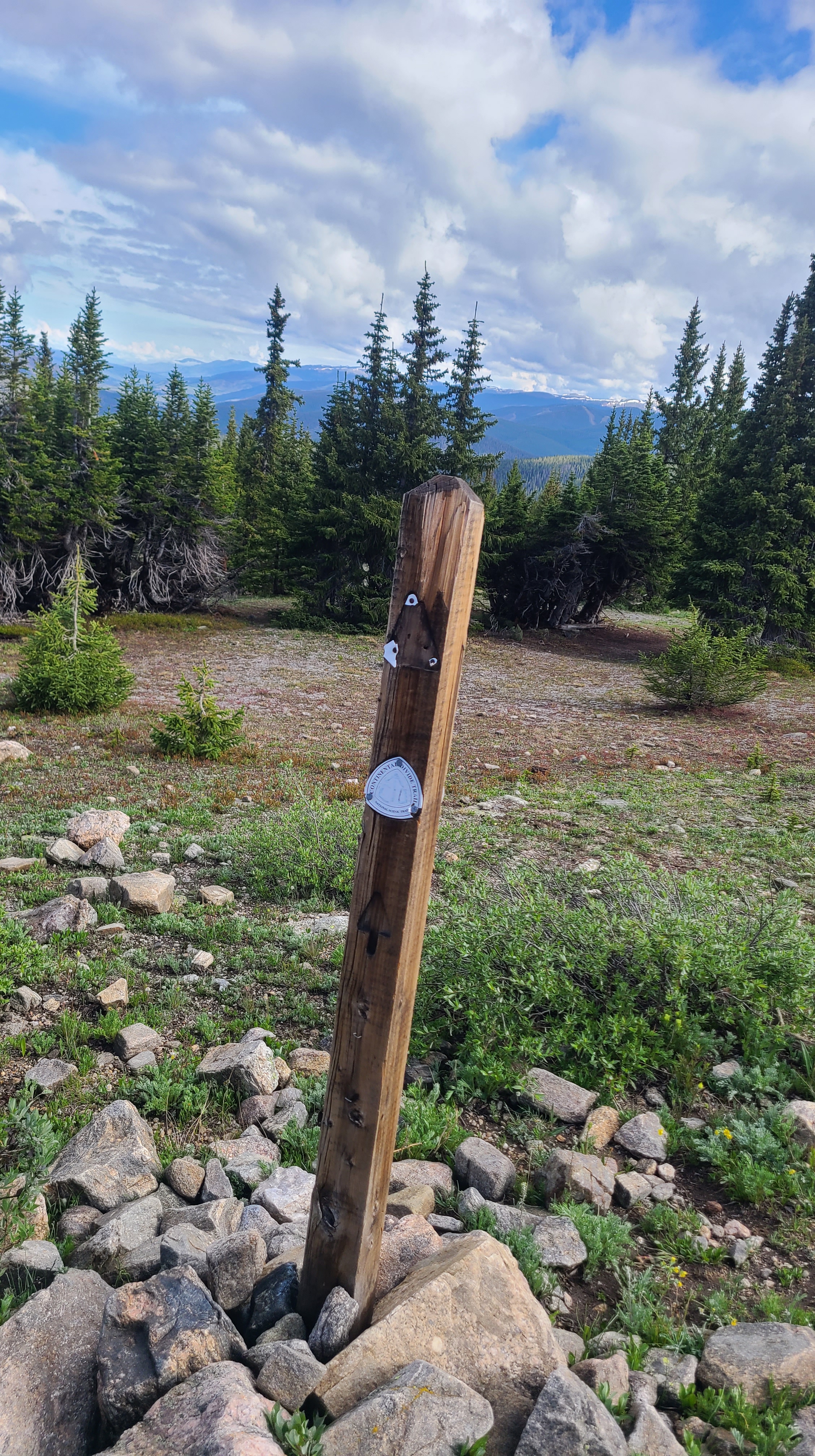
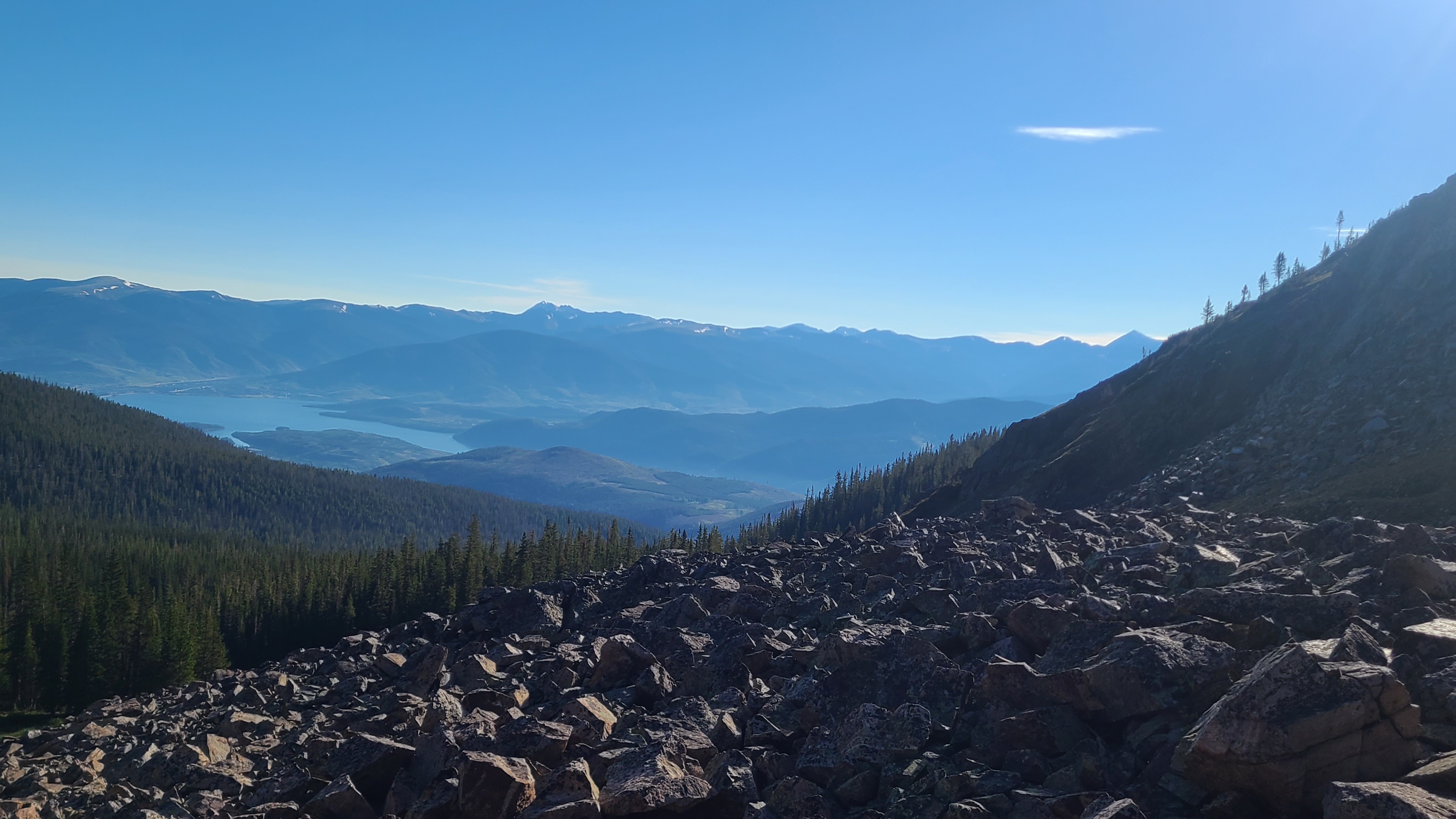
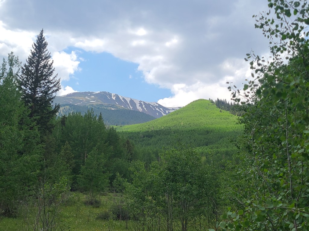
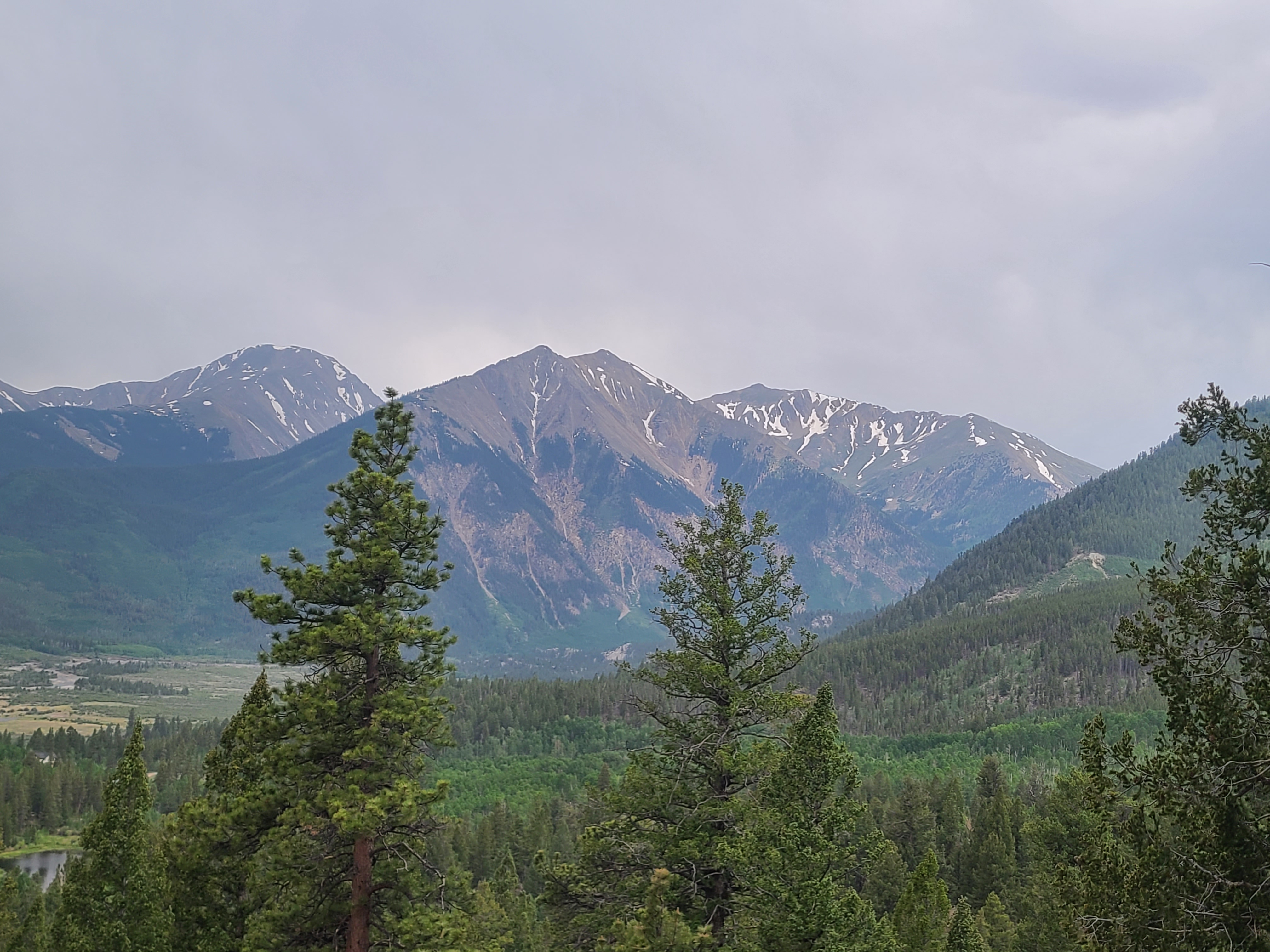
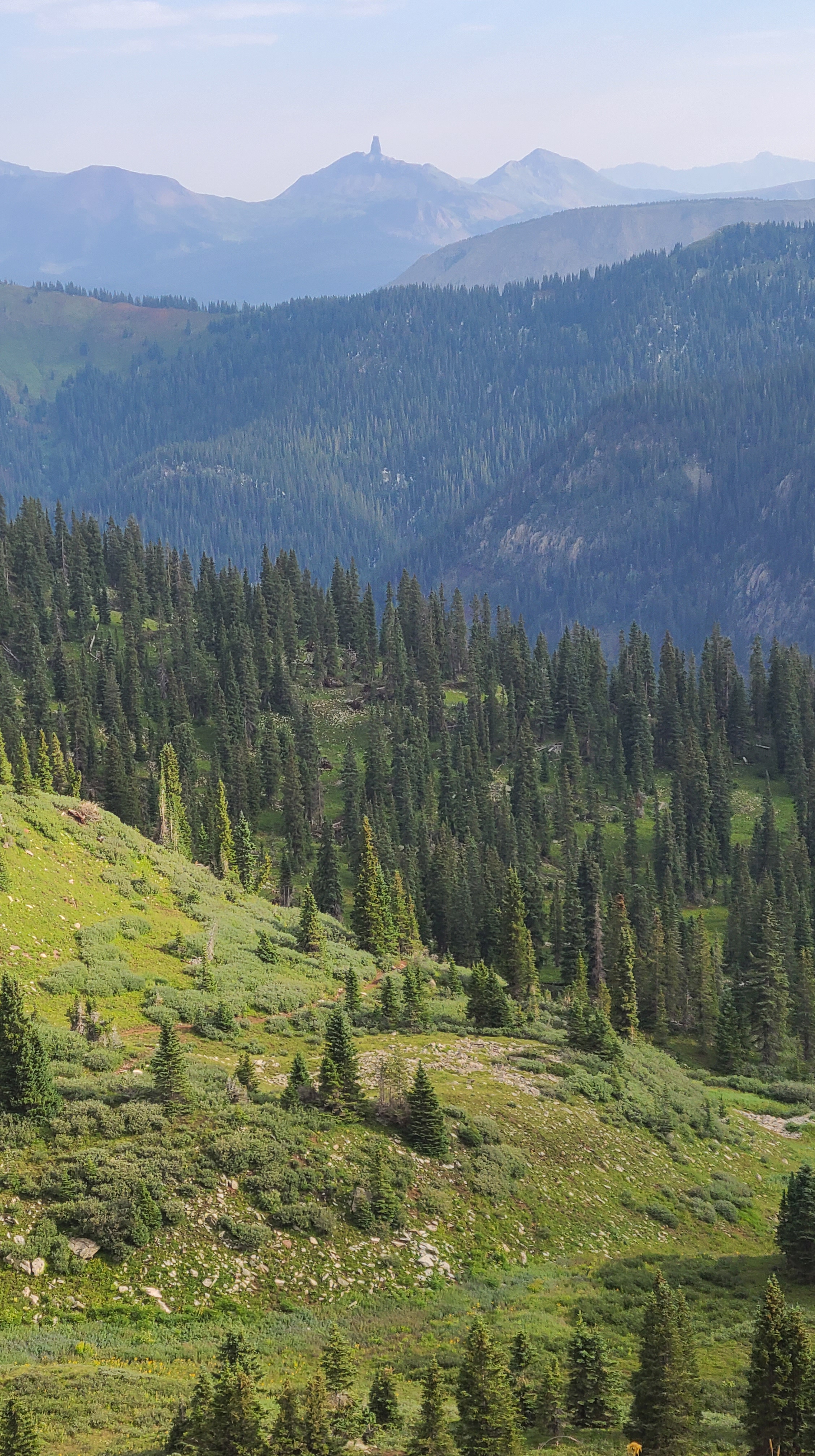
There were a few mountain bikers out today, and several let me know the view up ahead would easily make the climb worth it. The trail gains 2400 feet over 12 miles, not steep but a relentless climb. There was pretty run-off creek flowing down Searle Pass along the way. A friend had told me about a hut trip he had taken to Janet’s cabin, and it looked like pretty special place looking down from the pass. I finally made it up over Elk Ridge and despite the wind I took a few minutes to enjoy the views all around me. Even the Climax mine with it’s filtering ponds and Highway 91 in the distance added to the scene. Now, whenever I drive over Fremont Pass, I can look up from the highway towards this notch I passed through that day and remember what it was like to be all the way up there.
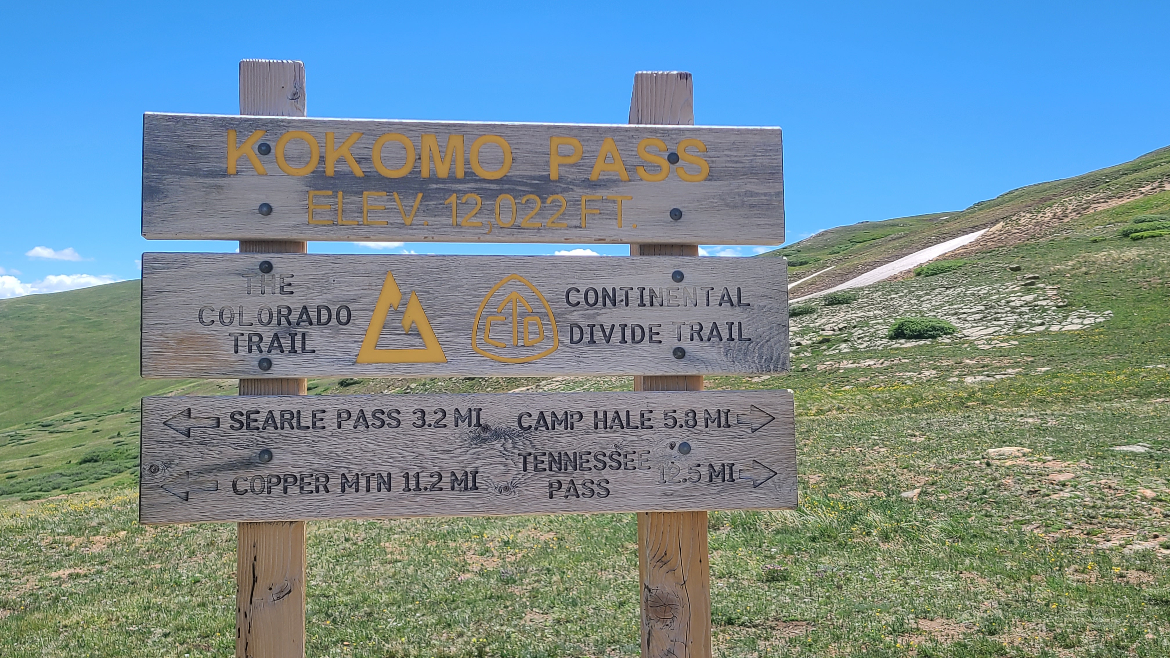
The trail followed along a grassy ridge to the top of Kokomo Pass. I was all alone at this point, and like many hikers before me I couldn’t help but sing that Beach Boys song out loud as I approached the sign. La Playa Brujas near Mazatlan, where I took my wife Maria on our first beach vacation, is my Kokomo. But it was cool to visit a real place called that too.
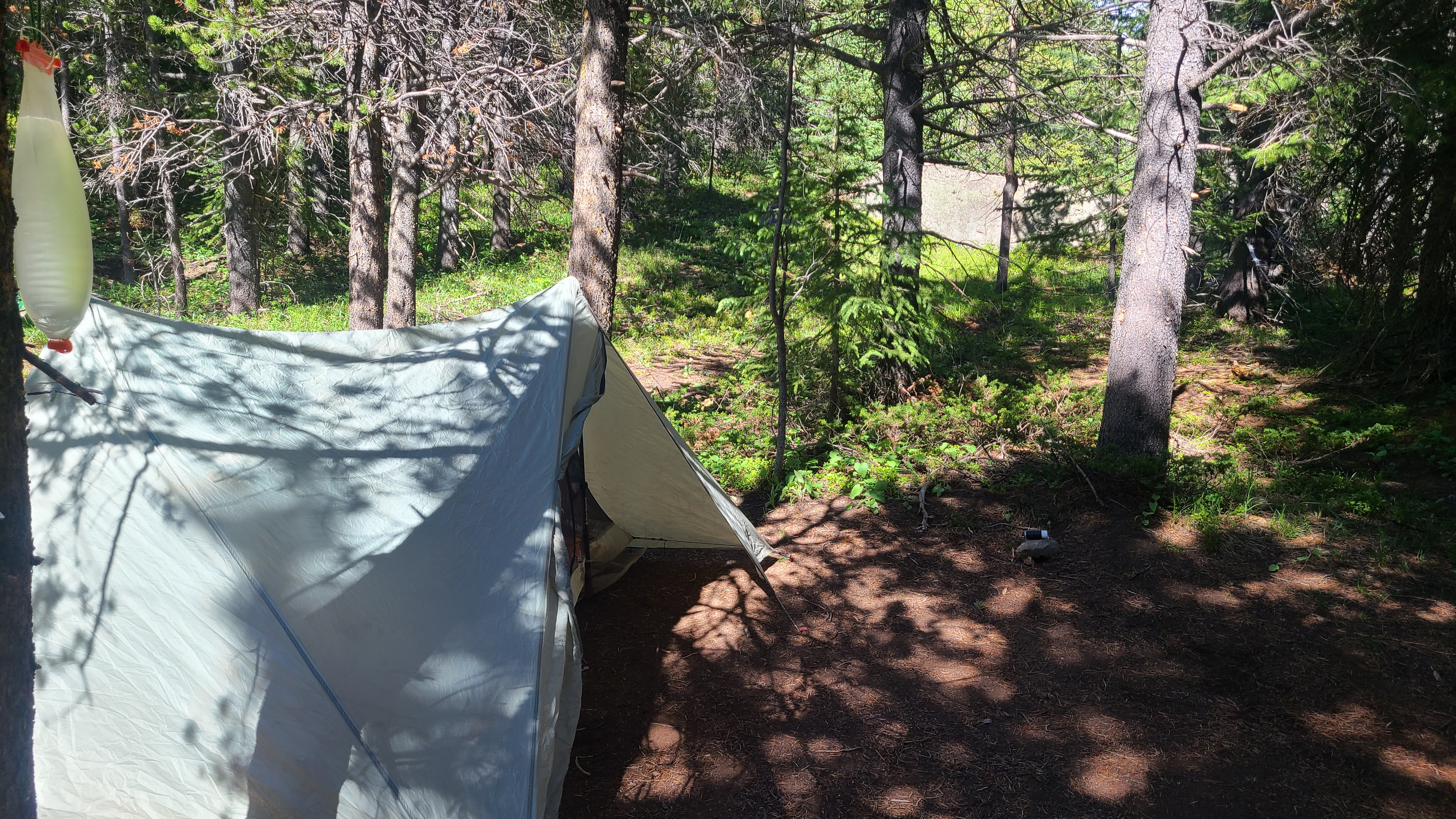
It was pretty much all downhill from hear to camp. I passed Cataract Falls, then some more friendly CDT NOBOs and my first bikepackers of the summer. A trail crew that had been clearing some deadfall and passed me on their way back to the trail head. One of the younger crew members offered me his granola bar – nothing spectacular but I happily accepted my first bit of trail magic. There were several nice established campsites to choose from along the creek so it was an easy end to the day.
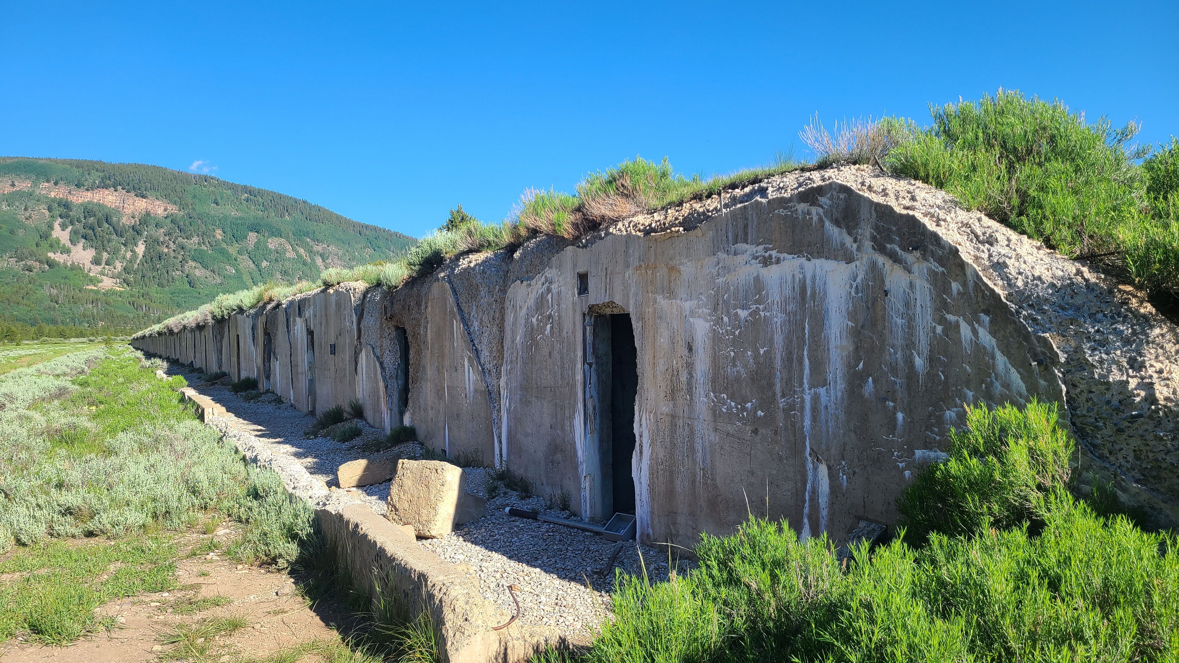
The next morning I covered the last 10 miles in about 4 hours, a pretty good pace for me. A fellow CT hiker named Chris joined me for a couple miles leading up to Camp Hale and shared a story of some the the heroics of the 10th Mountain Division. The barracks there were dug into the turf and seemed to go on endlessly. I obeyed the sign to not leave the trail as there could be some unexploded munitions nearby. There was a clear, almost haunting feeling as I passed by Camp Hale, that I was walking through hallowed ground.
I visited with a few more CT hikers as we passed the old coke ovens near the Tennessee Pass Trailhead. It was fun to visit with Snackbox, who had made some really helpful CT Youtube videos, as I reached the parking lot. I can’t even remember the last time I hitchhiked before this, but I was happily surprised it took me only 10-15 minutes to get a ride back to Leadville. Ironically a former AT hiker just passing through on his way to Texas picked me up – he seemed to think I was homeless at first. In the moment, that didn’t feel like such a bad thing.
I completed Segments 1-5 on the Colorado Trail over a few weekends in May and early June. Then I skipped ahead to hike Segments 10 and 11 up to around CT mile 185 while waiting for the snow to melt in Segments 6 and 7. Georgia Pass and the Tenmile Range were now accessible so my plan for this trip was to hike both segments from Kenosha Pass to Copper Mountain. I worked my graveyard job Sunday night as usual, then drove to Goldhill Trailhead to meet my shuttler Erica. This was her third time shuttling me this spring, and I while I was happy to see Erica and her family again I was a little sad this would be my last shuttle trip with her. I had been watching the weather closely and knew a thunderstorm was due to hit early in the afternoon.
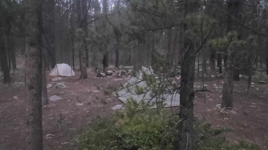
Erica dropped me at Kenosha Pass and not long after starting my hike nature called me to do some business off trail. I had spotted a tree far enough away from the trail to use as a landmark, but when I finished I spent probably 20 minutes finding my way back to the trail. I was still pretty new at this; my Guthook app let me know the trail was close by but I just couldn’t see the it. From that point on whenever I walked off-trail I took a quick compass bearing of my direction of travel off-trail from my Instinct watch, and also pointed my poles back towards the trail when I stopped. I was a bit frustrated knowing I was short on time with the impending storm. I had hoped to hike at least 10 miles that day, but only made it around 6 miles to Jefferson Creek when the rain started. The rain got heavy right as I crossed the road, and I decided to make camp at the next decent site. I found an established spot right away and thankfully stopped there as the rain continued for several hours that afternoon. I was especially happy to have stopped when I could hear thunder and see the lightning flashing up the hillside on the next day’s climb. Thankfully my Xmid tent kept me dry overnight.
The skies cleared a bit overnight and I started out before daylight the next morning to try and make up some miles. I had to cover 46 miles over 4 days / 3 nights, plus a planned side trip to Breck. While I made the right choice to set up camp ahead of a pretty big storm on the first night after just 6 miles, I would need to hike at least 20 miles today to stay on track. Up to this point I had never carried a backpack more that 14-15 miles in a day.
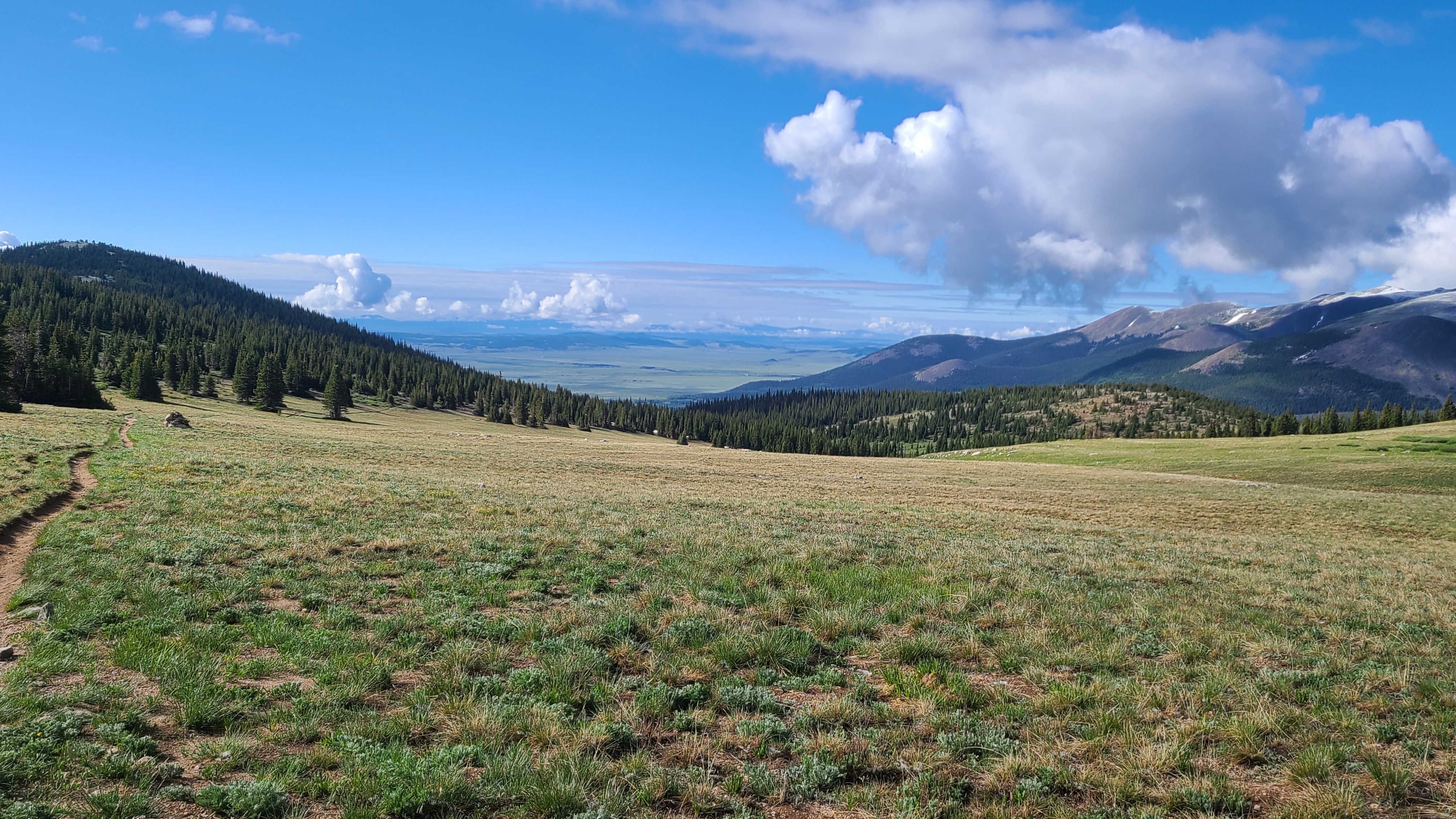
I could see some fresh snow higher up on the trail as I started towards Georgia Pass. Not far up the trail I passed a few other hikers still in camp drying out their tents from yesterday’s storm. I had heard them passing my camp during the storm late in the afternoon before while I was already cozied up inside my tent. I had to climb about 2000 feet over the first 6 miles, but I was excited finally get to Georgia Pass and kept a good pace that morning. I leap-frogged with a handful of other friendly CT thru-hikers along the way which seemed to help with the climbs. It looked as if I was still ahead of the CT bubble. As I reached Georgia Pass I was rewarding with the view of South Park behind me and the Gore Range ahead of me as the trail turned north towards Breckenridge and connected with the Continental Divide Trail.
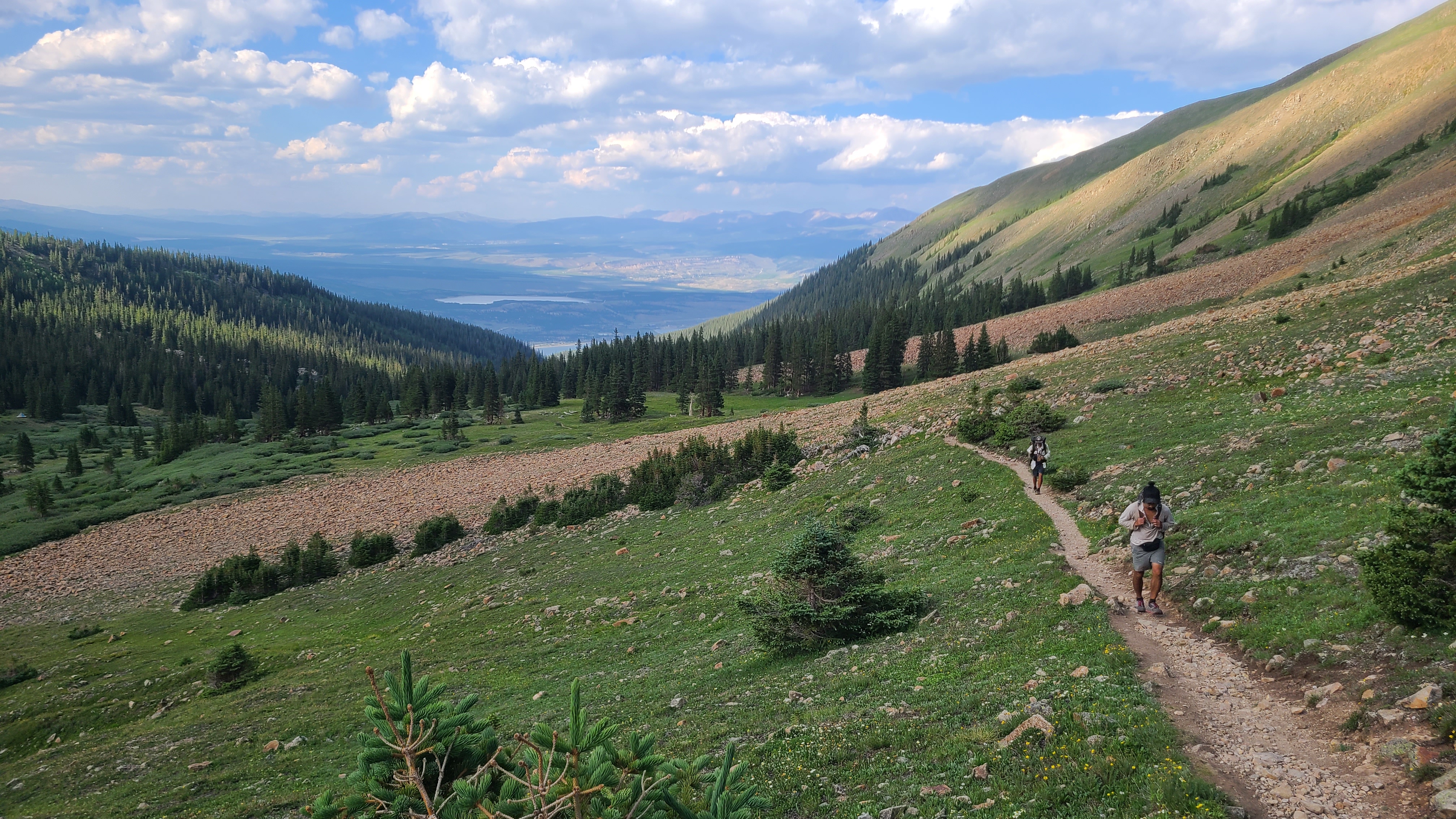
I saw a surprising number of NOBO CDT hikers that day. These folks were my new idols, and it was cool how they seemed as excited for me on my CT hike as I was for them on their CDT journey. I imagined this is what a mite hockey player must feel like when they get to play a game during intermission at an NHL game, and get high fives from their heroes as they leave the ice. I stopped for a long lunch at the Swan River after about 13 miles and filtered water to carry over the next 9-mile dry section. The trail gains about 1000 feet over the next two miles towards Keystone. There was another unexpected climb after that through a beetle kill area. I visited with nice pair of CDT hikers called Fire Hazard & Spider Monkey alongside the trail while they contemplated whether to carry on that afternoon towards Grays Peak, the only 14er on the CDT, in the wake of yesterday’s big thunderstorm.
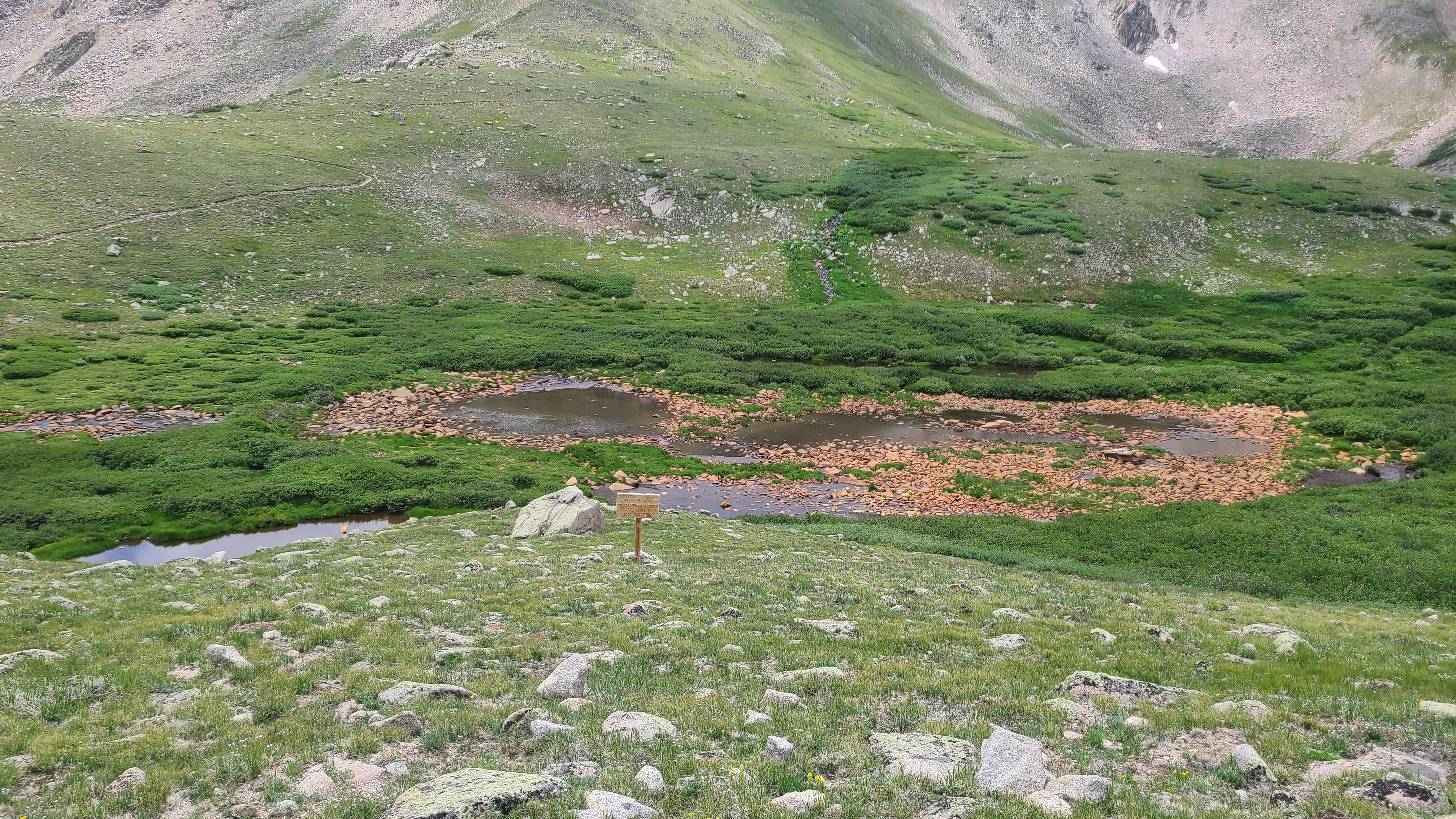
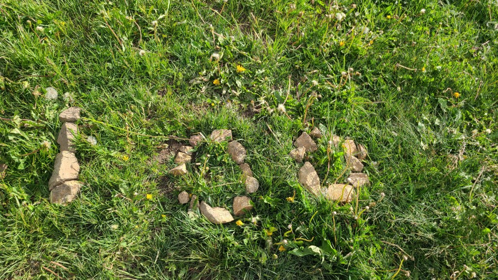
I had done my first 20-plus mile day, but still had another mile left to reach the next water. I felt ok, but some much younger fast-moving CDT hikers let me know I didn’t look so great. One thankfully followed up with “just another half hour to go, you got this!”. I finally crossed a marshy gully with a little creek trickling just enough to fill up my CNOC. It was fun to see “100” written out on some nearby stones. The CT Databook let me know there was a nearby campsite on the ridge ahead, and I was grateful when some others already camped there pointed me to a flat spot nearby. I was close to overjoyed to have covered 22 miles, by far my longest day on-trail so far. The miles plus the vibe I had gotten from CDT hikers and my fellow CT hikers that day had me feeling like maybe I belonged here after all.
I had a pretty easy 4-mile hike the next morning towards my truck at the Goldhill Trailhead. I had left myself a couple cold sodas in my Yeti and was more than ready for one. I drove to Breck for a big breakfast, then headed back to Goldhill to begin Segment 7. I needed to cover an additional 5 miles with around 1500 elevation gain to camp by Miner’s Creek. I passed a couple more CDT hikers along the way and met one who even carried a Mariposa backpack just like mine; it seemed like most of the CDT hikers carried the higher-end Hyperlite. I kind of laughed at myself as I realized I was sizing up the hikers I met by the gear they carried. In the weeks to come I would learn that a hiker’s gear or even the size & shape of the hiker had little to do with their ability or past experience on-trail. I reached my campsite in the early afternoon and again got lucky getting set-up and inside my tent just ahead of the next thunderstorm.
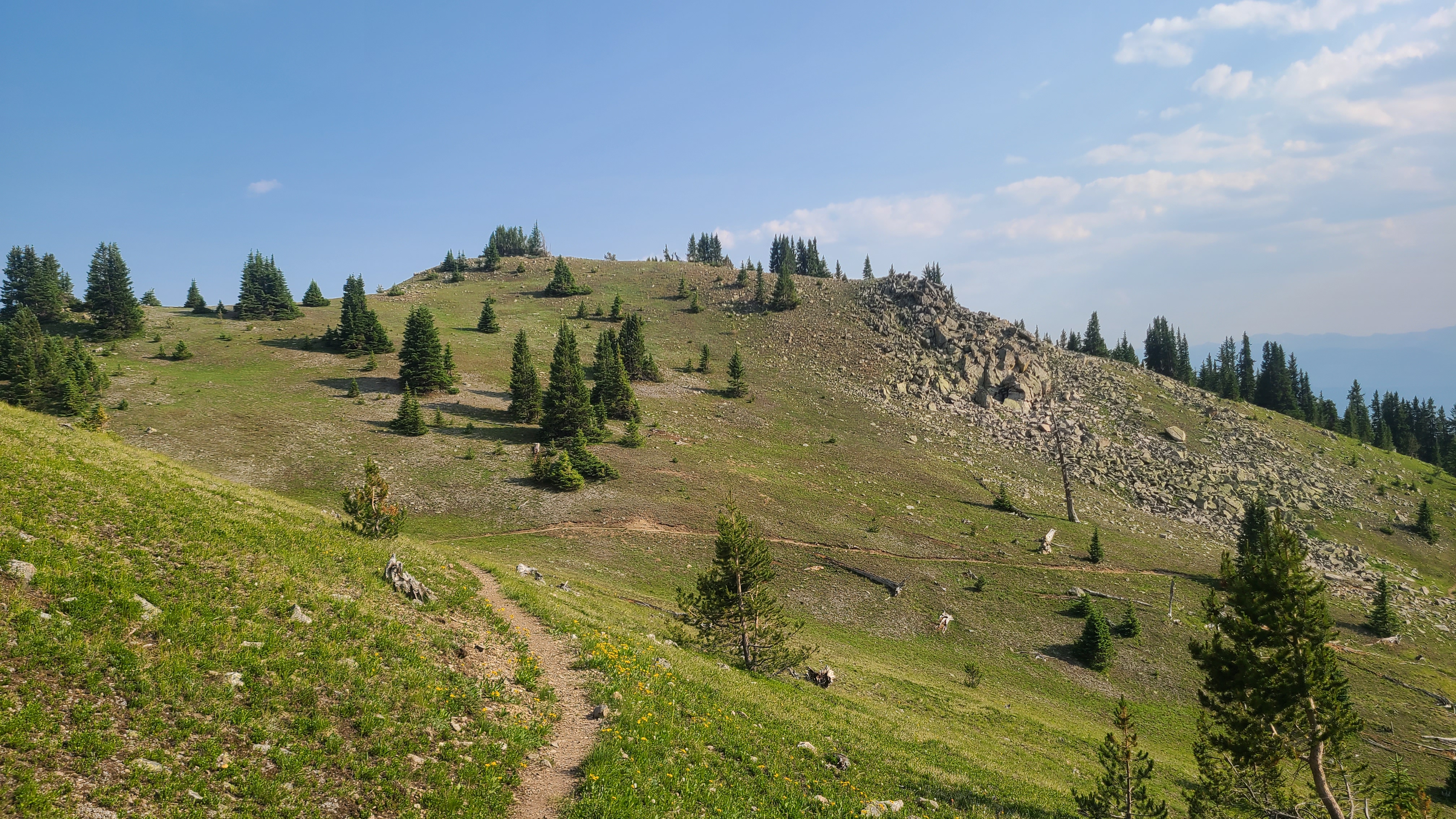
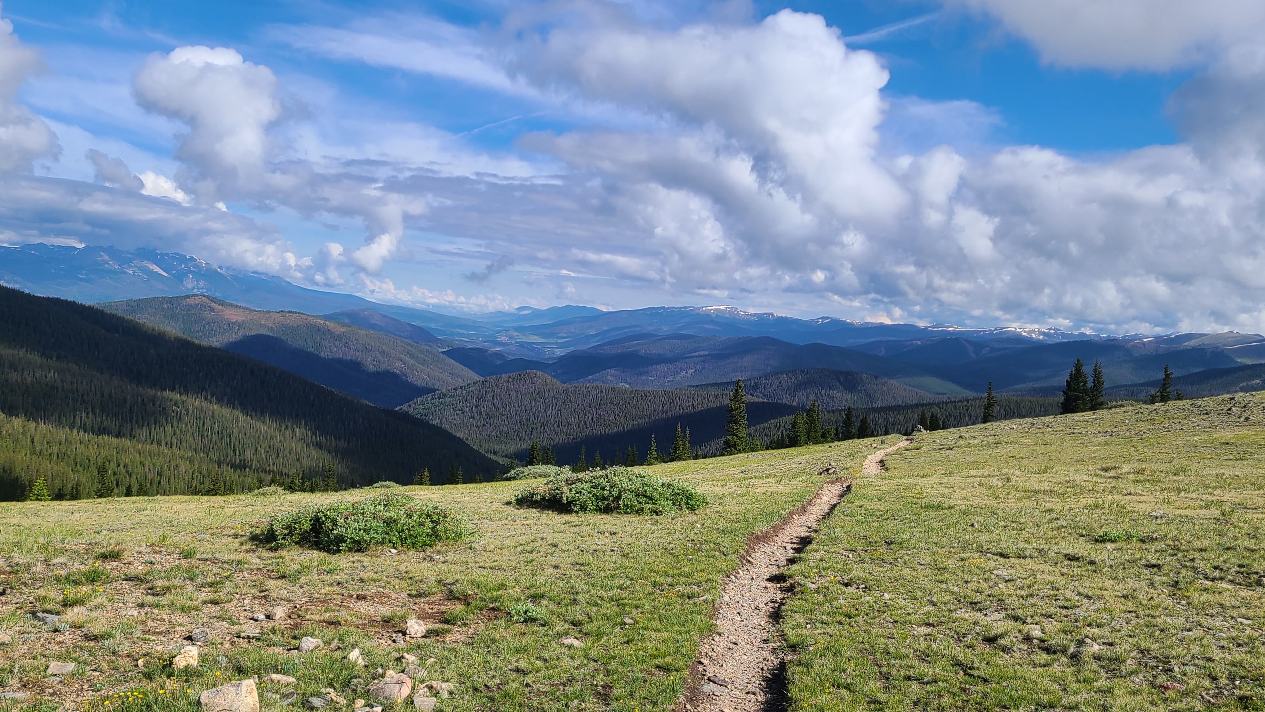
I had left myself 8 miles to go on Wednesday to finish out this trip, with a 2000 foot climb up & over the Tenmile range in the first 3 miles. I struggled as the trail relentlessly continued up through woods. I could see some jagged high peaks ahead and wondered how I could ever get over. As I got closer to treeline the route became more clear, and there were even some scenic stepping stones to help me up the first peak.
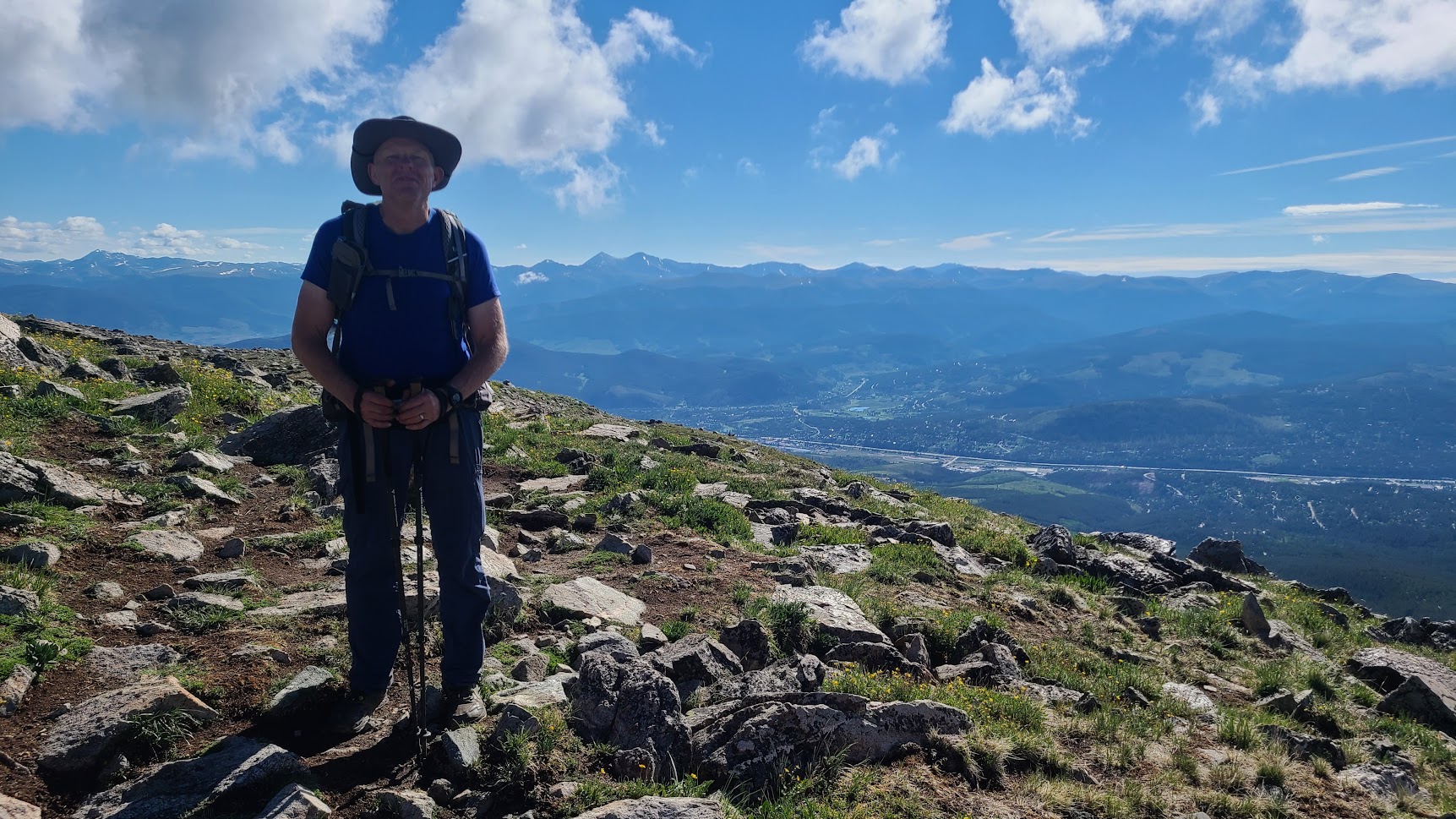
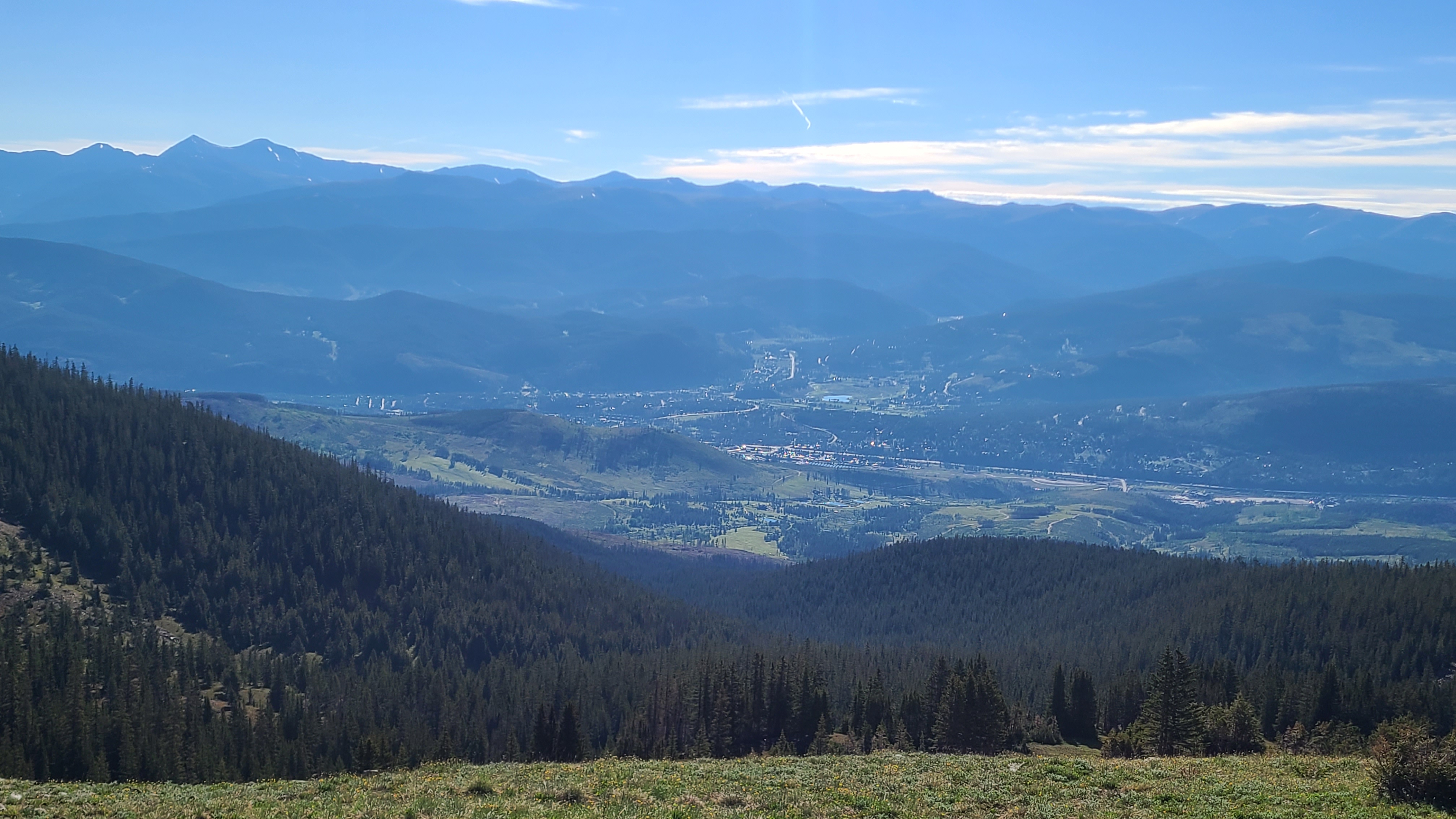
I could then see Breck down below as continued up toward the top of the ski area. This was not easy hiking, but the worst was behind me and the views were simply spectacular. I met a woman hiking with her dog as I crossed over the Tenmile range who had been hiking between Copper and Breck daily every hiking season for the past 20 years. The trail wound its way though a rocky field on the ridge, and I wondered where the hikers on the next higher peak were headed. As I started down I saw one of them sprinting hard down the steep hillside with a hang glider on his back then take off, somehow managing to avoid dragging his body on the ground by a foot or less.
As hard as the climb up had been, the descent down towards Copper seemed longer and steeper. I didn’t envy the CDT NOBOs I crossed on their way up. I was surprised to see CT hiker called Springer I had met in the last segment who had decided to flip over to Copper and hike back towards Breck. I finally made it down to Highway 91 and walked across towards Copper to take the free Summit Stage back to Goldhill. I’ve driven over Fremont Pass dozens of times to visit my son in Leadville; I often looked up that crazy steep mountainside wondering how CT hikers could possibly make it up & over. Now I knew.
This is my favorite weekend every year, our annual Fathers’ Day Campout with my son & his daughter. Erik was super supportive of my Colorado Trail thru-hike this summer and I don’t think it was accidental that he had picked Twin Lakes for this weekend. I had been section hiking my way from Denver to Twin Lakes (the actual lakes, not the village) on my weekends since early May, then beginning mid July I planned to start from there to finish the last 300 miles of the CT into Durango. It was Friday morning, and the plan was to meet Erik at their campsite, then he would drop my back at Half Moon Road so I could hike the first half of Segment 11 up to Twin Lakes. I still had to go back and hike Segments 6-9 over the next few weekends as the snowmelt allowed.
I had just finished Segment 10 on the previous Monday, and had to walk about and 1-1/2 miles extra to meet Erik on Half Moon Road to the construction closure. I was a little frustrated at first that I would need to backtrack today over that same stretch of road to get back to the CT. Once I started hiking it didn’t take long for me to just enjoy the short extra road walk as part of the journey and get in a little bit more training to help me get to Durango. Plus it was hard to not be in a happy mood with our Fathers’ Day weekend underway.
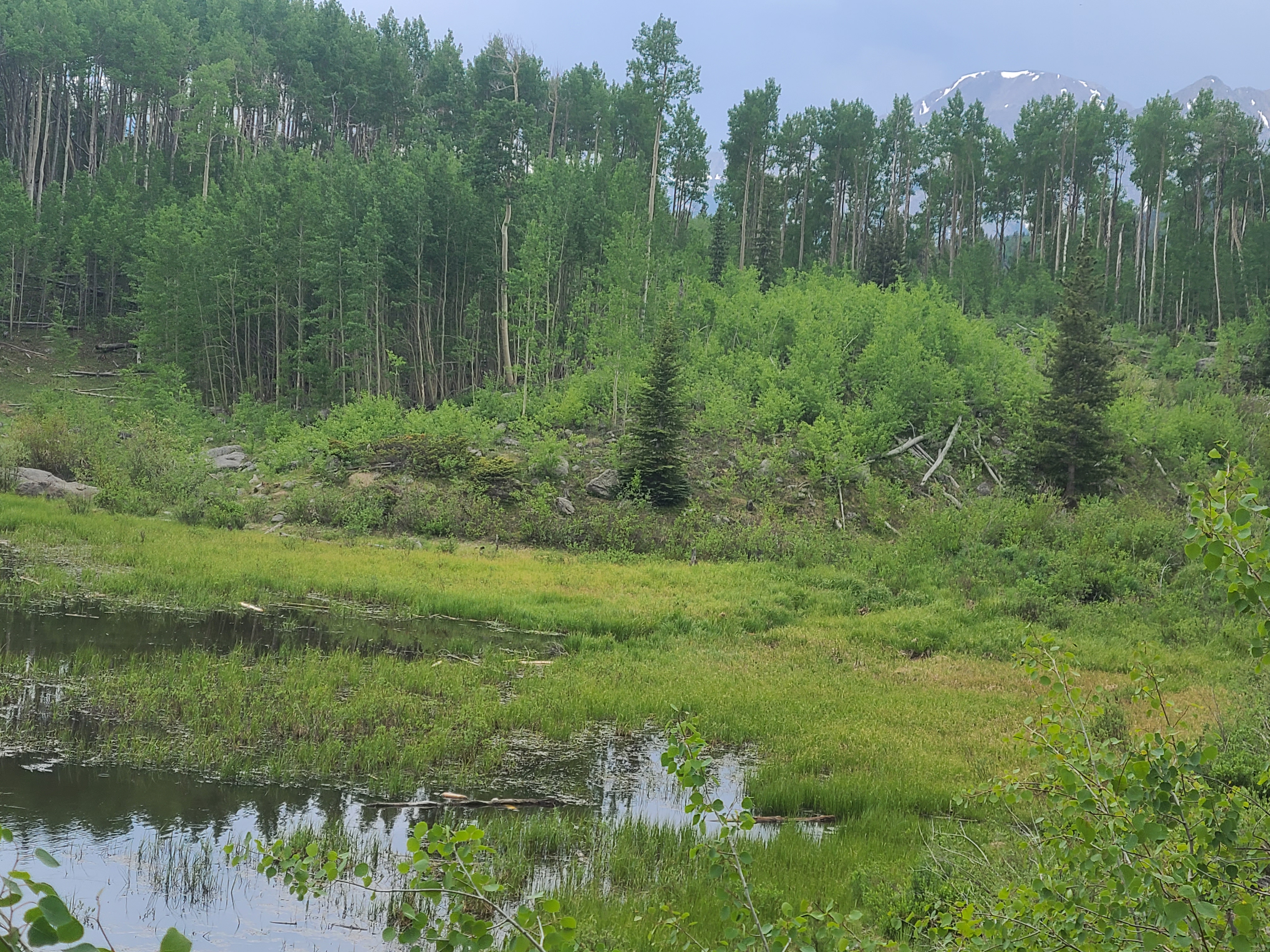
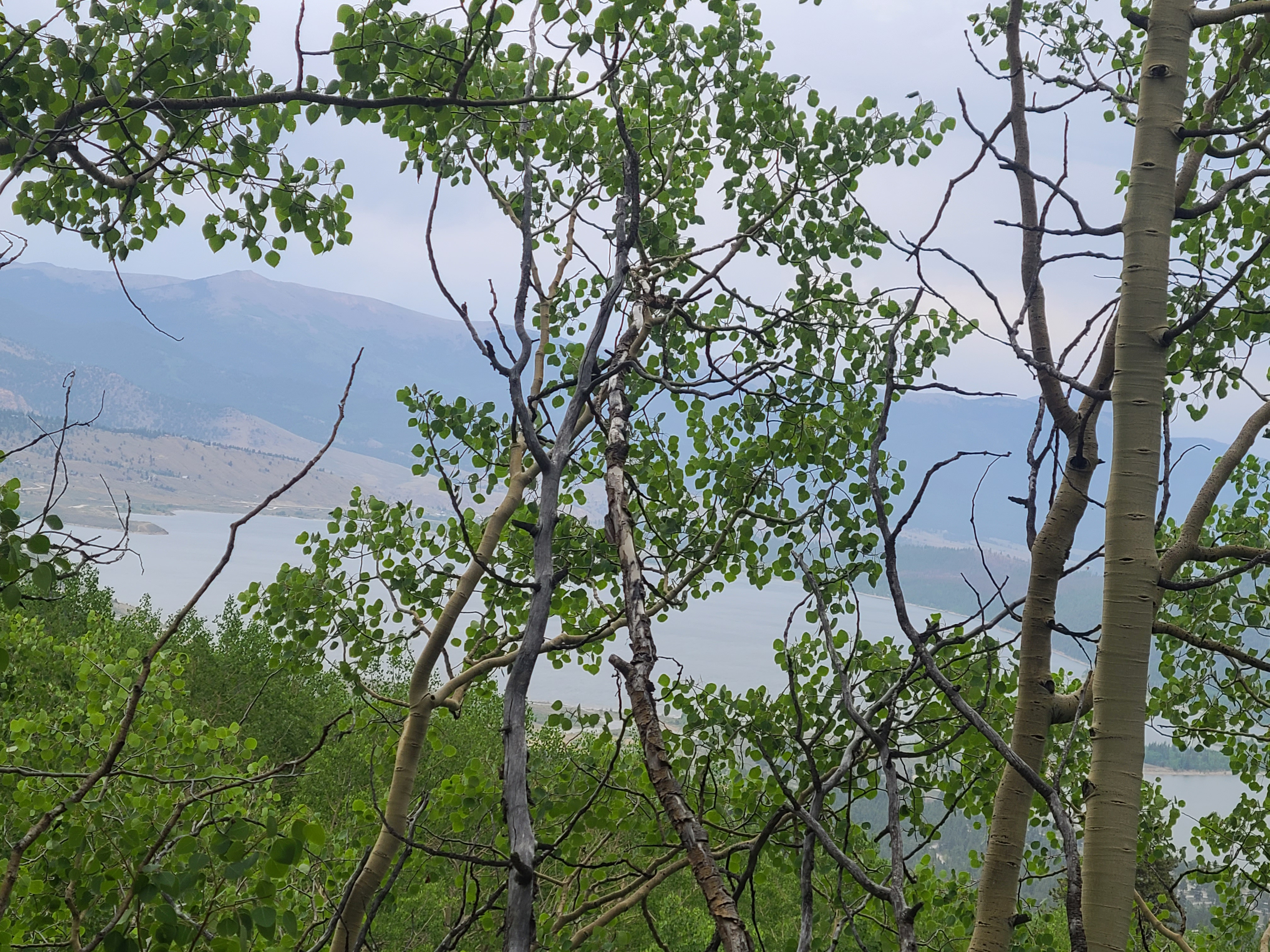
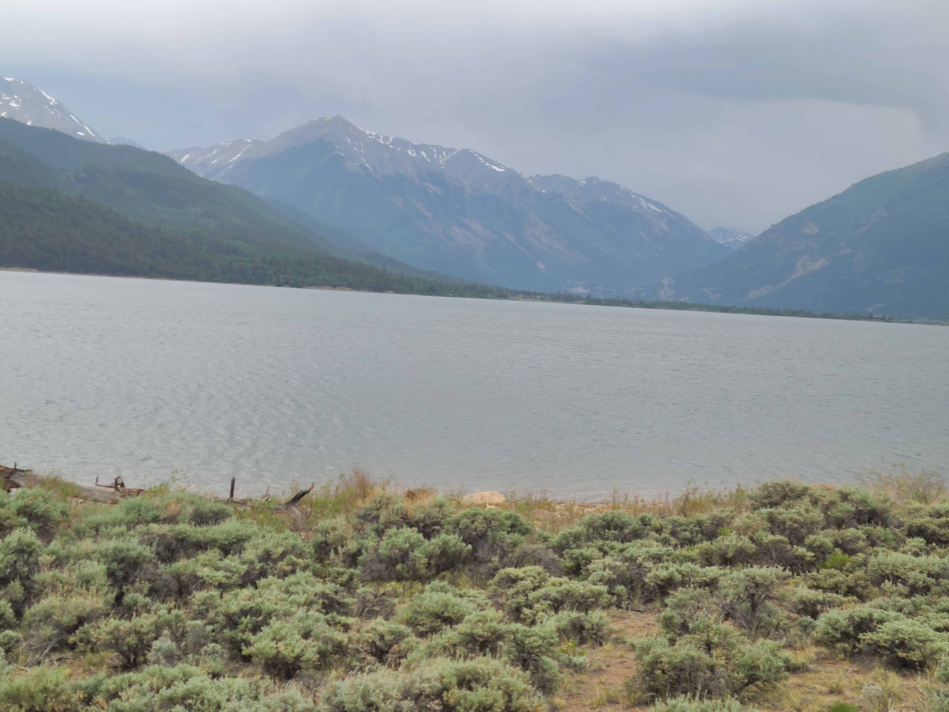
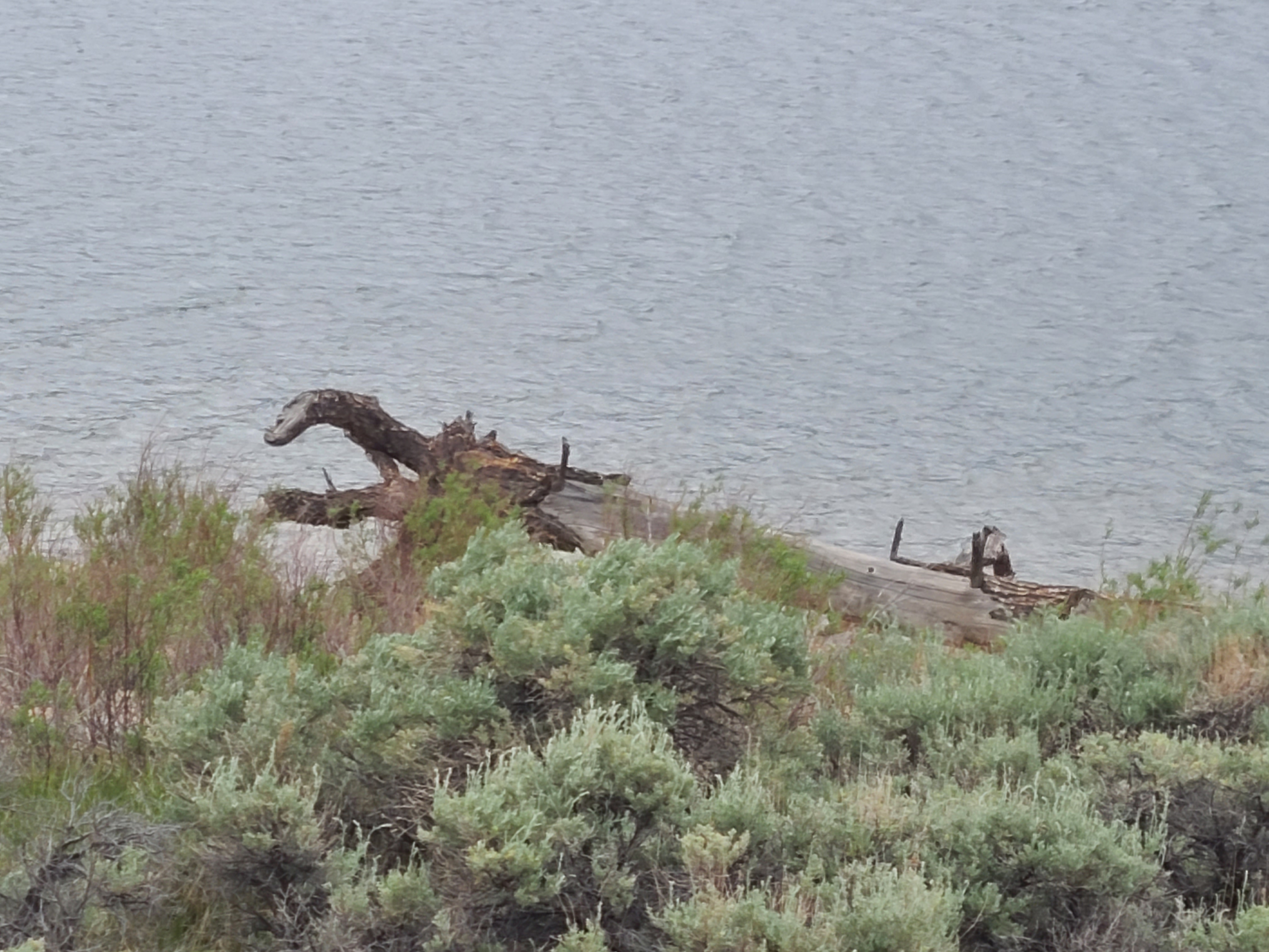
Segment 11 starts out with a decent climb up the Mt Elbert trail. I remembered that climb from summitting Mt Elbert the summer before; we had seen some CT hikers going up when we were hiking down and thinking they were nuts to be backpacking that trail. Yet here I was less than a year later doing the same thing. As the CT diverges from the main Mt Elbert trail, I was surprised at how lush and green this section was. I had picked a good time to hike this here after the snowy & rainy spring we had. I crossed paths with the first NOBO CDT hikers I had seen; they were friendly enough but had an impressive hard-driving demeaner that I hoped to have someday. I began to descend towards Twin Lakes and could see some of the Collegiate mountains, a pretty spectacular site. The trail then becomes fairly unspectacular as it follows between the road and Twin Lakes Reservoir most of the way around. Miles of sagebrush-lined trail seems to go on forever. A highlight was a Loch Ness monster-looking piece of driftwood on the shoreline.
I heard later that some hikers take a semi-bushwhacking short-cut around the short end of the reservoir, but I had to follow the traditional CT route anyway to meet my family for our Father’s Day weekend. I crossed another pair of fast-moving CDT hikers and could finally see our campsite. I was dragging myself towards camp when my granddaughter Kya saw me. She sprinted towards me for probably 50 yards with open arms to greet me with probably the best end to a hike ever.
I think Segment 10 on the Colorado Trail from Timberlinke Lake Trailhead to the Mt. Massive Trailhead will always be my favorite. This section had gifted me many special memories since I first came here just a couple years earlier.
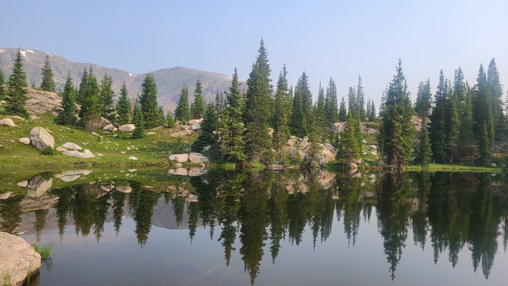
I hadn’t gone backpacking in probably 30 years until I reconnected with my old backpacking buddy Bill a few years ago, when he invited me to join him and his son on a weekend trip. Even though I struggled with both my fitness level and garage sale gear, by the end of that weekend I had rediscovered my passion for backpacking. My friend and co-worker Kat is a backpacking enthusiast, and she offered me lots of tips and inspiration as she answered my endless questions. I upgraded my gear a bit, and later that summer I challenged myself to go on my first ever solo backpacking trip to Timberline Lake. I remember thinking it was cool to be at trailhead that also connected to the Colorado Trail, but never imagined at that time that I might hike the CT one day. The hike to Timberline Lake was only about 3 miles but it was uphill most of the way and was a hard hike for me. It was fun to reach the lake, especially when I discovered no one else was camped there. I was a bit freaked out about being there solo, but soon realized that there is so much to do in camp that the time passes quickly. On my way out the next day I was in a happy mood already when I passed a hearty woman, at least my age if not a few years older, hiking with her dog. I let her know was excited to have just done my first solo overnight backpacking trip. She proceeded to tell me I could hike to Tennessee Pass in one direction and towards Mt Massive in the other from that trailhead if I wanted to pursue some more adventures. By the end of our talk, I was on fire to explore at least of bit of the Colorado Trail. I don’t think she had any idea how much that brief conversation would change my life.
Timberline Lake
My son lives with his daughter in Leadville, and on his first Fathers’ Day he started a tradition of us all going on an annual campout. Erik loves 4-wheeling with his Jeep in the hills around Leadville and we had camped a couple times up Hagerman’s Pass not far from the Timberline Lake Trailhead. I love the view of Mt Massive from his house (or just about anywhere in Leadville), and I dreamed of someday summiting Mt Massive. In 2020, I drafted my buddy Art to join me and we made it a multiple day backpacking trip along segment 10 of the Colorado Trail. Upon summitting Mt Massive I realized I needed a new goal, and after picking up on this seemingly magical trail vibe from the CT thru-hikers we encountered along segment 10, I knew this goal was to someday hike the entire Colorado Trail. So that’s a lot of the “why” I wanted to hike the Colorado Trail in 2021 and Segment 10 is such a special trail to me.
Mt Massive Taken from Mt ElbertMt Massive from Leadville
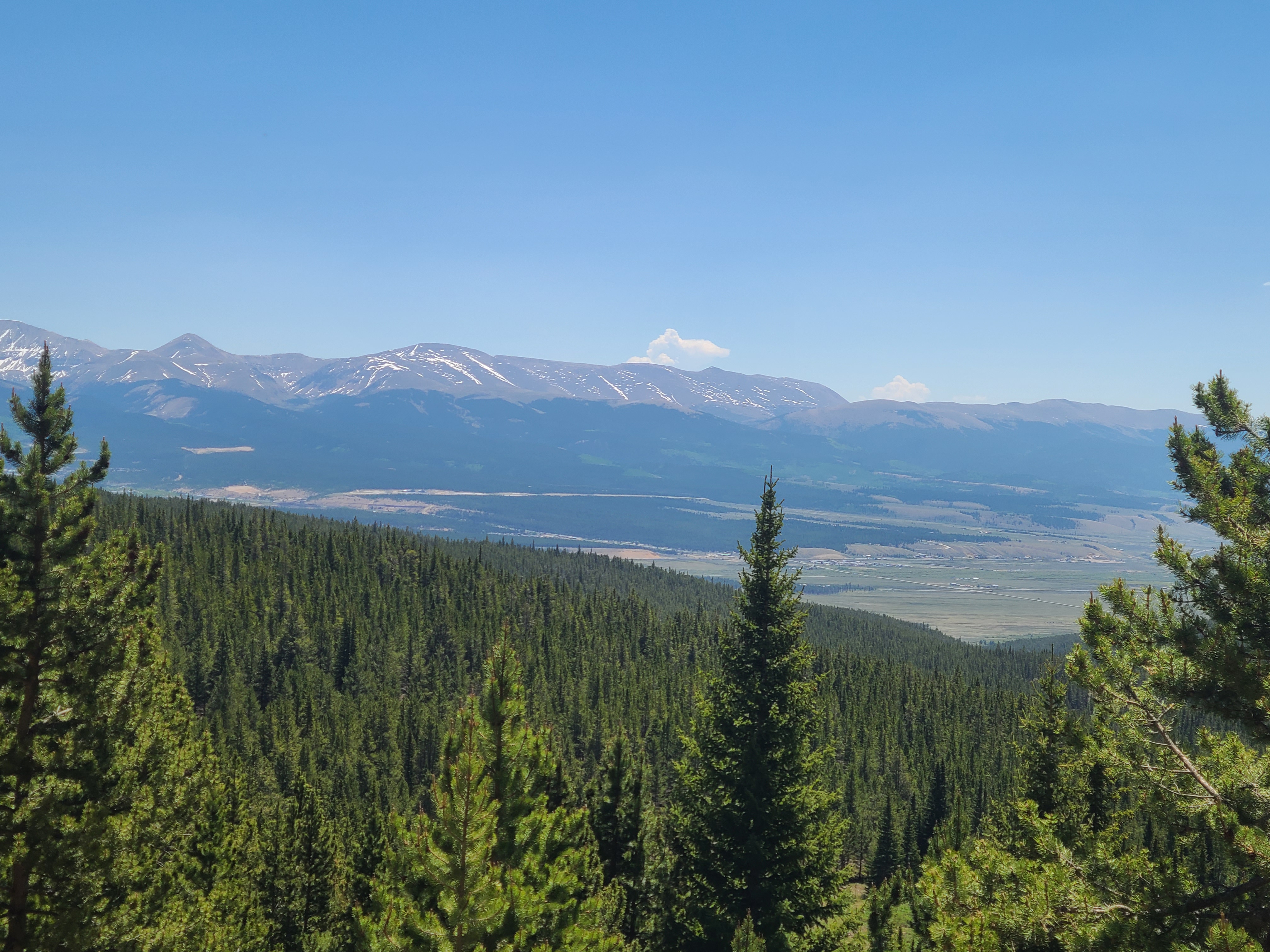
I had hiked the first 71ish miles through Segment 5 of the CT on my weekends earlier this spring, and the higher elevation snowpack was still too much for me. Along with many others, I was following the Colorado Trail 2021 Thru-hike Facebook page to see how a few hearty soles were faring getting over Georgia Pass in early June and cheering them on. These very experienced backpackers were struggling to get through, so I skipped ahead to Segment 10 and would hike Segments 6-9 a few weeks later. I arrived at the Timberline Lake Trailhead around 10:00 am on a Monday and thankfully found a parking spot for my truck. I carried a full backpack to get in some more training and planned to finish the 13-mile segment, plus another mile or two to get past the Half Moon Road closure to meet my son that afternoon.
Segment 10 is almost entirely through the woods. It starts out crossing over a creek and then begins with a pretty good climb up to Hagerman’s Pass Road. There’s a nice campground just above the road where Art & I had waited for my son to pick us up after Mt Massive last year, and I remembered being impressed watching last year’s thru-hikers make that climb. Now I had done the same, and fairly easily. I had started training for the Colorado Trail in January by skinning up to Thunderhead at the Steamboat ski area a couple times a week with my buddy Jim. Then in late March I switched to carrying my loaded backpack from our place in downtown Steamboat up Emerald Mountain, plus a bit of trail running. Hiking the lower elevation sections of the CT on my Sunday-Tuesday weekends was turning out to be a lucky good plan as I was slowly getting into hiking shape, and was I able to take some physical therapy for one very sore ankle in between hikes.
I saw just a few other hikers that day, and once again enjoyed the solitude. The trail has some nice up & down, through-the-woods hiking and I think I wore a smile almost the whole way. I could see Leadville from the trail and remembered all the times I had looked up this way at the treeline along the base of Mt Massive. Through the trees I could see snow-capped Mt Elbert and Mt Massive. When I crossed the fish hatchery trail I remembered seeing all the thru-hikers at that intersection the summer before; they seemed to have this silly, happy, but “serious as a heart attack” disposition that I not seen before. I passed the big, odd shaped rock that marked our campsite last year, then passed the Mt Massive trail intersection. The descent down towards Half Moon Road was steeper than I remembered, and was happy to be finishing downhill.
I hiked past the Half Moon Road closure where I met my son to drop me back at my truck at the Timberline Lake TH. He had shown up with one of his off-road buddies and we finished an already pretty awesome day with fun Jeep run past some of the trail I had just hiked. The rest of the Colorado Trail would far exceed any of my expectations, but this day had solidified Segment 10 as my all-time favorite. As I drove back towards Leadville I could see a far-off thunderstorm in the sunset; I missed the foreshadowing of what was to come.
I had enjoyed hiking and camping with Kinnikinnick yesterday, but he didn’t share my penchant for being up and on trail before daylight. I was making good time this morning until I stopped to filter some water and my cell phone fell from my unzipped shoulder strap pocket to the bottom of a shallow stream. I had topo maps and a compass but my navigation skills were rusty, having relied primarily on the convenience of the Guthook app on my phone to supplement the Colorado Trail Databook to this point. As I picked up my phone in disbelief, Flame walked up from behind and saw my sad and embarrassed expression. We had met just the day before and it was apparent then that she was a very experienced hiker. She wished me luck with my phone, which must have done the trick as it somehow worked just fine for the rest of my hike. I couldn’t keep Flame’s pace but we leap frogged several times that morning as she stopped to appreciate the views and waterfalls in this section. I was impressed to see her almost skip over a narrow log creek crossing that I had to take super slow using both poles to get across.
I cleared an unnamed saddle and thought I had made it over ahead of a typical pm thunderstorm. I just had to get across this little meadow. But almost immediately a lightening & hailstorm hit and I had to duck into a small grouping of trees for at least a bit of cover. It hailed non-stop for probably 1-1/2 hours with thunder & lightning flashing overhead the entire time. I was soaked and freezing, and finally had to move just to stay warm, so I tried dashing across the meadow through the storm. I slipped and ate it hard a couple times sloshing through the mud with my backpack but made it across and another couple miles to set up camp.
A much more athletic friend I had met earlier raced past me. Danimal let me know he was “going long” to try & warm up by hiking fast to get ahead of the storm & into the night. I was later relieved to see Flame, Waves, & Gadget, then Kinnikinnick, had all made it through safely as they hiked past my campsite, and they had been worried about me as well. Gadget complemented my campsite with the “flat stuff” it featured, namely a sawed off tree stump that made a coveted dining table.
I was out of camp by around 4am the next morning to get as far away from that area as soon as possible, expecting another similar storm. The deep hail had frozen solid on the trail and the only way I could hike the uphill sections that early was thanks to the big footprints Danimal had left in the hail the night before. This seemingly horrible experience ended up being one of my favorite memories from the Colorado Trail, and also taught me some valuable life lessons.
The day before I had only made around 15 miles when I set up camp early after the storm, and had to get in 20 or more today. I would also be starting a possible 22-mile stretch without water that might leave me dry-camping. Despite my early morning head start, Flame & Waves passed me later that morning, followed by Gadget that afternoon. Haze from far-off wildfires began to roll in later in the day. We got a rare break from the monsoon rain, so I decided to push on to a potential water source that would leave me at about 23 miles for the day.
I was happy to see Flame, Waves, and Gadget had stopped at the campsite. They directed me to a small, barely trickling creek just beyond the campsite where Flame had masterfully placed a leaf as a water spout. I was surprised and impressed that I could fill my 3-liter CNOC bag here. I texted that good news to Kinnikinnick who had decided to dry camp a few miles behind us. It was Friday night and I had 30 miles left to finish in Durango by Sunday. I relaxed a bit knowing I had had two modest 15-mile days ahead.